Michigan's Upper Peninsula has 1,700 miles of Great Lakes shoreline, the only mountains in the Midwest worth the name, and roughly the population of a mid-size suburb spread across an area the size of Denmark. It is the best hiking in the region and the least crowded, and it is drivable from Chicago, Milwaukee or Minneapolis, which is what makes it a cheap trip rather than an expensive one.
The two that matter most
Pictured Rocks National Lakeshore
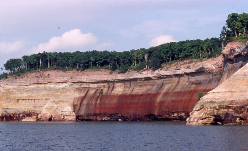
Forty-two miles of sandstone cliffs above Lake Superior, streaked mineral-orange and green, with waterfalls dropping straight into the lake. The North Country Trail runs the length of it, and the cliff-top section between Munising and Grand Marais is the finest lakeshore walking in the United States that most people have never heard of.
Chapel Rock to Mosquito Falls is the best single day, about ten miles taking in the arch, the beach and the cliff tops. For the full thing, our 3-day Pictured Rocks backpacking route walks the cliffs end to end. Backcountry permits are required and are far easier to get than anything out west, but the good sites still go early for July and August.
Porcupine Mountains
Michigan's largest state park, and the only place in the Midwest with genuine old-growth hardwood forest at scale, about 35,000 acres of it. The Lake of the Clouds overlook is the photograph everyone knows; the Escarpment Trail above it is the walk almost nobody does, and it is better.
The park has rustic cabins and yurts you can reserve, which turns a backpacking trip into a hut-to-hut one. See our Porcupine Mountains route.
Waterfalls, which the UP has more of than anywhere
- Tahquamenon Falls. The Upper Falls is 200 feet across and the second-largest by volume east of the Mississippi. The four-mile river trail between the Upper and Lower falls is the way to see it properly.
- Bond Falls. The most photogenic in the state for the least effort, a few hundred yards from the car.
- Presque Isle River. Three named falls in a mile and a half at the western end of the Porkies.
- Munising area. A dozen falls within twenty minutes of town, several walkable in an afternoon.
Isle Royale, if you want the wildest thing in the Midwest
A roadless island in Lake Superior, reachable only by ferry or floatplane, closed entirely from November to April, and the least-visited national park in the lower 48. Wolves and moose, no vehicles, and 165 miles of trail. It is a serious trip rather than a weekend, and the ferry timetable dictates everything. Our 4-day Isle Royale route is built around the boat.
When to go
- Late June to early September. The reliable window. Lake Superior keeps it cool even in July.
- Late September to early October. Peak fall colour, and arguably the best time in the region. Bugs gone, light low, trails empty.
- Black flies, late May to late June. They are not a nuisance, they are a trip-ruiner. Head nets are not optional in that window.
- Winter. The Porkies run a ski hill and the waterfalls freeze into something extraordinary, but most trails are snowshoe-only and services close.
Practical things people get wrong
- Distances. The UP is bigger than it looks. Munising to the Porcupine Mountains is four hours. Do not try to base in one place and see it all.
- Cell coverage. Largely absent outside the towns. Download offline maps before you cross the bridge.
- Lake Superior is cold. Around 45 to 55°F even in August. It is for looking at, mostly.
- Fuel. Stretches of US-2 and M-28 run 50 miles between stations. Fill up in town.
Making a week of it
The UP pairs naturally with the rest of the state and with the wider region. Our 10-day Michigan circuit links the Upper Peninsula with Sleeping Bear Dunes and the Lower Peninsula coast, and the Superior Hiking Trail across the lake in Minnesota is the obvious extension for anyone who wants more Lake Superior shoreline.
Plan the full trip
Upper Peninsula · Lake Superior
Lower & Upper Peninsula · Great Lakes
Michigan & Wisconsin · Freshwater Coast
Upper Peninsula · Lake Superior