Grand Canyon Rim to Rim:
A Weekend Hiking Itinerary
Hike the classic rim to rim: down the North Kaibab Trail from the North Rim to Phantom Ranch and the Colorado River, then up Bright Angel to the South Rim, over a 2 to 3 day backpacking weekend.
Free interactive planner · drag & reorder your days, add stops, map it in minutes
Build your own rim to rim trip, drag, reorder & map it.
Drag stops between days, swap Bright Angel for South Kaibab on the climb out, and add your own water stops and side trips with the place search. The live map and mileage recalculate as you go, and we'll warn you before you build a day no one should attempt in the inner-canyon heat.
Opens a side panel · reorder days, add custom stops, see your route live
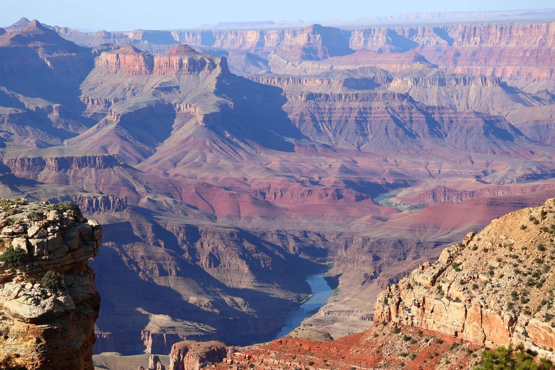
One canyon, rim to rim, North Rim to South Rim.
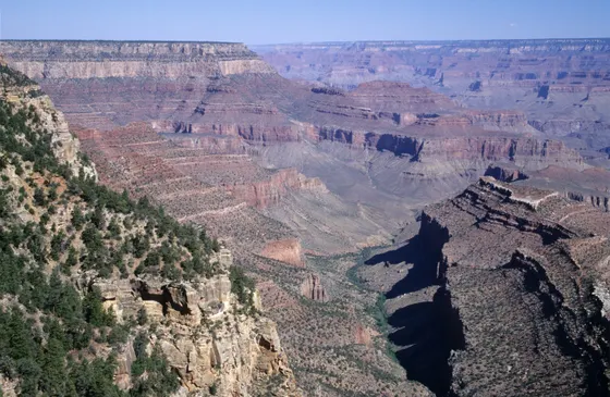
The Grand Canyon rim to rim is the great American canyon crossing: roughly 24 miles from the cool, forested North Rim at 8,200 feet, down through a mile of vertical desert to the Colorado River, and back up to the South Rim. It is not a loop and not a quick drive, it is a one-way hike through every life zone between Canada and Mexico, and one of the most rewarding things you can do in Arizona.
This rim to rim Grand Canyon itinerary takes the classic line: down the North Kaibab Trail from the North Rim, past Manzanita and Cottonwood to Phantom Ranch and Bright Angel Campground beside the river, then up Bright Angel Trail (or South Kaibab) to the South Rim. Most hikers do it as a 2 to 3 day backpack with at least one night below the rim, which gives you time to enjoy the inner gorge instead of racing the heat.
Timing is everything. The North Rim is only open mid-May to mid-October and is snowed in the rest of the year, so the season is short. May and September into October are the sweet spots: the rims are cool but the inner canyon is not yet deadly. Summer is genuinely dangerous, with inner-canyon highs well over 100°F that kill hikers most years, so do not attempt rim to rim in the heat of midsummer, and never try rim to rim to rim in a single day unless you are extremely fit.
A backcountry permit from recreation.gov is required to camp at Bright Angel Campground or Cottonwood, and the most popular dates go the moment they open, so plan months ahead. Phantom Ranch dorms and cabins are a separate lottery and are very hard to win. Because rim to rim is one-way, arrange a shuttle (the Trans-Canyon Shuttle) or two cars in advance, as driving between the rims is about 4.5 hours and 215 miles by road.


North Rim down the North Kaibab Trail to Phantom Ranch
Start on the North Rim at 8,200 feet, in cool spruce-fir forest that feels nothing like the desert below. From the North Kaibab trailhead near Grand Canyon Lodge, drop onto the North Kaibab Trail and begin the long descent: down through the Supai Tunnel and Roaring Springs into the inner canyon, losing nearly 6,000 feet over the day. The grade is relentless on the knees, so use poles and take it slow.
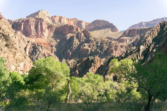
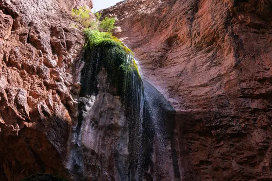
Pass Cottonwood Campground and the seasonal water at Manzanita, with the optional short side trip to Ribbon Falls, then follow Bright Angel Creek down through "The Box," a narrow inner-gorge passage that bakes in the afternoon. Aim to reach Phantom Ranch and Bright Angel Campground beside the Colorado River with energy to spare. Get below the rim early so you are off the hottest stretch before midday, and check current water status before you go, because the pipeline that feeds Manzanita, Cottonwood, and Phantom Ranch can be shut off for repairs.
- ~14 mi to the river · ~6,000 ft down · start at first light
- Seasonal · pipeline can be shut off · check status before you go
- Ribbon Falls side tripShort optional spur off the North Kaibab · shady waterfall
- Beside the Colorado River · backcountry permit required
- The North Rim is only open mid-May to mid-October. Outside that window the trailhead is snowed in, so this crossing simply is not possible in winter.
- Start the descent at first light. The inner canyon and "The Box" along Bright Angel Creek bake in the afternoon, and inner-canyon heat is the number one danger on rim to rim.
- Water at Manzanita, Cottonwood, and Phantom Ranch is seasonal and depends on a fragile pipeline. Check current water status with the park before you go and carry the capacity to treat creek water if needed.
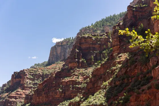
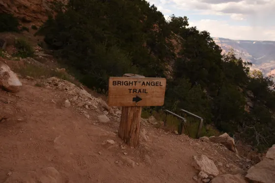
Phantom Ranch up Bright Angel Trail to the South Rim
Wake beside the Colorado River at the bottom of the canyon and, if you have the time, take the morning slowly: cross the silver bridge, soak your feet in Bright Angel Creek, and grab the famous lemonade or a bagged breakfast at Phantom Ranch if you booked one. Then it is time for the hard part, the climb out to the South Rim, so start early to beat the heat through the lower canyon.
Take the Bright Angel Trail for the climb, the more gradual and better-watered of the two South Rim trails, with seasonal water and rest at Havasupai Gardens before the long grind up the switchbacks to the rim, about 4,400 feet of gain over roughly 9.5 miles. Strong, light hikers sometimes climb out on the steeper, waterless South Kaibab Trail instead for the views off Skeleton Point and Ooh Aah Point. Getting back: because rim to rim is one-way, you finish on the South Rim about 215 miles by road from where you started, so use your pre-booked Trans-Canyon Shuttle or your second car to close the loop, and fly home from Las Vegas (LAS) or Flagstaff (FLG).
- ~9.5 mi · ~4,400 ft up · seasonal water at Havasupai Gardens
- Steeper · no water · big views off Skeleton & Ooh Aah Point
- Trans-Canyon Shuttle or second carRim to rim is one-way · ~215 mi by road between the rims
- Split the climb over 3 days · permit required · easier on the body
- Climb out on the Bright Angel Trail if you want water and a slightly gentler grade. Save the steeper, waterless South Kaibab for cool conditions or strong, light packs.
- Rim to rim is one-way, so sort out your return before you start. The Trans-Canyon Shuttle runs between the rims, or stage two cars, because the drive between rims is about 4.5 hours and 215 miles.
- If two days feels too aggressive, add a night at Cottonwood and split the climb out into a third day. It is far safer in the heat and much kinder on your knees.
Now build your rim to rim trip.
You've seen the whole crossing. Open the free drag-and-drop planner and tune it for your dates, your pace, and whether you go in two days or split the climb out over three.
What we actually learned crossing the canyon.
You need a backcountry permit
To camp below the rim at Bright Angel Campground or Cottonwood you need a backcountry permit, issued through recreation.gov. The most popular dates go the instant they open, so apply months ahead. Phantom Ranch dorms and cabins are a separate, very competitive lottery.
Rim to rim is one-way, plan the shuttle
You cannot quickly drive back to your car. The road between rims is about 215 miles and 4.5 hours, so arrange the Trans-Canyon Shuttle or stage two cars before you start. Many hikers fly into Las Vegas (LAS) or Flagstaff (FLG) and drive in from there.
The North Rim season is short
The North Rim, where rim to rim begins, is only open mid-May to mid-October and is snowed in the rest of the year. Outside that window the crossing is not possible from the north, so build your trip around that short season.
Heat is the number one danger
Inner-canyon temperatures regularly top 100°F in summer and kill hikers most years. Aim for May or September into October, get below the rim early, and never attempt rim to rim to rim in a single day unless you are extremely fit.
Check water status before you go
Seasonal water sits at Manzanita, Cottonwood, and Phantom Ranch, but it depends on an aging pipeline that is sometimes shut off for repairs. Confirm current water status with the park before your hike and be ready to treat creek water if a station is dry.
Slower is safer, consider three days
Two days is doable for fit hikers, but a third day with a night at Cottonwood splits the big climb, beats the heat, and saves your knees. Phantom Ranch is the only lodging below the rim, so most rim to rim trips mean camping with a permit.
Everything you'll actually want to know.
Ready to go? Get your
rim to rim hiking route.
Trailheads and mileages, the backcountry permit process, seasonal water stops, the Trans-Canyon Shuttle logistics, North Rim and South Rim lodging, and the heat timing you need to cross the canyon safely.
Instant book · Free cancellation · Secure payment via Stripe


Planning this trip?
Save it, share it with your crew, or find travelers heading the same way.

Liked this itinerary?
What other travelers are saying
Be the first to leave a tip or question for the next traveler.