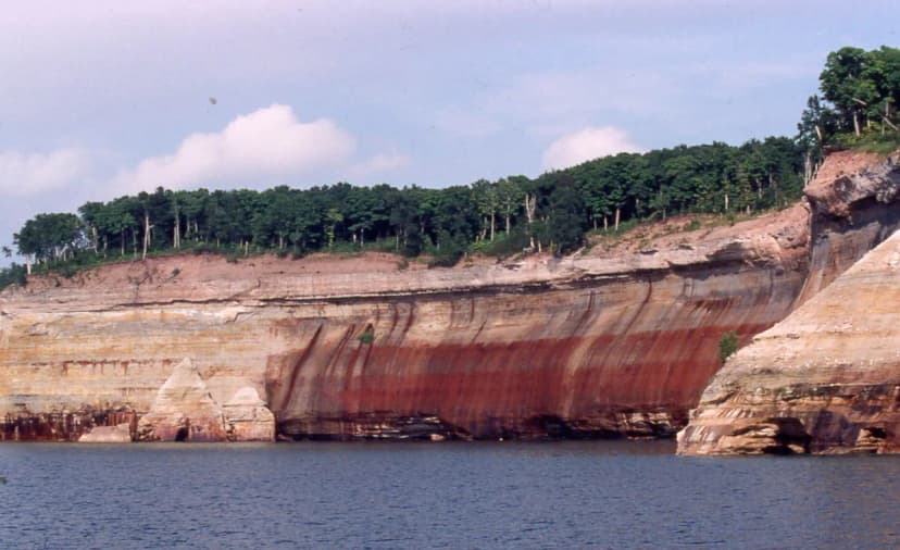
Where the cliffs meet Lake Superior
Pictured Rocks National Lakeshore runs about 42 miles along Lake Superior between the towns of Munising and Grand Marais in Michigan's Upper Peninsula. The name comes from the mineral-stained sandstone cliffs, streaks of red iron, green copper, and black manganese, that rise up to 200 feet straight out of the water. Add waterfalls, sand dunes, and beaches the color of toast, and you have one of the most varied stretches of hiking in the Midwest. It is the wild northern counterpoint to the lower-peninsula dunes on our Great Lakes family road trip.
The cliff-top classics: Miners Castle and Chapel
The most accessible cliff view is Miners Castle, a turreted rock formation reached by a short paved path to two railed overlooks. It is the easiest way to get the iconic turquoise-water photo with almost no effort, perfect for the youngest hikers. For more of a day out, the Chapel Falls and Chapel Beach area offers a layered hike: a 2.8-mile round trip just to the falls, or a longer loop past Chapel Rock and the famous tree whose roots stretch across a gap to the mainland.
- Miners Castle: paved, stroller-friendly, big payoff
- Chapel Falls: 2.8 miles round trip to the cascade
- Chapel Loop: roughly 10 miles for ambitious teens and adults
Waterfalls you can knock out fast
The Munising side is packed with quick waterfall walks that are ideal between bigger adventures. Munising Falls is a flat, accessible quarter-mile path to a 50-foot curtain of water. Wagner Falls just south of town is another easy boardwalk stroll, and Sable Falls on the Grand Marais end drops in tiers down a staircase to the Lake Superior beach. Stringing two or three of these together gives kids a sense of accomplishment without big mileage.
The North Country Trail and Log Slide
The North Country National Scenic Trail threads the entire shoreline and is the route for backpackers, but day hikers can sample its best parts. The Log Slide Overlook near Grand Marais is a short walk to a dune that plunges 300 feet to the lake; sliding down is tempting but the climb back can take a fit adult an hour, so admire it from the top with kids. Nearby, the Au Sable Light Station hike follows the beach past old shipwreck timbers, a favorite with curious children.
See the cliffs from the water
Many of the most colorful cliffs simply cannot be seen well from land. A boat cruise out of Munising or a guided kayak tour gets you right under formations like Lovers Leap and the Grand Portal. Cruises run from late May into October, and a calm morning paddle is one of the highlights of any U.P. trip. Book ahead in July and August, when tours fill quickly.
- Best season: mid-June through September for warm-enough days and running waterfalls
- Bring layers: Lake Superior keeps the shore cool even in summer
- Fuel up in Munising: it is the last good supply stop before the eastern trailheads
Working it into a Great Lakes loop
Pictured Rocks pairs naturally with a Mackinac Island ferry day and the Sleeping Bear Dunes farther south, since the drive up I-75 and across the Upper Peninsula links them all. Allow at least a full day, ideally two, so you can mix an easy waterfall walk, a cliff overlook, and a boat or kayak outing. For a ready-made route that connects these stops with kid-friendly drive times, follow our 7-day Great Lakes itinerary.
Pictured Rocks National Lakeshore FAQs
The paved path to the Miners Castle overlooks is the easiest, with a big payoff and turquoise-water views. Munising Falls is another flat, accessible quarter-mile walk that suits young children and strollers.
Yes, overlooks like Miners Castle and the Chapel area show the cliffs from land. But many of the most colorful formations are best seen on a boat cruise or kayak tour out of Munising.
Mid-June through September offers the warmest days, running waterfalls, and operating boat tours. September brings thinner crowds and early fall color, though Lake Superior keeps the shore cool year-round.