Sawtooth Mountains, Idaho:
A Weekend Hiking Itinerary
Three days of Sawtooth Mountains Idaho hiking: Sawtooth Lake under Mount Regan, Alice Lake from Pettit, the Bench Lakes above Redfish, plus a Salmon River raft trip and a hot-springs soak from Stanley.
Free interactive planner · drag & reorder your days, add stops, map it in minutes
Build your own Sawtooth trip, drag, reorder & map it.
Drag stops between days, swap one alpine lake hike for another, and add your own trailheads and hot springs with the place search. The live map and drive times recalculate as you go, and we'll warn you before you stack two big lake days back to back at altitude.
Opens a side panel · reorder days, add custom stops, see your route live
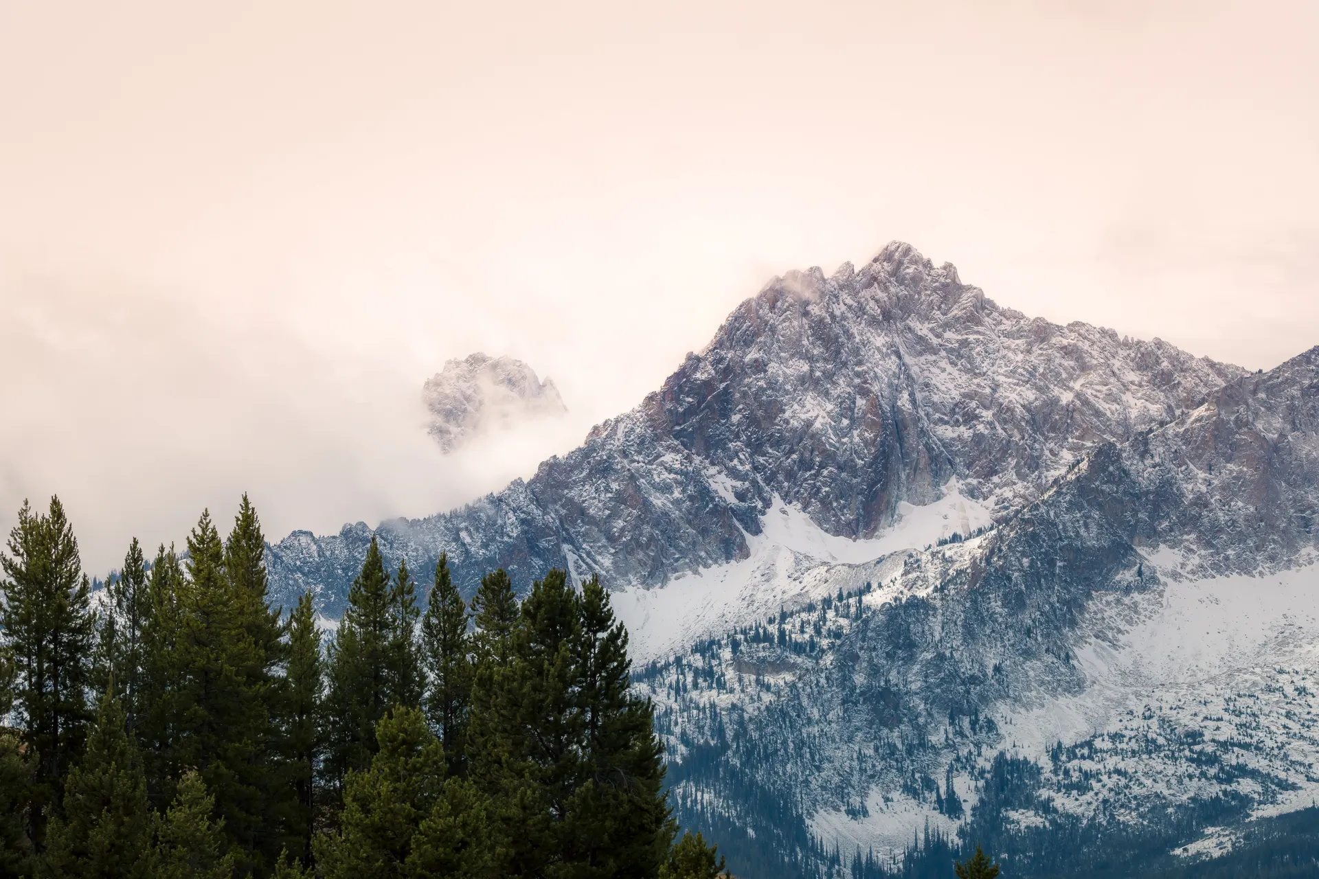
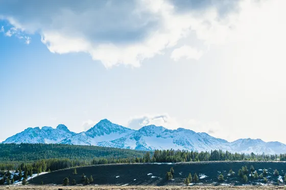
Jagged granite peaks over alpine lakes, all from one mountain town.
The Sawtooth National Recreation Area wraps a wilderness of jagged granite peaks, more than 50 of them over 10,000 feet, around hundreds of alpine lakes in central Idaho. The little town of Stanley sits right at the foot of the range where the Salmon River begins, and from there nearly every classic trailhead is a short drive away.
This weekend route is built around the best Sawtooth Mountains Idaho hiking: Sawtooth Lake under the wall of Mount Regan, Alice Lake from Pettit Lake, and the Bench Lakes above Redfish Lake. You'll thread in a Salmon River raft trip through Stanley, a soak at the riverside hot springs, and the lodge and swimming beaches at Redfish Lake.
This is high country with a short season. Snow lingers on the passes well into July, the lakes sit between 7,000 and 9,000 feet, and afternoon thunderstorms build fast in summer. The window is July through September, so start hikes early, carry layers, and be off the high ground before the clouds stack up.
Stanley is tiny and its lodging fills fast on summer weekends, so reserve early or base in Ketchum and Sun Valley about an hour south. Trailhead lots at Iron Creek, Pettit Lake, and Redfish fill by mid-morning in peak season, so start early. The Redfish Lake boat shuttle and the Salmon River raft trips both run on summer schedules and are worth booking ahead.


Drive in & the classic: Sawtooth Lake
Stanley is remote: plan on about 3 hours from Boise (BOI) over the Banner Summit, or roughly an hour up from Ketchum and the Sun Valley airport (SUN). Get in the night before if you can, because today is the signature hike and you want to be at the trailhead early before the lot fills and the afternoon clouds build.
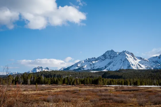
Drive to the Iron Creek trailhead and hike to Sawtooth Lake (about 10 miles round trip), the classic of the range. The trail climbs steadily past Alpine Lake to the largest alpine lake in the Sawtooths, sitting in a granite bowl beneath the sheer wall of Mount Regan. Save energy for the climb, start early, and turn around in time to be below treeline before any storms roll in.
- Sawtooth Lake via Iron Creek~10 mi RT · moderate · the classic Sawtooth hike · under Mount Regan
- Drive in from Boise or KetchumBOI ~3 hr over Banner Summit · SUN / Ketchum ~1 hr
- Start early, watch the skyAfternoon thunderstorms build fast · be below treeline by early afternoon
- Stay in StanleyTiny town right under the peaks · books up on summer weekends
- The Iron Creek trailhead lot fills by mid-morning on summer weekends. Arrive early both to park and to beat the afternoon thunderstorms.
- Sawtooth Lake sits near 8,400 feet and snow can linger on the upper trail into July. Carry layers and traction early in the season, and check conditions at the Stanley ranger station.
- Stanley is small and lodging sells out fast in summer. Reserve early, or base in Ketchum and Sun Valley about an hour south and drive up.
Alice Lake from Pettit Lake

Today is the other great lake hike: Alice Lake from the Pettit Lake trailhead (about 12 miles round trip). The trail climbs gently along Pettit Lake Creek through meadows and forest to one of the most photographed spots in the range, a turquoise lake ringed by granite spires with El Capitan rising behind it. It is a long day but moderate in grade, and many hikers rate it the most beautiful in the Sawtooths.
Want a bigger day? Strong hikers can extend onto the Alice–Toxaway loop (about 18 miles), continuing over Toxaway Lake and back, usually done as an overnight. Pick the out-and-back to Alice or the full loop, not a rushed attempt at both. Either way carry plenty of water and layers, start early, and keep an eye on the afternoon sky at altitude.
- Alice Lake via Pettit Lake~12 mi RT · moderate grade, long day · spires & turquoise water
- Alice–Toxaway loop (bigger alternative)~18 mi · often an overnight · do this INSTEAD of the out-and-back, not on top of it
- Carry water and layersHigh alpine · weather turns fast · filter from creeks if needed
- Second night in StanleyStay put so you can hit the Pettit Lake trailhead early
- Alice Lake is a long but moderate day. Start early from the Pettit Lake trailhead so you reach the lake before midday clouds and have time to linger.
- The Alice–Toxaway loop (about 18 miles) is the upgrade for fit hikers and is usually done as an overnight backpack. Do it instead of the Alice out-and-back, not in addition.
- There is no water until you reach the creek and lakes, and storms build fast at altitude. Pack layers, a filter, and rain protection even on a clear morning.
Redfish Lake, the Bench Lakes & a Salmon River raft
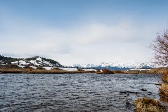
Ease off the big mileage today around Redfish Lake, the heart of the recreation area, with its lodge, swimming beaches, and a boat shuttle that ferries hikers across the lake to wilderness trailheads. For an easy leg-stretcher, walk the flat Fishhook Creek meadow trail; for a bit more, climb to the Bench Lakes (about 7 miles round trip from Redfish), a string of small alpine lakes with the Grand Mogul reflected in the water.
In the afternoon, get on the water with a guided Salmon River raft or float trip through the Stanley basin, then soak tired legs at a riverside hot spring such as Sunbeam or the Boat Box right beside the highway. Getting home: it is about 3 hours back to Boise (BOI) over Banner Summit or roughly an hour to Ketchum and Sun Valley (SUN), so fuel up in Stanley and leave with daylight to spare.
- Guided Salmon River raft or scenic float through Stanley · book ahead
- Bench Lakes from Redfish~7 mi RT · moderate · alpine lakes with the Grand Mogul reflected
- Redfish Lake & the boat shuttleLodge, swimming beaches, and a shuttle across the lake to trailheads
- Hot springs soakSunbeam or the Boat Box hot spring right beside the river
- The Redfish Lake boat shuttle saves miles to wilderness trailheads and runs on a summer schedule, so check times and book ahead in peak season.
- White Cloud Rafting runs guided Salmon River raft and float trips out of the Stanley basin. Reserve ahead, especially on summer weekends, and bring a change of clothes.
- Hot springs near Stanley such as Sunbeam and the Boat Box sit right beside the river and the highway. Water temperatures vary with river levels, so test before you get in and never soak alone after dark.

Now build your Sawtooth trip.
You've seen all three days. Open the free drag-and-drop planner and tune it for your dates, your pace, and whether you base in Stanley right under the peaks or in Ketchum and Sun Valley to the south.
What we actually learned in the Sawtooths.
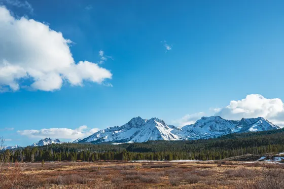
Go July through September
The Sawtooth season is short. Snow lingers on the high passes into July, the lakes sit between 7,000 and 9,000 feet, and the prime window is July through early September. Even then, summer afternoons bring fast-building thunderstorms, so start hikes early and be off the high ground by early afternoon.
Start at the trailhead early
Iron Creek, Pettit Lake, and Redfish are the main trailheads, and their lots fill by mid-morning on summer weekends. An early start gets you a parking spot, cooler hiking, and a buffer against the afternoon storms that roll over the peaks.
Carry water, a filter and layers
These are full alpine days. There is no water until you reach the creeks and lakes, and the weather can swing from hot sun to cold rain in an hour. Pack a filter, extra layers, and rain protection even when the morning starts clear.
Book Stanley lodging early
Stanley is tiny and its handful of lodges, cabins, and campgrounds sell out fast on summer weekends. Reserve well ahead, or base in Ketchum and Sun Valley about an hour south and drive up to the trailheads each morning.
Expect spotty cell service
Cell coverage is patchy around Stanley and largely gone in the backcountry. Download offline maps, screenshot your trailheads and the boat-shuttle schedule, and tell someone your plan before you head into the wilderness.
Fuel up in Stanley
Services are limited and the next town is over an hour away in any direction. Top off your tank in Stanley before long drives, and remember the road from Boise climbs over Banner Summit, which is slow going and can hold snow into early summer.
Everything you'll actually want to know.
Ready to go? Get your
Sawtooth hiking route.
Trailheads and mileages for Sawtooth Lake, Alice Lake and the Bench Lakes, the Redfish boat shuttle, the Salmon River raft outfitter, hot springs, Stanley lodging, and drive times from Boise and Sun Valley.
Instant book · Free cancellation · Secure payment via Stripe


Planning this trip?
Save it, share it with your crew, or find travelers heading the same way.

Liked this itinerary?
What other travelers are saying
Be the first to leave a tip or question for the next traveler.