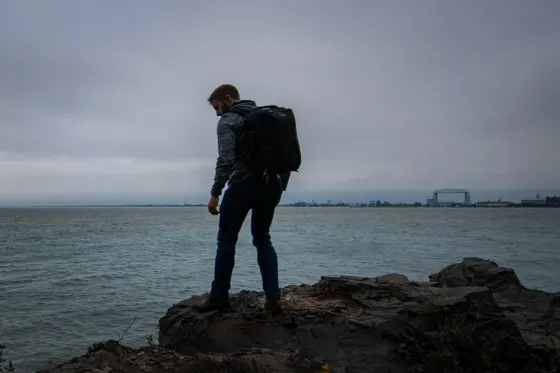
Superior Hiking Trail:
A 4-Day Minnesota Itinerary
Four days section-hiking the Superior Hiking Trail along Lake Superior's North Shore: Gooseberry Falls, Split Rock, Tettegouche, Carlton Peak, and the Oberg Mountain fall-color overlook.
Free interactive planner · drag & reorder your days, add stops, map it in minutes
Build your own Superior Hiking Trail trip, drag, reorder & map it.
Drag stops between days, swap sections, and add your own waterfalls and overlooks with the place search. The live map and drive times recalculate as you go, so you can plan a point-to-point section hike around your shuttle and your dates.
Opens a side panel · reorder days, add custom stops, see your route live
One ridgeline trail, waterfalls, cliffs & big-lake views, along the North Shore.
The Superior Hiking Trail runs about 310 miles along the ridgeline above Lake Superior's North Shore in Minnesota, from near Duluth all the way to the Canadian border. It is free, well-marked, and maintained by the volunteer-driven Superior Hiking Trail Association, with first-come backcountry campsites spaced along the route that require no fee and no permit.
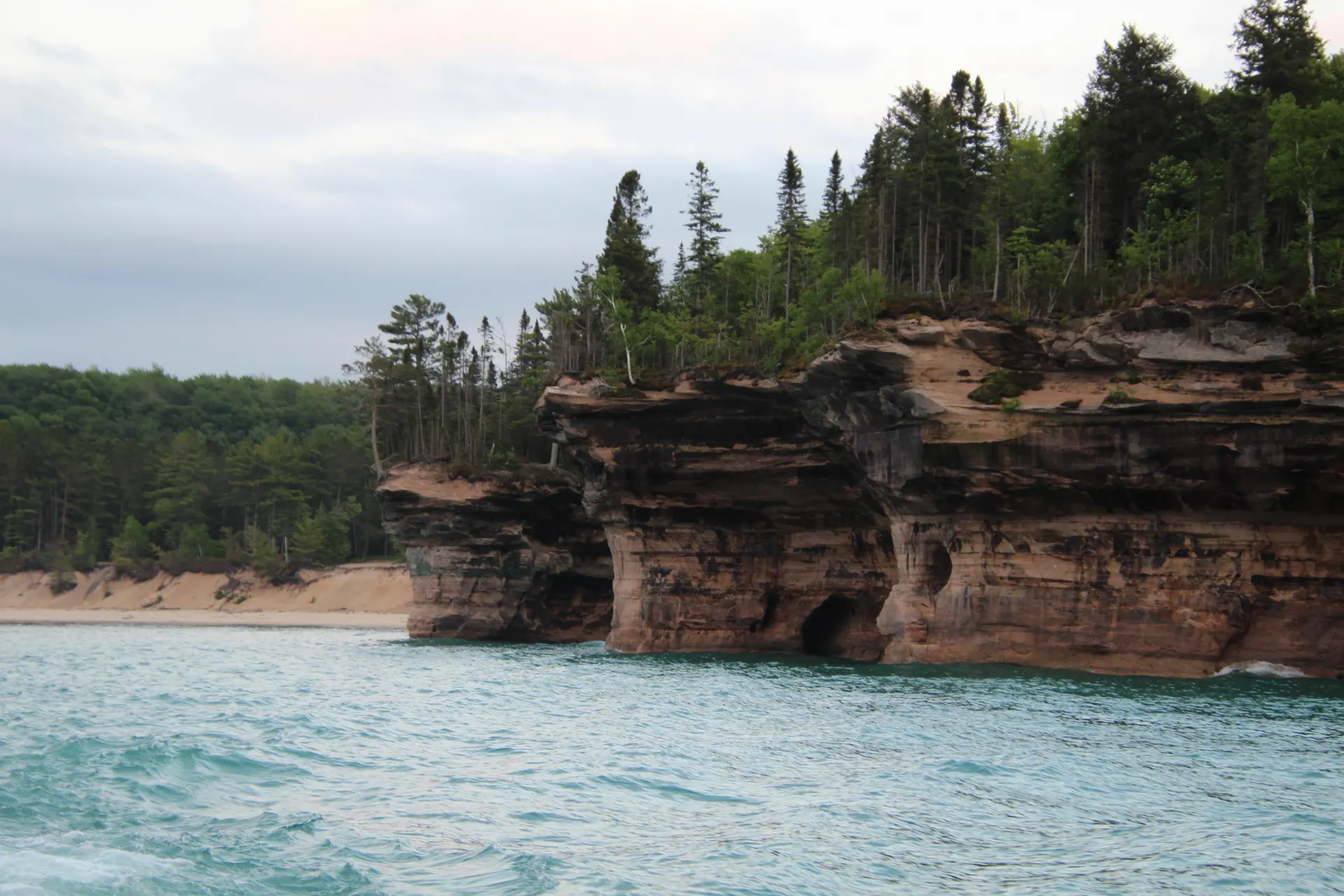
Almost no one hikes the whole thing at once. Most people do sections, and this 4-day route strings together the most scenic stretch through the North Shore state parks: Gooseberry Falls and Split Rock Lighthouse, Tettegouche with its high falls, Shovel Point, and the Palisade Head cliffs, then the Temperance River, Carlton Peak, the famous Oberg Mountain fall-color overlook, and the Cascade River.
Because the trail is point-to-point, you will need a shuttle back to your car, or you can string the days together lodge-to-lodge from town to town. Late September through early October is the prime window for spectacular fall color and peak crowds. Summer is lush and green but buggy, so pack head nets and repellent.
North Shore lodging in Two Harbors, Silver Bay, Tofte, and Grand Marais books up fast for fall-color weekends, often months ahead, so reserve early. The backcountry campsites along the trail are free and first-come with no permit, but they fill on peak weekends too. Arrange your shuttle ahead through the Superior Hiking Trail Association, since this is a point-to-point trail and you will need a ride back to your car.

Up the shore · Gooseberry Falls & Split Rock
Fly into Duluth (DLH), about 30 minutes south of the trail's southern end, and drive up Highway 61 along the shore. Start where most North Shore trips begin, at Gooseberry Falls State Park, where the Superior Hiking Trail threads past a series of waterfalls dropping toward the big lake. It is the perfect warm-up section to find your trail legs.
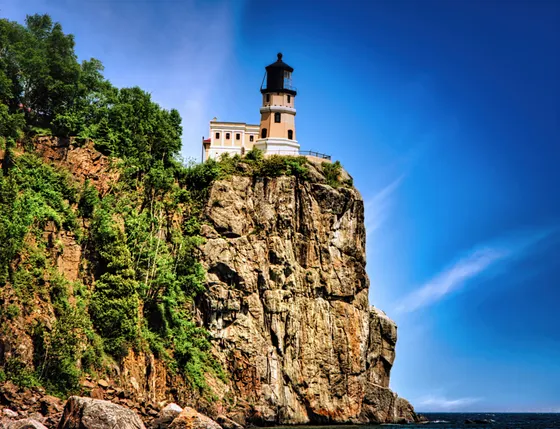
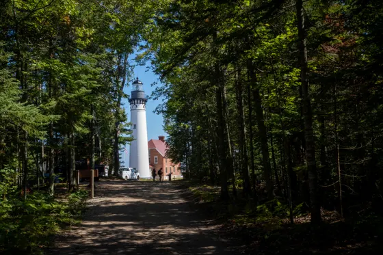
Continue to Split Rock Lighthouse State Park, where the SHT climbs to overlooks above the most photographed lighthouse on Lake Superior, perched on a cliff over the water. Base your first night in Two Harbors, the southern hub for the North Shore, and sort out your shuttle for the point-to-point days ahead.
- Waterfall section · easy to moderate · classic North Shore warm-up
- Cliff-top views over the most photographed lighthouse on the lake
- Point-to-point trail · book a shuttle through the SHTA
- Stay in Two HarborsSouthern North Shore hub · easy access to both parks
- The trail is point-to-point, so plan your shuttle before you start. The Superior Hiking Trail Association can connect you with shuttle services for the North Shore sections.
- A Minnesota state park vehicle permit is required to park at Gooseberry, Split Rock, Tettegouche, and the other state parks, even though the trail itself is free.
- Duluth (DLH) is the closest airport, about 30 minutes south of the trail's southern end. Pick up any last supplies in Duluth or Two Harbors.

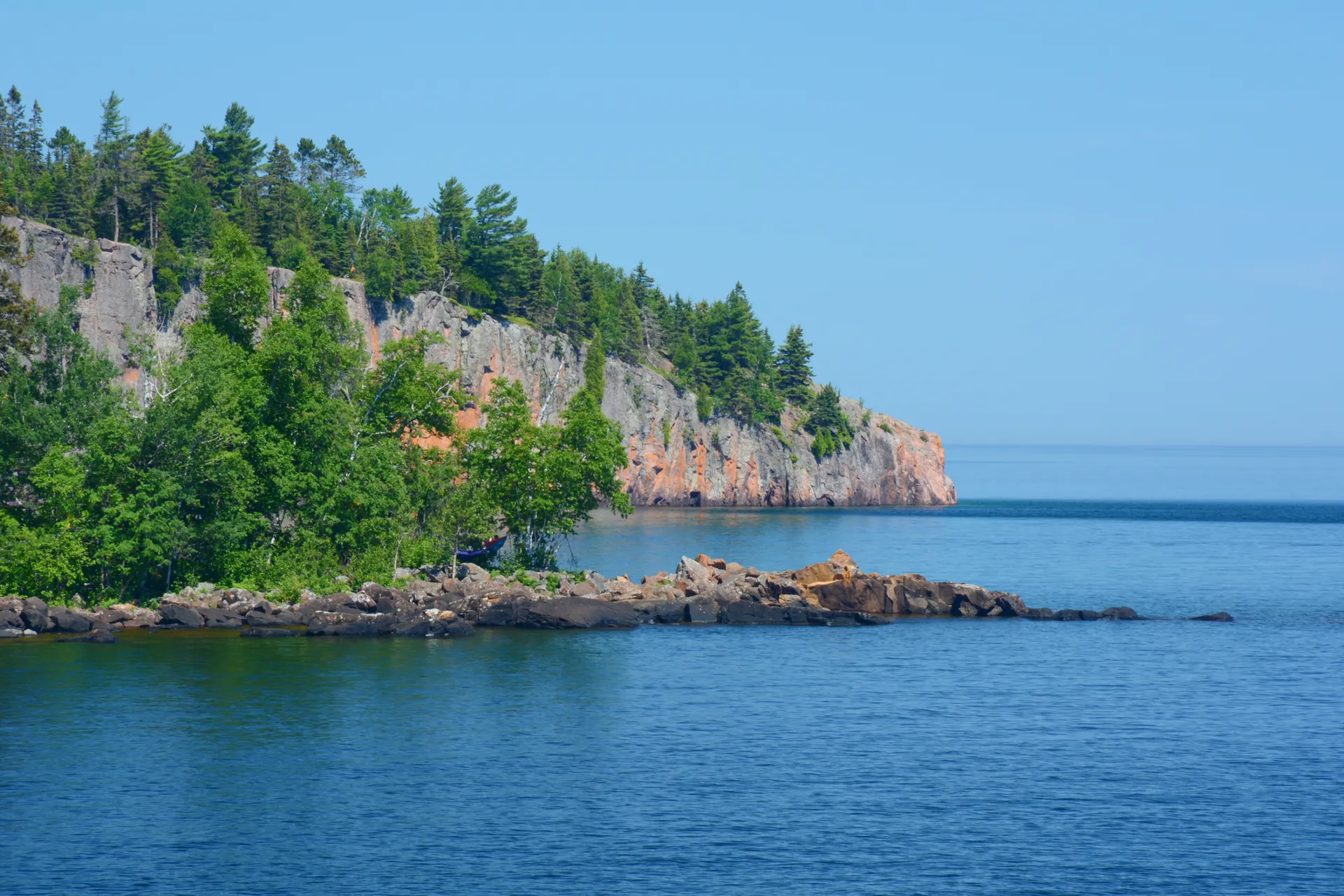
Tettegouche · High Falls, Shovel Point & Palisade Head

Today is the most dramatic state-park day on the route. Tettegouche State Park is where the Superior Hiking Trail hits its rugged best: hike to High Falls on the Baptism River, one of the tallest waterfalls entirely within Minnesota, then out to Shovel Point, a rocky finger of cliffs jutting into Lake Superior.
Just down the shore, the Palisade Head cliffs rise straight from the water, a sheer wall of red rhyolite with one of the best big-lake views on the entire North Shore. Base in Silver Bay tonight, the small town right at the heart of the Tettegouche section, and let your shuttle reset you for the next stretch.
- One of the tallest falls fully within Minnesota · on the Baptism River
- Rocky cliffs jutting into Lake Superior · big open-water views
- Sheer red rhyolite wall above the lake · one of the best overlooks
- Stay in Silver BayRight at the Tettegouche section · the heart of the route
- Tettegouche is the rugged heart of the North Shore. The terrain is rocky and rooty, so wear sturdy boots and budget more time than the mileage suggests.
- High Falls on the Baptism River is one of the tallest waterfalls entirely inside Minnesota and runs hardest in spring and after rain.
- Palisade Head is a short drive up a steep, narrow road and a popular rock-climbing spot. The cliff-edge views are unfenced, so keep well back from the rim.
Temperance River & Carlton Peak
Move up the shore to the Temperance River, where the Superior Hiking Trail follows a deep gorge the river has carved through the rock, a string of churning potholes and chutes that is one of the most beautiful river sections on the whole trail.
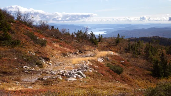
From there the trail climbs Carlton Peak, a knob of bare anorthosite rising above the forest with a sweeping summit view over Lake Superior and the endless green ridgeline. It is a steady, rewarding climb and a North Shore favorite. Drop down into Tofte for the night, a tiny shore town that puts you within minutes of tomorrow's Oberg Mountain trailhead.
- Deep carved gorge · potholes and chutes · one of the best river sections
- Bare-rock summit · sweeping view over Lake Superior · steady climb
- First-come along the trail · no fee, no permit · pack out everything
- Stay in TofteMinutes from the Oberg trailhead · midpoint shore town
- The backcountry campsites along the trail are free, first-come, and need no permit. They have tent pads and a fire ring, but no water, so filter from streams and the lake.
- Carlton Peak is a steady climb to a bare-rock summit. The exposed top is a great lunch spot, but it can be windy and cold off the lake even in summer.
- Stay on the marked trail through the Temperance River gorge. The rock near the potholes gets slick and the drop-offs are serious.


Oberg Mountain & the Cascade River
Save the most famous overlook for last. Oberg Mountain is a short loop off the Superior Hiking Trail with a series of overlooks that, in late September and early October, deliver the single best fall-color view on the North Shore: a sea of sugar-maple reds and golds rolling down to the blue of Lake Superior. It is the photo everyone comes north for.
Finish along the Cascade River, where the trail follows a staircase of waterfalls dropping through a mossy gorge toward the lake. Getting home: from here it is about a 2-hour drive back down the shore to Duluth (DLH), or stay an extra night in nearby Grand Marais, the artsy harbor town at the north end of the route, before heading out.
- Best fall-color overlook on the North Shore · peaks late Sep to early Oct
- Staircase of falls through a mossy gorge toward the lake
- Grand Marais harbor townArtsy harbor town at the north end · a fine final-night base
- Getting home: Duluth (DLH)~2 hr back down the shore to the airport · fuel up in Grand Marais or Tofte
- Oberg Mountain is the most popular fall-color hike on the North Shore. On peak-color weekends the small lot fills early, so arrive at dawn or have your shuttle drop you.
- Fall color on the upper shore usually peaks from late September into the first week or two of October, a week or so ahead of the lower shore near Duluth.
- Grand Marais is a great final-night base, with restaurants and an artsy harbor. From there it is about 2 hours back down Highway 61 to the Duluth airport.
Now build your Superior Hiking Trail trip.
You've seen all four days. Open the free drag-and-drop planner and tune it for your dates, your pace, and whether you base in Two Harbors, Silver Bay, Tofte, or Grand Marais.
What we actually learned on the North Shore.
Plan for a point-to-point trail
The Superior Hiking Trail runs point-to-point, so you cannot just hike out and back to your car. Arrange a shuttle through the Superior Hiking Trail Association, or string the days together lodge-to-lodge from town to town up the shore.
Backcountry camping is free and permit-free
The trail's backcountry campsites are free, first-come, and require no permit, each with tent pads and a fire ring. They can fill on peak fall weekends, so have a backup, carry a filter since there is no potable water, and pack out everything.
Buy a state park permit
The trail itself is free, but parking at Gooseberry, Split Rock, Tettegouche, Temperance River, and the other Minnesota state parks needs a vehicle permit. A day or annual permit covers them all and supports the parks you hike through.
Go late September to early October for color
The North Shore is famous for fall color, and the sugar maples around Oberg Mountain peak from late September into early October, a week or so ahead of the lower shore. That is the best window, and also the busiest, so book lodging early.
Expect rugged, rocky footing
This is not a flat lakeshore stroll. The trail rolls over a rocky, rooty ridgeline with real climbs to overlooks like Carlton Peak and Oberg. Wear broken-in boots, budget more time than the mileage suggests, and use trekking poles on the descents.
Pack for bugs in summer
Summer on the trail is lush and green but buggy: mosquitoes and black flies peak from late spring into midsummer. Bring repellent and a head net, or hit the trail in fall when the color is best and the bugs are gone.
Everything you'll actually want to know.
Ready to go? Get your
Superior Hiking Trail route.
Section mileages, state-park trailheads, the shuttle logistics, free backcountry campsites, North Shore lodging towns, and the fall-color timing you need to hike the Superior Hiking Trail.
Instant book · Free cancellation · Secure payment via Stripe

Planning this trip?
Save it, share it with your crew, or find travelers heading the same way.

Liked this itinerary?
What other travelers are saying
Be the first to leave a tip or question for the next traveler.