The Weight Room of the Cascades
Mount Si is where Seattle-area hikers go to suffer productively. The 8-mile round trip gains 3,150 feet, more elevation per mile than most Cascade day hikes, and the trail offers essentially no flat recovery sections. It's used as training for rainier climbs, as a weekly fitness benchmark, and as a rite of passage for anyone serious about Cascade hiking. You'll see people running it, people with 50-pound training packs, and first-timers in yoga pants who didn't know what they were getting into.
The summit itself is one of the best in the region: a rocky platform at 3,900 feet with direct views of Snoqualmie Valley, Seattle and Puget Sound on clear days, and the imposing north face of the adjacent haystack, a rock scramble that adds 300 feet and takes the summit to 4,167 feet. The Haystack is not technical mountaineering, but it's exposed Class 3 climbing that requires handholds and comfort with heights.
Trail Stats
- Distance: 8 miles round trip to main summit; add 0.5 miles and ~300 ft for Haystack
- Elevation gain: 3,150 feet to main summit (3,900 ft)
- Difficulty: Strenuous
- Best season: Year-round, snow and ice on upper trail November through April
- Permit: Discover Pass required for parking
- Time: 4–7 hours round trip depending on fitness
Getting to the Trailhead
The Mount Si trailhead is north of North Bend, WA on Mount Si Road. From Seattle: I-90 east to exit 32 (436th Ave SE), north on 436th, left onto SE North Bend Way, right onto Mount Si Road. Follow Mount Si Road 2.4 miles to the large parking area at the trailhead. GPS: 47.4877° N, 121.7271° W. About 30 minutes from Seattle.
The parking lot is large and rarely fills on weekdays. On summer weekends, arrive by 8am. A Discover Pass is required. There are restrooms at the trailhead, the last facilities before the summit.
The Route
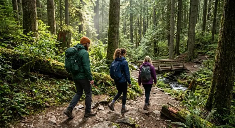
Miles 0–2 (Lower forest section): The trail starts in the parking area and immediately begins climbing through second-growth forest. The lower 2 miles are moderately steep and forested, no views, but the old-growth stumps from historic logging and the massive Douglas firs are worth noticing. This section is often muddy in spring and after rain.
Miles 2–3.5 (Middle section): The trail steepens. Several rocky switchbacks. The forest begins transitioning, smaller trees, more rock, occasional views through breaks in the canopy looking south toward Rattlesnake Mountain and the Snoqualmie Valley. This is where less-prepared hikers start struggling. Pace yourself.
Miles 3.5–4 (Upper section and summit): The final half-mile is the steepest. The trail becomes more rocky and the grade is relentless. Then it levels abruptly at a boulder field and the summit area opens up. Views appear suddenly and are immediately dramatic.
The Haystack: The Haystack is the rock pinnacle visible from the main summit. A rough trail leads to the base of the scramble. The climbing itself is about 300 feet on steep, exposed rock with solid handholds but real consequences for a fall. Most hikers with scrambling experience and no fear of heights can manage it. If the rock is wet, wait for a dry day. Do not attempt in icy conditions.
Views from the Summit
On a clear day, and clarity is rare enough to feel like a gift here, the summit delivers: Snoqualmie Valley stretching west, Cedar River Watershed to the south, the Cascade peaks from the Snoqualmie Pass corridor including Chair Peak, Kaleetan, and Cathedral Rock to the northeast. Seattle's skyline and Puget Sound appear to the west. Mount Rainier floats above the southern horizon, enormous and improbable-looking. The Haystack adds a more exposed 360° view over the main summit.
Year-Round Conditions
Summer (June–September): Best conditions. Dry trail, excellent summit views on clear mornings before afternoon clouds build. Start early, the exposed upper section gets hot in direct sun.
Fall (October–November): Excellent. Crowds thin after Labor Day. Fall color in the valley below is spectacular from the summit. First snow possible in October on the upper section.
Winter (December–March): The upper trail is frequently snow-covered and icy. Microspikes are essential above 2,000 feet in these conditions. The Haystack scramble is dangerous with snow or ice. Many experienced hikers do winter Si, it's arguably the best season for the views when Puget Sound is clear and the mountains are white, but it requires traction gear and route-finding ability in snow.
Spring (April–May): Mud and lingering snow at elevation. The trail can be icy on north-facing switchbacks through April. Wildflowers begin appearing on the rocky summit area in May. Check WTA trip reports.
Training Advice
Mount Si is explicitly used as training for Rainier, Baker, and other Cascade climbs. Common training approaches: carry a pack weighted progressively heavier over weeks (start at 20 lbs, build to 40+); run the lower sections to build aerobic base; do the round trip multiple times in a day for endurance work. Many climbers benchmark their fitness against their Si time, experienced mountaineers run it in under 2 hours round trip.
For general fitness: if you can hike Si in under 4 hours, you have solid Cascade hiking fitness. If it takes 6+ hours, you're working at your limit, build base fitness before attempting more demanding Cascade objectives.
Little Si: The Alternative
Little Si is a separate, much shorter trail from the same general area, 5 miles round trip with 1,200 feet of gain. It's appropriate for families with young children, beginners, and those wanting a more casual outing. The summit viewpoint is modest but pleasant. The Little Si trailhead is on Mount Si Road, slightly before the main trailhead.
What to Bring
3 liters of water (no water on trail), high-calorie food (the gain burns through glycogen fast), trekking poles (strongly recommended for the descent, your quads will thank you), layers for the summit (wind and temperature drop at elevation), and microspikes from November through April when icy. Wear trail runners or hiking boots, not road shoes. The descent is hard on knees; poles reduce impact significantly.