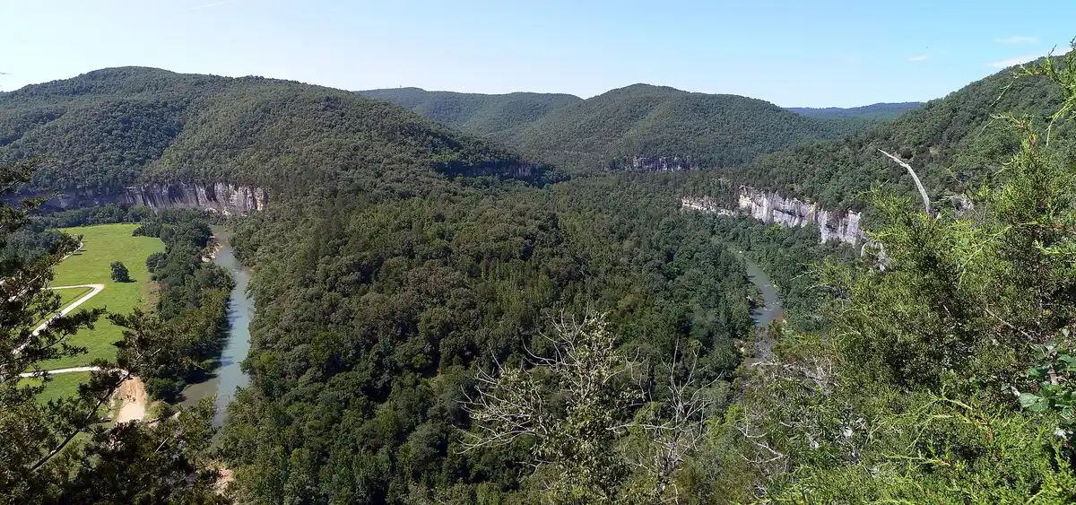
The best waterfall hikes in Arkansas are Hemmed-In Hollow and Lost Valley on the Buffalo National River, Glory Hole, Richland Creek and Kings River Falls in the Ozark National Forest country, and Cedar Falls at Petit Jean State Park. Go in spring or within a day or two of a good rain, because most Arkansas falls are rain-fed and some barely run in a dry spell. Lost Valley and Cedar Falls are the easy starters. Hemmed-In Hollow is the big one, and the hard one.
This page is the waterfall companion to our best hikes in Arkansas guide. Distances below come from the National Park Service, Arkansas State Parks, Arkansas Tourism and the Arkansas Natural Heritage Commission. Where those sources don't give a figure, we say so instead of guessing.
When to go for Arkansas waterfalls
Arkansas Tourism names March through May as the best window, since spring rains bring the strongest flows. That's the season to plan around. But timing a trip to the rain matters more than the calendar. The NPS says Hemmed-In Hollow only flows after a considerable amount of rain, and Arkansas State Parks says most falls in its parks depend on rainfall. A wet week in winter can put on a better show than a dry week in April.
Check recent rainfall before you drive, and call the park or ranger district if you're unsure. The trade-off is that the wettest days are also when trails get slick, creeks rise and gravel roads wash out. Go the morning after a storm, and stay off the trails while it's still pouring.
Buffalo National River waterfalls
The upper Buffalo River, around Ponca, Compton and Boxley Valley, holds the state's two best-known waterfall hikes. Ponca and Jasper are the closest towns. Our Buffalo National River weekend works both hikes into a float trip.
Hemmed-In Hollow Falls
At about 209 feet, Hemmed-In Hollow is the tallest waterfall between the Rockies and the Appalachians. It pours over the Ozark bluffs in the Ponca Wilderness. From the Compton Trailhead the hike is about 5 miles round trip, out and back. The NPS says the average hiker takes 4 to 6 hours and rates the trail steep, rugged and highly strenuous.
The hard part is the return. You drop down to the falls, then climb back out over about 2.5 miles. NPS pages put that climb at 1,200 to 1,400 feet, so plan for the higher number. The park lists this hike as one of its most frequent search and rescue locations. Carry at least 2 liters of water and salty snacks, and bring a headlamp if you start after lunch.
To reach Compton, take Highway 43 south from Harrison about 18.5 miles. Turn onto the dirt road across from the Compton Post Office and drive 1 mile to the trailhead. The Centerpoint Trailhead on Highway 43 is another way in. The NPS calls it a little less strenuous, but it's still a full day.
Eden Falls on the Lost Valley Trail
Lost Valley is the easiest good waterfall hike in Arkansas. The NPS lists it at about 2.5 miles round trip, easy to moderate, and about 2 hours on average. The trail follows Clark Creek into a box canyon past a small waterfall at the Natural Bridge and Cob Cave, a large bluff shelter. Eden Falls, a 53-foot drop, sits about a mile in.
Past the falls, a steeper path climbs to a 200-foot cave with a 25-foot waterfall inside. You need a flashlight and some agility, and the NPS warns that the Eden Falls section is where people slip. The trailhead is off Highway 43 about 2 miles south of Ponca, at the end of a short dirt road. Pets aren't allowed on this trail, and it's open for day use only.
Triple Falls near Jasper
Arkansas Tourism lists this one as Twin Falls near Jasper. It's a double waterfall that shows a third tier after plenty of rain, which is why locals also call it Triple Falls. Don't confuse it with the Twin Falls at Richland Creek below. The walk is short, about 0.5 mile round trip. The drive is the harder part. From Highway 74 you take gravel County Road 2300, then County Road 2306, a steep road where Arkansas Tourism recommends all-wheel drive.
Ozark National Forest waterfalls
South of the Buffalo River, the Boston Mountains section of the Ozark National Forest has more waterfalls and fewer people. Many of the roads are gravel and trail signs are sparse, so bring a paper map.
Glory Hole Falls
Glory Hole is the odd one. Instead of going over a cliff edge, the creek pours through a round hole that erosion cut in the roof of a rock overhang, so the water drops into the shelter below. Arkansas Tourism lists the hike at about 2 miles round trip. The trail heads downhill on the way in and crosses small streams, so the climb comes on the way back.
The trailhead is on Highway 21 about 6 miles south of Boxley, near Ozone. There's no official sign, just a small pull-off and a trail marker, so watch your mileage.
Twin Falls and Richland Falls, Richland Creek
Arkansas Tourism says more than 30 waterfalls have been cataloged in the Richland Creek watershed. The two most people hike to are Twin Falls, which drops in tiers on Devil's Fork, and Richland Falls, a wide cascade on Richland Creek just upstream from the confluence. From Richland Creek Campground it's about 2 miles on the Richland Creek Trail to the Devil's Fork confluence. Twin Falls is about a quarter mile up Devil's Fork, and Richland Falls is about a quarter mile up Richland Creek. All of that is one way.
The Forest Service says there are no developed trails inside the Richland Creek Wilderness, and Arkansas Tourism recommends a topographic map. Expect creek crossings that get dangerous in high water. Potable water isn't available, so bring your own or a filter.
Getting there takes planning. From I-40 at Russellville, Arkansas Tourism's route goes north on Highway 7 about 36 miles to Pelsor, east on Highway 16 about 10 miles, then north on Forest Road 1205 about 8 miles to the campground. The Forest Service warns that the road between Falling Water Falls and the wilderness is prone to landslides and is down to one lane in a couple of places. The county may close it for repairs. The Forest Service doesn't encourage camping trailers on this road.
Falling Water Falls
No hike needed. Falling Water Falls is a roadside drop on Falling Water Creek, visible from Forest Road 1205 on the way to Richland Creek. Arkansas Tourism's directions run from Pelsor east on Highway 16 to Ben Hur, south about 1.5 miles to Forest Road 1205, then 3 to 4 miles to the falls. It's an easy stop to pair with the Richland Creek hike or a quick look if the long walk isn't on.
Kings River Falls
Kings River Falls sits in a state natural area in Madison County near the community of Boston. The Arkansas Natural Heritage Commission lists the trail at 2 miles round trip, easy to moderate, with blue blazes. It isn't ADA accessible.
From Boston on Highway 16, go north on County Road 3175 for 2.1 miles, bear right on County Road 3415 for 2.3 miles, then turn left at the T with County Road 3500. You cross a creek before parking at the natural area sign. Those are unpaved county roads, and that crossing is worth a hard look after heavy rain.
Petit Jean State Park waterfall
Cedar Falls
Cedar Falls drops 90 feet into a canyon cut by Cedar Creek, and it's the easiest Arkansas waterfall to fit into a road trip. The Cedar Falls Trail starts at a breezeway near Mather Lodge and runs 2 miles round trip on orange blazes. Arkansas State Parks rates it moderate to strenuous and notes the rocky drop is steep going down and tricky coming back up.
If you can't do the climb, the Cedar Falls Overlook has a barrier-free walkway that's wheelchair accessible and looks down on the falls and canyon from above. Petit Jean is west of Morrilton on Highway 154. Our Arkansas 10 day outdoor circuit stops here on the way between the Ozarks and the Ouachitas.
Arkansas waterfalls by area
- Buffalo National River: Hemmed-In Hollow (about 5 miles round trip, strenuous), Eden Falls on the Lost Valley Trail (about 2.5 miles, easy to moderate), Triple Falls near Jasper (about 0.5 mile, steep gravel road).
- Ozark National Forest and Boston Mountains: Glory Hole (about 2 miles), Twin Falls and Richland Falls (about 2 miles to the confluence, each way, plus a short spur), Falling Water Falls (roadside), Kings River Falls (2 miles).
- Petit Jean State Park: Cedar Falls (2 miles round trip, moderate to strenuous) or the accessible Cedar Falls Overlook.
Waterfall safety in Arkansas
Wet sandstone is slick, and the NPS says slips, trips and falls cause most accidents on the Lost Valley Trail. Stay on the trail, keep back from bluff edges and don't climb on the falls.
Flash floods are the other risk. The NPS has warned visitors to avoid even the Lost Valley Trail during high water because of its history of flash floods. A storm upstream can raise the Buffalo River and its side creeks hours later without a drop of rain where you're standing. If a creek is high, brown and carrying debris, don't cross it. Drowning is the leading cause of death at Buffalo National River.
Roads close too. Gravel and dirt access roads in the Buffalo River area and the Ozark National Forest can wash out, slide or flood at low-water crossings after heavy rain. Check the Buffalo National River alerts page and the Ozark-St. Francis National Forest alerts before you go. Cell service is unreliable in the park, so leave your plan with someone and save the park's 24-hour dispatch number, 888-692-1162.
Plan an Arkansas waterfall trip
For a weekend, base in Ponca and pair Lost Valley with Hemmed-In Hollow, then add Glory Hole on the drive south. With more time, swing through Richland Creek and Falling Water Falls and finish at Petit Jean. For more trail ideas, see our Ozarks hiking guide. ExplorOFF can also match you with a local guide who knows which falls are running that week. Tell us your dates.
Arkansas Waterfall Hikes: 9 Falls by Region FAQs
Hemmed-In Hollow Falls on the Buffalo National River is the tallest, at about 209 feet. The NPS calls it the highest waterfall between the Rockies and the Appalachians. The hike from the Compton Trailhead is about 5 miles round trip and strenuous, with a long climb back out.
Lost Valley on the Buffalo National River is the easiest good one. The NPS lists it at about 2.5 miles round trip, easy to moderate, ending at 53-foot Eden Falls. At Petit Jean State Park, the Cedar Falls Overlook has a wheelchair-accessible walkway if you want to see a big falls without a hike.
Spring, roughly March through May, according to Arkansas Tourism, because spring rains bring the strongest flows. Most Arkansas falls are rain-fed, so the day or two after a good soaking rain beats any calendar date. In a long dry spell many falls thin out or stop.
About 5 miles round trip from the Compton Trailhead. The NPS says the return is about 2.5 miles with 1,200 to 1,400 feet of climbing, depending on which NPS page you read, and the average hiker takes 4 to 6 hours. It's one of the park's most frequent search and rescue locations, so carry at least 2 liters of water.
Arkansas State Parks lists the Cedar Falls Trail at 2 miles round trip, rated moderate to strenuous. It starts near Mather Lodge and drops into the canyon to the base of 90-foot Cedar Falls, so the climb comes on the way back.
Not for most of them. Lost Valley, Compton (Hemmed-In Hollow) and Petit Jean are reached on paved highways plus short dirt or paved roads. Arkansas Tourism recommends all-wheel drive for the steep county road to Triple Falls near Jasper, and the Forest Service discourages trailers on the rough Forest Road 1205 to Richland Creek, which has had landslides.
Yes. The worked day-by-day plan is Buffalo National River: 3-Day Float & Hike Itinerary (3 Days), with the permits, the stays and the drive times already sorted. Tell us your dates and we will put it together for you and confirm what is genuinely open on those days. Asking is free: no card, no deposit, and nothing is held until you say yes.