Arkansas Outdoor Circuit Map +
10-Day Ozarks to Ouachitas Road Trip
10-day Arkansas outdoor road trip from XNA. Backpack and paddle the Buffalo National River in the Ozarks, soak on Bathhouse Row in Hot Springs, drive the Talimena Scenic Byway, run Cossatot whitewater, and summit Mount Magazine, the state high point.
Free interactive planner · drag & reorder your days, add stops, map it in minutes
Build your own Arkansas trip, drag, reorder & map it.
Drag stops between days, swap trails and paddles, and add your own overlooks and trailheads with the place search. The live map and drive legs recalculate as you go, so you can tune this Ozarks-to-Ouachitas circuit to your pace before you lose cell service in the backcountry.
Opens a side panel · reorder days, add custom stops, see your route live
Ozark bluffs, a spa town & Ouachita whitewater, in one loop.
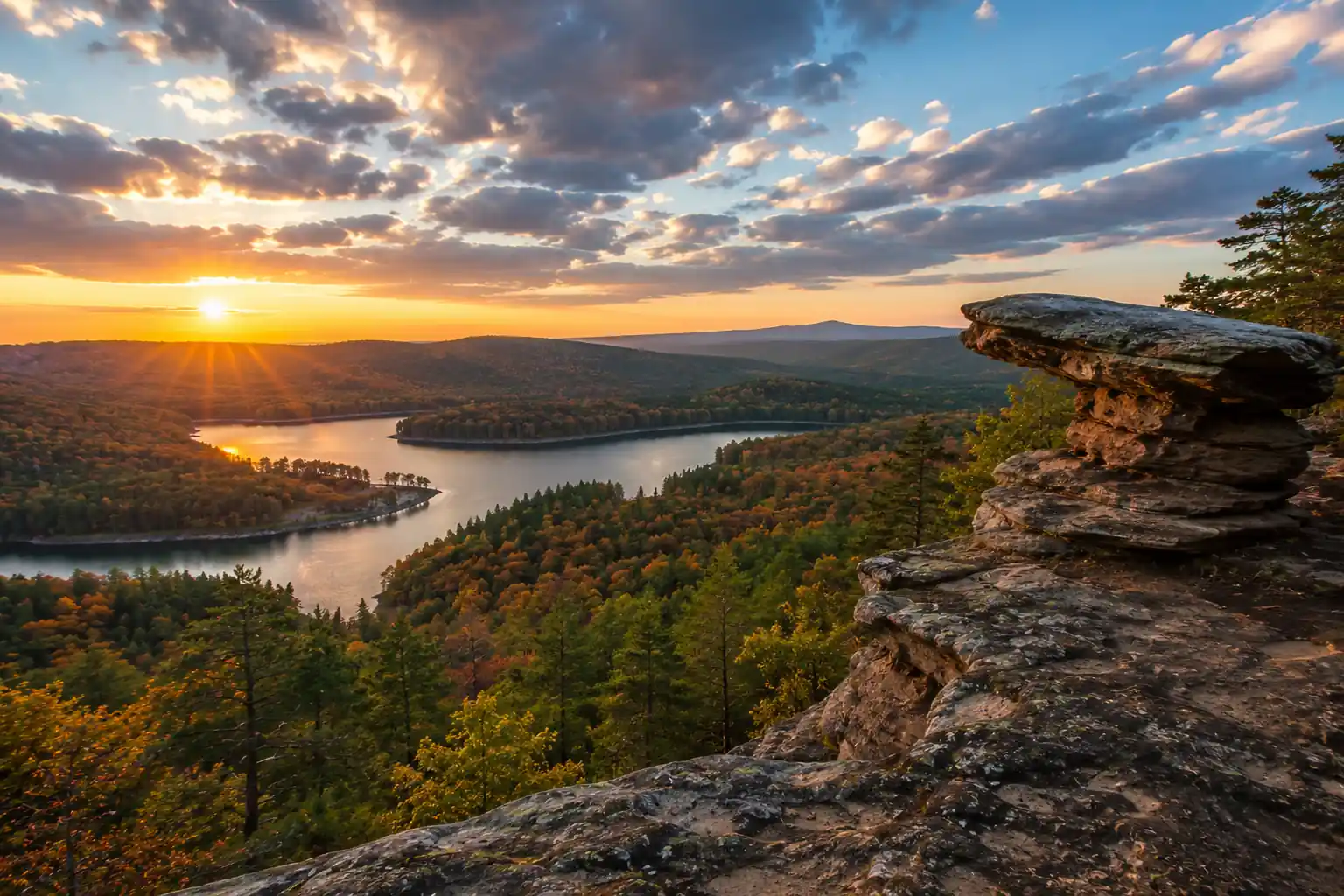
This 10-day Arkansas outdoor circuit covers the state's two mountain ranges in a single loop from Northwest Arkansas National Airport (XNA). You start in the Ozarks around Ponca and the Upper Buffalo National River, then swing south to Hot Springs and the Ouachita Mountains before climbing Mount Magazine on the way back.
The trip mixes it all: day hikes to Whitaker Point (Hawksbill Crag), a multi-day backpack on the Buffalo River Trail, a canoe float below the Ponca bluffs, a soak on historic Bathhouse Row, the 54-mile Talimena Scenic Byway, technical Cossatot River whitewater, and Signal Hill, the highest point in Arkansas at 2,753 ft.
A free, self-issued backcountry permit is required for overnight stays along the Buffalo National River; state-park campsites and cabins need reservations. Spring (April–May) brings wildflowers and runnable rivers; fall (October–November) brings foliage, cooler hiking, and fewer bugs. Base towns are Ponca or Jasper, Hot Springs, and Mena.
For peak spring and fall seasons, book lodging in Ponca, Jasper, and Hot Springs 3–6 months out; state-park campsites and the lodges at Queen Wilhelmina and Mount Magazine can be reserved up to a year ahead through arkansasstateparks.com. Buffalo River canoe and shuttle rentals (Buffalo Outdoor Center) and any guided Cossatot trip should be reserved in advance, especially on weekends.
Arrive in Ponca & Lost Valley Trail · 2.2 miles
Fly into Northwest Arkansas National Airport (XNA), pick up your rental car, and drive roughly 2.5 hours to Ponca, the gateway to the Upper Buffalo National River. Check into your cabin or motel in the Ponca/Jasper area and settle in.
In the afternoon, stretch your legs on the easy Lost Valley Trail (2.2 miles round trip). It leads past bluffs and Eden Falls to a small cave you can explore with a flashlight, a gentle introduction to the Ozarks that works for all ages.
- Drive from XNA to Ponca~2.5 hr · rental car required · gateway to the Buffalo River
- 2.2 mi round trip · ~200 ft · Eden Falls & a walk-in cave
- Check into Ponca / Jasper lodgingCabins & motels · book early for spring and fall
- XNA is the closest major airport; rental cars are available on-site and you will need one for the whole loop.
- Book Ponca and Jasper lodging 3–6 months ahead for spring and fall weekends, as options are limited near the trailheads.
- Eden Falls is seasonal, so it flows best after spring rains; the cave at the top is short but muddy.
PoncaOzark bluffsWhitaker Point & a Buffalo River Paddle
Buffalo River floatOzark bluffsStart with the iconic hike to Whitaker Point (Hawksbill Crag), a 3-mile out-and-back to one of Arkansas's most photographed overlooks above the Upper Buffalo wilderness. Arrive early for soft light and to beat the crowds, and mind the exposed bluff edges.
In the afternoon, and depending on water levels, rent a canoe or kayak and paddle the Ponca to Kyles Landing stretch of the Buffalo National River (10.5 miles, 4–6 hours, Class I–II) past towering bluffs. Outfitters like the Buffalo Outdoor Center handle rentals and shuttles.
- 3 mi round trip · ~400 ft · iconic Ozark overlook
- 10.5 mi · 4–6 hr · Class I–II · check water levels
- Second night in Ponca / JasperEasy access for tomorrow's backpacking start
- The Whitaker Point trailhead sits on gravel Cave Mountain Road; a normal car is fine but drive slowly.
- The Ponca-to-Kyles float only runs with enough water, so check the Buffalo River gauge or ask your outfitter before committing.
- If levels are low, swap in a lower, longer stretch of the river or add a second Ozark day hike.
Buffalo River Trail Backpacking · 10.5 miles
Before you start, grab a free, self-issued Buffalo National River backcountry permit from a visitor center or trailhead kiosk. Then set off on your multi-day backpack along the Buffalo River Trail (BRT), hiking the Ponca low-water bridge to Kyles Landing section, roughly 10.5 miles of rugged, rewarding terrain.
The BRT climbs and drops steeply with big views of the river and its bluffs. Camp at a primitive backcountry site along the way, filter your water, hang or canister your food, and practice strict Leave No Trace.
- Free · self-issue at trailheads & visitor centers
- ~10.5 mi · 6–8 hr · strenuous · big elevation changes
- Backcountry camp along the BRTPrimitive site · camp 100+ ft from water · pack it out
- Carry enough water or a reliable filter; on-trail sources vary with the season.
- Prior backpacking experience helps here, as the BRT features steep, rocky ascents and descents.
- Bear-resistant storage is recommended; hang a bear bag or use a canister and keep a clean camp.
Backcountry campRiver bluffsBRT to Pruitt & Drive to Hot Springs · 6 miles + drive
Final BRT milesBathhouse RowFinish the backpacking leg with the Kyles Landing to Pruitt section of the BRT, about 6 miles of morning solitude and scenic overlooks before you retrieve your vehicle or meet a shuttle at Pruitt.
After the hike, begin the roughly 3-hour drive south to Hot Springs, trading Ozark wilderness for a historic spa town. Break for lunch around Russellville, check into your hotel, and enjoy dinner downtown.
- ~6 mi · 3–4 hr · moderate · last Ozark views
- Drive to Hot Springs~3 hr · ~120 mi · lunch stop in Russellville
- Check into Hot Springs lodgingHistoric hotels or modern stays near Bathhouse Row
- Sort out your Pruitt-end logistics before you start: either spot a car or book a trailhead shuttle.
- Book Hot Springs lodging well ahead, especially for weekends, and prioritize a stay near Central Avenue for walkable Bathhouse Row access.
- It is a scenic but long drive through central Arkansas, so top off fuel and plan a real lunch break.
Hot Springs National Park & Bathhouse Row
Explore Hot Springs National Park, one of the smallest and oldest in the system. Start at the restored Fordyce Bathhouse Visitor Center to learn the story of the thermal waters, then take a traditional soak at Buckstaff or a modern spa session at Quapaw Baths & Spa.
Walk off the relaxation on the Hot Springs Mountain Trail, a 1.7-mile loop with panoramic views and an observation tower right behind Bathhouse Row. There is no park entrance fee; bathhouse soaks are charged separately.
- Free · 1–2 hr · park museum & history · no bathing here
- Soak on Bathhouse RowBuckstaff (traditional) or Quapaw (modern) · reserve ahead
- 1.7 mi loop · ~200 ft · panoramic views & tower
- Reservations are recommended for Buckstaff and Quapaw, especially on weekends.
- Parking on Bathhouse Row is limited, so use the parking garage or nearby street parking.
- Fill a bottle at the free thermal-water jug fountains along Central Avenue, a classic Hot Springs ritual.
Fordyce BathhouseMountain TowerOuachita National Forest & Lake Ouachita Vista Trail · 5–7 miles
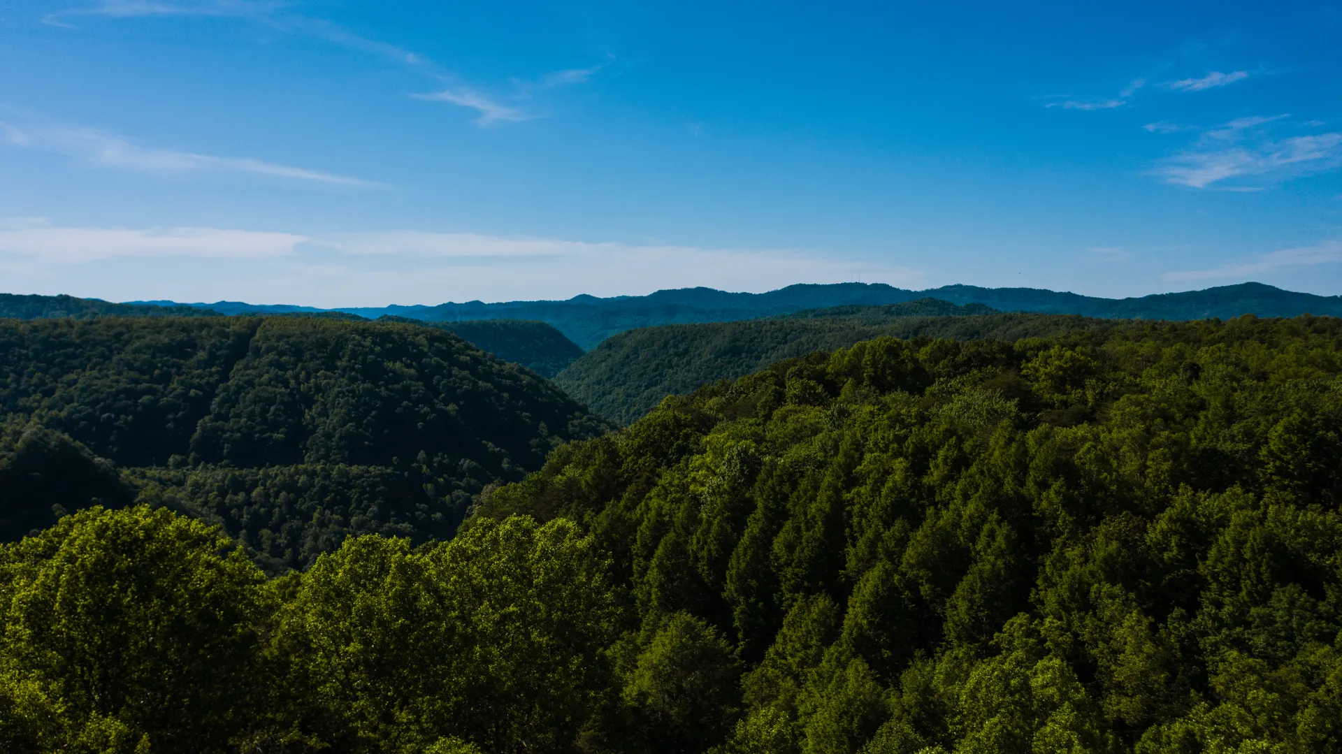
Ouachita ForestLake OuachitaDrive about an hour west into the Ouachita National Forest, a vast landscape of rolling ridges and pine. Hike a section of the acclaimed Lake Ouachita Vista Trail (LOViT), an out-and-back of 5–7 miles with beautiful views over Lake Ouachita.
The LOViT is a well-built multi-use trail with several access points, and there are chances to swim in the lake. Afterward, either return to Hot Springs or push west toward Mena to shorten tomorrow's drive to the Talimena Scenic Byway.
- Drive into the Ouachita National Forest~1 hr · ~40 mi · fuel up, limited cell service
- 5–7 mi out-and-back · ~500 ft · lake views
- Overnight in Hot Springs or MenaMove west to cut tomorrow's drive · or forest camping
- Download offline maps before you enter the forest, as cell coverage is patchy.
- For a bigger day, a portion of the Eagle Rock Loop offers more challenging terrain.
- If you shift to Mena tonight, note it has fewer lodging and dining options than Hot Springs, so plan ahead.
Talimena Scenic Byway & Queen Wilhelmina State Park
Drive the stunning Talimena Scenic Byway, a 54-mile National Scenic Byway that rides the crest of the Ouachitas from Mena, Arkansas to Talihina, Oklahoma, with overlook after overlook, spectacular in spring and fall.
Stop at Queen Wilhelmina State Park atop Rich Mountain, Arkansas's second-highest peak. Tour the historic lodge, take in the views, and walk a short trail like the Tall Peak Trail. Spend the night in Mena at the base of the range.
- Talimena Scenic Byway54 mi · 2–3 hr · numerous overlooks · Mena to Talihina
- Rich Mountain · historic lodge · restaurant & views
- 1.2 mi loop · easy forest walk near the lodge
- Services along the byway are limited, so start with a full tank and pack snacks and water.
- The Queen Wilhelmina lodge restaurant is a convenient lunch stop with a view.
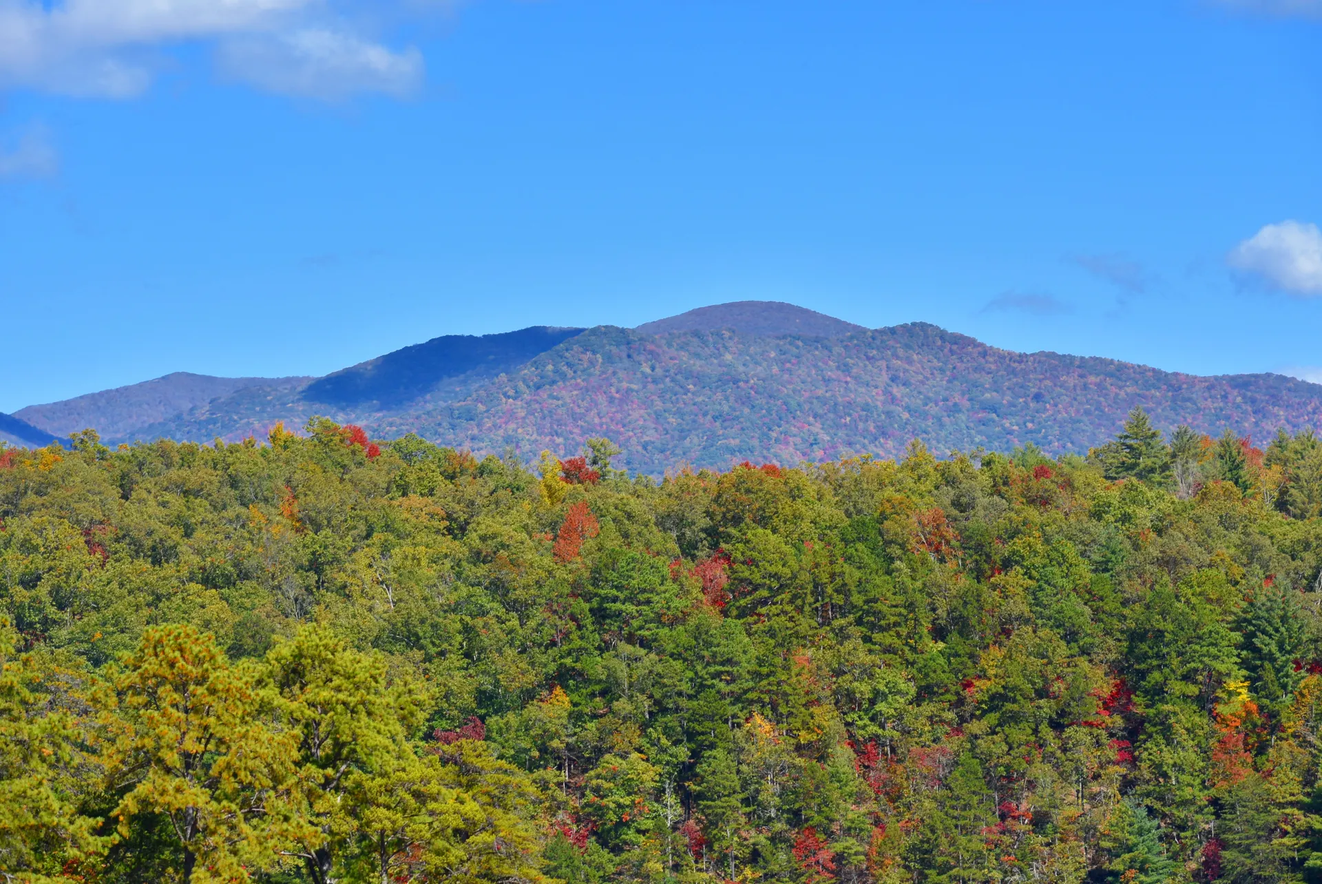
- Fall color typically peaks late October into early November along the Ouachita crest.
Queen WilhelminaRich MountainCossatot River Whitewater · Class II–IV
Cossatot RiverCaddo backupExperienced paddlers can take on the Cossatot River, one of the most technical runs in the Mid-South, with Class II–IV rapids that peak at Cossatot Falls when water is high. This is a serious whitewater day and not for beginners.
If the Cossatot is too much, or the gauges are low, opt instead for a calm, family-friendly float on the nearby Caddo River, with outfitters handling rentals and shuttles. Return to Mena for your final night in the Ouachitas.
- Class II–IV · check gauges · PFD & helmet essential
- Alternative: Caddo River float8–12 mi · calm · family-friendly · outfitter rentals
- Final night in MenaRecover after the paddle · gateway to the Ouachitas
- The Cossatot is rainfall-dependent; late winter and early spring (February–April) usually bring the highest, most runnable water.
- A PFD is legally required, and a helmet is essential on the whitewater sections.
- If you are not an expert, hire a local guide or default to the Caddo River float instead.
Mount Magazine & Signal Hill · Arkansas High Point · 2 miles
Drive north to Mount Magazine State Park, home to the highest point in Arkansas. Hike the short Signal Hill Trail to the 2,753-foot summit, the state high point, and add the Benefield Loop or a bluff-edge trail for more views over the Petit Jean River Valley.
The mountaintop is known for its diverse ecosystems, hang-gliding launches, and butterflies. Cap the trip with a night at the Lodge at Mount Magazine for its dramatic overlook, or begin driving north toward XNA for a shorter departure day.
- Drive to Mount Magazine State Park~1.5 hr · ~60 mi · winding mountain roads
- ~1.5 mi loop · summit marker at 2,753 ft
- Clifftop lodge & views · or start driving toward XNA
- The summit approach is a scenic but slow, winding drive, so allow extra time.
- The Lodge at Mount Magazine books up in peak season; reserve early if you want the clifftop view.
- Nearby Paris and Russellville offer more lodging if the lodge is full or you want to shorten the last drive.
Mount Magazine LodgeValley viewsDeparture · Drive to XNA
River ValleyOzarksOn your final morning, enjoy a last Arkansas breakfast or squeeze in a short hike if your flight allows. Then drive roughly 2 hours north to Northwest Arkansas National Airport (XNA), returning the rental car with a full tank.
From the Ozark bluffs of the Buffalo River to the thermal waters of Hot Springs and the Ouachita crest, you have covered both of Arkansas's mountain ranges and every activity the state does best.
- Drive to XNA airport~2 hr · ~80 mi · return rental with full tank
- Optional final short hike or breakfastIf your flight schedule allows
- Confirm your flight status before leaving Mount Magazine, as XNA has limited daily departures.
- Fuel up near Paris or Alma so you can return the rental car full.
- Leave a buffer for rental-car return and security at XNA.
Now build your Arkansas trip.
You've seen all ten days. Open the free drag-and-drop planner and tune it for your dates, your pace, and whether you lean into whitewater or keep it to scenic hikes and soaks.
Essential permits, rivers & planning.
Buffalo National River permit
Backcountry camping along the Buffalo River Trail requires a free, self-issued permit, available at trailheads and visitor centers. Pack out all trash, camp 100+ ft from water, and use a bear bag or canister. Check current river levels before any paddling, as conditions change rapidly.
Hot Springs National Park
There is no entrance fee to the park itself, but bathhouse soaks are charged separately. Parking on Bathhouse Row is limited, so use the parking garage or street parking. The park is open year-round, and free thermal-water fountains line Central Avenue.
State-park reservations
Camping fees vary by park and site. Reserve campsites, cabins, and the lodges at Queen Wilhelmina and Mount Magazine early, especially in spring and fall, through arkansasstateparks.com.
Cossatot River is expert-only
The Cossatot is rainfall-dependent and holds Class II–IV whitewater. Always check gauge readings before you launch, a PFD is legally required, and it is not recommended for beginners. If in doubt, float the calm Caddo River instead.
Download offline maps
Cell service is spotty to non-existent across much of the Ozark and Ouachita National Forests. Download offline maps, fuel up before entering the forests, and share your itinerary with someone before heading into the backcountry.
Go spring or fall
April–May brings wildflowers, higher water for paddling, and comfortable hiking; October–November brings foliage, cooler weather, and fewer bugs. Summer runs hot and humid with low rivers; winter can be cold with occasional snow and limited access.
Everything you'll actually want to know.
Ready to go? Get your
Arkansas outdoor circuit route.
Trailheads and mileages, the free Buffalo River permit, canoe outfitters and shuttles, Bathhouse Row soaks, the Talimena Scenic Byway, Cossatot gauge tips, and the drive times that tie the Ozarks and Ouachitas into one 10-day loop.
Instant book · Free cancellation · Secure payment via Stripe
Planning this trip?
Save it, share it with your crew, or find travelers heading the same way.

Liked this itinerary?
What other travelers are saying
Be the first to leave a tip or question for the next traveler.