Buffalo National River Map +
3-Day Float & Hike Itinerary
3-day Buffalo National River itinerary on America's first national river. Hike the Lost Valley Trail to Eden Falls, float 11 miles of Class I–II water from Pruitt to Carver past towering Ozark bluffs, and finish at 209-ft Hemmed-In Hollow Falls, all from a base in Ponca, Arkansas.
Free interactive planner · drag & reorder your days, add stops, map it in minutes
Build your own Buffalo River trip, drag, reorder & map it.
Drag stops between days, swap floats and hikes, and drop in your own access points or trailheads with the place search. The live map and legs recalculate as you go, so you can tune the float length and shuttle logistics to your pace before you head into the Ozarks.
Opens a side panel · reorder days, add custom stops, see your route live
Float and hike America's first national river, from a Ponca base.
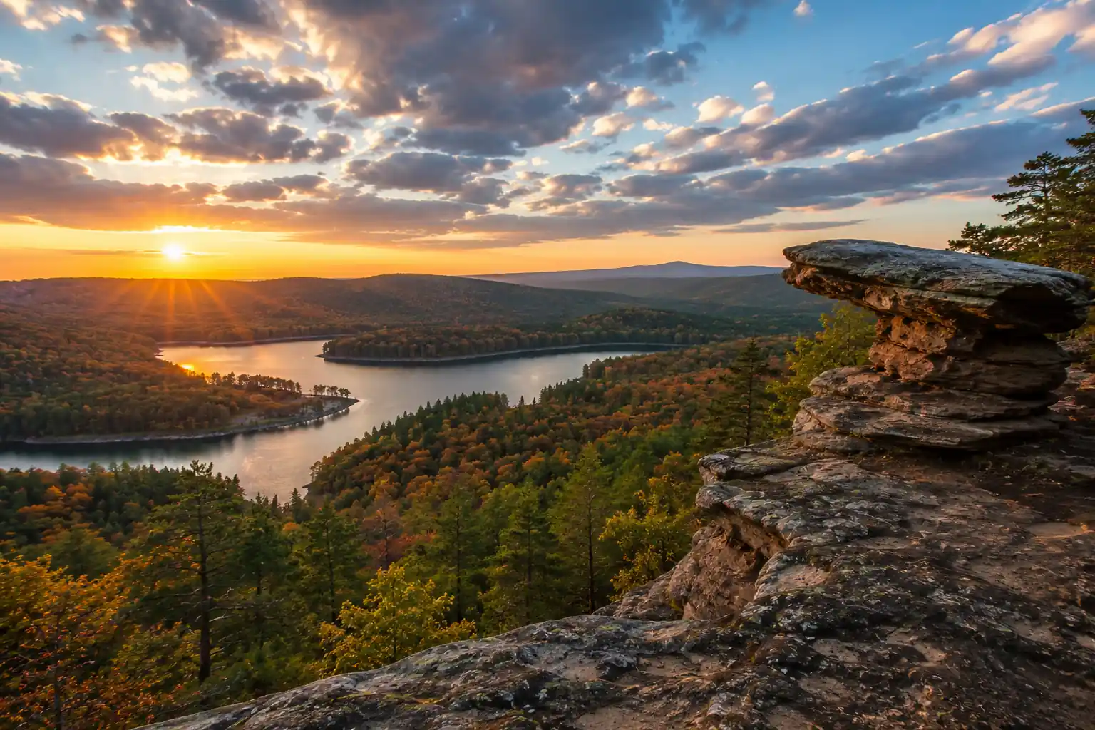
For a 3-day trip on the Buffalo National River, base your logistics out of Ponca, Arkansas, the gateway to the upper and middle districts. This itinerary balances paddling and hiking through iconic Ozark landscapes: free-flowing water, towering limestone bluffs, and some of the tallest waterfalls between the Rockies and the Appalachians.
The route pairs the family-friendly Lost Valley Trail (2.3 miles to Eden Falls and Cob Cave) with an 11-mile Pruitt-to-Carver float through the middle district, and finishes with the strenuous descent to Hemmed-In Hollow Falls, at 209 feet the tallest waterfall between the Rocky Mountains and the Appalachians.
No permits are required to float the river in your own canoe or kayak, and there are no entrance fees. A free backcountry permit is required for primitive overnight camping. April through early June brings the best water levels; late September to October brings cooler air, fewer bugs, and fall foliage.
Book canoe/kayak rentals and shuttles with a local outfitter 3–6 months out for peak season (April–June); outfitters like the Buffalo Outdoor Center in Ponca fill up fast. Developed campgrounds such as Steel Creek and Kyle's Landing take reservations on Recreation.gov, while backcountry primitive camping needs only a free NPS permit obtained at a visitor center or online.
Arrive in Ponca & Lost Valley Trail · 2.3 miles
Drive to Ponca, Arkansas, secure your canoe or kayak rental and shuttle with a local outfitter, and check into your lodging or set up camp. Ponca is about 2 hours from Northwest Arkansas National Airport (XNA) and serves as the primary access point for the upper Buffalo River.
Spend the afternoon on the Lost Valley Trail, a 2.3-mile out-and-back that packs in more Ozark scenery per mile than any other hike in the area: seasonal waterfalls, Cob Cave, a natural bridge, and 53-ft Eden Falls. Bring a headlamp to scramble up into the Eden Falls Cave, where a 25-ft waterfall hides in a room about 200 ft back.
- Drive to Ponca, AR~2 hr from Northwest Arkansas National Airport (XNA) · limited cell service
- Rentals ~$50–80/day · shuttle ~$30–60 · book ahead in peak season
- 2.3 mi RT · ~200 ft gain · Eden Falls, Cob Cave & cave scramble
- Book your canoe/kayak rental and shuttle with a local outfitter well ahead of a peak-season (April–June) weekend; the Buffalo Outdoor Center in Ponca and other outfitters fill up fast.
- The Lost Valley trailhead is off AR-43 about 1.5 miles south of Ponca. Wear sturdy shoes; the trail can be slick, and the final scramble to Eden Falls is rocky.
- A free backcountry permit is required for primitive overnight camping. Developed campgrounds like Steel Creek and Kyle's Landing take reservations on Recreation.gov.
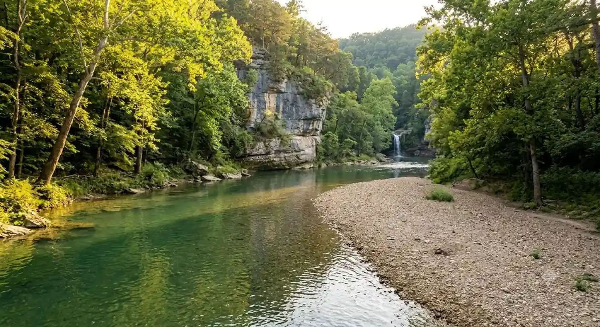
Ponca gatewayOzark bluffsPruitt to Carver Float · 11 miles
River bluffsBack to PoncaThis is a full day on the water. Shuttle to the Pruitt put-in on AR-7 and launch onto an 11-mile stretch of the middle district, with scenic limestone bluffs, gravel bars perfect for a picnic or a swim, and generally calm water broken by the occasional easy Class I–II riffle. Check the river gauge before you launch: low water makes for a lot of dragging, high water can be dangerous.
Watch for towering bluffs on river left, including Jim Bluff, a dramatic limestone wall and a classic photo stop. Pull out at the Carver access, where your pre-arranged shuttle meets you, then head back to Ponca (or Harrison, 30 minutes away, for more dining) for the night.
- Shuttle to Pruitt launch15–20 min from Ponca · restrooms at the access · check the Pruitt gauge
- 11 mi · 4–6 hr paddling · Class I–II · bluffs & gravel bars
- Photo stop at Jim BluffTowering limestone wall on river left · classic Buffalo River view
- Overnight in Ponca or HarrisonLimited dining in Ponca · Harrison (30 min) has more amenities
- Always check the current river level before you launch. The NPS provides real-time gauge data; low water can make the float a slog and high water can be dangerous.
- Glass containers are prohibited on the river. Pack everything in dry bags, and a PFD (life vest) is required for every person aboard.
- Confirm your shuttle pickup time and location at Carver before you launch. Restrooms are available at both the Pruitt and Carver access points.
Hemmed-In Hollow Hike & Departure · 5 miles
Drive to the Compton Trailhead (rough gravel for the final miles; arrive early for parking) and drop into the box canyon on the strenuous Hemmed-In Hollow hike, roughly 5 miles round trip with about 1,400 ft of descent and climb. The trail starts high above the falls and drops steeply toward the river, so pace yourself and save energy for the climb out.
Reach the base of Hemmed-In Hollow Falls, at 209 feet the tallest waterfall between the Rocky Mountains and the Appalachians. It runs best after heavy rain and can slow to a trickle in dry spells. After the hike, drive out through Harrison for a final meal before heading home; cell service improves as you leave the park boundary.
- Drive to Compton Trailhead~20 min from Ponca · rough gravel road · limited parking, arrive early
- ~5 mi RT · ~1,400 ft loss/gain · strenuous · allow 4–6 hr
- 209 ft · tallest falls between the Rockies & Appalachians
- The Compton Trailhead sits above the falls, so the hard climb comes at the end when you are tired. Carry plenty of water and snacks and allow 4–6 hours round trip.
- Hemmed-In Hollow Falls is seasonal and is most impressive after heavy rain; in dry spells it can be little more than a trickle.
- The hollow sits in a designated wilderness area. Stay on marked paths, respect the fragile ecosystem, and pack out everything you bring in.
Wilderness canyonDrive outNow build your Buffalo River trip.
You've seen all three days. Open the free drag-and-drop planner and tune it for your dates, your pace, and how much of the river you want to float from your Ponca base.
Essential river regulations & planning.
Permits & fees
There are no entrance fees and no permit is required to float the Buffalo National River in your own canoe or kayak. Commercial outfitters operate under NPS permits. A free backcountry permit is required for all primitive overnight camping outside developed campgrounds, obtainable at a visitor center or online.
Campgrounds & reservations
Developed campgrounds such as Steel Creek and Kyle's Landing take reservations on Recreation.gov and fill up fast in peak season; first-come, first-served sites are limited. Fees run roughly $16–24 per night. Primitive backcountry camping is free with a permit.
River rules & safety
A PFD is required for every person. Glass containers are prohibited on the river. Always check current river levels before launching, low water can strand you and high water can be dangerous. Follow Leave No Trace: pack out all trash and food scraps.
When to go
April to early June brings the best water levels and wildflowers, but also peak crowds. Late September to October offers cooler temperatures, fewer insects, and fall foliage, though lower water can make some sections hard to float. Always check current conditions.
Getting there needs a car
Ponca is about 2 hours from Northwest Arkansas National Airport (XNA) and roughly 45 minutes from Harrison, AR, which has the nearest full amenities and dining. Cell service is limited around the river, so download maps before you arrive. No public transportation reaches the access points.
Dogs on the river & trails
Dogs are allowed on the river and in developed campgrounds on a leash, but they are generally not permitted on hiking trails within the park, except the Buffalo River Trail and shared-use paths. Check the specific trail regulations before you bring a pet.
Everything you'll actually want to know.
Ready to go? Get your
Buffalo National River route.
Access points and float mileages, the shuttle and outfitter logistics, backcountry and campground permits, river-level and glass-container rules, drive times from XNA and Harrison, and the trailhead timing you need to hike Lost Valley and Hemmed-In Hollow in one weekend.
Instant book · Free cancellation · Secure payment via Stripe

Planning this trip?
Save it, share it with your crew, or find travelers heading the same way.

Liked this itinerary?
What other travelers are saying
Be the first to leave a tip or question for the next traveler.