Where Is St John Island? Map, Size and Getting to Virgin Islands National Park
St John is one of the three main US Virgin Islands, in the Caribbean, about 3 to 4 miles east of St Thomas across a channel called Pillsbury Sound. It is small, about 20 square miles end to end, and roughly 60 percent of that land is Virgin Islands National Park. There is no bridge and no commercial airport on St John. You fly into St Thomas, then take a passenger ferry from Red Hook to Cruz Bay, the island's only town. If a warm water paddle trip is more your speed than a mountain trail, our Everglades kayaking weekend is the closest thing on our site to island paddling.
Where St John Sits in the Caribbean
St John is part of the United States Virgin Islands, a US territory, not a foreign country. It sits east of St Thomas and west of the British Virgin Islands, in the chain of islands east of Puerto Rico. The three main US Virgin Islands are St Thomas, St John and St Croix. St Croix is the largest and sits alone, about 40 miles south across open water. St Thomas and St John are close enough that people commute between them by ferry every day.
Do not confuse St John with St John's, the capital of Antigua and Barbuda, or with St. John's, Newfoundland, in Canada. All three show up in the same search results, and they are nowhere near each other.
How Big Is St John?
St John covers about 20 square miles, roughly 9 miles long and up to 5 miles wide at its widest point. Virgin Islands National Park, established in 1956, protects about 7,259 acres of that land, which the National Park Service states is about 60 percent of the island's land mass, plus more than 5,600 acres of adjacent submerged land offshore. The other 40 percent is private land: Cruz Bay, the small town of Coral Bay on the east end, and scattered homes and resorts.
The Beaches, From Cruz Bay Outward
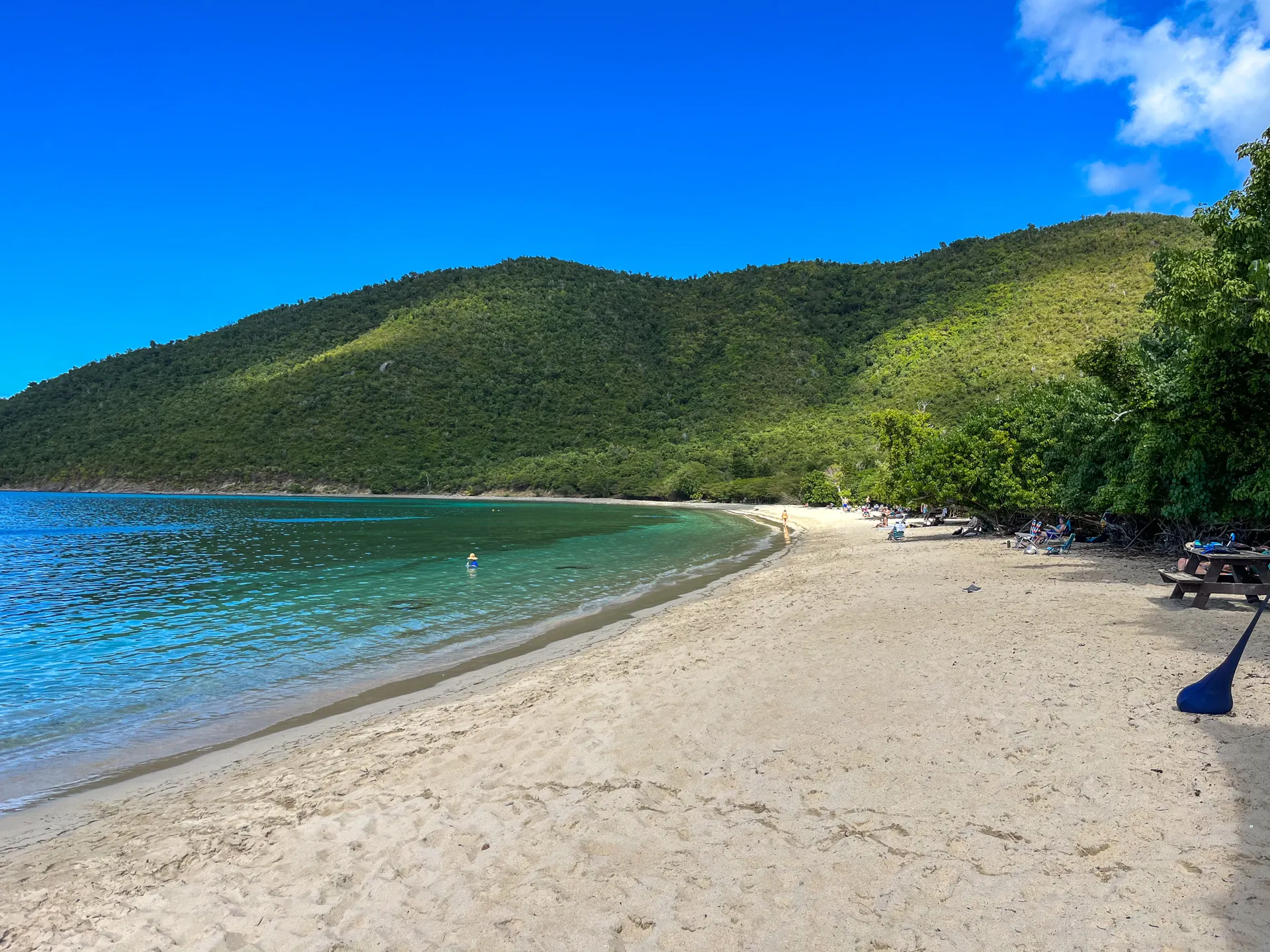
St John's beaches run along the north shore road out of Cruz Bay and along a rougher stretch of the south and east coast. A plain rundown, west to east on the north side:
- Frank Bay. The closest beach to town, a short walk from the Cruz Bay ferry dock. Small and calm, a good stop if you have an hour before or after a ferry rather than a full beach day.
- Trunk Bay. The park's best known beach, with a roughly 225 yard marked underwater snorkeling trail and visitor amenities. It gets crowded by mid morning.
- Cinnamon Bay. East of Trunk Bay and about a mile west of Maho Bay. Home to the island's only campground, with kayak rentals and a restaurant on site.
- Maho Bay. Known for calm, shallow water close to the road, which makes it an easy stop for families and for spotting sea turtles.
- Salt Pond Bay. On the quieter south side, reached by a short trail rather than a roadside pull off.
We are not embedding a map tool here. The layout above, run in order along the road from Cruz Bay, is the map: everything sits along one loop road on the west and north side of the island.
Getting to St John From Red Hook
There is no bridge to St John. The route is: fly into St Thomas (Cyril E. King Airport), get to Red Hook at the east end of St Thomas, then take the passenger ferry to Cruz Bay. The crossing itself runs about 20 minutes. Ferries run roughly every hour through the day, with the schedule changing between peak and off season and around holidays, so check the current timetable before you plan a tight connection. A separate car barge runs the same route for anyone bringing a vehicle over. Cruz Bay's National Park Service visitor center is an easy walk from the ferry dock.
Have Us Plan the Water Part of Your Trip
We do not currently run a Caribbean itinerary, so if you are pairing island time with a mainland paddle trip, our Everglades kayaking weekend is the nearest match on the site for warm water and mangroves. Tell us your dates and we can help fit the rest of the trip around it.
Where Is St John Island? Map, Size and Getting to Virgin Islands National Park FAQs
St John is one of the US Virgin Islands, in the Caribbean, about 3 to 4 miles east of St Thomas across Pillsbury Sound. It is a US territory, reached by ferry from Red Hook, St Thomas, since there is no bridge or commercial airport on the island.
About 20 square miles, roughly 9 miles long and up to 5 miles wide. Virgin Islands National Park covers about 60 percent of that land, plus more than 5,600 acres of adjacent water.
Frank Bay is the closest beach to Cruz Bay, a short walk from the ferry dock. It is small and calm, better for a quick stop between a ferry and a hotel than for a full beach day.
Dead Chest is a small, uninhabited island in the British Virgin Islands, near Peter Island, not on St John and not part of Virgin Islands National Park. It sits in a different territory (British, not US) about 20 miles east.
By passenger ferry from Red Hook, on the east end of St Thomas, to Cruz Bay on St John. The crossing takes about 20 minutes, with ferries running roughly every hour; confirm the current schedule before you travel since it shifts by season.
No. St John in the US Virgin Islands is a different place from St John's, the capital of Antigua and Barbuda, and from St. John's, Newfoundland, in Canada. All three turn up in the same search results.
Yes. The worked day-by-day plan is Everglades Kayaking Weekend: 3-Day Chickee Camping Route (3 Days), with the permits, the stays and the drive times already sorted. Tell us your dates and we will put it together for you and confirm what is genuinely open on those days. Asking is free: no card, no deposit, and nothing is held until you say yes.






























