California Road Trip Itinerary: 2 Classic Loops
The best California road trip itinerary follows one of two classic loops. The national parks loop links Yosemite, Sequoia and Kings Canyon, Death Valley, and Joshua Tree for granite domes, giant sequoias, and desert. The Pacific Coast Highway loop runs from San Francisco south through Big Sur and the Central Coast for cliffs and ocean. Plan 7 days for a single loop, or 10 to 14 days to combine both into one big circle. Spring and fall are the best times to go, since summer bakes the desert parks and winter closes the high Sierra passes.
California is built for the road trip. In a single loop you can stand under a giant sequoia, watch a waterfall thunder off a granite cliff, cross a below-sea-level desert, and end the day on a fog-wrapped ocean overlook. This guide is a hub for planning a California road trip itinerary, laying out the two classic routes, how many days you need, and the best time to go. When you are ready to turn the outline into a day by day plan, our detailed ExplorOFF itineraries handle the drive times, trailheads, and where to sleep. Start with the California national parks family loop for the inland route or Big Sur hiking for the coast.
Loop 1: the California national parks road trip itinerary
The inland loop is the classic California road trip itinerary for anyone who wants mountains, forests, and desert in one circle. It links four headline parks, and you can run it clockwise or counterclockwise depending on the season and where you fly in. Our California national parks family loop maps the full route day by day.
Yosemite
Yosemite is the anchor of any Sierra Nevada road trip: waterfalls off sheer granite, the domes and spires of the valley, and high country meadows along Tioga Road. Plan two to three days to hike to Vernal and Nevada Falls, walk the valley floor, and drive up to Glacier Point for the big view. Tioga Road over the crest is closed in winter, which reshapes the loop in the colder months. Our Yosemite hiking trips guide picks the best trails by fitness level.
Sequoia and Kings Canyon
Just south of Yosemite, Sequoia and Kings Canyon protect the largest trees on Earth by volume, including the General Sherman Tree. Walk the Congress Trail among the giant sequoias, climb Moro Rock for a Sierra panorama, and drop into the deep glacial trench of Kings Canyon if the season allows. A day or two here pairs naturally with Yosemite for a giant-trees-and-granite leg of the trip.
Death Valley
Death Valley is the desert extreme of the loop: the lowest point in North America at Badwater Basin, sculpted badlands at Zabriskie Point, and sand dunes near Stovepipe Wells. It is best from late fall through early spring, since summer temperatures are genuinely dangerous. A winter or shoulder-season visit is spectacular and quiet. Our Death Valley winter hiking itinerary times it right and picks the cooler trails.
Joshua Tree
Joshua Tree closes the desert side of the loop where two deserts meet, with its namesake spiky trees, giant boulder piles, and some of the darkest night skies in Southern California. It is an easy park to enjoy in a single full day of short hikes and scrambles, and like Death Valley it shines in the cooler months. See our guide to things to do in Joshua Tree for the best stops.
Extend it: the Eastern Sierra
If you have more time, the east side of the Sierra Nevada strings together alpine lakes, Mono Lake, and Mammoth on Highway 395, a spectacular connector between Yosemite and Death Valley when Tioga Road is open. Our Eastern Sierra 10 day loop turns that stretch into a full trip of its own.
Loop 2: the Pacific Coast Highway road trip itinerary
The coastal California road trip itinerary follows Highway 1 down the edge of the continent. Most travelers drive it north to south so the ocean sits on the passenger side and every pullout is an easy right turn. It is a shorter loop than the parks route but no less iconic.
San Francisco
San Francisco is the classic northern launch point for a Pacific Coast Highway trip. Give it a day for the Golden Gate Bridge, the coastal trails of the Marin Headlands and Lands End, and the hills of the city itself before you point the car south. It is also the natural finish line if you run the combined parks-and-coast loop back to the Bay Area.
Big Sur
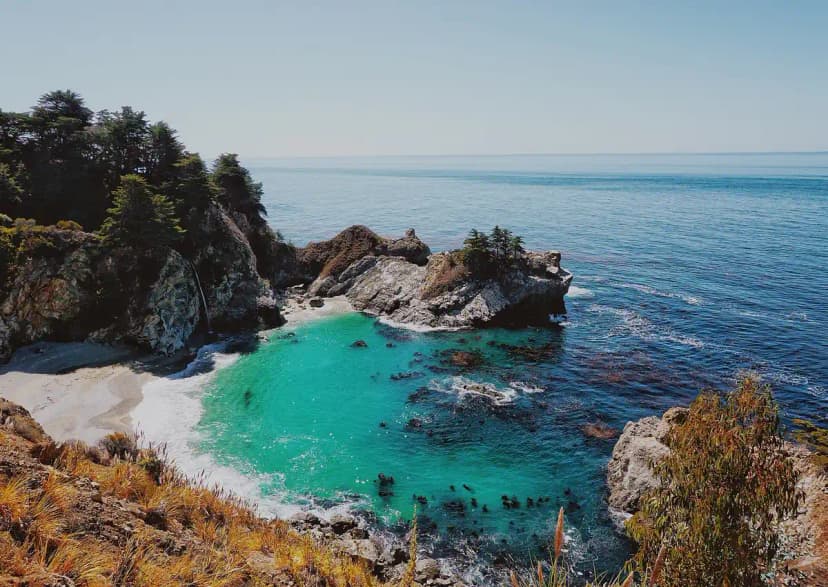
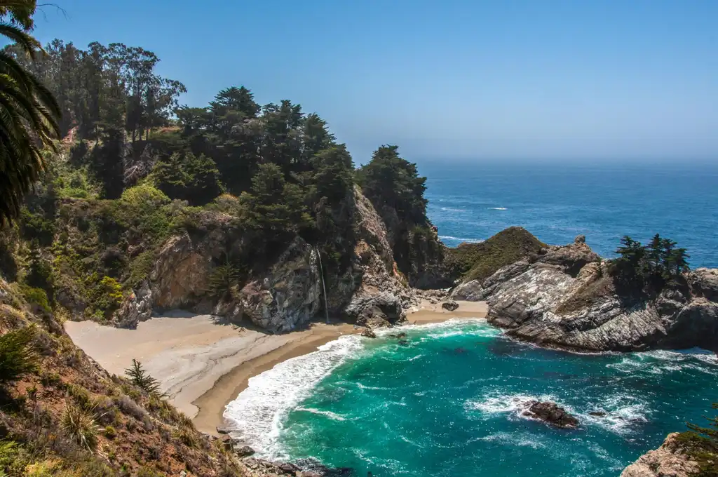
Big Sur is the heart of the drive: about 90 miles of cliffs, redwood canyons, and ocean between Carmel and San Simeon. The signature stops are Bixby Creek Bridge, Pfeiffer Big Sur State Park, and the waterfall-onto-the-beach at McWay Falls. Highway 1 here is prone to landslides and closures, so check road status before you commit to driving straight through. Our Big Sur hiking itinerary lays out the drive and the best short trails.
The Central Coast
South of Big Sur the road eases into the Central Coast: Hearst Castle and the elephant seals at San Simeon, the wide beaches of Cambria and Morro Bay with its harbor rock, and the wine country and dunes around San Luis Obispo. It is a gentler, sunnier stretch that makes a relaxed end to the coastal leg before you either turn inland toward the desert parks or continue south.
How many days do you need?
Budget your California road trip itinerary by how much you want to combine:
- 5 days: a fast sampler. Yosemite plus Big Sur, or the coast on its own. Expect long drives and few full hiking days.
- 7 days: one full loop done well. Either the national parks circle or the Pacific Coast Highway leg with time to actually hike.
- 10 to 14 days: the combined big loop. Drive the coast one direction and the Sierra and desert parks the other, with rest days built in so it stays a trip and not a marathon.
Best time to go
Spring and fall are the sweet spots for a California road trip. April, May, September, and October give you mild coast weather, thinner crowds, and open mountain roads. Summer brings the fullest Yosemite waterfalls and the warmest ocean, but Death Valley and Joshua Tree are dangerously hot, so push the desert parks to the shoulder seasons. Winter flips the script: it is the ideal time for Death Valley and Joshua Tree and a quiet season on the coast, but snow closes high Sierra passes like Tioga Road, which forces a longer detour on any parks loop. Our Death Valley winter hiking itinerary is built around that cooler window.
Plan your California road trip
Ready to turn this outline into a real trip? For the inland route, the California national parks family loop maps Yosemite, Sequoia and Kings Canyon, Death Valley, and Joshua Tree day by day, and the Eastern Sierra 10 day loop extends it up Highway 395. For the coast, start with Big Sur hiking, and dial in individual parks with Yosemite hiking trips, Death Valley winter hiking, and things to do in Joshua Tree. Mix and match to build the California road trip itinerary that fits your days.
California Road Trip Itinerary: 2 Classic Loops FAQs
Most travelers want 7 to 14 days for a California road trip itinerary. Seven days is enough for one loop: either the national parks route through Yosemite, Sequoia and Kings Canyon, Death Valley, and Joshua Tree, or the Pacific Coast Highway leg from San Francisco through Big Sur to the Central Coast. If you want to combine the parks and the coast into a single big loop, plan on 10 to 14 days so you are not spending every day behind the wheel. A rushed 5 day trip can still hit Yosemite and Big Sur, but you will trade hikes for windshield time.
The two classic California road trip itineraries are the national parks loop and the Pacific Coast Highway loop. The national parks loop links Yosemite, Sequoia and Kings Canyon, Death Valley, and Joshua Tree into an inland circle of granite domes, giant sequoias, and desert. The Pacific Coast Highway loop follows Highway 1 from San Francisco south through Big Sur and the Central Coast. With 10 to 14 days you can join them: drive the coast one direction and the Sierra and desert parks the other, ending back where you started.
Spring and fall are the best times for a California road trip. April, May, September, and October bring mild temperatures, thinner crowds, and open mountain roads. Summer is peak season with the warmest coast and the fullest Yosemite waterfalls, but Death Valley and Joshua Tree are dangerously hot, so save the desert parks for the shoulder seasons or winter. Winter is ideal for Death Valley and Joshua Tree and quiet on the coast, though high Sierra passes like Tioga Road close with snow, which reshapes any parks loop.
Yes, and it is the most rewarding California road trip itinerary if you have 10 to 14 days. A common plan starts in San Francisco, drives Highway 1 south through Big Sur and the Central Coast, cuts inland to Joshua Tree, loops north to Death Valley, then climbs into the Sierra for Sequoia, Kings Canyon, and Yosemite before returning to the Bay Area. Distances are long, so build in rest days and remember that Tioga Road over the Sierra is closed in winter, which forces a longer detour.
Highway 1 through Big Sur is one of the most scenic drives in the world, but it is prone to landslides and occasional closures, so check the current road status before you go. When a section is closed you may need to approach Big Sur from the north out of Monterey and turn around, rather than driving straight through. The classic stops still stand: Bixby Creek Bridge, Pfeiffer Big Sur, McWay Falls, and the pullouts along the cliffs. Our Big Sur guide lays out the drive and the best short hikes.
A first-timer California road trip itinerary should hit Yosemite for granite and waterfalls, Big Sur for the coast, and at least one desert park, either Joshua Tree or Death Valley, for contrast. Add San Francisco at one end and Sequoia and Kings Canyon for the giant trees if you have the days. That mix gives you mountains, ocean, and desert in a single trip, which is the whole reason people road trip California in the first place. Use our detailed ExplorOFF itineraries to turn the outline into a day by day plan.
Yes. The worked day-by-day plan is California National Parks Family Loop: A 10-Day Itinerary (10 Days), with the permits, the stays and the drive times already sorted. Tell us your dates and we will put it together for you and confirm what is genuinely open on those days. Asking is free: no card, no deposit, and nothing is held until you say yes.