
What Makes Acadia Different
Most national parks are defined by a single landscape feature, a canyon, a geyser, a glacier. Acadia is defined by compression. On Mount Desert Island's 108 square miles, you get granite-capped summits with ocean views, tide pools, old-growth forest, freshwater lakes, and 45 miles of broken-stone carriage roads that John D. Rockefeller Jr. funded and built by hand in the early 20th century. You can stand on a summit and look simultaneously at open Atlantic, inland ponds, and the mainland coast of Maine. That combination, mountain + ocean, all within a day hike, is genuinely rare.
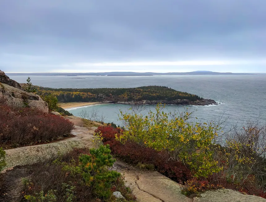
The park draws roughly 4 million visitors a year, and the crowds concentrate heavily in July and August. The shoulder seasons, late May through mid-June, and September through mid-October, offer much of the same scenery with a fraction of the people. Fall foliage in Acadia peaks around mid-October and is spectacular: the mixed hardwood forest below the summits turns bright red and orange against the gray granite above.
Cadillac Mountain: The Summit Everyone Does
At 1,529 feet, Cadillac Mountain is the highest point on the East Coast north of Brazil, technically. More practically, it's the place where you can stand above the Atlantic at sunrise from October through March (the rotation of the Earth tilts it into first-light position during those months). The summit is accessible by car via the Cadillac Mountain Summit Road, which is part of the park entry permit system in summer. But hiking it is genuinely better.
Cadillac South Ridge Trail (7.0 miles round-trip, 1,530 ft gain)
The South Ridge Trail is the longest approach but the least crowded and, for many hikers, the most beautiful. It starts at the Cadillac South Ridge Trailhead off Route 3 and climbs gradually through forest before breaking out onto open granite slabs with 360-degree views. The trail surface is classic Acadia: pink Cadillac granite, polished smooth by glaciers. Blue painted blazes mark the route. You'll pass several false summits before the actual top. Descend the same way or loop via the North Ridge and take the island Explorer shuttle back (in season). Allow 4-5 hours for a relaxed round-trip.
North Ridge Trail (4.4 miles round-trip, 1,530 ft gain)
The more direct approach from the north side, starting near the Eagle Lake trailhead area. Steeper and more exposed than the South Ridge, but shorter. The North Ridge offers open granite walking from about the halfway point, with views of Frenchman Bay and Bar Harbor below. Most hikers who go up this way come down the same route.
The Beehive: Acadia's Best Iron Rung Scramble
The Beehive (1.6 miles round-trip, 450 ft gain) has a difficulty-to-distance ratio unlike anything else in the park. The summit is only 520 feet above sea level but the trail reaches it via iron rungs and handholds bolted into near-vertical granite cliffs, a via ferrata-style scramble that feels significantly more committing than the numbers suggest. The views from the top look directly over Sand Beach and the Atlantic. Do not attempt this trail if you're uncomfortable with heights or in wet conditions. Wet granite is slippery. The adjacent Bowl Trail offers a non-exposed route to the same area if you want the destination without the scramble.
The Beehive Trail is one-way, you ascend via the iron rungs and descend via the easier Bowl Trail loop back to the parking area. It's a 1.6-mile loop total. The entire thing takes 1.5-2 hours at a relaxed pace. The Sand Beach parking area requires a fee vehicle reservation on Recreation.gov during peak season (late May through mid-October).
The Precipice: Even More Exposed Than the Beehive
If the Beehive is the warm-up, the Precipice (1.6 miles round-trip, 1,058 ft gain) is the main event. The Precipice Trail climbs the east face of Champlain Mountain via iron rungs, ladders, and ledge traverses. It's steeper and more sustained than the Beehive, more like a mountain scramble than a trail. The views from the Champlain summit at 1,058 feet encompass Frenchman Bay, the Porcupine Islands, and the open Atlantic to the southeast.
The Precipice closes periodically for peregrine falcon nesting (typically February through mid-August some years), check the park website before driving out. When closed, the Beehive or the East Face Trail offer similar but less dramatic alternatives. The Precipice lot requires the same peak-season reservation as Sand Beach.
Ocean Path: The Easy Alternative That Isn't Boring
Ocean Path (4.4 miles round-trip, nearly flat) runs along the rocky coastline between Sand Beach and Otter Cliff. The path stays close to the water the entire way, passing Thunder Hole (a sea cave that produces dramatic surges when wave conditions are right, aim for 3/4 tide incoming), Otter Cliff, and several pocket beaches. This is Acadia's best walk for anyone who doesn't want to scramble: it's entirely accessible, the scenery is legitimately stunning, and the coast views hold up the whole way.
Thunder Hole is worth timing right: the surge is most dramatic when swells are running and the tide is on the incoming side, roughly 1.5-2 hours before high tide. A sign near the parking area usually tells you the current tide status.
Jordan Pond Path and the North Bubble
Jordan Pond is the park's most photographed interior lake, framed perfectly by the twin domes of the Bubbles (North Bubble at 872 feet, South Bubble at 766 feet). The Jordan Pond Path (3.3 miles, flat) circles the lake on a combination of gravel path and wooden bog bridges, it's accessible and beautiful. The Jordan Pond House at the south end of the lake has been serving popovers and tea since 1895; it remains the park's most popular dining spot.
For a more serious outing, the North Bubble (1.8 miles round-trip from Jordan Pond, 600 ft gain) offers views looking down the full length of Jordan Pond, one of the best perspectives in the park. Bubble Rock sits at the summit: a glacial erratic the size of a car, balanced on the ridge's edge as if placed by hand. Combine the Bubbles with a partial Jordan Pond loop for a 4-5 mile day with solid elevation and excellent views.
Carriage Roads: Running or Biking, Not Just Walking
Rockefeller's 45-mile carriage road system covers the interior of the island with finely crushed gravel roads, intricate stone bridges, and gentle grades. These aren't hiking trails, they're too flat and wide for that, but they're exceptional for trail running, cycling, and leisurely walks with young children. Acadia Bike rents well-maintained bikes in Bar Harbor. The Eagle Lake Loop (6 miles) and the around-Bubble Pond route are popular carriage road circuits. No motorized vehicles are permitted on the carriage roads.
Getting There and Permits
The island is accessed via Route 3 from Ellsworth, Maine, about a 5-hour drive from Boston. Bar Harbor is the primary town, with lodging, restaurants, outfitters, and the ferry terminal for the Cranberry Islands. The park entrance fee is $35 per vehicle (2025 rates); an annual America the Beautiful Pass covers it. The Island Explorer shuttle runs free between June and Columbus Day, it hits all major trailheads and eliminates the parking problem entirely on peak days.
The Acadia Timed Entry Permit system covers the Cadillac Summit Road (car entry) and key trailhead parking areas. Hiking permits are not required, only vehicle entry to certain areas. The Island Explorer shuttle lets you hike without worrying about reserved parking spots.
Best Season and Weather
July and August are peak: all trails open, popovers available, shuttles running, and the island fully tourist-mode. September is the best overall month: cooler temps, fewer crowds, the beginning of foliage, and all the infrastructure still in place. October offers peak fall color but expect cold mornings and some trail-closure risk from early storms. The park is open year-round; winter hiking on Acadia's lower trails is excellent with microspikes, and the carriage roads are groomed for skiing in some years. Summer fog is common on the Maine coast, the summits are socked in several days a week in July. Check the forecast but don't cancel over it.


