Maine 10-Day Outdoor Circuit Map +
Katahdin, Allagash & Acadia Itinerary
10-day Maine wilderness circuit for experienced adventurers. Summit Katahdin (5,269 ft) via the Knife's Edge, paddle the Allagash Wilderness Waterway for four days, then hike Cadillac Mountain and the Precipice Trail in Acadia National Park.
Free interactive planner · drag & reorder your days, add stops, map it in minutes
Build your own Maine circuit, drag, reorder & map it.
Drag stops between days, swap sections, and add your own trailheads, campsites, and coastal stops with the place search. The live map and legs recalculate as you go, so you can tune the Katahdin–Allagash–Acadia circuit to your pace before you head into the North Woods.
Opens a side panel · reorder days, add custom stops, see your route live
Three iconic Maine adventures, one 10-day circuit, from Bangor.
This 10-day Maine outdoor circuit is built for experienced adventurers. It strings together three of the state's greatest wilderness experiences: a strenuous summit of Katahdin in Baxter State Park, a multi-day canoe trip on the Allagash Wilderness Waterway, and coastal hiking in Acadia National Park.
You fly into Bangor International Airport (BGR) and base out of three towns: Millinocket for Katahdin, Ashland (or a northern outfitter) for the Allagash put-in, and Bar Harbor for Acadia. Careful planning for permits, gear, and shuttle logistics is essential, this is a demanding itinerary, not a casual road trip.
The trip requires three separate reservations: Baxter State Park day-use parking for the Katahdin trailhead, an Allagash Wilderness Waterway overnight permit, and an Acadia Cadillac Summit Road timed-entry vehicle reservation. Late June to early October is the window, with July through September ideal for warmer water and lighter bug pressure.
Three reservations make or break this trip. Baxter State Park day-use parking (Roaring Brook) opens two weeks in advance and fills within minutes for Katahdin. Acadia's Cadillac Summit Road vehicle reservations release 90 days and 2 days ahead on Recreation.gov. Allagash overnight permits are easier but still book early, and reserve your canoe outfitter, shuttle, and Bar Harbor lodging 6–12 months out for peak season.
Arrive in Millinocket & Baxter State Park Prep
Fly into Bangor International Airport (BGR), pick up your rental car, and drive about 1.5 hours north to Millinocket, the gateway town for Baxter State Park. Spend the afternoon finalizing gear and provisions for tomorrow's Katahdin ascent.
Check into your Millinocket lodging, grab dinner at a local restaurant, and do a full gear check. Get an early night, the climb ahead is a full-day, 10–12 hour effort and an early start is essential.
- Drive BGR to Millinocket~75 mi · 1.5 hours · last major town for supplies
- Check into Millinocket lodging$100–200/night · motels & cabins · book ahead
- Dinner & gear checkLast-minute supplies · review Baxter trail map
- Millinocket is the last major town for gas, groceries, and gear before Baxter State Park, so stock up here.
- Confirm your Baxter State Park day-use parking reservation for Roaring Brook before you go to bed, it is required and non-transferable.
- Lay out layers, water, and headlamp the night before, an early start is crucial for a safe Katahdin round trip.
Katahdin aheadBaxter State ParkSummit Katahdin via the Knife's Edge · 10.4 miles RT
Baxter Peak summitChimney Pond basinAn early start is crucial. Drive into Baxter State Park to the Roaring Brook Campground trailhead and climb the steep, rocky Helon Taylor Trail to Pamola Peak. From there, traverse the iconic Knife's Edge, a narrow, highly exposed ridge with sheer drops on both sides, to Baxter Peak, the true summit of Katahdin and Maine's highest point.
Descend the less-technical Saddle Trail into the Chimney Pond basin, then follow the Chimney Pond Trail back to Roaring Brook. Allow a full 10–12 hours. The Knife's Edge is not recommended in high winds, rain, or ice, turn back if conditions are unfavorable.
- Day-use parking reservation required · book online
- 3.2 mi · steep & exposed · 4,188 ft gain
- Traverse the Knife's Edge to Baxter Peak1.1 mi · highly exposed · technical scrambling
- Descend Saddle & Chimney Pond Trails6.1 mi · less technical · back to Roaring Brook
- Start at first light. Rangers may turn hikers back if you begin the Knife's Edge too late in the day.
- The Knife's Edge is not for those with a fear of heights, and it is dangerous in high winds, rain, or ice. Have a bail-out plan via the Saddle Trail.
- Carry plenty of water and food. This is one of the most strenuous single-day hikes in the Northeast, with 4,188 ft of gain.
Drive North to the Allagash & Canoe Prep
After a demanding day on Katahdin, enjoy a relaxed morning, then drive north from Millinocket toward the Allagash Wilderness Waterway. Your destination is your outfitter or put-in point near Ashland or, farther north via logging roads, Churchill Dam.
Pick up your rented canoe, paddles, PFDs, and dry bags, and acquire your Allagash Wilderness Waterway permit for the overnight stays ahead. Make final grocery runs, pack all food into dry bags, and overnight near the put-in so you can launch early.
- Drive Millinocket to Allagash outfitter60–90 mi · 1.5–2 hrs · rough logging roads north
- Required for all overnight stays · fee per person/night
- Canoe & gear pickup from outfitterCanoe, paddles, PFDs, dry bags · confirm shuttle
- Northern Maine logging roads can be rough, confirm your vehicle is suitable with your outfitter before you drive in.
- Cell service is limited to nonexistent in the North Woods, so download offline maps and confirm all shuttle details in advance.
- Pack food carefully into dry bags, planning for weight and perishability across four days on the water.
North Woods roadsChurchill Dam put-inAllagash: Put-in to Musquacook · 15–20 miles
Moose countryMusquacook campBegin your Allagash adventure. From your put-in (Churchill Dam or Telos Lake, depending on your outfitter), navigate a mix of lakes and river sections, getting acquainted with a loaded canoe. Today is about finding your rhythm on the water.
Keep an eye out for moose, eagles, and loons along the banks. Set up camp at one of the designated primitive campsites, such as those near Musquacook Stream. Sites are first-come, first-served with fire rings and privies, and strict carry-in, carry-out rules apply.
- Paddle the Allagash lakes & river15–20 mi · 4–6 hrs · mixed lake and river
- Watch for moose, eagles & loonsBest at dawn and dusk · keep a respectful distance
- Camp near Musquacook StreamPrimitive site · first-come, first-served · fire ring & privy
- Waterproof everything. Secure all gear in dry bags and lash it into the canoe in case of a capsize.
- Campsites are first-come, first-served, so plan a realistic daily mileage and have a backup site in mind.
- Practice strict Leave No Trace: pack out all trash including food scraps, and burn only deadfall in designated fire rings.
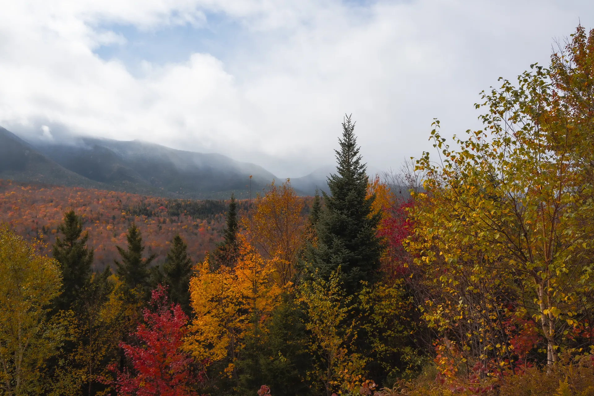
Allagash: Musquacook to Round Pond · 18–22 miles
Break camp and continue downstream through the most remote stretch of the trip. The waterway mixes flatwater with occasional quickwater, so watch river conditions and be ready for a short portage if levels are low. This is deep wilderness, self-reliance is the theme of the day.
The Allagash is renowned for wildlife, keep your camera ready for moose, deer, osprey, and bald eagles. Camp at a site on Round Pond or a nearby riverbank and enjoy a quiet evening in the North Woods.
- Paddle to Round Pond18–22 mi · 5–7 hrs · flatwater & quickwater
- Wildlife viewingMoose, deer, osprey & bald eagles · dawn and dusk
- Camp at Round PondPrimitive site · scenic · collect only deadfall
- Water levels dramatically affect paddling difficulty, so check conditions with your outfitter and be ready to line or portage quickwater.
- This is the most self-reliant day of the trip, carry a solid first-aid kit and know your evacuation options.
- Best wildlife viewing is at dawn and dusk. Approach slowly and keep a respectful distance from moose, especially cows with calves.
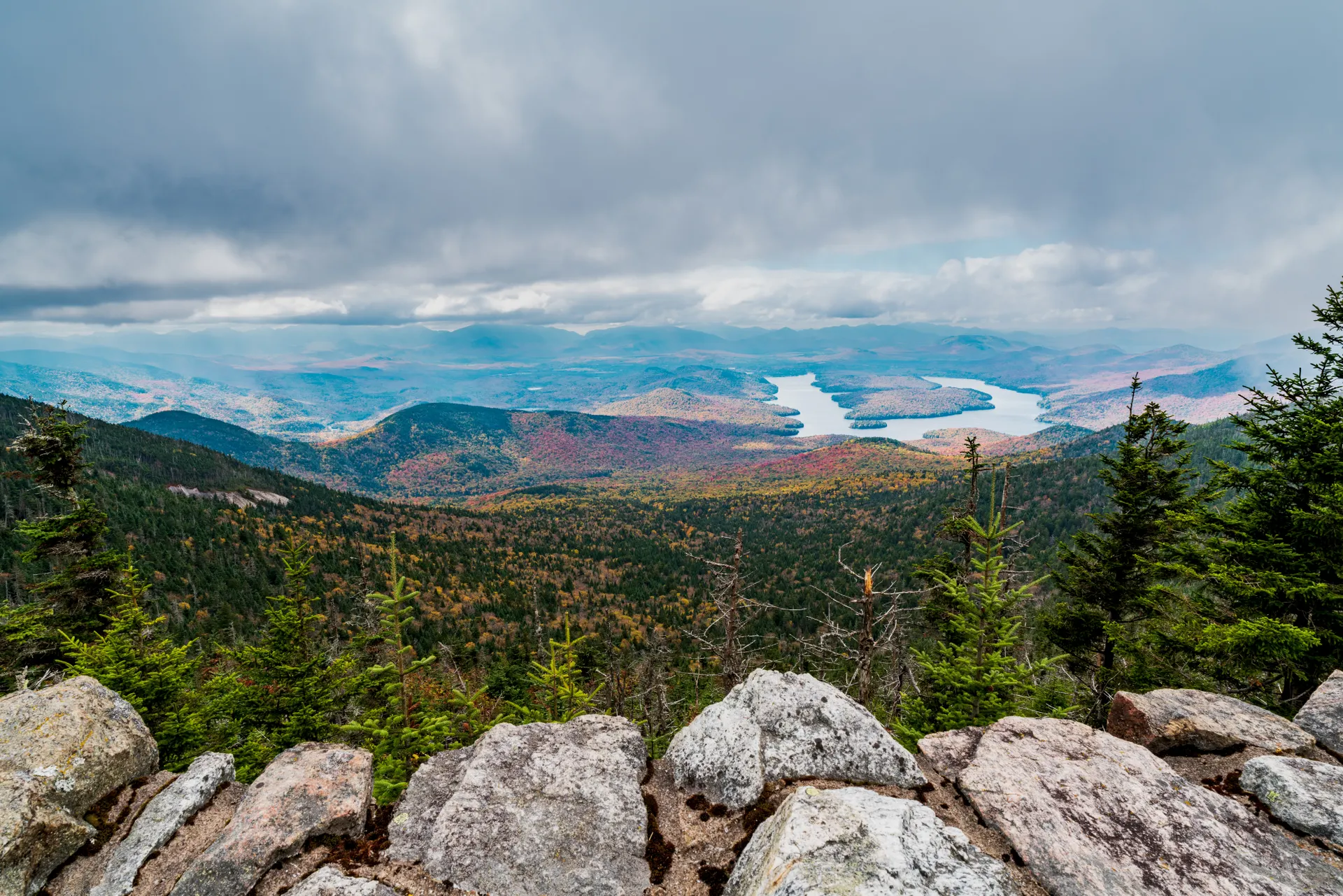
QuickwaterRound Pond campAllagash: Round Pond to Eagle Lake · 15–18 miles
Eagle LakeLast night outPaddle toward Eagle Lake, one of the larger, more open bodies of water on the Allagash. Bigger lakes mean wind can build quickly, so start early and stay near shore if conditions turn choppy.
Take time to explore the historic tramway remnants connecting Eagle Lake and Chamberlain Lake, rusting relics of an early-20th-century steam-powered log hauler and a fascinating window into Maine's logging history. Camp on Eagle Lake for your last full night on the water.
- Paddle toward Eagle Lake15–18 mi · 4–6 hrs · open lake, watch for wind
- Explore the Eagle Lake tramwayHistoric steam log hauler · logging-era relics
- Camp on Eagle LakePrimitive site · scenic sunsets · last night on the water
- Cross large lakes early in the day before afternoon winds build, and hug the shoreline if whitecaps appear.
- The Eagle Lake tramway and locomotives are a genuine historical highlight, budget time to walk out and see them.
- This is your last full night camping, so ration remaining food and fuel accordingly.
Allagash Take-out & Drive to Bar Harbor
Embark on the longest paddling day, heading to the take-out near Allagash Village. Coordinate with your outfitter for canoe pickup and the shuttle back to your vehicle. Then begin the significant drive south and east, about 3–4 hours, toward Bar Harbor, the main gateway to Acadia National Park.
This is a big transition day, from deep woods to the coast. Check into your Bar Harbor lodging, enjoy a hot shower after days in the wilderness, and settle in for the final leg of the circuit.
- Final paddle to Allagash Village take-out20–25 mi · 6–8 hrs · longest day on the water
- Canoe return, shuttle & drive to Bar Harbor150–180 mi · 3–4 hrs · woods to coast
- Check into Bar Harbor lodging$150–300+/night · very popular · book well ahead
- Confirm your exact take-out location and shuttle time with the outfitter in advance, this is not a day for surprises.
- The drive from the Allagash to Bar Harbor is long with limited dining, so pack snacks and fuel up when you can.
- Bar Harbor books out in summer, so reserve lodging months ahead, especially for the peak July–September window.
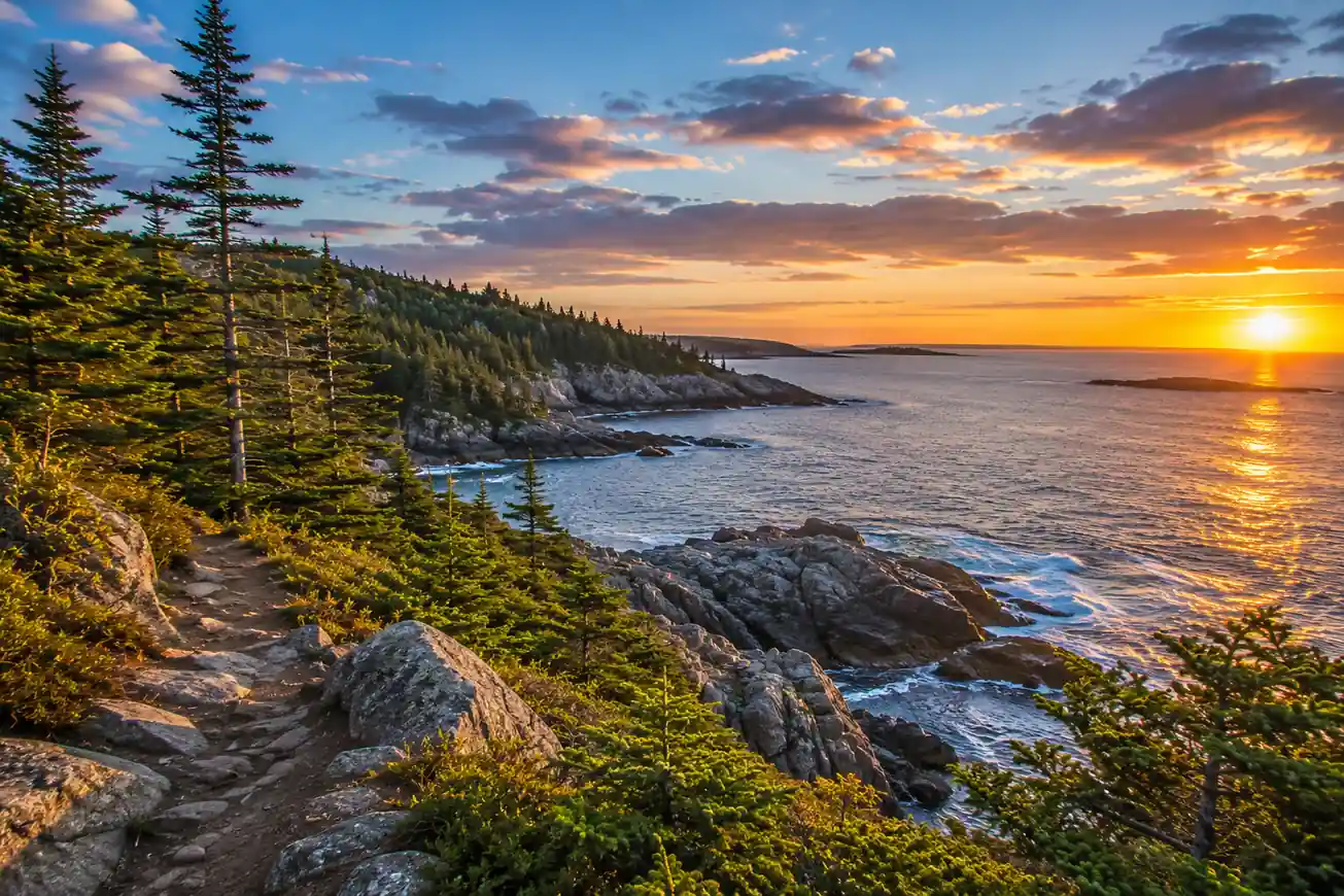
Take-outWoods to coastAcadia: Cadillac Mountain & Ocean Path · 5–7 miles
Thunder HoleJordan PondStart your Acadia days with a sunrise on Cadillac Mountain, the highest point on the U.S. East Coast and, for part of the year, the first place in the country to see the sunrise. A timed-entry vehicle reservation is required for the Cadillac Summit Road from late May to late October, booked on Recreation.gov.
Spend the afternoon hiking the Ocean Path, an easy coastal trail linking Sand Beach, Thunder Hole, and Otter Cliff. Cap it with popovers and tea at the historic Jordan Pond House, with its classic view of the Bubbles.
- Timed-entry vehicle reservation required · Recreation.gov
- 4.5 mi RT · easy · Sand Beach to Otter Cliff
- Visit Thunder HoleBest at mid-tide, incoming · thunderous wave spray
- Popovers at Jordan Pond HouseHistoric tea & popovers · Jordan Pond views · reserve
- Book your Cadillac Summit Road timed-entry vehicle reservation the moment it releases, 90 days or 2 days in advance on Recreation.gov.
- Dress in layers for the Cadillac summit, it is often windy and cold at sunrise even in summer.
- Thunder Hole is best at mid-tide on an incoming tide, so check the tide chart to time your visit.
Acadia: Precipice Trail & Bass Harbor Head Light · 3–4 miles
For adventurous hikers, tackle the Precipice Trail up Champlain Mountain, a strenuous, exposed climb of iron rungs, ladders, and granite ledges. Check for seasonal closures, it is typically closed May through August for peregrine falcon nesting. The Beehive Trail is a shorter alternative with similar thrills.
In the afternoon, drive to the quiet side of Mount Desert Island to visit the iconic Bass Harbor Head Light, an 1858 lighthouse perched on a rugged granite bluff. Wind down with a farewell Maine lobster dinner back in Bar Harbor.
- 1.6 mi loop · 1,000 ft gain · iron rungs & ladders
- Drive to Bass Harbor Head Light~30–40 min to the quiet side of MDI
- Explore Bass Harbor Head Light1858 lighthouse · rocky shore · sunset photography
- Farewell lobster dinner in Bar HarborFresh Maine lobster · reservations recommended
- Confirm the Precipice Trail is open, it closes roughly May–August for peregrine falcon nesting. If closed, hike the Beehive Trail instead.
- The Precipice is a one-way up-only climb with iron rungs, not for anyone with a fear of heights or in wet conditions.
- Bass Harbor Head Light parking is small and fills fast at sunset, so arrive early for the best light and a spot.
Bass Harbor LightFarewell lobsterDepart from Bar Harbor
WaterfrontFly home from BGREnjoy a final Maine breakfast or a last stroll along the Bar Harbor waterfront. Then drive about an hour back to Bangor International Airport (BGR) for your departing flight, concluding your epic 10-day Maine outdoor circuit.
Allow ample time for the rental-car return and airport procedures, and refuel before you drop the car. You will leave having climbed Katahdin, paddled the Allagash, and hiked Acadia, three of Maine's greatest wilderness experiences in a single trip.
- Final breakfast & Bar Harbor waterfrontLast stroll before the drive to the airport
- Drive Bar Harbor to BGR~50 mi · 1 hour · refuel before returning the car
- Give yourself a buffer for the drive plus rental-car return and security at BGR.
- Refuel the rental car near Bar Harbor or Ellsworth, options thin out closer to the airport.
- If your flight is late, a morning hike on a shorter Acadia trail is an easy add before you leave.
Now build your Maine circuit.
You've seen all ten days. Open the free drag-and-drop planner and tune it for your dates, your pace, and how much of the Allagash and Acadia you want to take on.
Essential permits, rules & planning.
Three separate reservations
This circuit needs Baxter State Park day-use parking for Roaring Brook (opens two weeks out, fills fast), an Allagash Wilderness Waterway overnight permit (per person, per night), and an Acadia Cadillac Summit Road timed-entry vehicle reservation (released 90 and 2 days ahead on Recreation.gov). Miss any one and that leg falls apart.
Katahdin & the Knife's Edge
The Katahdin loop is a 10–12 hour, 10.4-mile day with 4,188 ft of gain. The Knife's Edge is extremely exposed with sheer drops on both sides, and it is dangerous in high winds, rain, or ice. Start early, watch the weather, and be willing to turn back or bail via the Saddle Trail.
Allagash paddling experience
Previous multi-day canoe experience is strongly recommended. Most of the Allagash is flatwater, but there are quickwater and rapid sections depending on water levels. Be comfortable with basic strokes, portaging, and wilderness navigation, and confirm your outfitter, shuttle, and permit before you launch.
Leave No Trace in the wilderness
The Allagash is strict carry-in, carry-out: pack out all trash including food scraps, cut no live trees, and build fires only in designated rings. Baxter and Acadia enforce Leave No Trace too. Campsites on the waterway are first-come, first-served with fire rings and privies.
Go July through September
The season runs late June to early October. July and August bring the warmest water but the biggest Acadia crowds and heaviest black flies and mosquitoes up north. September is ideal, cooler, buggier-free, and quieter, though early snow is possible on Katahdin late in the month.
Getting there needs a car
Fly into Bangor International Airport (BGR): roughly 1.5 hours to Millinocket, 2 hours to the Allagash region, and 1 hour to Bar Harbor. Northern Maine logging roads are rough with little to no cell service, so download offline maps and rent a suitable vehicle.
Everything you'll actually want to know.
Ready to go? Get your
Maine outdoor circuit route.
Trailheads and mileages, the three reservations you can't skip, canoe outfitter and shuttle logistics, Cadillac timed-entry timing, drive times from Bangor, and the alpine-start and paddling-day planning you need to link Katahdin, the Allagash, and Acadia in ten days.
Instant book · Free cancellation · Secure payment via Stripe

Planning this trip?
Save it, share it with your crew, or find travelers heading the same way.

Liked this itinerary?
What other travelers are saying
Be the first to leave a tip or question for the next traveler.