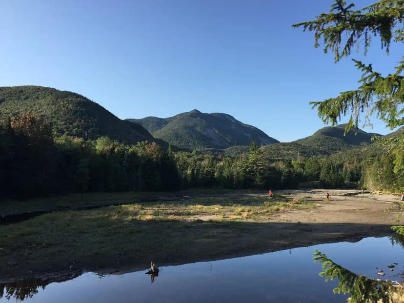
Wright Peak: A Great First 46er
At 4,580 feet, Wright Peak is one of the most accessible of the 46 Adirondack High Peaks and a perfect introduction to alpine hiking in New York. It shares its approach with Algonquin Peak, so you get a genuine above-treeline summit with panoramic views for less effort than most of the 46. For many hikers, Wright is the peak that turns them into aspiring 46ers.
The round trip from the trailhead is roughly 6.6 miles with about 2,400 feet of elevation gain. It is still a real mountain climb, but it is short enough to do comfortably in a single morning if you start early.
Trailhead and Route
Start at the Adirondak Loj at Heart Lake, the busy trailhead 8 miles south of Lake Placid. Pay the parking fee, sign the register, and follow the Van Hoevenberg Trail before bearing left onto the trail toward MacIntyre Range and Algonquin. You climb steadily alongside MacIntyre Brook through dense forest.
About 2.5 miles in you reach the signed Wright Peak junction. Turn left here; the spur is short but steep, climbing roughly 0.4 miles to the summit. The final stretch breaks out of the trees onto open rock.
The Summit and the B-47 Crash Site
Wright's summit is a broad alpine dome with views across the High Peaks Wilderness toward Algonquin, Marcy, and the slides of Colden. The exposed top can be ferociously windy, so it is rarely a place to linger long in bad weather.
The mountain holds a piece of history. In 1962 a U.S. Air Force B-47 bomber crashed near the summit, and small fragments of the wreckage are still scattered on the upper slopes. A memorial plaque honors the crew. Look but leave everything in place.
Protecting the Alpine Zone
Like Algonquin, Wright's summit sits in fragile alpine tundra. Follow these rules closely:
- Walk only on bare rock or the marked trail, never on the low alpine plants.
- Keep dogs leashed and out of the vegetation.
- Pack out everything, including food scraps.
- Respect summit stewards, who are often posted to guide foot traffic in summer.
Pair It with Algonquin or Go Overnight
Because the Wright junction sits right on the Algonquin trail, the two summits pair naturally. Many hikers tag Wright first thing, drop back to the junction, then continue up to Algonquin for a strong two-peak day. If you would rather not rush, our 3-day Adirondack High Peaks itinerary uses Wright Peak as a sunrise objective on a backcountry MacIntyre Range loop, so you can catch the alpine glow without a 4 a.m. trailhead start.
Getting There and Where to Stay
The Adirondak Loj trailhead sits at the end of Adirondak Loj Road, off Route 73 between Lake Placid and Keene. Lake Placid is the natural base, just 20 minutes away, with plenty of lodging, breakfast spots, and outfitters where you can rent traction or grab a forgotten layer. To shave time off your morning, you can also stay right at Heart Lake through the Adirondack Mountain Club, which offers lodge rooms, cabins, and campsites a short walk from the register; reserve early for summer weekends. Arrive at the trailhead before 7 a.m. on busy days, because the lot fills and overflow parking adds a long road walk to your hike.
What to Expect on the Trail
The lower trail along MacIntyre Brook is rocky and steadily uphill but well marked and easy to follow, passing a pretty cascade along the way. The character changes at the Wright junction. The spur is short but unrelenting, climbing through stunted spruce and fir before bursting onto open rock. Those final few hundred feet of bare slab can be slick when wet and dangerously windy in bad weather, so do not push for the summit if storms are building. On a clear morning, though, the reward is immediate: a wide alpine dome with the bulk of Algonquin rising just to the south and the whole High Peaks Wilderness rolling out toward Marcy. Because Wright is shorter than its neighbors, it is a great choice when afternoon weather looks unsettled and you want to be back below treeline early.
What to Pack for Wright Peak
Treat Wright like the serious alpine summit it is, even though it is one of the shorter 46ers:
- Layers and a wind shell, because the summit is far colder and windier than Heart Lake.
- 2 liters of water per person and snacks, since there is no water above the brook.
- A paper map and headlamp, as cell service is unreliable.
- Traction if any ice or snow lingers on the slab, common well into spring.
When to Go
Summer through early fall, roughly late June to early October, is the easiest window, with snow-free rock and long daylight. Foliage in late September is spectacular but crowded. In winter Wright becomes a serious objective demanding snowshoes or crampons and full wind gear; the exposed summit is notoriously cold and the spur trail can ice over. Check the New York DEC conditions report before any trip.
Wright Peak Adirondacks FAQs
Wright Peak is one of the easier 46 High Peaks, with about 6.6 miles round trip and 2,400 feet of gain. It is a fine first alpine summit for fit beginners who are comfortable with steep, rocky trail, but it is still a strenuous mountain climb.
It starts at the Adirondak Loj at Heart Lake, 8 miles south of Lake Placid. You share the Algonquin approach until the signed Wright Peak junction about 2.5 miles in, then take a short steep spur to the summit.
A U.S. Air Force B-47 bomber crashed near Wright's summit in 1962. Small pieces of the wreckage remain scattered on the upper slopes and a memorial plaque honors the crew. Please look but leave everything in place.