Why Algonquin Peak Is Worth the Climb
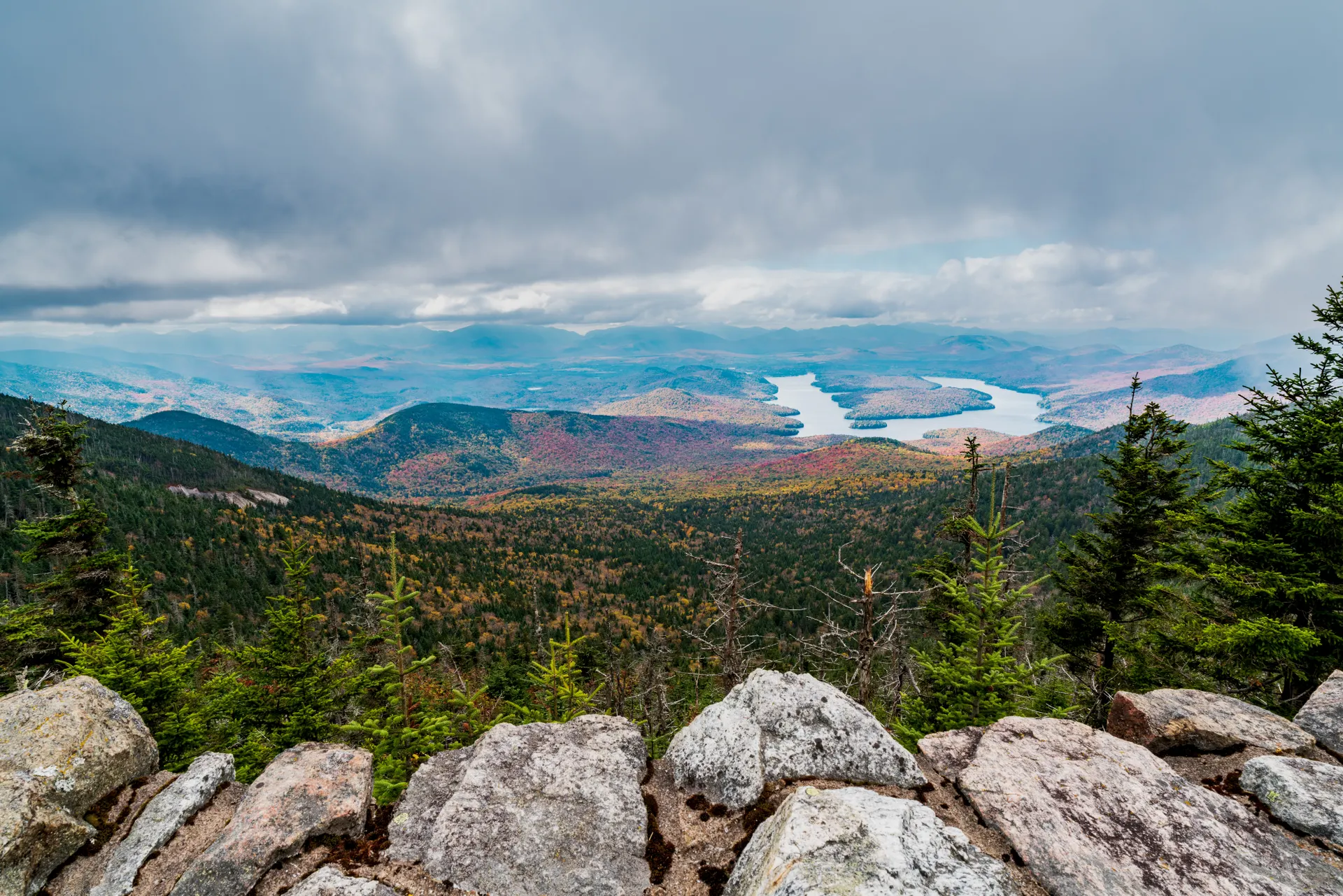
At 5,114 feet, Algonquin Peak is the second-highest summit in New York after Mount Marcy and the high point of the MacIntyre Range. It is one of the most rewarding day hikes in the Adirondacks because the upper third of the climb breaks above treeline into a true alpine zone, with sweeping views across the High Peaks Wilderness to Marcy, Colden, and the slides of Mount Colden. On a clear day you can see all the way to Vermont's Green Mountains.
It is also a serious climb. This is not a stroll; it is roughly 8 miles round trip with about 2,950 feet of elevation gain, much of it on steep, rooty, and rock-slab trail. Plan a full day.
The Trailhead and Approach
Nearly everyone starts at the Adirondak Loj at Heart Lake, about 8 miles south of Lake Placid down Adirondak Loj Road. There is a parking fee and the lot fills early on summer weekends, so arrive before 7 a.m. Sign the trail register, then follow the Van Hoevenberg Trail a short distance before splitting left onto the Algonquin trail toward MacIntyre Range.
The first miles climb steadily through hardwood and then spruce-fir forest alongside MacIntyre Brook, with a worthwhile detour to a small waterfall. The grade ramps up sharply once you pass the junction for Wright Peak.
Climbing Into the Alpine Zone
Above roughly 4,000 feet the trees shrink and you emerge onto open rock. This is fragile alpine tundra, home to rare plants found almost nowhere else in the state. Stay on the bare rock and the marked path at all times and never step on the low vegetation. Summit stewards are often posted here in summer to help hikers protect it. The final pitch is exposed slab that can be slick when wet, so save it for good weather.
Add Wright Peak and Iroquois
Strong hikers turn Algonquin into a multi-summit day. The most popular add-ons:
- Wright Peak (4,580 feet), a short steep spur off the main trail that adds about a mile round trip and bags a second of the 46.
- Iroquois Peak (4,840 feet), reached by continuing past Algonquin and dropping into Boundary Peak, then following a herd path. This adds significant time and rough trail.
Linking Wright, Algonquin, and Iroquois in one push is a classic MacIntyre Range traverse. If you would rather spread it across several days and sleep in the backcountry, our 3-day Adirondack High Peaks MacIntyre Range itinerary maps out exactly that, including a Wright Peak sunrise.
Best Time to Hike Algonquin
The prime season runs from late June through early October, when the trail is dry-ish and the alpine zone is snow-free. September brings cooler air and fall color but also crowds. From November through April this becomes a full winter climb requiring snowshoes, crampons or microspikes, and serious wind protection; the exposed summit regularly sees brutal cold and zero visibility. Always check the New York DEC High Peaks conditions and the summit weather before you go.
Where to Stay Near the Trailhead
If you want an alpine start, base yourself close to the Adirondak Loj. Lake Placid is the obvious hub, with hotels, gear shops, and good food, about a 20-minute drive from the trailhead. For a wilder option, the Adirondack Mountain Club runs lodging and tent sites right at Heart Lake, which puts you steps from the register; these book out fast in summer. Many backpackers instead camp at the designated tent sites and lean-tos around Marcy Dam and Lake Colden the night before, shortening the next day's push and letting them hit the alpine zone before the crowds and the afternoon weather. Wherever you sleep, remember that the eastern High Peaks require a bear canister and that camping is banned above 3,500 feet.
What the Climb Actually Feels Like
The Algonquin trail is famous for one thing: it goes up and rarely lets you rest. After the gentle opening miles along MacIntyre Brook, the grade kicks into a long, sustained staircase of rock and root that does not relent until you hit the slab near the top. In wet conditions the polished rock becomes genuinely slippery, and many hikers find the descent harder than the climb because gravity wants to put you on the seat of your pants. Trekking poles help enormously on the way down. The payoff is one of the great alpine summits in the Northeast: a bald, windswept dome with 360-degree views over the heart of the High Peaks Wilderness, the Great Range to the east, and on clear days the distant ridgelines of Vermont and Canada.
What to Pack
Even in summer the summit is far colder and windier than the trailhead. Carry layers including a wind shell, more water than you think (there is none above treeline), a headlamp, a paper map, and traction if any ice lingers. A bear canister is required for overnight trips in the eastern High Peaks. Leave a trip plan with someone before you head up. Round it out with these essentials:
- Sturdy boots with good tread for the wet slab and loose rock.
- At least 2 to 3 liters of water per person, since there are no reliable sources above the brook.
- Sun protection, because the exposed alpine zone offers no shade.
- A warm hat and gloves even in July, for the cold summit wind.


