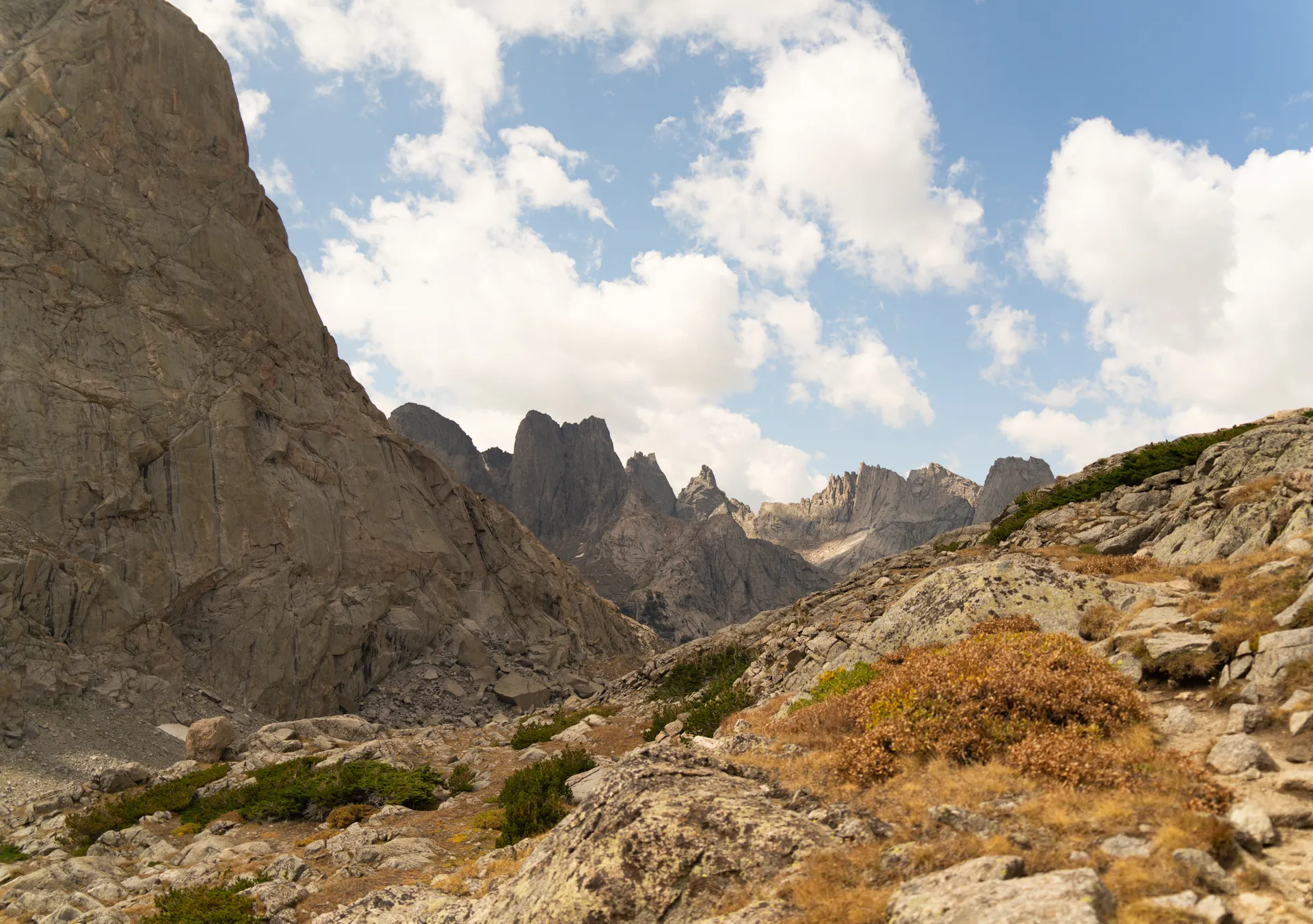
The Cirque of the Towers is the most photographed place in the Wind River Range, and standing inside it for the first time explains why. A horseshoe of granite spires (Pingora, Wolf's Head, Warbonnet, and the rest) curls around a single high tarn called Lonesome Lake. It is one of the great alpine amphitheaters in the Lower 48, and you can reach it on foot in a hard day or, far better, over two or three days of backpacking.
Where the Cirque of the Towers is
The Cirque sits in the southern Winds, inside the Popo Agie Wilderness on the Shoshone National Forest side, just over the Continental Divide from the Bridger Wilderness. The nearest town is Lander, Wyoming, about a two-hour drive to the standard trailhead. Pinedale and Boulder serve the western approaches. Most hikers come in from the south at the Big Sandy trailhead, which is also the gateway used by the broader 7-day Wind River Range backpacking itinerary that links the Cirque with Titcomb Basin to the north.
The classic route over Jackass Pass
From the Big Sandy trailhead the trail climbs gently along the Big Sandy River to Big Sandy Lake at about 5 miles, a popular first-night camp. From there the route to the Cirque turns north and steepens dramatically over Jackass Pass (also called North Creek Pass), passing North Lake and Arrowhead Lake before cresting the divide and dropping you face to face with the towers at Lonesome Lake. It is roughly 9 miles each way with around 2,000 feet of gain, and the final climb is rocky and slow.
- Big Sandy trailhead to Big Sandy Lake: about 5 miles, easy grade
- Big Sandy Lake to the top of Jackass Pass: steep, talus-heavy, roughly 2 miles
- Jackass Pass to Lonesome Lake: a short, scenic descent into the Cirque
Strong hikers do it as a long out-and-back day, but the magic is in waking up there. Watching first light hit Pingora's east face is worth the extra pack weight.
Camping and the Lonesome Lake rules
Camping is prohibited within a quarter mile of Lonesome Lake to protect the fragile shoreline, so plan to camp at Big Sandy Lake, along the approach, or up in Lizard Head Meadows. Bear canisters or proper hangs are required, fires are discouraged at elevation, and you should treat all water. The whole basin is above 10,000 feet, so practice Leave No Trace religiously; the soil and vegetation here recover slowly.
Best time to hike the Cirque
The window is short. Mid-July through mid-September is the reliable season, after the snow clears Jackass Pass and before autumn storms arrive. Early July often still holds steep snow on the pass that can be dangerous without an ice axe. August brings afternoon thunderstorms almost daily, so summit ridges and the pass should be crossed in the morning. Mosquitoes peak in July near the lakes and ease off by late August.
Permits and logistics
There is no permit or fee to hike or backpack into the Cirque of the Towers on the Shoshone side, but you do need to fill out a free self-issued wilderness registration at the trailhead. The Big Sandy trailhead road is rough gravel; a passenger car can usually make it in dry conditions, but go slow. Cell service disappears well before the trailhead, so download maps offline and tell someone your plan.
Connecting the Cirque to a longer trip
The Cirque rewards a day, but it is even better as one chapter of a longer Winds traverse. Many backpackers link it with Lizard Head Meadows, the Shadow Lake basin, and the high country toward Titcomb Basin below Gannett Peak. If you want a structured multi-day plan that strings these together, the full Wind River Range backpacking week covers the route, mileage, and camps day by day.


