Things to Do in Death Valley National Park: 15 Places Worth the Drive
Almost everything worth seeing in Death Valley is reachable by paved road from Furnace Creek, the park's hub. Badwater Basin, 282 feet below sea level and the lowest point in North America, is the single most-visited stop. Entrance is $30 per vehicle for 7 days. Racetrack Playa, with its moving rocks, needs a high-clearance or 4WD vehicle and a full day. See our Death Valley winter hiking itinerary for how to string these together over two or three days.
Death Valley Places to Visit Near Furnace Creek
Furnace Creek is the park's visitor center and the natural base for almost every trip. A short drive south, Golden Canyon has an easy, well-marked trail into a narrow, colorful wash, doable in under an hour round trip for the first stretch. Harmony Borax Works, just north of Furnace Creek, is a short walk to the ruins of a 19th-century borax processing operation and the wagons that gave the Twenty Mule Team its name. Both work as a first stop right after you check in or grab a map. The visitor center itself is worth ten minutes for the exhibits on the valley's geology and the pupfish that survive its handful of springs, and it's the place to ask about current road status before you head out to anything unpaved.
South on Badwater Road
Badwater Road runs south from Furnace Creek and strings together most of the park's best-known stops. Devil's Golf Course, a field of jagged salt crystal formations, is an easy pullout a short way down the road. Artist's Drive is a one-way, paved loop a bit further south, about 9 miles long, that climbs through hills streaked pink, green and purple from mineral deposits, best in late afternoon light. Natural Bridge, reached by a short, moderate hike up a side canyon off Badwater Road, is a real rock arch spanning the wash. Badwater Basin itself, at the end of this corridor, is a boardwalk out onto a vast white salt flat at 282 feet below sea level, the lowest point in North America. Give this whole corridor a half day if you stop at all four. Go early or late in the day if you can. By midday, especially outside winter, the salt flat at Badwater has no shade at all, and the metal boardwalk rail gets too hot to touch.
East of Furnace Creek: Overlooks and a Colorful Detour
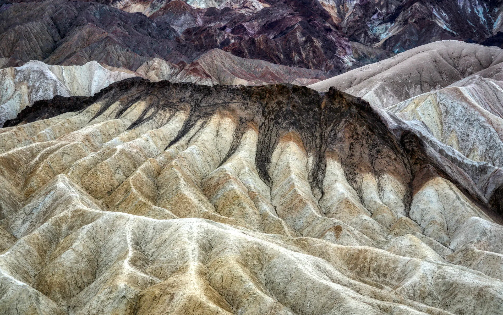
Zabriskie Point, a short drive and a two-minute walk from a parking area, looks out over badlands of golden, eroded hills and is one of the park's best sunrise spots. Twenty Mule Team Canyon, a short, unpaved one-way loop road near Zabriskie Point, winds through more of the same badlands at a slower pace than the main highway allows. Dante's View, about 20 miles from Furnace Creek on a paved but winding road, looks almost straight down at Badwater Basin from more than a mile above it, with the Panamint Range across the valley. It's one of the best sunset spots in the park, and one of the coolest places to be on a hot afternoon since the elevation drops the temperature noticeably. Bring a jacket even in summer; the wind at the overlook is often strong enough to make the several-thousand-foot elevation gain feel like a different climate entirely.
North of Furnace Creek
Salt Creek, reached by a short spur road and an easy boardwalk trail, is home to the Death Valley pupfish, a small, endangered fish that survives in this isolated desert stream, best seen in late winter and early spring when the creek is flowing. Mesquite Flat Sand Dunes, near Stovepipe Wells, are the park's most accessible dune field, walkable straight from the road with no trail required. Ubehebe Crater, further north still, is a half-mile-wide volcanic crater you can walk the rim of or hike down into; it's also recognized as an excellent dark sky location, one of the least light-polluted spots in the park.
Racetrack Playa: The Moving Rocks
Racetrack Playa is the park's most famous oddity: rocks that appear to have slid across the dry lakebed on their own, leaving long trails behind them. Getting there requires a rough, unpaved road past Ubehebe Crater, and the National Park Service and most rental car agreements require high-clearance or four-wheel drive for it; a standard sedan risks a flat tire or worse. Plan a full day for the round trip from Furnace Creek, and check current road conditions before you go, since washouts do close it periodically. Bring at least one full-size spare tire, more water than you think you need, and tell someone your plan before you leave cell coverage, which ends well before the playa itself.
Death Valley Places to Visit: Time Needed
| Place | From Furnace Creek | Time Needed |
|---|---|---|
| Harmony Borax Works | A few minutes north | 15 to 20 minutes |
| Golden Canyon | A short drive south | 45 minutes to 2 hours |
| Devil's Golf Course | About 15 minutes south | 15 minutes |
| Artist's Drive | About 15 minutes south, then a 9-mile loop | 30 to 45 minutes |
| Badwater Basin | 17 miles, about 25 minutes south | 30 to 45 minutes |
| Zabriskie Point | About 10 minutes east | 15 to 30 minutes |
| Dante's View | About 20 miles, 45 minutes to an hour | 1 to 1.5 hours round trip |
| Salt Creek | About 20 minutes north | 20 to 30 minutes |
| Mesquite Flat Sand Dunes | About 25 to 30 minutes north | 30 minutes to 1 hour |
| Ubehebe Crater | About an hour to 90 minutes north | 30 to 45 minutes |
| Racetrack Playa | Past Ubehebe, unpaved road | Full day round trip, 4WD or high-clearance required |
Best Time of Year for This List
Most of this list works better from November through March, when daytime highs at Badwater and the lower elevations are comfortable for walking around outside. Death Valley regularly hits well over 110F in July and August, and low-elevation stops like Badwater Basin and Devil's Golf Course have essentially no shade, so summer visits should be limited to early morning, evening and air-conditioned driving between overlooks. Dante's View and Ubehebe Crater, both at higher elevation, stay a bit more tolerable in summer than the valley floor does. Our Death Valley winter hiking itinerary is built around that November-through-March window.
Near Death Valley
Rhyolite, a ghost town from the early 1900s gold rush, sits just over the Nevada line near Beatty, a natural stop if you're entering or leaving the park from the east. Pahrump, Nevada, southeast of the park, is the closest full-service town if you need groceries, gas or a chain hotel and the in-park options are full. Lone Pine, California, west of the park over Towne Pass and through the Panamint Valley, sits at the base of Mount Whitney and works as a base if you're combining Death Valley with the eastern Sierra.
What's Currently Closed
Scotty's Castle, the park's other well-known historic stop, has been closed since flood damage in 2015 and remains closed for restoration. Check the park's current alerts page before planning a visit around it, since it is not one of the 15 stops above for that reason.
Have Us Plan Your Death Valley Days
Tell us how many days you have and whether Racetrack Playa is realistic with your vehicle, and we will build the route around it. Planning is free, and we earn only if you book through us.
Things to Do in Death Valley National Park: 15 Places Worth the Drive FAQs
Badwater Basin, the lowest point in North America at 282 feet below sea level, Zabriskie Point for sunrise, Artist's Drive for the colored hills, and Dante's View for the highest overlook in the park are the four most visited stops.
Golden Canyon and Harmony Borax Works are both a short drive from Furnace Creek, and Badwater Basin, Zabriskie Point and Artist's Drive are all within about 20 to 30 minutes.
No. It has been closed since flood damage in 2015 and remains closed for restoration. Check the park's current alerts page before planning a trip around it.
$30 per vehicle for 7 days, $25 for a motorcycle, or $15 per person on foot or bicycle. An annual pass specific to Death Valley is $55. The park does not accept cash at the entrance.
Not safely. The road past Ubehebe Crater to Racetrack Playa is rough and unpaved, and the National Park Service recommends a high-clearance or four-wheel-drive vehicle. A standard sedan risks a flat tire on the sharp rocks.
Rhyolite and Beatty, Nevada, near the east side; Pahrump, Nevada, southeast of the park with full services; and Lone Pine, California, west of the park at the base of Mount Whitney.
Yes. The worked day-by-day plan is Death Valley Winter Hiking: A 3-Day Itinerary (3 Days), with the permits, the stays and the drive times already sorted. Tell us your dates and we will put it together for you and confirm what is genuinely open on those days. Asking is free: no card, no deposit, and nothing is held until you say yes.






























