Plants of Yosemite National Park: What Grows at Each Elevation
The plants of Yosemite National Park sort into five vegetation zones stacked by elevation, from hot, dry foothill chaparral around 1,800 feet up to alpine tundra above 9,500 feet. Giant sequoias grow only in the lower montane zone, in three groves: Mariposa, Merced and Tuolumne. Meadow wildflowers peak in June through August, later at the higher elevations. Our Yosemite 3-day itinerary crosses all but the lowest of these zones in a single trip, from the Valley floor to Tioga Road.
Yosemite's Five Vegetation Zones
Yosemite spans more elevation than almost any other national park in the contiguous United States, from around 1,800 feet at the low end near the Merced River canyon to over 13,000 feet at the summit of Mount Lyell. Plant communities change with that elevation gain roughly every 2,000 to 3,000 feet, moving from oak woodland and chaparral, through two bands of conifer forest, into a subalpine zone of hardier pines, and finally into alpine ground above the treeline. Most visitors pass through three or four of these zones in a single day of driving from the Valley to Tuolumne Meadows without noticing the transition, because it happens gradually along the road.
| Zone | Elevation | What Grows There |
|---|---|---|
| Foothill woodland and chaparral | About 1,800 to 3,000 ft | Blue oak, gray pine, chamise, manzanita, ceanothus |
| Lower montane forest | About 3,000 to 6,000 ft | Ponderosa pine, incense cedar, white fir, California black oak, giant sequoia |
| Upper montane forest | About 6,000 to 8,000 ft | Red fir, lodgepole pine, Jeffrey pine |
| Subalpine forest | About 8,000 to 9,500 ft | Lodgepole pine, western white pine, mountain hemlock |
| Alpine | Above about 9,500 ft | Low cushion plants, sedges, wildflowers adapted to wind and cold, no trees |
Foothill Woodland and Chaparral: Hot, Dry, and the First Zone You Pass Through
Entering from the west on Highway 140 or Highway 41, the lowest elevations are hot and dry in summer with little or no snow in winter, and the plants here are built for drought and for fire. Blue oak and gray pine form an open woodland, and chamise, manzanita and ceanothus fill the understory as chaparral shrubland. Many of these plants resprout from their roots after a burn rather than relying only on seed, which is part of why chaparral recovers quickly after a wildfire moves through.
Lower Montane Forest: Where the Giant Sequoias Grow
Climbing to about 3,000 to 6,000 feet, the forest becomes the classic Sierra mix of ponderosa pine, incense cedar, white fir and California black oak, the tree whose acorns fed Miwok and Paiute communities in the Valley for centuries before the park existed. This is also the only zone where giant sequoias grow in Yosemite, and they grow in exactly three groves: Mariposa, near the South Entrance, plus the smaller Tuolumne and Merced groves off Big Oak Flat Road. Giant sequoias need fire to reproduce: their cones only fully open and release seed after heat from a fire, and without periodic burning, a grove's seedlings struggle to compete with shade-tolerant trees around them. Our Mariposa Grove guide covers the trails through the largest of the three.
Upper Montane Forest: Red Fir Country
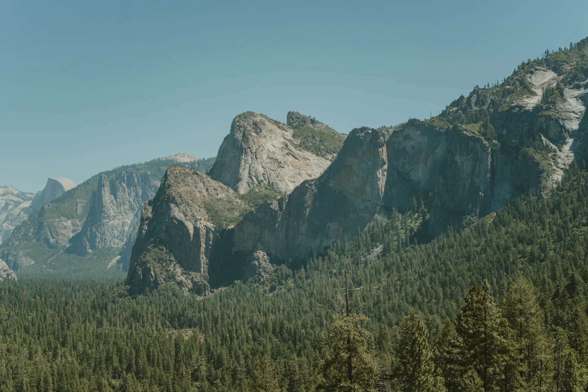
Between roughly 6,000 and 8,000 feet, red fir and lodgepole pine take over in pure stands, tall, straight trunks growing close together under winters that bring six feet of snow or more. Jeffrey pine, easy to identify by its vanilla-scented bark, grows on drier, rockier sites in this same band. Yosemite Valley's rim and much of the drive up toward Crane Flat and Glacier Point Road sit in this zone, so it is the forest most visitors see even if they never leave a paved road.
Subalpine Forest: Tuolumne Meadows and the High Country
From about 8,000 to 9,500 feet, the forest thins and the trees get tougher: lodgepole pine still grows here but is joined by western white pine and mountain hemlock, species built to survive short growing seasons and heavy snowpack. Tuolumne Meadows, at 8,600 feet, sits right in this zone, and it is where the park's best wildflower meadows are, with shooting star, corn lily and lupine among the common summer blooms. Wildflowers here typically peak from June through August, later than lower elevations because snow can linger into early summer. Our Tuolumne Meadows hikes guide covers the easy meadow walks where you will see the most flowers for the least effort.
Alpine: Above the Trees
Above roughly 9,500 feet, conditions get too harsh for trees altogether, and the alpine zone takes over: low cushion plants, sedges and a handful of hardy wildflower species that hug the ground to survive wind and cold that would kill anything taller. Mount Lyell, Yosemite's highest point at over 13,000 feet, sits well within this zone, along with most of the park's remaining glacier. Very few visitors walk through true alpine ground, since it requires a multi-day trip or a serious day hike from a high trailhead, but the Sierra crest visible from Tioga Road and Tuolumne Meadows is largely alpine terrain.
When to See the Best Wildflowers
Because Yosemite's zones bloom on different schedules, there is no single peak week for the whole park. Lower elevations, the oak woodland and chaparral near the Valley, bloom earliest, often starting in April. The meadows around Tuolumne Meadows and other subalpine areas peak later, typically June through August, once the snow has cleared and the ground has warmed. If wildflowers are the goal, plan a spring trip for the foothills and a summer trip for the high country, since a single visit rarely catches both at their best.
Have Us Plan a Trip Around the Zones
Tell us when you are coming and we can time your route to catch the sequoias, the meadow wildflowers or both, depending on the season. Planning is free, and we earn only if you book through us.
Plants of Yosemite National Park: What Grows at Each Elevation FAQs
Five, stacked by elevation: foothill woodland and chaparral around 1,800 to 3,000 feet, lower montane forest from 3,000 to 6,000 feet, upper montane forest from 6,000 to 8,000 feet, subalpine forest from 8,000 to 9,500 feet, and alpine tundra above that.
Only in the lower montane zone, roughly 3,000 to 6,000 feet, and only in three groves: Mariposa Grove near the South Entrance, and the smaller Tuolumne and Merced groves off Big Oak Flat Road.
Their cones need heat to fully open and release seed, and periodic fire clears competing shade-tolerant trees so sequoia seedlings can establish. Without fire, a grove's regeneration slows down over time.
It depends on elevation. Lower-elevation foothill wildflowers can start in April, while the subalpine meadows around Tuolumne Meadows, at 8,600 feet, typically peak from June through August, once the snow has cleared.
The Valley floor and rim sit mostly in the lower and upper montane zones, with ponderosa pine, incense cedar, white fir and California black oak on the floor, and red fir and lodgepole pine higher on the rim and toward Glacier Point Road.
The alpine zone, above roughly 9,500 feet, has no trees at all. Low cushion plants, sedges and a handful of hardy wildflower species grow close to the ground there, adapted to wind, cold and a very short growing season.
Yes. The worked day-by-day plan is Yosemite 3 Day Itinerary: Valley, Glacier Point, Falls (3 Days), with the permits, the stays and the drive times already sorted. Tell us your dates and we will put it together for you and confirm what is genuinely open on those days. Asking is free: no card, no deposit, and nothing is held until you say yes.