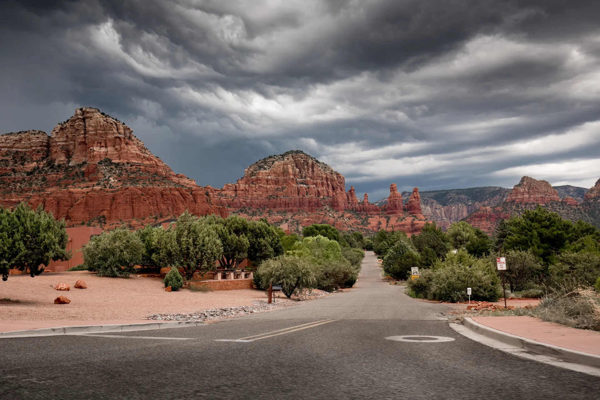
There is no direct line. The route goes south to Kingman, east across northern Arizona on Interstate 40, and then drops 2,500 feet into red rock country.
The Time Zone Trap
Nevada is on Pacific time. Arizona is on Mountain Standard time and does not observe daylight saving.
From March to November the two clocks read the same, so the drive costs you nothing. From November to March, Arizona is an hour ahead. Leave Vegas at 2pm in January and you arrive in Sedona at 7:30pm local, in the dark, on a canyon road. Check which side of that line your trip falls on before you book a dinner reservation.
Route 1: Through Kingman and Flagstaff
This is the route your map app gives you and it is the right one.
- US-93 south out of Las Vegas. Twenty-five miles to Boulder City, then over the Mike O'Callaghan and Pat Tillman Memorial Bridge, 900 feet above the Colorado River just downstream of Hoover Dam.
- Kingman, mile 105. The last reliably cheap fuel and the biggest town for the next 145 miles. Fill up here.
- Interstate 40 east. Kingman to Flagstaff is 145 miles of high desert climbing steadily from 3,300 to nearly 7,000 feet.
- Flagstaff, mile 250. Ponderosa pine, snow in winter, and the highest point of the day.
- The last 30 miles. Two choices, below.
The Oak Creek Canyon finish
From Flagstaff take State Route 89A south. The road runs through pine forest, arrives at an overlook on the canyon rim, and then drops through a set of tight switchbacks into Oak Creek Canyon. Fourteen miles of creek, sycamores, red walls and no shoulder.
It is slower. It is also the reason to drive rather than fly. There is a pullout at the top with a view down the whole canyon and a row of Navajo craft tables, and it is worth the ten minutes.
In winter this road can close or require chains. Check Arizona 511 before committing.
The interstate finish
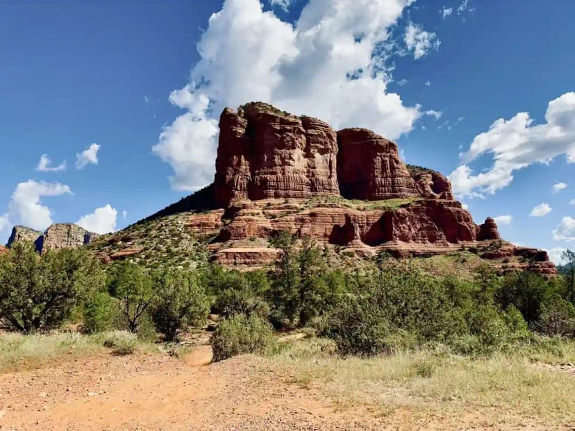
Stay on Interstate 17 south from Flagstaff to exit 298, then State Route 179 north into the Village of Oak Creek. Faster by about twenty minutes and not a consolation prize: you come in past Bell Rock and Courthouse Butte with the whole red rock skyline in the windshield.
Use 179 if you are arriving after dark or towing anything.
Route 2: The Long Way Through Jerome
Stay on US-93 south past Kingman all the way to Wickenburg, then north through Prescott and over Mingus Mountain on 89A into Jerome and Cottonwood.
It is about 290 miles and closer to six hours because the mountain section is slow. What you get is Jerome, an old copper town built into a 30-degree slope at 5,200 feet, and a set of switchbacks off Mingus that look down on the entire Verde Valley.
Take this one on the return leg if you want to see something different in each direction.
Where to Stop
- Hoover Dam bypass bridge, mile 30. Park at the memorial plaza and walk the pedestrian path across for the view down at the dam. Twenty minutes. Visiting the dam itself means a security checkpoint and a good deal longer.
- Kingman, mile 105. Route 66 runs through the middle of it. The Powerhouse Visitor Center and the old motel neon are worth a quick loop.
- Seligman, mile 195. Leave Interstate 40 at exit 123 and take the historic Route 66 alignment 25 miles to Ash Fork at exit 146. Same driving time, and Seligman is where the Route 66 revival started.
- Williams, mile 220. The Grand Canyon gateway town, and the last place with a decent lunch before Flagstaff.
- Flagstaff, mile 250. A real town with real food. Stretch here before the canyon.
Adding the Grand Canyon
From Williams it is 60 miles north on State Route 64 to the South Rim entrance, then 60 miles back, plus whatever you spend at the rim. That is three hours minimum added to an already long day, and you will arrive in Sedona late and having rushed the canyon.
The version that works: night one in Tusayan or at the South Rim, sunrise on the rim, then down to Sedona through Flagstaff and Oak Creek Canyon the next morning. It turns a driving day into a proper three-day trip.
Practicalities
Fuel. The gap between Kingman and Flagstaff is the one to watch. Prices in Sedona are among the highest in Arizona, so fill in Flagstaff or Cottonwood.
Elevation. Flagstaff sits at 6,910 feet and Sedona at 4,350. You lose 2,500 feet in half an hour, and gain about 20°F doing it. Pack for both.
Winter. Interstate 40 across northern Arizona closes for snow several times most winters, usually for hours rather than days. Oak Creek Canyon ices up. This is a genuinely different drive in January.
Parking in Sedona. Most red rock trailheads need a Red Rock Pass, sold at vending machines at the lots and at the ranger station. An America the Beautiful pass covers it. The big trailheads fill by 8am from March through May and again in October.
What to Do the Moment You Arrive
If you land with an hour of light left, drive Airport Mesa for the sunset view over the whole valley, or park at Bell Rock on 179 and walk fifteen minutes up the slickrock. Both are short, both need no permit beyond the parking pass, and both explain why you drove 280 miles.
Las Vegas to Sedona: How Far It Is and Which Route to Drive FAQs
About 275 to 280 miles by the standard route through Kingman and Flagstaff. Driving time is four and a half hours without stops, and closer to six with a proper lunch and a photo stop.
It depends on the season. Arizona does not observe daylight saving time. From roughly March to November the clocks match, so you arrive at the time your map app says. From November to March, Arizona is one hour ahead of Nevada and you lose an hour on the way over.
Take the standard route to Flagstaff, then drop into Sedona on State Route 89A through Oak Creek Canyon. It adds about twenty minutes over the interstate finish and it is the best half hour of the drive.
Yes, but not as a quick detour. Leaving Interstate 40 at Williams and driving to the South Rim and back adds close to three hours before you have looked at anything. Treat it as an overnight.
You drive over the bypass bridge just downstream of it, which has a pedestrian walkway. Actually visiting the dam means taking the exit and clearing a security checkpoint, which adds thirty to forty-five minutes.
The same road in reverse, and the same four and a half hours. The one difference is the climb out of Oak Creek Canyon, which is 2,500 feet of switchbacks in about 14 miles and is slow behind an RV.
Yes. The worked day-by-day plan is Sedona Hiking: Devil's Bridge, Cathedral Rock and the Best Red-Rock Trails (3-Day Itinerary) (3 Days), with the permits, the stays and the drive times already sorted. Tell us your dates and we will put it together for you and confirm what is genuinely open on those days. Asking is free: no card, no deposit, and nothing is held until you say yes.