Sedona Hiking: Devil's Bridge, Cathedral Rock
and the Best Red-Rock Trails (3-Day Itinerary)
Three days hiking in Sedona: hiking Devil's Bridge Sedona to the largest sandstone arch, hiking Cathedral Rock Sedona up the iconic slickrock, plus easy Sedona hiking trails, the vortex sites and Oak Creek Canyon.
Free interactive planner · drag & reorder your days, add stops, map it in minutes
Build your own Sedona trip, drag, reorder & map it.
Drag trails between days, swap an easy vortex loop for a steep slickrock scramble, and drop in your own overlooks and swimming holes with the place search. The live map and drive times recalculate as you go, and we'll flag the trailheads where parking fills at dawn so you can plan the shuttle instead.
Opens a side panel · reorder days, add custom stops, see your route live
One red-rock town, arches, slickrock & vortex hikes, all in northern Arizona.
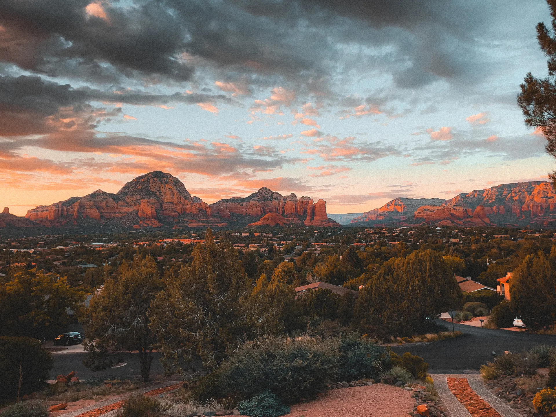
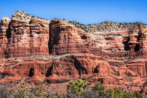
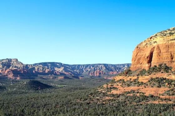
Sedona sits in a bowl of red sandstone buttes and spires in northern Arizona, about two hours north of Phoenix and 45 minutes south of Flagstaff. The whole town is wrapped in trails, from easy red-rock loops the whole family can do to steep slickrock scrambles and the famous energy-vortex sites, all set against some of the most photogenic rock in the Southwest.
This 3-day route is a complete Sedona hiking guide built around the best hiking in Sedona. You'll do hiking Cathedral Rock Sedona, a short but steep slickrock scramble to the most iconic viewpoint in town, and hiking Devil's Bridge Sedona out to the largest sandstone arch in the area. We balance the hard climbs with easy Sedona hiking trails like Bell Rock, Fay Canyon and the West Fork of Oak Creek, plus the vortex sites at Bell Rock, Boynton Canyon and Airport Mesa for sunset. If you're planning a Sedona hiking trip for beginners, every hard hike here has an easy swap.
Spring and fall are the best seasons, with comfortable days and cool nights, and November in particular is a sweet spot of crisp sunny days and thinner crowds. Summer is hot, with afternoons regularly in the 90s and 100s, so save the exposed slickrock for dawn and bring far more water than you think. Winter is mild and quiet, with January highs often in the 50s and the occasional dusting of snow on the red rocks that makes for unforgettable photos.
Sedona trailhead lots are small and fill by sunrise on weekends, especially Cathedral Rock, Devil's Bridge (Dry Creek Road) and Soldier Pass. The free Sedona Shuttle serves those popular trailheads from park-and-ride lots, so plan to ride it or arrive at dawn. You also need a Red Rock Pass ($5/day) or an America the Beautiful pass to park at most trailheads, and Sedona lodging is limited and pricey, so book your stay early.
Arrive & ease in · Bell Rock, Cathedral Rock & Airport Mesa sunset
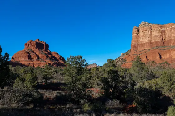
Sedona is an easy drive in: about 2 hours north from Phoenix (PHX) or roughly 45 minutes south from Flagstaff (FLG). Warm up your legs on the Bell Rock and Courthouse Butte Loop (about 4 miles round trip, easy), a gentle, mostly flat circuit around two of the most recognizable buttes in town. Bell Rock is also one of Sedona's celebrated energy vortexes, so it is a fitting first taste of the red rocks.
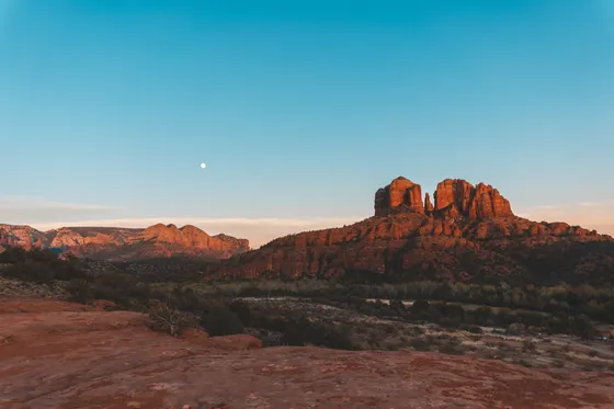
In the afternoon, take on the trip's signature climb: hiking Cathedral Rock Sedona (about 1.2 miles round trip, steep). It is short but no joke, a hand-over-hand slickrock scramble up a chute to a saddle between the spires, with one of the most photographed views in the Southwest waiting at the top. Cap the day at the Airport Mesa vortex for sunset, an easy walk to a 360-degree overlook that lights up gold and red as the sun drops.
- ~4 mi RT · easy · gentle loop · Bell Rock vortex
- ~1.2 mi RT · steep slickrock scramble · iconic view · vortex
- Airport Mesa vortex at sunsetShort walk · 360-degree overlook · the classic Sedona sunset
- Stay in SedonaBase in town for all three days · book lodging early
- The Cathedral Rock trailhead lot is tiny and fills by sunrise. Ride the free Sedona Shuttle from the park-and-ride, or hike it at dawn before the lot fills.
- Cathedral Rock is only about 1.2 miles round trip but steep, with a slickrock chute you scramble up hand over hand. Wear grippy shoes and take your time.
- Airport Mesa is the easiest sunset spot in town, but the small lot and the road shoulder fill fast, so arrive at least an hour before sunset.
Bell Rock loopAirport Mesa sunsetHiking Devil's Bridge Sedona & Soldier Pass
 Soldier Pass
 Sedona red rocks
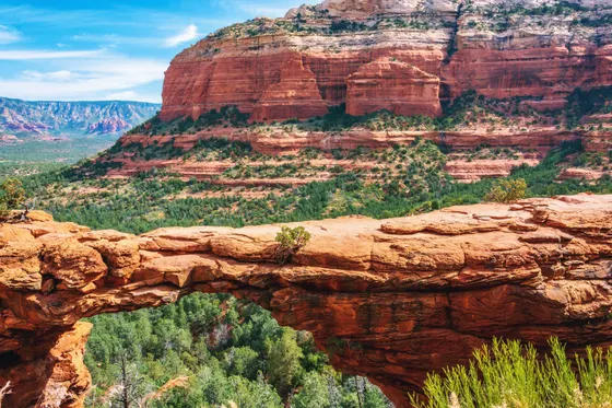
Today is the big arch day: hiking Devil's Bridge Sedona, the largest sandstone arch in the Sedona area. The hike runs about 4 miles round trip from the Dry Creek Road trailhead (longer if you start from the Mescal trailhead), or much shorter if you have a high-clearance 4x4 and drive the rough road in to the closer parking. The payoff is a dramatic natural span you can walk out onto for the classic Sedona photo. Go early, because both the trail and the queue for the bridge photo get busy.
In the afternoon, link up the Soldier Pass Trail (about 4.5 miles round trip), one of the most feature-packed hikes in town. It passes the Devil's Kitchen sinkhole, the Seven Sacred Pools set in the slickrock, and a short side scramble up to the Soldier Pass Arches (also called the Soldier Pass Cave). The trailhead lot is small and gated, so the free shuttle is the easy way in.
- ~4 mi RT from Dry Creek Rd · largest arch near Sedona · go early
- ~4.5 mi RT · Seven Sacred Pools, Devil's Kitchen, Soldier Pass Arches
- Ride the free Sedona ShuttleServes Dry Creek / Devil's Bridge and Soldier Pass · lots fill at dawn
- Second night in SedonaStay put so you can hit the trailheads or shuttle at dawn
- Devil's Bridge is about 4 miles round trip from the Dry Creek Road trailhead. A high-clearance 4x4 can drive the rough road in to a closer lot and cut the hike down, but a regular car should park at Dry Creek or Mescal and walk.
- There is usually a line to step out onto Devil's Bridge for the photo. Arrive at first light to beat the queue and the midday heat on the exposed approach.
- The Soldier Pass trailhead lot is small and the gate closes in the evening. Take the free Sedona Shuttle so you do not have to fight for a spot.
Boynton Canyon, the easy trails & a red-rock 4x4 tour
Spend your last morning on the Boynton Canyon Trail (about 6 miles round trip), a vortex hike that runs deep into a box canyon ringed by red and cream cliffs. Don't miss the short, steep side scramble up to the Subway Cave, a hollowed-out alcove with a window onto the canyon. If you want something gentler, swap in two of the best easy Sedona hiking trails: Fay Canyon (about 2.4 miles round trip, flat and shaded) or Doe Mountain, a short climb to a flat mesa top with big valley views.
For an effortless way to reach the backcountry rock formations you can't hike to, finish with a guided red-rock 4x4 tour with Safari Jeep Tours (Ultimate Sedona Experience), a long-running Sedona outfitter that runs open-air Jeeps over the slickrock to spots most visitors never see. Getting home: it is about 2 hours back down to Phoenix (PHX) or roughly 45 minutes up to Flagstaff (FLG), so leave with daylight to spare on the canyon drive.
- Guided open-air Jeep over the slickrock · long-running Sedona outfitter · book ahead
- ~6 mi RT · vortex canyon · Subway Cave side trip
- Fay Canyon or Doe MountainEasy options · Fay Canyon ~2.4 mi flat & shaded · Doe Mountain short climb to a mesa
- Getting home: Phoenix or FlagstaffPHX ~2 hr · FLG ~45 min · leave with daylight for the canyon drive
- The Subway Cave side trail off Boynton Canyon is unsigned and involves a short scramble. Watch for the spur on the right roughly two miles in, before the main trail climbs to the canyon overlook.
- For an easy, family-friendly day swap Boynton for Fay Canyon, about 2.4 miles round trip on flat, shaded ground, or Doe Mountain, a short steep climb to a flat mesa with panoramic views.
- Safari Jeep Tours (Ultimate Sedona Experience) runs guided open-air Jeep trips over terrain you cannot reach on foot. Reserve ahead, especially in spring and fall and on weekends.
 West Fork
 Oak Creek Canyon
Now build your Sedona trip.
You've seen all three days. Open the free drag-and-drop planner and tune it for your dates, your pace, and whether you want hard slickrock scrambles or easy red-rock loops.
What we actually learned on the red rocks.
Get a Red Rock Pass or bring your pass
Most Sedona trailheads sit on Coconino National Forest land and require a Red Rock Pass to park, about $5 per day or $15 per week. An America the Beautiful pass also covers it. Buy a pass at a visitor center, a self-serve kiosk, or online before you hike.
Take the free Sedona Shuttle
The free Sedona Shuttle serves the most popular trailheads, including Dry Creek for Devil's Bridge, Cathedral Rock, and Soldier Pass, from park-and-ride lots. Those trailhead lots fill by sunrise on weekends, so the shuttle is often the only easy way in.
Carry more water than you think
Sedona is high desert and the slickrock is fully exposed. Carry at least 2 to 3 liters per person on a half-day hike, more in summer. There is no shade on Cathedral Rock or the approach to Devil's Bridge, so start at dawn and turn around if you run low.
Match the trail to your group
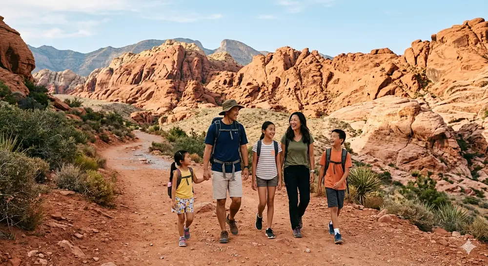
Cathedral Rock and Soldier Pass involve real scrambling, while Bell Rock, Fay Canyon, and the West Fork of Oak Creek are easy Sedona hiking trails that work for kids and beginners. Mix hard and easy across your days so nobody is wrecked by the heat.
Go in spring or fall, hike at dawn
Spring and fall bring comfortable days and cool nights, the best time to hike Sedona. Summer afternoons regularly reach the 90s and 100s, so do exposed hikes like Cathedral Rock and Devil's Bridge at first light. Winter is mild and quiet with occasional snow on the red rocks.
Chase the light at the vortex sites
Sedona's celebrated energy vortexes, at Cathedral Rock, Bell Rock, Airport Mesa, and Boynton Canyon, double as the best photo spots. Airport Mesa is the classic sunset overlook, while Cathedral Rock and the red rocks glow most at sunrise and the last hour of daylight.
Everything you'll actually want to know.
Ready to go? Get your
Sedona hiking route.
Trailheads and mileages for Devil's Bridge, Cathedral Rock and the easy red-rock trails, the shuttle and Red Rock Pass details, vortex sunset spots, a Jeep tour, and drive times from Phoenix and Flagstaff.
Instant book · Free cancellation · Secure payment via Stripe
Know these trails yourself? Become a local guide and host free community hikes.


Planning this trip?
Save it, share it with your crew, or find travelers heading the same way.
What other travelers are saying
Be the first to leave a tip or question for the next traveler.
How was your experience?
Tell us what worked and what did not. It goes straight to Yulia and Margarita.