Four Days Paddling
the Boundary Waters
Four days deep in the BWCAW: reserve your quota permit, pick an entry point, then paddle lake to lake, portage your canoe and gear, and camp under loon calls and northern lights.
Free interactive planner · drag & reorder your days, add stops, map it in minutes
Build your own Boundary Waters trip, drag, reorder & map it.
Drag stops between days, swap entry points and lakes, and add your own portages and campsites with the place search. The live map updates as you plan your loop, so you can sketch a realistic route before you reserve a permit and load the canoes.
Opens a side panel · reorder days, add custom stops, see your route live
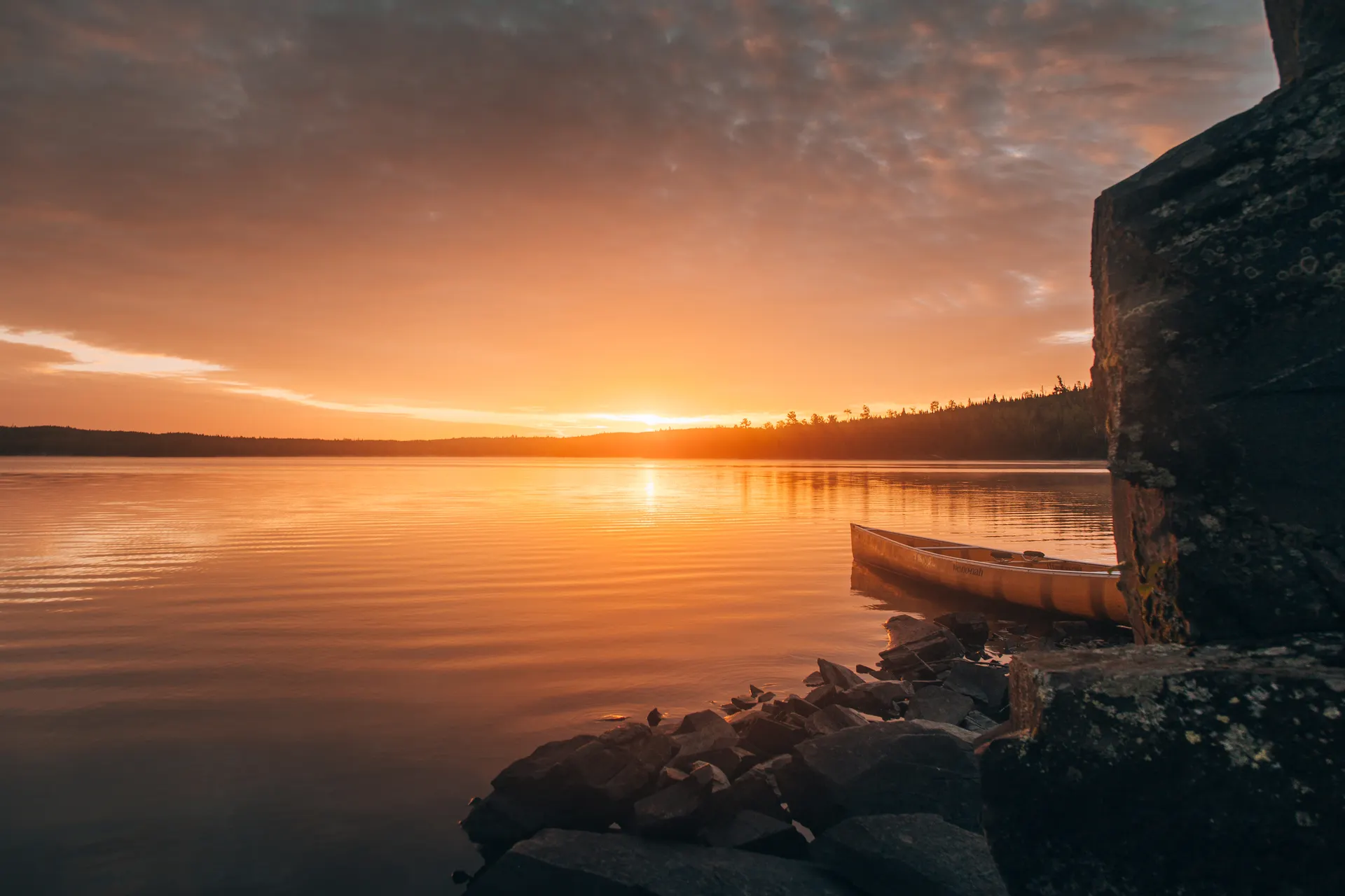
One wilderness, a thousand lakes & total silence, on the Canadian border.
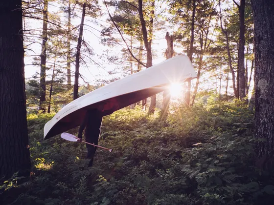
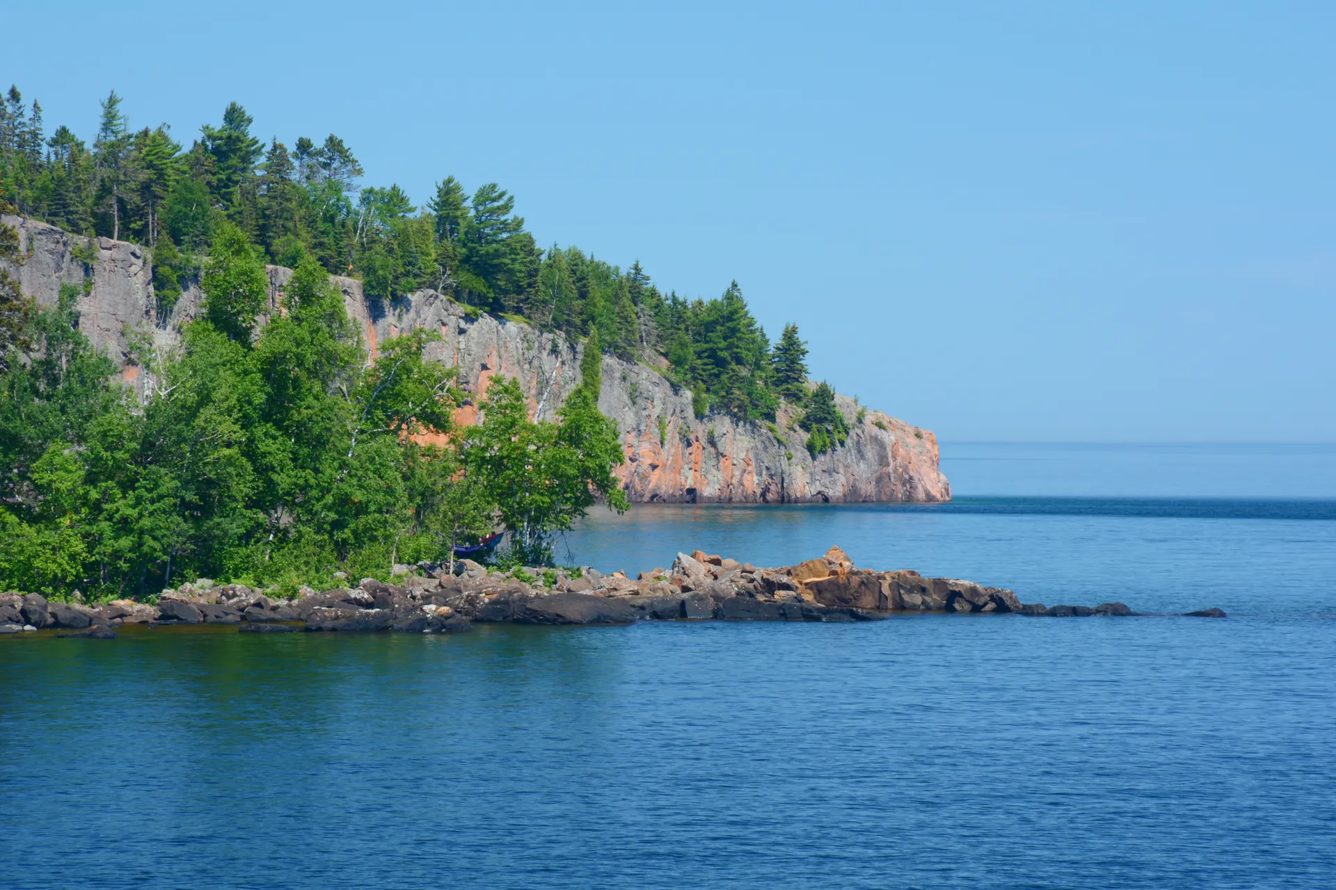
The Boundary Waters Canoe Area Wilderness (BWCAW) sprawls across more than a million acres of the Superior National Forest in far northern Minnesota, a maze of over 1,100 lakes and streams linked by portage trails and running right up to the Canadian border. There are almost no roads and no motors in most of it. You travel the way the voyageurs did, paddling a canoe from lake to lake and carrying it and your gear overland on the portages between them.
This 4-day route is built as a classic boundary waters canoe trip: choose an entry point, reserve a quota permit, then paddle a loop deep into the wilderness, camping on rocky pine-shaded islands and points along the way. You'll filter your water, hang or canister your food away from black bears, pack everything in and out, and fall asleep to loons, with a real chance of moose at the shoreline and the northern lights overhead.
The paddling season runs roughly May through September. Bugs (mosquitoes and black flies) peak in June, July and August bring warm swimming and the best fishing for walleye and northern pike, and late September delivers crisp air and gold-and-orange shoreline color. Whenever you go, the wilderness rewards an unhurried pace and a willingness to be genuinely off the grid.
Each entry point has a daily quota, and overnight paddle permits are reserved through recreation.gov. Summer permits for popular entry points like Lake One, Moose Lake, Sawbill, and Seagull go fast, so reserve as early as you can, often months ahead. If you do not own a canoe and gear, book an outfitter in Ely or Grand Marais early too. They rent canoes and equipment and run tow and shuttle service to the entry points.
Outfit in Ely or Grand Marais · paddle in from your entry point
Get to the edge of the wilderness first. Most paddlers base in Ely on the west side or Grand Marais on Lake Superior, the start of the Gunflint Trail on the east side, both about 2 hours from Duluth (DLH) or roughly 4 to 5 from Minneapolis. Pick up your reserved quota permit, watch the required Leave No Trace video, and load canoes and gear with an outfitter if you are renting.
Then drive to your entry point (Lake One, Moose Lake, Sawbill, and Seagull are classic starts) and push off. The first day is about getting your rhythm: paddling across your first lakes, finding and walking your first portages, and reaching a campsite a few lakes in. Aim to be off the water and setting up camp with plenty of daylight to spare, because the first portages always take longer than you expect.
- Reserved on recreation.gov · watch the Leave No Trace video · one permit per group
- Outfit & shuttle from Ely or Grand MaraisRent canoes and gear · arrange a tow or shuttle to your entry point
- Paddle in from your entry pointLake One, Moose Lake, Sawbill or Seagull · first lakes and portages
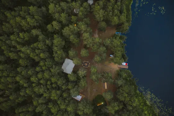
- Make camp at a wilderness siteFirst-come, first-served Forest Service sites · fire grate and box latrine
- You must reserve an overnight paddle quota permit for your entry point through recreation.gov, and summer dates for popular entry points sell out months ahead.
- No cans or bottles are allowed in the wilderness. Repackage food into bags or reusable containers before you leave the outfitter.
- BWCAW campsites are first-come, first-served and not reserved, so plan to reach your target lake with time to find an open site before evening.
Paddle deeper · portages, fishing & a lake-country loop
 Into the rhythm
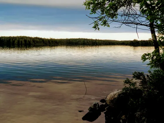
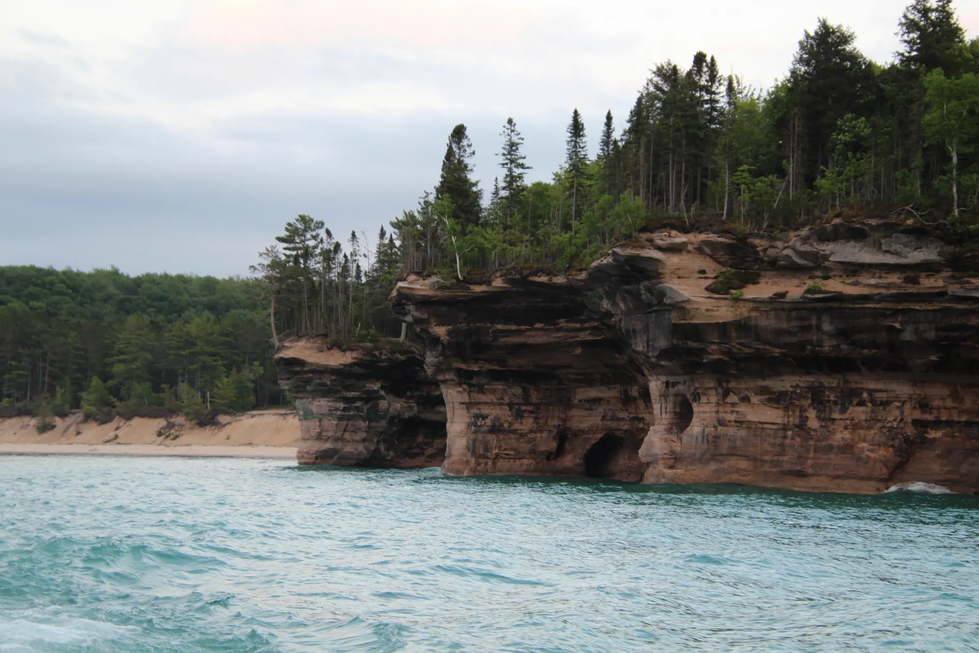
 Pine shorelines
This is your big travel day, pushing deeper into the wilderness. String together several lakes and the portages that connect them, settling into the wonderful rhythm of paddle, unload, carry, reload, paddle again. A portage is measured in rods (one rod is about 16.5 feet, roughly a canoe length), so a 160-rod carry is about half a mile. Take two trips if you need to: canoe on one, packs on the other.
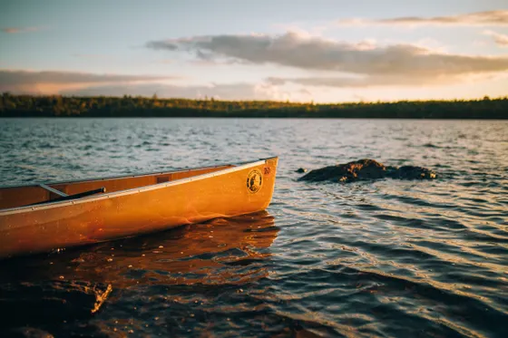
Trade speed for the experience. Drop a line for walleye or northern pike on a quiet bay, watch for moose feeding in the shallows, and let the absolute silence sink in. By afternoon, aim for a scenic campsite on a point or island deep in the loop, set up before the wind and bugs pick up, and filter your drinking water straight from the lake.
- Run a chain of lakes & portagesPortages measured in rods · about 16.5 ft each · two trips if loaded heavy
- Fish for walleye & northern pikeWorld-class lake fishing · a Minnesota fishing license is required
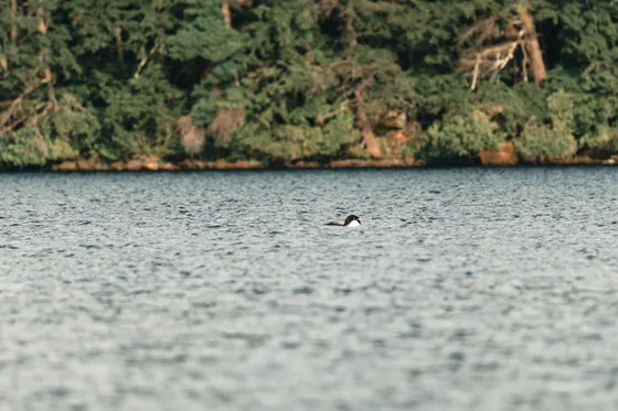
- Watch for moose & loonsMoose in the shallows · loons on every lake · keep a respectful distance
- Camp on a point or islandFilter lake water · hang or canister food away from black bears
- Portage distances are posted in rods. One rod is about 16.5 feet, so 320 rods is roughly a mile. Plan routes by total rods, not just lake miles.
- Filter, boil, or chemically treat all drinking water. The lakes look clean but are still surface water.
- Black bears live throughout the BWCAW. Hang your food pack from a tree well away from camp or use a bear-resistant canister, and never store food in your tent.
Layover day · explore, swim, fish & soak in the silence
Take a slower day at the heart of your loop. With camp already set, you can paddle out unloaded to explore a side lake or a waterfall, fish the early-morning and evening bites when walleye are most active, swim off a warm rock ledge, and simply do nothing in the best possible way. This is when a Boundary Waters trip stops being about miles and starts being about the place.
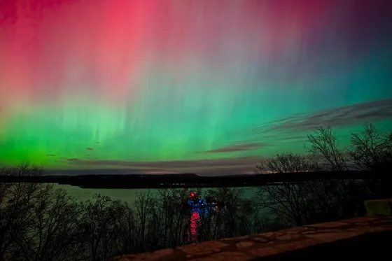
It is also your buffer. Weather in the north woods can turn fast, and a hard wind can make big-lake crossings genuinely unsafe, so a layover day gives you the slack to wait out a blow without blowing your schedule. As the light fades, watch for northern lights over the water. With no light pollution for tens of miles, the BWCAW is one of the best dark-sky spots in the Midwest.
- Paddle out unloaded to a side lakeExplore a quiet bay, narrows, or small waterfall with an empty canoe
- Fish the dawn & dusk bitesWalleye and pike hit hardest early and late · practice catch and release
- Swim, read & rest at campA built-in buffer day to wait out wind or just slow down
- Watch for the northern lightsNo light pollution for miles · one of the Midwest's best dark skies
- A layover day doubles as weather insurance. If a strong wind kicks up whitecaps on the big lakes, wait it out rather than risk a dangerous crossing.
- Fishing is best at dawn and dusk. Bring a few simple jigs and spoons, and check Minnesota regulations for the lakes you are paddling.
- On a clear, dark night look north for the aurora. Give your eyes 20 minutes to adjust and keep headlamps off to see it best.
Northern lights Island camps
Paddle out · close the loop & head back to town
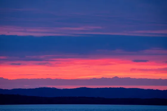
Break camp and paddle the loop closed back toward your take-out, leaving each campsite cleaner than you found it. Retrace your portages or follow the back half of the loop, timing your final big-lake crossings for the calm of early morning before the wind builds. Do one last sweep of the site for micro-trash and make sure your fire is dead out and cold to the touch.
Reach the landing, load the canoes onto the car or meet your outfitter shuttle, and drive back to Ely or Grand Marais for a hot shower, a burger, and a cold drink that tastes impossibly good after four days off the grid. Getting home: from either town it is about 2 hours to Duluth (DLH) or roughly 4 to 5 hours to Minneapolis, so plan your flight or drive with margin if your paddle-out runs long.
- Paddle out & close the loopCross big lakes early before the wind · retrace or finish the loop
- Leave No Trace at every sitePack out all trash · drown and stir your fire until it is cold
- Take out & meet your shuttleLoad canoes at the landing or meet the outfitter tow back
- Getting home: Duluth or MinneapolisDLH ~2 hr · MSP ~4 to 5 hr · plan margin if paddle-out runs long
- Big-lake crossings are calmest at first light. Plan your paddle-out for the morning so wind and waves do not pin you on the wrong shore.
- Before you leave any campsite, pack out every scrap of trash and make sure the fire is out cold, drowned and stirred until you can touch the ashes.
- Give yourself buffer time on your last day. Paddle-outs can run slow into a headwind, so do not book a tight same-day flight from Duluth or Minneapolis.
Now build your Boundary Waters trip.
You've seen all four days. Open the free drag-and-drop planner and tune it for your dates, your entry point, and whether you outfit out of Ely or Grand Marais on the Gunflint Trail.
What we actually learned on the water.
Reserve a quota permit early
Every overnight paddle group needs a BWCAW quota permit tied to a specific entry point and start date, reserved through recreation.gov. Each entry point has a small daily quota, so summer dates for popular starts like Lake One, Moose Lake, Sawbill, and Seagull go fast. Book as far ahead as you can, and watch the required Leave No Trace video when you pick the permit up.
Use an outfitter if you do not own gear
Outfitters in Ely and Grand Marais (the start of the Gunflint Trail) rent canoes, paddles, packs, tents, and stoves, and run tow and shuttle service to the entry points. A full outfit means you can fly in with almost nothing and still paddle a four-day loop. They are also a goldmine for current route, water, and bug conditions.
Plan by rods, not just miles
Portages are measured in rods (one rod is about 16.5 feet, roughly a canoe length). A 320-rod portage is about a mile of carrying canoe and gear, often two trips. When you build a route, add up the total rods per day, not just the open-water paddling distance, or you will badly underestimate the effort.
Camp clean and bear-aware
Campsites are first-come, first-served Forest Service sites with a steel fire grate and a box latrine, never reserved. Pack everything in and out, no cans or bottles allowed. Hang your food pack or use a bear canister well away from your tent, and keep a tidy camp so black bears stay wild.
Treat your water and respect the weather
Filter, boil, or chemically treat all drinking water straight from the lakes. Watch the wind: a hard blow turns big lakes dangerous fast, so cross early, hug shorelines, and be willing to wait out whitecaps. A layover day built into the trip is your insurance against being windbound.
Pick your season for bugs and color
The paddling season runs roughly May through September. Mosquitoes and black flies peak in June, July and August bring warm swimming and prime walleye fishing, and late September delivers crisp air, fewer bugs, and gold-and-orange shoreline color. Pack a head net and rain gear no matter when you go.
Pack a head net for the bug hatches
June and July bring heavy black fly and mosquito hatches in the north woods, and on a sweaty portage with a canoe on your shoulders bug spray wears off fast and your hands are full anyway. An ultra-packable mesh head net weighs only about an ounce and keeps the bugs off your face and neck when spray is useless. Add long sleeves and a light shell so you can cover skin instead of reapplying repellent all day.
Everything you'll actually want to know.
Ready to go? Get your
Boundary Waters canoe route.
Entry points, quota permits, portage rods, fishing and bear logistics, outfitter options out of Ely and Grand Marais, and drive times from Duluth and Minneapolis, everything you need to paddle the BWCAW.
Instant book · Free cancellation · Secure payment via Stripe
Know these trails yourself? Become a local guide and host free community hikes.

Planning this trip?
Save it, share it with your crew, or find travelers heading the same way.
What other travelers are saying
Be the first to leave a tip or question for the next traveler.
How was your experience?
Tell us what worked and what did not. It goes straight to Yulia and Margarita.