If Sedona's red rock trails are about big exposed views, the West Fork Trail is the opposite and just as essential. Tucked into Oak Creek Canyon about 10 miles north of town, it follows a shaded, narrowing canyon along the cold West Fork of Oak Creek, crossing the water again and again beneath towering striped walls. It is consistently rated one of the most beautiful hikes in Arizona, and it is the antidote to a hot afternoon on the open mesas.
Trail Stats and What to Expect
The maintained portion of the trail runs about 3.5 miles each way (roughly 7 miles round trip) with gentle elevation gain, making it accessible for most fitness levels and families. The reward is not a summit but the journey: 13 creek crossings on the official stretch, deep cool shade from sycamores and maples, and canyon walls that close in dramatically near the turnaround. The trail technically continues much farther for backpackers willing to wade and swim, but most hikers turn around where the maintained path ends.
Parking, Fees, and the Call of the Canyon Lot
The trail starts at the Call of the Canyon day-use area off Highway 89A. Key logistics:
- There is a per-vehicle day-use fee, and the lot is not covered by the standard Red Rock Pass or America the Beautiful pass.
- The lot is small and fills early on weekends and during fall color, often by mid-morning. Arrive before 9 a.m. or come on a weekday.
- There is a footbridge over Oak Creek near the start, and restrooms at the trailhead.
The Best Time to Hike West Fork
West Fork shines in two seasons. In fall, usually mid-October to early November, the bigtooth maples and sycamores blaze gold and crimson, making this the premier autumn hike in northern Arizona. In summer, the constant shade and creek crossings keep it 10 to 20 degrees cooler than the exposed Sedona trails, which makes it the smart choice when the rock basins bake. Avoid the canyon during heavy monsoon storms in July and August, when the creek can rise fast.
Mile-by-Mile: What You Will See
The hike opens through the historic Mayhew Lodge ruins, an old guest resort from the early 1900s where authors and Hollywood crews once stayed, just a few minutes past the footbridge. From there the trail enters the riparian corridor and the first creek crossings begin within the first mile. By mile 2 the canyon visibly narrows and the walls rise several hundred feet, banded in cream and rust sandstone. The most photographed stretch comes near the end of the maintained section, where the walls pinch to a corridor barely wide enough for the creek and a sliver of sky. This is your natural turnaround point at roughly mile 3.5.
How West Fork Compares to Other Sedona Trails
Most first-time visitors stack their days with the famous viewpoints, but West Fork offers a completely different experience. Here is how it stacks up:
- Devil's Bridge: exposed, dry, and crowded, with a dramatic natural arch payoff. West Fork is the shaded, water-along counterpoint.
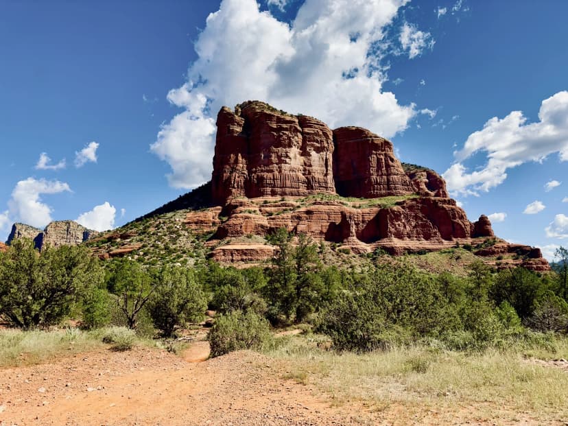
- Cathedral Rock: short but steep scrambling to a sunset overlook. West Fork is flat and family friendly by comparison.
- Soldier Pass: moderate with the Seven Sacred Pools and a cave detour. West Fork is longer but mellower underfoot.
The smart move is to mix one cool canyon hike like West Fork with one or two red rock viewpoint trails so your legs and your camera both get variety.
Getting There from Sedona and Flagstaff
From Uptown Sedona, drive north on Highway 89A through Oak Creek Canyon for about 10 miles; the Call of the Canyon lot is on the left (west side) just past the Bootlegger Campground. The drive itself is one of Arizona's most scenic, with pullouts and the Slide Rock State Park swimming area along the way. Coming from Flagstaff, take 89A south down the canyon switchbacks for roughly 15 miles and watch for the lot on the right. Cell service is spotty in the canyon, so download your map and directions before you leave town.
What to Bring and Trail Tips
Wear shoes you do not mind getting wet, since the crossings are unavoidable, and consider trekking poles for balance on the slick rocks. Bring layers even in summer, as the deep canyon stays cool. Pack at least two liters of water per person, sunscreen for the open first stretch, and a few snacks for the turnaround. Pets are allowed on leash, and dogs love the water. Stay on the trail to protect the sensitive riparian habitat, and pack out everything, since this is a heavily loved corridor.
Fit West Fork Into a Bigger Sedona Plan
West Fork pairs perfectly with a day of red rock hiking, giving you one cool canyon hike to balance the open mesa trails. Our 3-day Sedona hiking itinerary shows how to combine West Fork with Devil's Bridge, Cathedral Rock, and the Soldier Pass trails so you get variety across your trip without burning out in the heat.
West Fork Trail, Sedona FAQs
The maintained section of the West Fork Trail is about 3.5 miles one way, or roughly 7 miles round trip, with gentle elevation gain and 13 creek crossings. Most hikers turn around where the maintained trail ends, though it continues farther for experienced backpackers.
No. The West Fork Trail uses the Call of the Canyon day-use area, which charges its own per-vehicle fee and does not accept the Red Rock Pass or the America the Beautiful interagency pass. Plan to pay the day-use fee at the trailhead.
Fall, from mid-October to early November, is the most spectacular thanks to peak maple and sycamore foliage. Summer is also excellent because the shaded canyon and creek crossings stay much cooler than Sedona's exposed trails. Arrive early, since the small parking lot fills fast.