The Superior Hiking Trail runs roughly 310 miles along the ridgeline above Lake Superior, from the Wisconsin border near Jay Cooke State Park up to the Canadian border at the 270 Degree Overlook. Thru-hiking the whole thing takes two to three weeks, but the brilliant secret of the SHT is that its very best scenery is packed into a handful of accessible day-hike sections. With short spur trails from well-marked trailheads off Highway 61, you can stand on a clifftop ridge over the largest freshwater lake on Earth and be back at your car for a fish dinner in Grand Marais by evening. Here are the sections worth driving for.
Oberg Mountain Loop
If you only do one section of the Superior Hiking Trail, make it the Oberg Mountain Loop near Tofte. The 2.3-mile loop climbs gently to a clifftop circuit with nine marked overlooks. You get sweeping views of Oberg Lake, Leveaux Mountain, the Sawtooth ridgeline, and the open expanse of Lake Superior. In late September the maple forest below the overlooks turns into a blanket of red and orange that draws photographers from across the Midwest. The trailhead sits on Forest Road 336 off Onion River Road, just a few minutes from Tofte.
Carlton Peak from Britton Peak
The hike to Carlton Peak from the Britton Peak trailhead is about 3.4 miles round trip and finishes on a massive dome of anorthosite rock high above the Temperance River valley. The summit is a favorite of rock climbers, and the 360-degree view takes in Lake Superior, the Sawtooth Mountains, and the forest stretching inland for miles. The footing gets rocky near the top, so wear real hiking shoes.
Bean and Bear Lakes Loop
Starting from the Penn Boulevard trailhead in Silver Bay, the loop past Bean Lake and Bear Lake is one of the most photographed stretches of the entire trail. The roughly 6.5-mile loop hugs cliffs that drop straight down to two deep blue lakes ringed by birch and cedar. It is moderately strenuous, so plan for three to four hours and bring plenty of water.
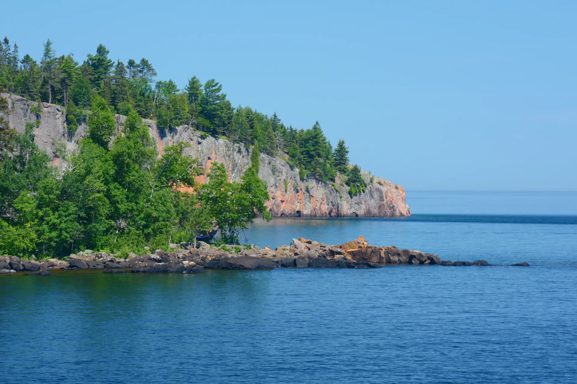
Section 13 and Palisade Head
For raw drama, the overlook known as Section 13 near Beaver Bay delivers a cliff-edge panorama with almost no crowds. Pair it with a quick drive to Palisade Head, a 200-foot sheer cliff inside Tettegouche State Park where peregrine falcons nest. Both spots showcase the same ancient lava-flow geology that gives the North Shore its rugged profile.
When to Go and What to Bring
The prime window runs from late May through October. Black flies peak in early June, fall color peaks in the last week of September, and the trail can hold ice on north-facing slopes well into May. A few essentials for any SHT day hike:
- Layers: Lake Superior generates its own weather and a sunny trailhead can turn cold and windy at the overlooks.
- Sturdy footwear: roots, boulders, and exposed rock are constant.
- Bug protection: June and July mean black flies and mosquitoes in the lowlands.
- The official SHT maps or app: spur trails to overlooks are signed but easy to overshoot.
- Water and snacks: there are no services between trailheads.
Build It Into a Multi-Day Trip
These sections are even better strung together over several days, basing yourself in Tofte, Silver Bay, or Grand Marais. If you want a ready-made plan that connects the highlights with where to sleep and eat, follow our 4-day Superior Hiking Trail itinerary, which sequences the best overlooks so you are never backtracking. Pair it with stops at the Temperance and Cascade River waterfalls and you have a North Shore weekend that rivals any in the country.


