Why Pinnacle Mountain is the Gateway to the Ouachitas
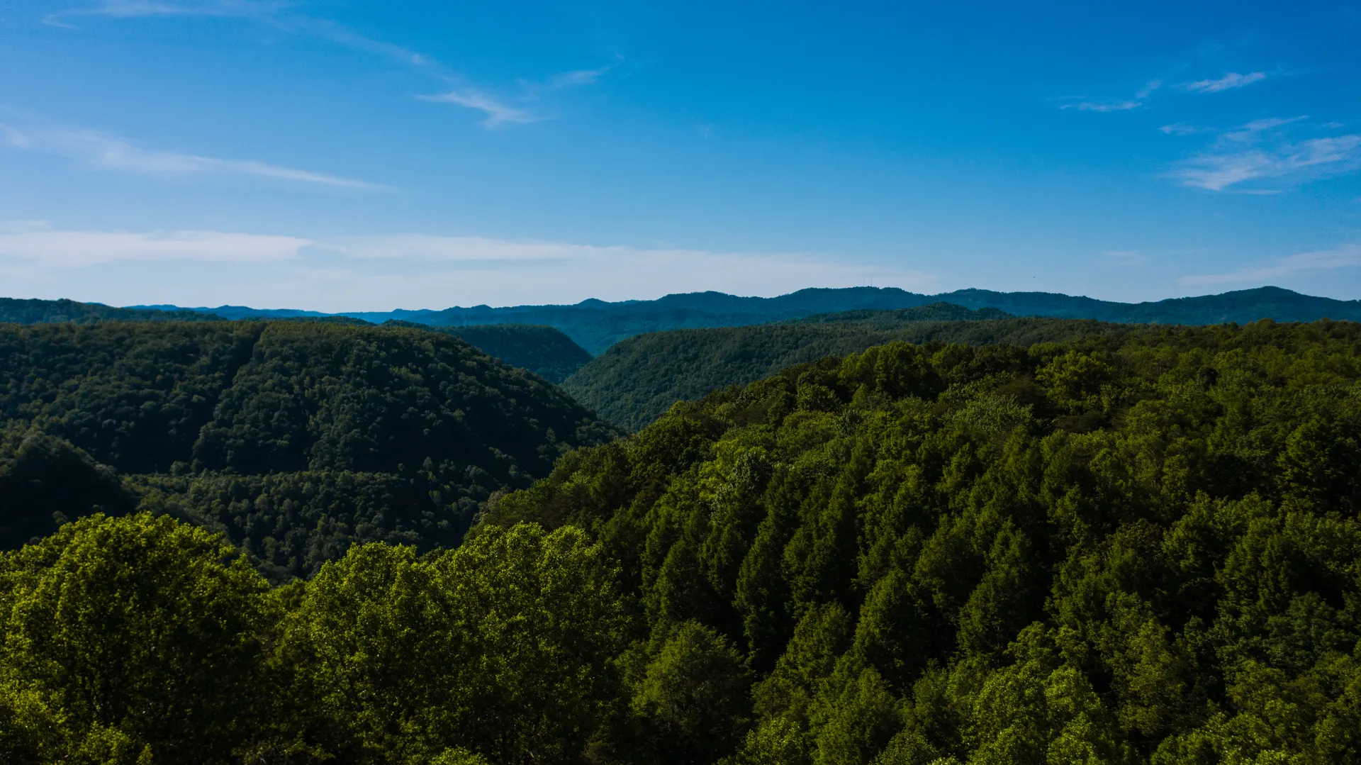
Rising 1,011 feet above the Arkansas River valley just 20 minutes west of downtown Little Rock, Pinnacle Mountain is the most recognizable peak in central Arkansas. Its cone-shaped summit makes it a magnet for day hikers, and the surrounding state park sits at the eastern doorstep of the Ouachita Mountains. If you only have a few hours, Pinnacle delivers the best big view per mile of effort anywhere near the capital. It is also the logical place to begin a longer adventure, since the official eastern terminus of the Ouachita National Recreation Trail is a short drive away at the park's visitor center area.
The West Summit Trail: Shortest Route to the Top
The West Summit Trail is the fastest way to the peak. It is roughly 0.75 miles each way and gains about 700 feet, with the upper third turning into a genuine rock scramble over talus and boulders. Wear shoes with grip and use your hands on the steep sections. Most hikers reach the summit in 30 to 45 minutes. From the top you get a sweeping 360-degree panorama of the Arkansas River, Lake Maumelle, and the rolling Ouachita ridgelines stretching west.
Key tips for the West Summit:
- Go early on weekends, the West Summit lot fills by mid-morning in spring and fall.
- Bring water, there is no shade on the rocky upper slope and no water on the trail.
- Loop it by descending the East Summit Trail to vary the views and ease your knees.
The East Summit Trail and the Summit Loop
The East Summit Trail is slightly longer and a touch less steep than the west side, climbing through hardwood forest before the final boulder field. Combining the two summit trails creates a popular 1.5-mile loop over the top. Going up the east side and down the west is the gentler option for the climb, though the descent over the west boulders still demands care. Either direction, plan on one to two hours round trip depending on how long you linger at the summit.
Base Trail and the Easier Options
Not everyone wants to scramble. The Base Trail circles the foot of the mountain in about 1.8 miles of mostly flat, shaded walking, perfect for families, trail runners, or a recovery day. For a longer flat outing, the Kingfisher and Rocky Valley trails wander through the park's bottomland and along the Little Maumelle River, adding several quiet miles with good birding. The Arkansas Arboretum near the visitor center adds a short paved interpretive loop that is wheelchair accessible.
Connecting to the Ouachita National Recreation Trail
Pinnacle Mountain State Park is where many through-hikers and section hikers stage the eastern end of the long trail. From here the Ouachita Trail runs roughly 223 miles west to Talimena State Park in Oklahoma, passing the Flatside Wilderness, Forked Mountain, and dozens of remote ridge miles. If the summit view leaves you wanting more, treat Pinnacle as your warm-up and plan a multi-day section hike. Our four-day plan in the Ouachita National Recreation Trail itinerary links the best eastern segments into a loop you can drive between, starting right here near Little Rock.
When to Go and What to Pack
Spring (March to May) brings dogwood and redbud blooms and comfortable temperatures, while fall (October to early November) offers crisp air and color across the Ouachitas. Summer is hot and humid, so start at sunrise and carry extra water. Winter hikes are quiet and clear but watch for ice on the shaded boulder fields. Always pack water, traction-friendly footwear, sunscreen, and a layer, since the exposed summit catches the wind.
Trail Difficulty, Safety, and Trail Etiquette
Pinnacle is short but deceptively demanding because of the boulder scrambles, and the park typically sees several rescues a year from hikers who underestimate the rock. The most common mistakes are wearing flip-flops or smooth-soled sneakers, climbing in wet conditions when the talus is slick, and pushing on in summer heat without enough water. Take the boulder fields slowly, test each rock before committing your weight, and turn around if a storm rolls in, since the bare summit is dangerously exposed to lightning. Dogs are welcome on leash, but the upper scrambles are hard on paws, so the Base Trail is the better choice for most pets. Because the summit trails are narrow and busy, yield to uphill hikers and step aside on the rocks to let faster groups pass. Trekking poles help on the descent, especially the steep West Summit drop.
Logistics: Fees, Facilities, and Nearby Stops
Pinnacle Mountain State Park charges no day-use entrance fee, which makes it one of the best free outdoor outings near Little Rock. The visitor center has restrooms, water, trail maps, and helpful staff who can give you current conditions and water levels. There is no campground inside this particular park, so overnight visitors usually stay in Little Rock hotels or at nearby Maumelle Park, a Corps of Engineers campground on the Arkansas River with RV and tent sites. After your hike, the trailheads put you within easy reach of paddling on the Little Maumelle River, road biking on the river trail system, and the restaurants of west Little Rock. Many visitors pair a sunrise summit with breakfast in town, then drive west to start exploring the deeper Ouachitas. Whether you come for a quick leg-burner before work or as the launchpad for a longer backcountry trip, Pinnacle Mountain rewards the effort with one of the finest accessible views in the state.


