Why Every Hiker Should Know Topo Maps
Your phone's GPS is a single point of failure. Batteries die, screens crack, and cell signal doesn't reach the places worth hiking to. A topographic map and the ability to read it gives you a backup that never runs out of battery and never loses signal. More importantly, a topo map lets you understand terrain before you ever set foot on it, you can predict where the steep sections are, find water sources, identify ridgelines you can follow, and estimate how long each section will take.
Reading topo maps is not a complex skill, but it does require learning a few core concepts. Once those click, you'll find yourself looking at a map and seeing a three-dimensional landscape rather than a flat sheet of paper.
What a Topographic Map Actually Shows
A topographic map represents three-dimensional terrain on a two-dimensional surface using contour lines. Every contour line connects points of equal elevation. If you were to walk along a single contour line, you would never go uphill or downhill, your elevation would stay constant the entire time.
The map also shows rivers, lakes, roads, trails, buildings, forest cover, and the names of peaks, valleys, and features. But the contour lines are what distinguish a topo from a regular trail map, and they're what make it possible to visualize the shape of the land.
Contour Lines: The Core of the Map
Every contour line on a standard USGS 7.5-minute topographic map (the most common type used for hiking) represents a change in elevation of 40 feet. This is called the contour interval, and it's printed in the map legend. Some maps use 20-foot or 80-foot intervals depending on the terrain, flatter terrain uses smaller intervals to show detail; steep terrain uses larger intervals to keep the map readable.
Index contours are the darker, bolder lines printed every fifth contour line. They're labeled with an elevation number. Between any two index contours, you have four lighter intermediate contours, each representing one interval of elevation change.
To find your elevation at any point on a topo map: locate the nearest index contour (with a number), count how many contour lines are between you and that index contour, and multiply by the contour interval. Add or subtract depending on whether you're above or below the index contour.
Reading Slope Steepness from Contour Spacing
This is the most practical skill a hiker gets from topo maps. The closer together the contour lines are, the steeper the terrain. Lines packed tight together mean a near-vertical cliff. Lines spread far apart mean gentle, rolling ground.
When you're planning a route, look at the contour spacing along your intended path. A section where lines are crowded together is going to be slow, hard on your legs, and potentially dangerous in wet conditions. A section of widely spaced contours is the flat-ish walking that lets you make good time and recover.
On a 1:24,000 scale map (the standard USGS topo), one inch on the map equals 2,000 feet on the ground. At this scale, contour lines that are 1/8 inch apart represent a slope of approximately 32% grade, steep enough to require hands on the trail and significantly harder to descend than ascend. Use a ruler to get a rough sense of spacing when you're planning.
Recognizing Terrain Features
Ridge lines (arêtes): On a topo, a ridge appears as contour lines that form a V or U shape pointing downhill. The elevated spine of the ridge runs along the center of the V, with slopes falling away on both sides.
Valleys and drainages: The opposite of a ridge. Contours form a V or U pointing uphill. Water flows toward the point of the V, so a stream or river will run along the bottom of any drainage visible on a topo.
Peaks and summits: Concentric rings of contour lines that close in toward a center point. The innermost ring is the summit or high point. If two peaks are close together, a saddle (col) appears between them as a narrowing of the rings.
Saddles and passes: The low point between two peaks. On a topo, a saddle looks like an hourglass shape where contours from two different peaks nearly pinch together. Most trail passes follow saddles because they represent the path of least resistance over a ridgeline.
Cliffs: Contour lines that run so close together they appear to merge. On a printed topo, a cliff may appear as a single thick line or a set of lines so close they're touching. Cliffs are rarely safe to descend without technical gear.
Map Scale and What It Means for Hiking
Scale is the ratio of map distance to real-world distance. The most useful topo maps for hiking use a 1:24,000 scale (sometimes written as 7.5-minute maps, referring to the area of latitude and longitude they cover). At this scale, one inch on the map equals 2,000 feet in the real world, or about 0.38 miles per inch.
Some trail maps use 1:62,500 or 1:100,000 scales. These cover more area on a single sheet but sacrifice detail. On a 1:100,000 map, a 40-foot contour interval compresses a lot of terrain variation, small ridges and gullies disappear, and what looks like gentle terrain might actually be quite broken.
For day hiking, a 1:24,000 map gives you more than enough detail. For expedition-style trips covering large distances, a 1:62,500 or 1:100,000 map is more practical since you won't need as many individual map sheets.
The Map Legend and Grid
Always read the legend before using a new map. The legend tells you the contour interval, the date the map was published (terrain changes; a 1965 map may show trails that no longer exist and miss trails built since), the magnetic declination (the difference between true north and magnetic north at that location), and the symbols used for roads, trails, water, buildings, and vegetation.
USGS topo maps use a consistent color system: brown contour lines on a white background, blue for water features, green for forested areas, gray or red for roads and human features. Trails are typically shown as dashed lines.
The UTM grid (Universal Transverse Mercator) printed on the map allows you to communicate your location to search and rescue using a precise coordinate. Learn to read the grid, in an emergency, UTM coordinates are more reliable than describing landmarks.
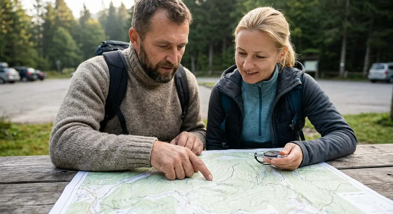
Practical Route Planning with a Topo
When you're planning a hike, lay the topo out and trace your intended route with your finger. As you trace, count the contour lines you cross and note whether you're crossing uphill or downhill. Multiply the number of lines by the contour interval to get your total elevation gain and loss, a much more accurate predictor of difficulty than mileage alone.
Use Naismith's Rule as a planning baseline: allow 30 minutes per mile, plus an additional 30 minutes for every 1,000 feet of elevation gain. A 6-mile route with 2,000 feet of gain thus takes roughly 4 hours of moving time. Add time for breaks, navigation, and any technical terrain.
Look for water sources along your route. On a topo, any blue line, solid or dashed, indicates water. Solid blue lines are perennial streams (flowing year-round in most conditions); dashed blue lines are seasonal. Plan your water carries accordingly, especially in arid climates where seasonal streams are dry from July through October.
Using a Topo with a Compass
A topo map and a compass together let you do something a GPS cannot: take a bearing on a visible landmark, plot it on the map, and triangulate your position. This technique, called resection, lets you figure out exactly where you are without any electronic device.
The key step is accounting for magnetic declination. In the western US, magnetic north is east of true north by 10–15 degrees. In the eastern US, it's west of true north by 5–15 degrees. If you don't correct for declination, your compass bearing and your map will disagree. The map legend tells you the declination for that location; some compasses have an adjustable bezel that lets you set the declination once and forget it.
Digital Topos vs. Paper Maps
Gaia GPS, CalTopo, and AllTrails all display topographic maps on your phone with your live GPS position overlaid. This is tremendously useful, but it doesn't replace paper for a few reasons: phones don't work in cold (below-freezing temps drain batteries fast), screens wash out in bright sunlight, and dropping a phone on a rocky trail can end your navigation capability entirely.
For serious backcountry trips, carry a printed topo as your primary navigation document and use your phone app as a supplement. Print or purchase maps from the USGS store or CalTopo before you go. A waterproof map case adds an ounce and could save your life.


