Navigation and Trail Features
TrailheadThe starting point of a trail, typically where the parking area is located and where trail signs, maps, and permit boxes are placed. Many trailheads have pit toilets, trail registers, and information boards about the trail system.
TerminusThe official starting or ending point of a long trail. The Appalachian Trail has two termini: Springer Mountain in Georgia and Mount Katahdin in Maine.
WaypointA specific GPS coordinate or landmark saved in a navigation device or app. Saving the trailhead as a waypoint before you start is standard practice for navigation safety.
BearingA direction expressed in degrees (0–360) relative to magnetic north. A bearing of 90° is due east; 180° is due south. Understanding bearings is fundamental to using a compass for navigation.
Topographic map (topo map)A map that uses contour lines to show terrain elevation. Closely spaced lines indicate steep terrain; widely spaced lines indicate gentle slopes. Learning to read topos is the most valuable navigation skill a hiker can develop.
Contour linesLines on a topographic map that connect points of equal elevation. The spacing between lines, the contour interval, tells you how much elevation change each line represents. On USGS 1:24,000 scale maps, each contour typically represents 40 feet of elevation change.
Elevation gainThe total amount of upward climbing on a route, measured from the lowest to the highest point (or summed across all ascents on a route with multiple ups and downs). A trail's difficulty is often better described by its elevation gain than its distance.
GradeThe steepness of a trail expressed as a percentage. A 10% grade means 10 feet of elevation gain for every 100 feet of horizontal distance. Trails above 15% grade are considered steep; above 25% is very steep and requires careful footing.
SwitchbackA zigzag path built into steep terrain to make the climb more gradual and sustainable. Switchbacks manage erosion and make steep grades hikeable. Cutting across switchbacks causes significant trail damage and should never be done.
Spur trailA short trail that branches off a main trail to reach a viewpoint, water source, or feature. Spur trails are typically out-and-back by nature.
Loop trailA trail that returns to the starting point via a different route rather than retracing the same path. Loops generally provide more varied terrain and scenery than out-and-back routes.
Out-and-back trailA trail where you hike to a destination and return via the same route. Out-and-back trails have the advantage of familiarity on the return and are common for summit routes.
Thru-hikeHiking a long trail from one end to the other in a single continuous trip. The Appalachian Trail, Pacific Crest Trail, and Continental Divide Trail are the three major US thru-hikes.
Section hikeCompleting a long trail in multiple non-continuous trips over time rather than in a single thru-hike.
Terrain Terms
TalusAn accumulation of large, angular rock fragments at the base of a cliff or steep slope. Hiking on talus requires careful footing and is significantly more demanding than maintained trail. Rocks can shift underfoot.
ScreeSmaller, loose rock fragments, typically from pea-sized to fist-sized, that form unstable slopes. Ascending scree is exhausting (two steps up, one slide back). Descending scree carefully, using the slope for braking, is a useful technique called scree skiing.
RidgelineThe high line connecting peaks or high points along a mountain range. Hiking ridgelines offers panoramic views but often involves more exposure and wind than valley trails.
Col or saddleA low point on a ridge between two higher points, or a pass between two valleys. Saddles are common destinations and navigation landmarks.
CirqueA glacier-carved bowl or amphitheater at the head of a valley, often containing a lake. The Wind River Range in Wyoming has some of the most dramatic cirque scenery in North America.
TundraThe treeless, low-growing vegetation zone above treeline in arctic or alpine environments. Alpine tundra is extremely fragile, plants grow just millimeters per year and footprints can persist for decades.
Treeline (timberline)The elevation above which trees cannot grow due to cold temperatures, wind, and a short growing season. Above treeline, hikers are fully exposed to weather and lightning.
DeadfallFallen trees across or near a trail, from natural death or storm damage. Heavy deadfall can make a trail impassable or significantly slow progress.
BlowdownA section of trail where windstorm damage has created extensive deadfall. Blowdowns are common in the aftermath of major storms and can add hours to an otherwise straightforward hike.
Navigation Markers and Signage
CairnA stack of rocks placed as a trail marker, especially above treeline where trails are difficult to mark with signs. Cairns are valuable navigation aids on rocky alpine terrain. Building unnecessary cairns or destroying existing ones both create navigation problems for other hikers.
BlazeA painted mark on a tree or rock indicating a trail. Appalachian Trail blazes are white rectangles. Blue-blazed trails on the AT are typically side trails to shelters or water. Double blazes indicate a trail junction or change in direction ahead.
RegisterA log book at a trailhead or shelter where hikers sign in and out. Registers help search and rescue teams locate missing hikers and provide a record of trail use patterns.
PermitA required document for accessing certain high-use areas. Permits may be obtained in advance (lottery or reservation system) or as a walk-up at the ranger station. Popular trails like Angel's Landing, Half Dome, and the Enchantments require permits during peak season.
Gear and Equipment Terms
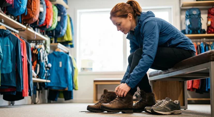
DaypackA pack designed for day hikes, typically 15–35 liters in volume. Daypacks are smaller and lighter than backpacking packs, without a frame or hip belt load transfer system for heavy loads.
Trekking polesAdjustable poles used for balance and to reduce knee stress, particularly on descents. Most modern trekking poles fold or collapse for pack storage. Planting poles correctly (tip behind your foot on ascent, ahead on descent) is a technique that takes a few hikes to develop.
GaitersProtective coverings for the lower leg and boot cuff, ranging from ankle-height (to keep debris out of shoes) to knee-height (for snow travel). Gaiters are essential for trail runners in muddy conditions and for any travel in snow.
CramponsMetal spike attachments for boots, providing traction on hard ice and compacted snow. Crampons are required equipment for glaciated terrain and many winter mountaineering routes.
MicrospikesA lighter alternative to crampons, consisting of chains with small spikes for moderate ice and packed snow. Microspikes fit most trail runners and hiking boots and are the right traction device for most shoulder-season and winter day hiking.
Trekking umbrellaA lightweight umbrella used as sun and rain protection on trail. More common among ultralight hikers and desert hikers than in general use, but effective in sustained rain as a complement to a rain jacket.
Hydration reservoir (hydration bladder)A flexible water container with a drinking tube that fits inside a pack's hydration sleeve. CamelBak and Platypus are the primary brands. Reservoirs allow hands-free drinking while moving, which encourages better hydration habits than reaching for a bottle.
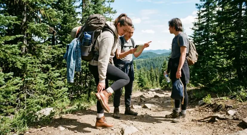
GPX fileA GPS exchange format file containing waypoints, routes, or tracks that can be imported into GPS devices and apps. Downloading GPX routes from trail databases and importing them into Gaia GPS is standard practice for navigating complex routes.
Leave No Trace and Camp Terms
Leave No Trace (LNT)A set of outdoor ethics principles for minimizing human impact on natural environments. The seven principles cover disposal of waste, camping location, fire use, wildlife interaction, trail behavior, and respecting other visitors.
Cat holeA hole dug 6–8 inches deep and at least 200 feet from trails, campsites, and water sources for burying human waste in the backcountry. Proper cat hole technique is a core LNT skill for anyone venturing beyond day-hiking distance from a toilet.
Pack it in, pack it outThe LNT principle that everything you bring to the backcountry comes back out with you. Includes all food packaging, waste, food scraps, and gear items.
Dispersed campingCamping outside of designated sites, typically permitted on National Forest and BLM land with proper setback distances from water, trails, and other visitors. Dispersed camping requires more LNT knowledge than campground camping.
Bear canisterA hard-sided, bear-resistant container for storing food in areas with active bear populations. Required in many National Parks including Yosemite and parts of the Sierra Nevada. Contents are inaccessible to bears who can't grip the smooth surface.
Bear hangA food storage method using a rope and tree branch to suspend food above bear reach. Harder to execute correctly than a canister but used where canisters aren't required.
Physical and Safety Terms
Bonking (hitting the wall)The state of sudden fatigue caused by glycogen depletion during prolonged exercise. Symptoms include heavy legs, difficulty concentrating, and dramatically reduced energy. Prevented by eating regularly on trail, roughly 200–300 calories per hour.
Post-holingBreaking through the surface of soft snow with each step, sinking to knee depth or deeper. Exhausting and slow, post-holing happens in spring when snow is soft in the afternoon but firm in the morning.
Altitude sickness (AMS)Acute Mountain Sickness, caused by reduced oxygen at high elevation. Symptoms include headache, nausea, fatigue, and sleep disruption. Begins to affect unacclimatized hikers above 8,000 feet. Descent is the definitive treatment.
HypothermiaDangerous drop in core body temperature from exposure to cold and wet conditions. Early signs include shivering, confusion, and poor coordination. Prevention: stay dry, carry layers, eat regularly to maintain caloric fuel for body heat production.
Heat exhaustionA heat-related illness from sustained exertion in high temperatures. Symptoms include heavy sweating, weakness, and cool, pale skin. Treatment: move to shade, rest, drink water and electrolytes.
Heat strokeA medical emergency where core body temperature rises above 104°F. Skin is hot and dry (no sweating), person is confused or unconscious. Call 911 immediately and cool the person by any means available.
Naismith's RuleA rule of thumb for estimating hiking time: 30 minutes per mile, plus 30 minutes for every 1,000 feet of elevation gain. A reasonable baseline for planning purposes, though individual pace varies significantly.
Golden hourThe first hour after sunrise and the last hour before sunset, when light is warm and directional, producing excellent photography conditions. Many experienced hikers plan hike timing around catching golden hour at a specific viewpoint.