The Flatside Wilderness: Designated Wild Country West of Little Rock
About an hour and a half west of Little Rock, deep inside the Ouachita National Forest, the Flatside Wilderness protects some of the most rugged and quiet terrain in central Arkansas. Originally designated in 1984 and expanded in 2019 with the Bethune addition, it now covers roughly 10,000 acres of steep oak-hickory and shortleaf pine ridges, clear streams, and rock outcrops. There are no roads, no facilities, and limited signage inside the boundary, which is exactly the point. This is where the Ouachita National Recreation Trail trades roadside trailheads for true backcountry, and where many section hikers find the trip's most memorable miles.
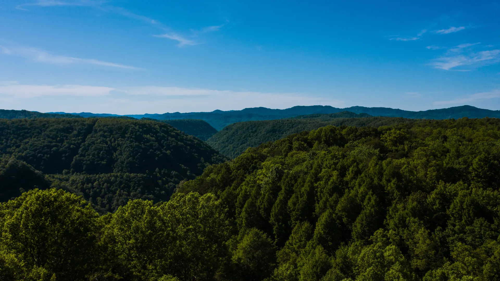
Flatside Pinnacle: The Best View for the Least Effort
Flatside Pinnacle is the headline destination. A short spur trail of only about a quarter mile climbs from the parking area on Forest Road 132 to a rocky bluff perched around 1,550 feet. The reward is an enormous view across the wilderness, with the distinctive twin-humped silhouette of Forked Mountain standing out to the southwest. It is one of the finest vistas in the Ouachitas and a frequent sunrise and sunset spot. Because the walk is so short, it is the ideal sampler if you cannot commit to a full day in the backcountry.
Hiking Deeper on the Ouachita Trail
The Ouachita Trail threads through the Flatside Wilderness, and using it as your spine lets you build longer outings. From the Flatside Pinnacle area you can drop onto the OT and walk west toward the Forked Mountain country, following blue-blazed tread over rolling ridges and through hollows. Out-and-back hikes of 4 to 10 miles are easy to scale to your fitness. Just remember that wilderness rules apply: trails are maintained more lightly, blowdowns are common, and you must rely on map and compass or a GPS track rather than heavy signage.
Plan around these realities:
- Carry navigation, cell service is spotty and junction signs are minimal inside the wilderness.
- Filter your water from creeks, which run well in spring but can go dry by late summer.
- Watch for ticks and chiggers from late spring through fall and treat clothing with permethrin.
- Pack out everything, there are no trash facilities and Leave No Trace is essential here.
Forked Mountain and the Surrounding Backcountry
Forked Mountain itself, with its dramatic notched profile, sits just outside the Flatside boundary and is most often admired from a distance rather than summited, as its upper crags are steep and unmarked. The broader Ouachita National Forest around the wilderness offers gravel forest roads, dispersed campsites, and access points that let you stitch together a multi-day trip. This stretch is a centerpiece of a longer section hike, and our Ouachita National Recreation Trail itinerary shows how to pair the Flatside Wilderness with the eastern peaks near Little Rock for a balanced four-day plan.
Trailheads, Camping, and Getting There
The most common access is the Flatside Pinnacle trailhead off Forest Road 132, reached via gravel roads from Highway 9 near Williams Junction. A high-clearance vehicle is helpful on the forest roads after heavy rain. Backcountry camping is allowed within the wilderness following Leave No Trace, and developed camping is available nearby at Lake Sylvia Recreation Area, which makes a comfortable basecamp with water and vault toilets. Spring and fall are prime, with wildflowers, flowing creeks, and cooler temperatures.
What Makes Flatside Different From a State Park Hike
Hikers used to manicured state park trails are sometimes surprised by the Flatside Wilderness. Federal wilderness designation means no chainsaws, no bikes, no motorized equipment of any kind, and only the lightest maintenance. Expect blowdowns across the tread, especially after winter storms, faint junctions, and stretches where the path narrows to a single boot-width through brush. That ruggedness is the appeal: the forest feels genuinely wild, wildlife is abundant, and you can walk for hours without seeing another person. Black bears live throughout the Ouachita National Forest, so store food properly and never leave a pack unattended at a viewpoint. You may also share the country with deer, wild turkey, and the occasional armadillo rooting through the leaf litter at dusk.
Building a Day Hike or Overnight Loop
For a satisfying day, many hikers combine the quick climb to Flatside Pinnacle with a few out-and-back miles on the Ouachita Trail, then finish at Lake Sylvia for a swim or a picnic. For an overnight, drop into the wilderness on the OT, find a durable, established campsite well back from water and trail, and make a quiet camp under the pines. Useful planning notes:
- Download offline maps and a GPS track before you arrive, since service drops out on the forest roads.
- Top off your water at Lake Sylvia or a reliable creek, and never count on ridge-top sources in late summer.
- Tell someone your plan, including which trailhead and when you expect to return, because help is far away.
- Time your visit for an April green-up or an October cool-down for the best conditions and color.
The Flatside Wilderness packs an outsized sense of remoteness into a region most travelers overlook, and it pairs perfectly with the nearby peaks for a complete Ouachita experience.


