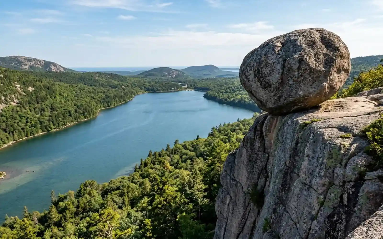
Bubble Rock is a boulder the size of a small car, sitting on the edge of a cliff on South Bubble in Acadia National Park, looking every single day like it is about to go over. It has been looking like that for roughly 12,000 years. It is the most photographed rock in Maine and the hike to it takes about an hour.
Here is the hike, the geology story that makes it interesting, and the nearby Bubble Pond that people confuse it with.
The hike to Bubble Rock
| Detail | |
|---|---|
| Distance | About 1.5 miles round trip |
| Time | 1 to 1.5 hours |
| Difficulty | Moderate. Short, steep, rocky |
| Gain | About 400 feet |
| Trailhead | Bubble Rock parking, Park Loop Road near Jordan Pond |
Park at the Bubble Rock lot on the Park Loop Road just north of Jordan Pond House. The trail climbs steadily through woods, then up rock steps and a short scramble to the open summit of South Bubble. It is not long but it is properly steep in places, and there is loose gravel on granite on the way down that catches people out. Take it slowly on the descent.
At the top, walk to the far edge and the boulder is there, perched with the whole of Jordan Pond laid out below it. The view straight down the pond with The Bubbles framing it is one of the classic Acadia views and it is worth the climb on its own, boulder or not.
Everyone takes the photograph pretending to push it off. You will too. Do not actually get between the rock and the drop for a better angle, which is a thing people do and it is a very long way down.
Why it is there
Bubble Rock is a glacial erratic, which means it did not come from this mountain. Geologists traced its composition to bedrock roughly 20 to 40 miles away to the northwest, near Lucerne. During the last ice age a sheet of ice more than a mile thick carried it here, and when the ice retreated around 12,000 years ago it set the boulder down on the cliff edge and left.
That is genuinely the whole story and it is better than any legend. The rock is a different granite to the mountain it sits on, which is how anyone worked it out in the first place, and if you look closely you can see it.
No, it will not fall. It is more stable than it looks, and people have been leaning on it for well over a century.
The Bubbles, and which is which
There are two of them, North Bubble and South Bubble, the pair of rounded hills at the north end of Jordan Pond that give the whole area its name.
- South Bubble is the one with Bubble Rock on it, and the shorter climb. This is the one you want.
- North Bubble is slightly higher with a better all-round view, and almost nobody on it. Add it as a loop if you have the legs, which makes the outing about 3 miles.
You can also link the whole thing to the Jordan Pond Loop below for a bigger day: 3.3 flat miles around the water, then up South Bubble, then popovers. That is a very good afternoon.
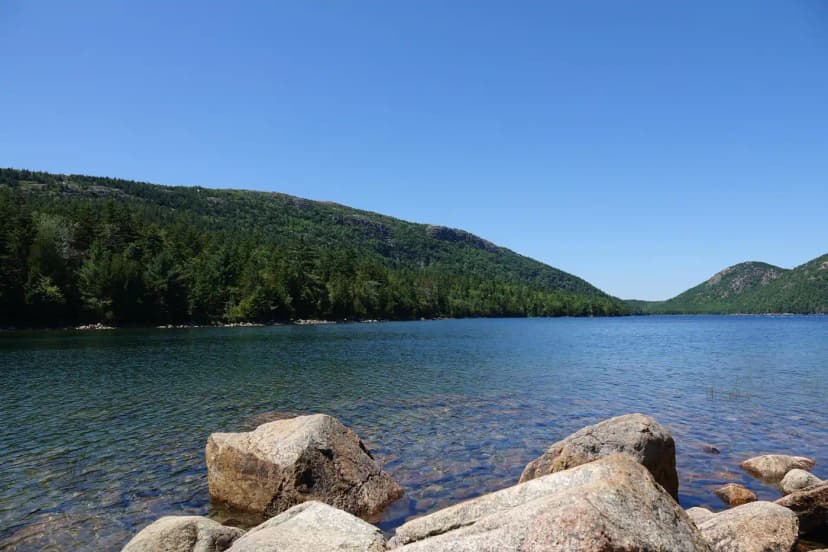
Bubble Pond is a different place
This confuses people constantly, so: Bubble Pond is not at The Bubbles. It is a separate long narrow pond about two miles northeast, sitting in a steep valley between Cadillac and Pemetic Mountain, and it is reached from its own parking area on the Park Loop Road.
It is worth going to. A carriage road runs along the shore, the water is glassy and reflects the mountainsides, and it is a lovely flat walk or an easy bike ride with a fraction of the Jordan Pond crowd. It also connects into the wider carriage road network if you want to make a longer loop of it.
One note: Bubble Pond and Jordan Pond are both public water supplies, so no swimming, no wading and no dogs in the water at either.
When to go
The Bubble Rock lot is small and fills by 9am in summer, and the Jordan Pond lots nearby fill even earlier. Come first thing or late afternoon. Late afternoon is better anyway, because the light down the pond is warmer and the summit is quieter.
In October the view down Jordan Pond with the foliage turning on both sides is about as good as Acadia gets. Bring layers, since the summit is exposed and the wind funnels up the valley.
Where it fits
Bubble Rock, the Jordan Pond loop and the carriage roads make up day three in our Acadia National Park 3 day itinerary, which orders them so you are not driving back and forth across the island. Every stop is mapped and the whole plan is free to read.
For the other trails on the island, see our Acadia hiking trails guide, and if you are doing Jordan Pond anyway, read the popover situation before you queue.
Bubble Rock, Acadia: The Balanced Boulder and the Hike Up FAQs
About 1.5 miles round trip with roughly 400 feet of gain, taking one to one and a half hours. It is short but steep in places, with rock steps and a brief scramble near the top. The descent has loose gravel over granite, which is where people slip, so take it slowly coming down.
It is far more stable than it looks. Bubble Rock is a glacial erratic left on the cliff edge when the last ice sheet retreated about 12,000 years ago, and it has sat there ever since. People have been leaning on it and photographing it for well over a century without moving it.
Not from the mountain it sits on. Its composition matches bedrock roughly 20 to 40 miles to the northwest, near Lucerne, so a glacier more than a mile thick carried it here during the last ice age and set it down when the ice melted. The rock is a visibly different granite to South Bubble underneath it, which is how geologists worked it out.
No, and this catches people out. Bubble Rock sits on South Bubble above Jordan Pond. Bubble Pond is a separate long narrow pond about two miles northeast, between Cadillac and Pemetic Mountain, with its own parking area and a carriage road running along the shore. Both are worth visiting but they are different places.
No. Both are public drinking water supplies, so swimming, wading and dogs in the water are all prohibited. Echo Lake on the west side is the designated swimming spot in the park if you want a freshwater swim.
South Bubble has Bubble Rock and the classic view straight down Jordan Pond, and it is the shorter climb, so it is the one to do if you only pick one. North Bubble is slightly higher with a better all round view and far fewer people. Doing both as a loop makes it about 3 miles.
Yes. The worked day-by-day plan is Acadia National Park 3-Day Itinerary: Best Hikes + Where to Stay (3 Days), with the permits, the stays and the drive times already sorted. Tell us your dates and we will put it together for you and confirm what is genuinely open on those days. Asking is free: no card, no deposit, and nothing is held until you say yes.