The Acadia hiking trails are unlike anywhere else in the country, and it took me an embarrassing number of visits to work out why. It is the granite. The whole park is pink granite scoured bare by glaciers, so instead of walking through trees for two hours to earn a view, you pop out of the woods after fifteen minutes and you are already on open rock with the Atlantic underneath you. Acadia packs 158 miles of trail onto an island you can drive across in forty minutes, and almost all of it pays out immediately.
Here is every trail worth your legs, sorted by what you actually want out of the day.
| Trail | Distance | Difficulty | Time | Go for |
|---|---|---|---|---|
| Cadillac North Ridge | 4.4 mi | Moderate | 3-4 hrs | Sunrise, and skipping the road reservation |
| Precipice Trail | 1.6 mi up | Strenuous | 3 hrs | Iron rungs on a near-vertical cliff |
| Beehive Trail | 1.5 mi loop | Strenuous | 1.5 hrs | The Precipice in half the time |
| Ocean Path | 4.4 mi | Easy | 2 hrs | Thunder Hole and the Otter Cliffs |
| Jordan Pond Loop | 3.3 mi loop | Easy | 1.5 hrs | Flat water views, then popovers |
| South Bubble & Bubble Rock | 1.5 mi | Moderate | 1 hr | The most photographed boulder in Maine |
| Great Head Trail | 1.7 mi loop | Moderate | 1 hr | Cliff tops with nobody on them |
| Acadia Mountain | 2.5 mi loop | Moderate | 2.5 hrs | Somes Sound, and actual solitude |
| Gorham Mountain | 1.8 mi | Easy to moderate | 1.5 hrs | Ocean views without the rungs |
| Dorr Mountain | 3.5 mi | Strenuous | 3 hrs | Granite staircases and no crowds |
| Bar Island | 1.6 mi | Easy | 1 hr | Walking across the ocean floor |
| Eagle Lake carriage loop | 6.1 mi | Easy | 2.5 hrs | Car-free gravel and stone bridges |
If you only get one hike, make it Cadillac at sunrise
Cadillac Mountain is 1,530 feet, which is not a mountain by western standards and nobody in Acadia cares. From October 7 to March 6 it is the first place in the contiguous United States to catch the sunrise, and standing on bare granite in the dark waiting for that is one of the genuinely great American outdoor experiences.
Here is the part most people miss. You can drive to the summit, but from May 20 to October 25, 2026 that requires a $6 per vehicle reservation on recreation.gov, and they are irritating to get. Thirty percent release 90 days out and the rest exactly two days ahead at 10:00 AM EST, which means setting an alarm on holiday.
Hike the North Ridge Trail instead and the reservation does not apply to you. It is 4.4 miles round trip, moderate, and open granite slabs for most of the climb, so you are watching the sky change the entire way up rather than at the end. Start about ninety minutes before sunrise, bring a headlamp, and wear more layers than feels reasonable. The summit in September is a different climate to the parking lot.
One honest warning: the summit has a gift shop and a road, so at sunrise you will be sharing it with people in pajamas who drove up. The hike is still worth it. You will have earned your coffee and they will not.
The iron rung trails, and whether you actually want them
Acadia has two famous trails with iron rungs and ladders bolted into the cliff, and they are the reason a lot of people come. They are also the ones that get people in trouble.
Precipice Trail
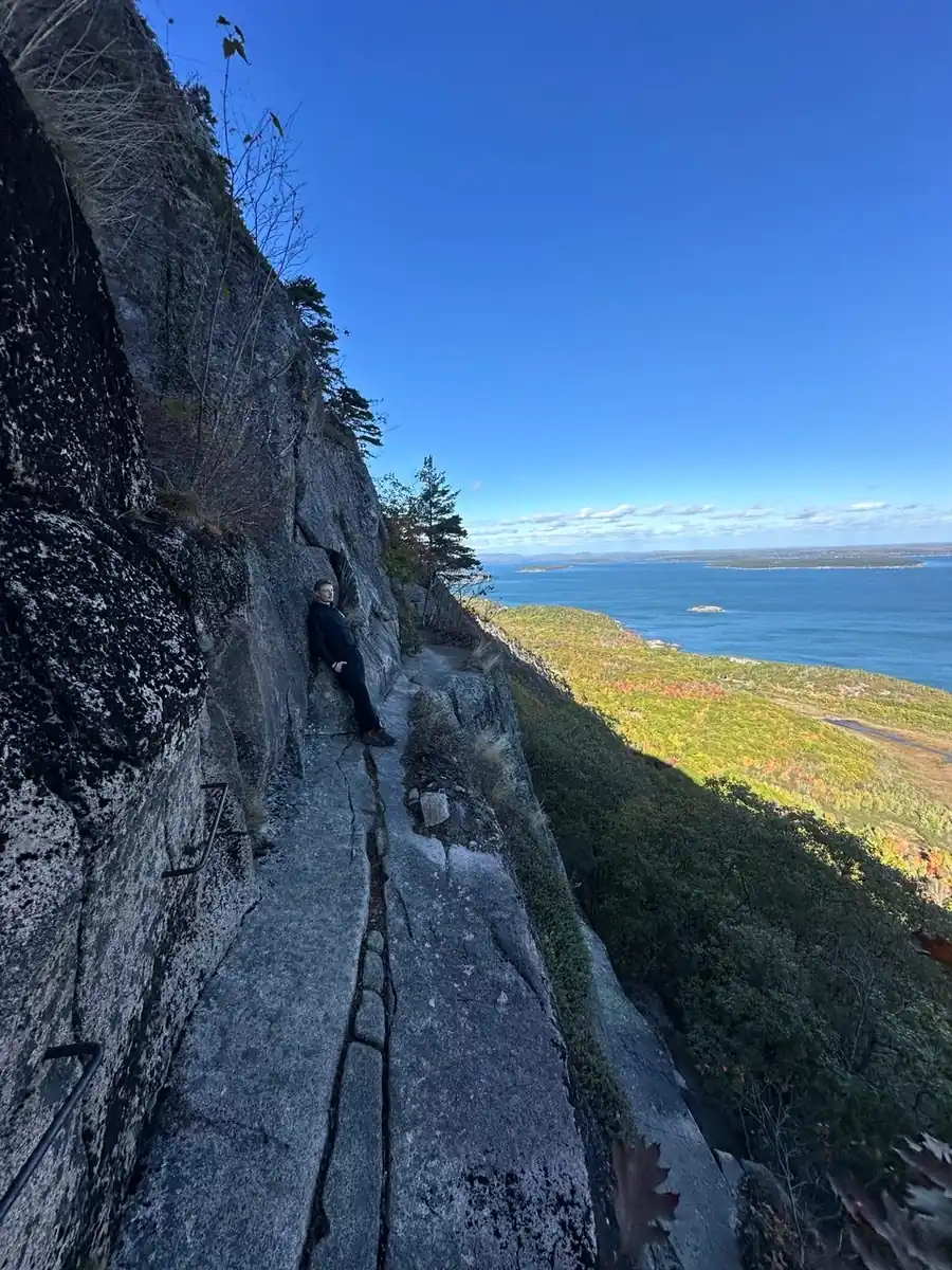
1.6 miles up the east face of Champlain Mountain on rungs, ladders and narrow ledges with a lot of air underneath. It is the hardest maintained trail in the park and it is closed most springs and summers, roughly April through mid-August, because peregrine falcons nest on that cliff. Check the closure before you plan a day around it, because plenty of people drive out and find a rope across the trailhead.
Go up the Precipice and come down something else. The Orange and Black Path or the North Ridge of Champlain both work. Downclimbing rungs is where the falls happen. We wrote a full Precipice Trail guide with the closure dates, the descent options and an honest read on whether you should be on it.
Beehive Trail
The Beehive is the Precipice with the commitment dialed down: same rungs, same exposure, 1.5 miles as a loop, and about ninety minutes. It goes straight up from across the road at Sand Beach, which makes it the busiest scramble in the park by a mile. Get on it before 8am or you will spend the climb queuing on a ladder behind someone having second thoughts.
Both trails are one-way up. There is no passing, and there is no turning around halfway without ruining somebody else’s morning. If heights bother you at all, take the Bowl Trail up the back instead. Same summit, no rungs, nobody will know.
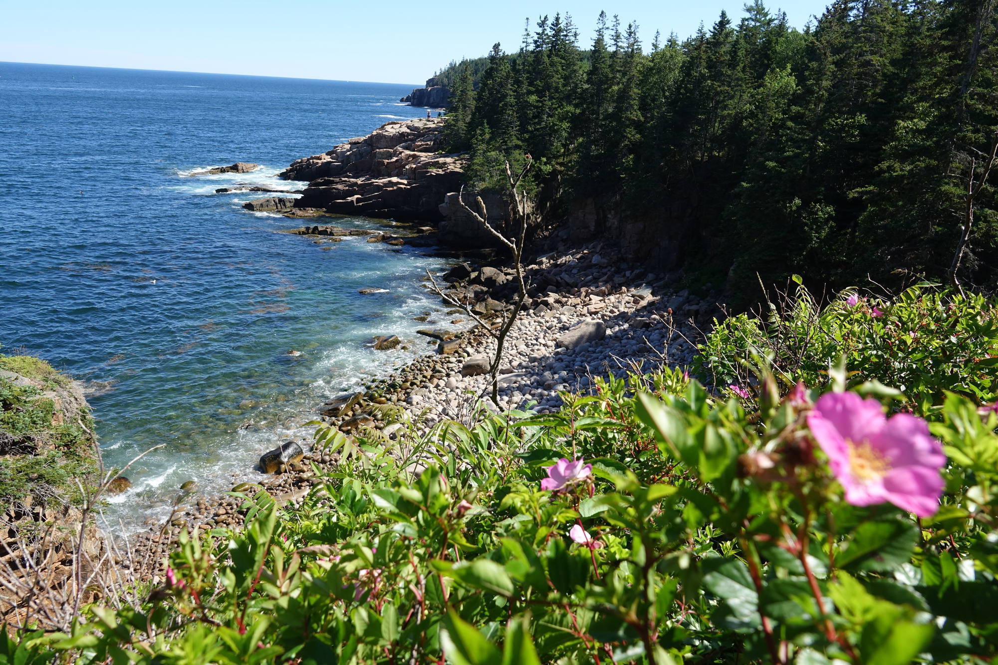
Easy coastal walks that are not remotely boring
Normally "easy trail" means "consolation prize." Not here.
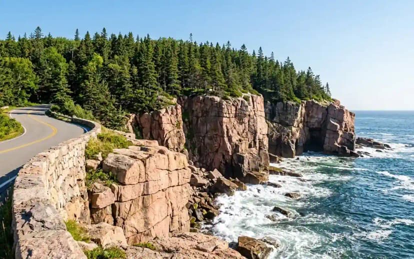
Ocean Path is 4.4 miles of flat gravel along the entire east-side coast, and it is the best walk in the park. It runs past Thunder Hole, a chasm in the rock that fires spray up to forty feet when the swell is right, and on to the Otter Cliffs, 110 feet of sheer pink granite dropping into the sea. Time Thunder Hole for a rising tide, about two hours before high, or it is just a wet hole in a rock and you will wonder what the fuss was.
It is also the trail to fall back on when everything else has gone wrong. Lots full, fog on the summits, someone in the group with a bad knee: Ocean Path always works.
Bar Island is the strangest easy hike in Maine. At low tide a gravel bar surfaces across the harbour from downtown Bar Harbor and you walk out to an island on what was ocean floor ninety minutes earlier. You get roughly a ninety minute window either side of low tide. Check the tide chart, actually check it, because the water comes back and the harbourmaster has opinions about rescuing people who did not.
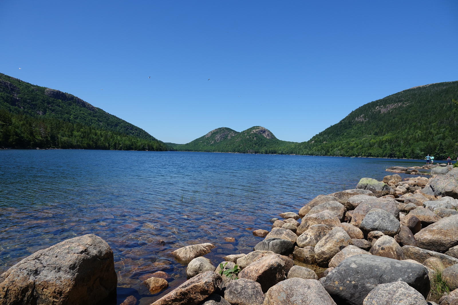
Jordan Pond, the Bubbles, and the popover situation
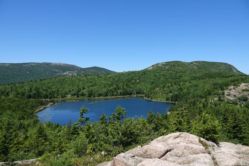
Jordan Pond Loop is 3.3 miles around water so clear it is unsettling, with The Bubbles, two rounded hills, framed at the far end. Half of the loop is on plank bridges over bog, which is oddly fun and completely flat. It is the most family-friendly real hike in the park.
Add South Bubble if anyone in the group has any energy left. It is a short steep 1.5 mile push to Bubble Rock, a glacial erratic the size of a car balanced on a cliff edge, dropped there by a retreating ice sheet and looking like it will go over any second. It will not. People have been posing under it for a hundred years.
Then popovers at the Jordan Pond House, which have been served on that lawn since the 1890s. They are enormous, hollow, and mostly a vehicle for butter and jam. The wait in August is real. Put your name down before the hike, not after.
The quiet side, where the locals go
Everything above is on the east side of the island, which is where the Park Loop Road runs and where roughly everyone goes. Cross to the west side and the crowd thins out dramatically.
Acadia Mountain is a 2.5 mile loop with the best view down Somes Sound in the park, which is the only fjard on the east coast of the United States. It is a steeper climb than the numbers suggest and the descent is a proper knee-worker, but you will share the summit with three people instead of sixty.
Gorham Mountain sits back on the east side but gets skipped because it is next to the Beehive. It is 1.8 miles, no rungs, and the ocean views run the whole ridge. If you want the Beehive payoff without the Beehive, this is the trade.
Dorr Mountain is the one nobody talks about. Granite staircases hand-built into the mountainside, a genuinely hard 3.5 miles, and it sits directly across from Cadillac so you get the good view of the good mountain. Empty most days.
45 miles of carriage roads, and no cars on any of them
John D. Rockefeller Jr. hated cars, so between 1913 and 1940 he built 45 miles of crushed-stone carriage road through the park with seventeen hand-cut granite bridges, and no motor vehicle has ever been allowed on them. They are wide, beautifully graded, and the single best thing in Acadia for anyone not looking to scramble.
The Eagle Lake loop is the classic: 6.1 miles of gravel around the lake, gentle enough to run or ride, with the good bridges on the northern half. Rent a bike in Bar Harbor and do the whole network in an afternoon. In winter, when they are groomed, this is where the island goes to ski.
The signposts are a system of numbered wooden junction markers rather than trail names, which confuses everyone the first time. Grab the carriage road map, or just accept that you are going to take a wrong turn and it will be a nice wrong turn.
When to go, and what the weather actually does
Late September into early October is the best time to hike in Acadia and it is not particularly close. Foliage peaks on the lower slopes, the summer crowd has gone home, and the air is cool and clear in a way it simply is not in August.
July and August give you the longest days and every service running, but the parking lots at Sand Beach, Jordan Pond and the Bubbles fill by 9am and rangers turn cars away rather than let a queue build. Have a second trailhead in mind for every plan.
Fog is the thing nobody warns you about. This is the Maine coast, and the summits are socked in several days a week in July. Do not cancel over a forecast, because it burns off by mid-morning more often than not, but do not bank your only sunrise on day one either. Keep the flexibility to move it.
Winter hiking on the lower trails is excellent with microspikes, and most of the island is closed, which is either the appeal or the problem depending on you.
Acadia granite will hurt you if you let it
The rock here is grippy and confidence-inspiring when dry and genuinely treacherous when wet, and the change happens fast. Fog counts as wet. Morning dew on a sloping slab counts as wet.
- Do not start a rung trail in the rain. Wet iron and wet granite together is how the rescue calls happen.
- Wear real shoes. Sticky rubber, not trail runners with worn-out tread and definitely not sandals. Half the park is friction climbing on slabs whether the sign says so or not.
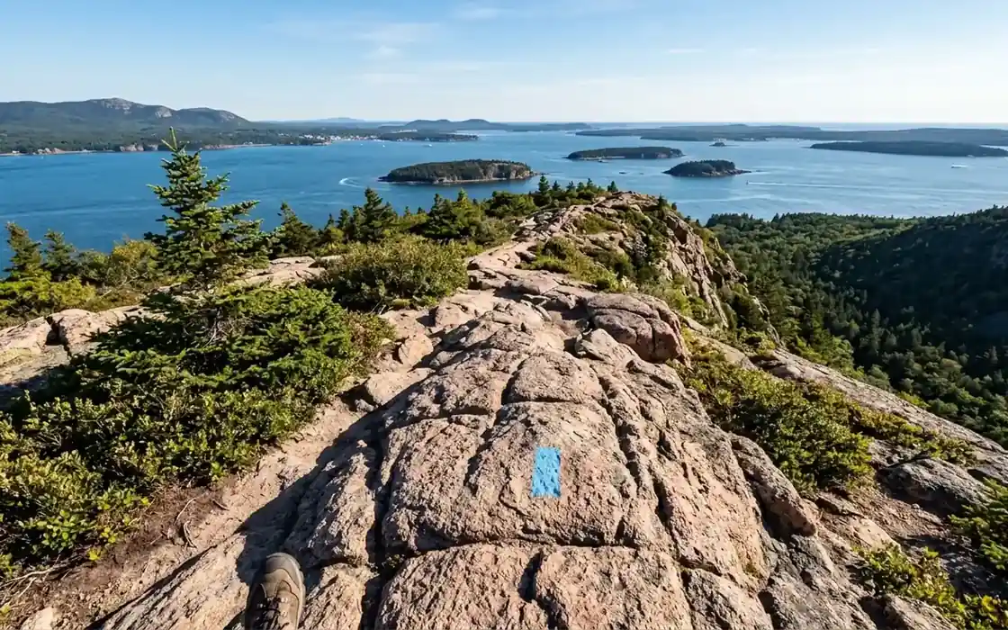
- Watch the blue blazes. On open granite the trail is marked with paint and cairns, and it is easy to wander off onto rock that looks identical. Stop when you have not seen a blaze in a while rather than pushing on.
- Do not build cairns. Acadia uses a specific Bates-style cairn and extra rock piles genuinely get people lost.
- Cell service is patchy on the carriage roads and the west side. Download the map before you leave the hotel.
Turning these into an actual trip
Three days is the sweet spot for a first visit, and it is enough to do everything on this list without rushing any of it. Our Acadia National Park 3 day itinerary lays it out day by day: Cadillac at sunrise and the Ocean Path on day one, the Precipice and Champlain on day two, then Jordan Pond, the carriage roads and Bass Harbor Head on day three. Every stop is pinned to a map and the whole thing is free to read.
Base yourself in Bar Harbor if you can get a room, since it is fifteen minutes from every trailhead on this page. Book early. On an island this small, summer and foliage season sell out four to six months ahead, and that is not a scare tactic, it is just the arithmetic of a small island.
Acadia Hiking Trails FAQs
For most people it is Cadillac Mountain via the North Ridge Trail: 4.4 miles round trip on open granite to the highest point on the US Atlantic seaboard, and hiking it means you skip the summit road reservation entirely. If you want excitement rather than views, the Precipice and Beehive trails with their iron rungs are the most thrilling trails in the park. For an easy walk that still delivers, take the Ocean Path.
Acadia has about 158 miles of hiking trails packed onto Mount Desert Island, plus another 45 miles of car-free carriage roads. Because the island is small, you are rarely more than fifteen minutes from a trailhead when based in Bar Harbor.
They cover the full range. The Ocean Path and Jordan Pond Loop are flat and suitable for almost anyone, while the Precipice and Beehive involve iron rungs bolted to near-vertical cliffs with serious exposure. What catches people out is that Acadia trails are short but steep, so a 1.5 mile hike here can be harder than a 5 mile hike elsewhere.
Often not. The Precipice closes roughly April through mid-August most years for nesting peregrine falcons, and the exact dates shift with the birds. Always check the current closure on the park website before planning a day around it, because the trailhead gets roped off with no warning.
No reservation is needed for any hiking trail. You only need one to drive up the Cadillac Summit Road, which costs $6 per vehicle and is required May 20 to October 25, 2026 on recreation.gov. Hikers and cyclists going to the summit under their own power do not need it. You do need a park entry pass, which is $35 per vehicle for 7 days.
Late September to early October. Foliage peaks on the lower slopes, the summer crowds have thinned, and the weather is cool and clear. July and August have the longest daylight but the parking lots fill by 9am. Winter hiking on the lower trails is excellent with microspikes, though most island services close.
Yes, in summer. The free Island Explorer shuttle runs from late June through Columbus Day and connects Bar Harbor with almost every major trailhead, so a car-free hiking trip is entirely realistic. Outside that window you will want a car.