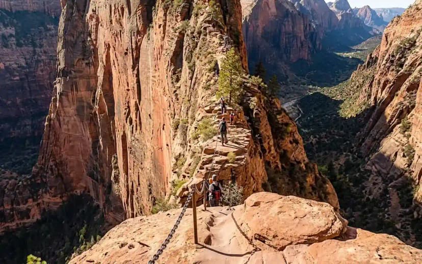
The best Zion hikes are Angels Landing (5.4 miles, ~1,500 ft gain, permit required), The Narrows (a river walk, up to ~9.4 miles), Observation Point (~7 miles via East Mesa, ~700 ft gain), Emerald Pools (1.2–3 miles, easy), Canyon Overlook (1 mile, big views), and the Watchman (3.3 miles).
I'm Yulia, and I've hiked Zion across every season. The trails here range from paved strolls to exposed, chained ridgelines, and the logistics (permits, shuttles, river flow) trip up more people than the climbs do. Below is my honest ranking with real numbers and the planning details that matter.
What are the best hikes in Zion National Park?

Here's the short list, ordered the way I'd tackle them with a few days in the park:
- Angels Landing5.4 mi round trip, ~1,500 ft gain, strenuous, permit required
- The Narrows (bottom-up)up to ~9.4 mi round trip, minimal climbing, moderate-strenuous (in-river)
- Observation Point~7 mi via East Mesa Trail (or ~8 mi via the closed-prone Weeping Rock route), moderate
- Canyon Overlook1 mi round trip, ~160 ft gain, easy-moderate
- Emerald Pools1.2–3 mi depending on loop, easy-moderate
- Watchman Trail3.3 mi round trip, ~370 ft gain, moderate
| Hike | Distance | Gain | Permit | Best for |
|---|---|---|---|---|
| Angels Landing | 5.4 mi | 1,500 ft | Yes, lottery | The chains, if you want them |
| The Narrows, bottom up | Up to 9.4 mi | Flat | No | Walking up a river |
| Observation Point, East Mesa | 7 mi | 700 ft | No | The view that beats Angels Landing |
| West Rim Trail | 14.5 mi one way | 3,600 ft down | Only to camp | The big day, or an overnight |
| Canyon Overlook | 1 mi | 160 ft | No | The most view per step in the park |
| Emerald Pools | 1.2 to 3 mi | 200 to 600 ft | No | Families, and hot afternoons |
| Watchman Trail | 3.3 mi | 370 ft | No | Sunset, and no shuttle needed |
| Riverside Walk | 2.2 mi | Flat, paved | No | The warm-up to the Narrows |
| Pa’rus Trail | 3.5 mi | Flat, paved | No | Bikes, and the only trail dogs may use |
| Taylor Creek, Kolob | 5 mi | 450 ft | No | Escaping the canyon crowds entirely |
Angels Landing: the iconic chained ridge
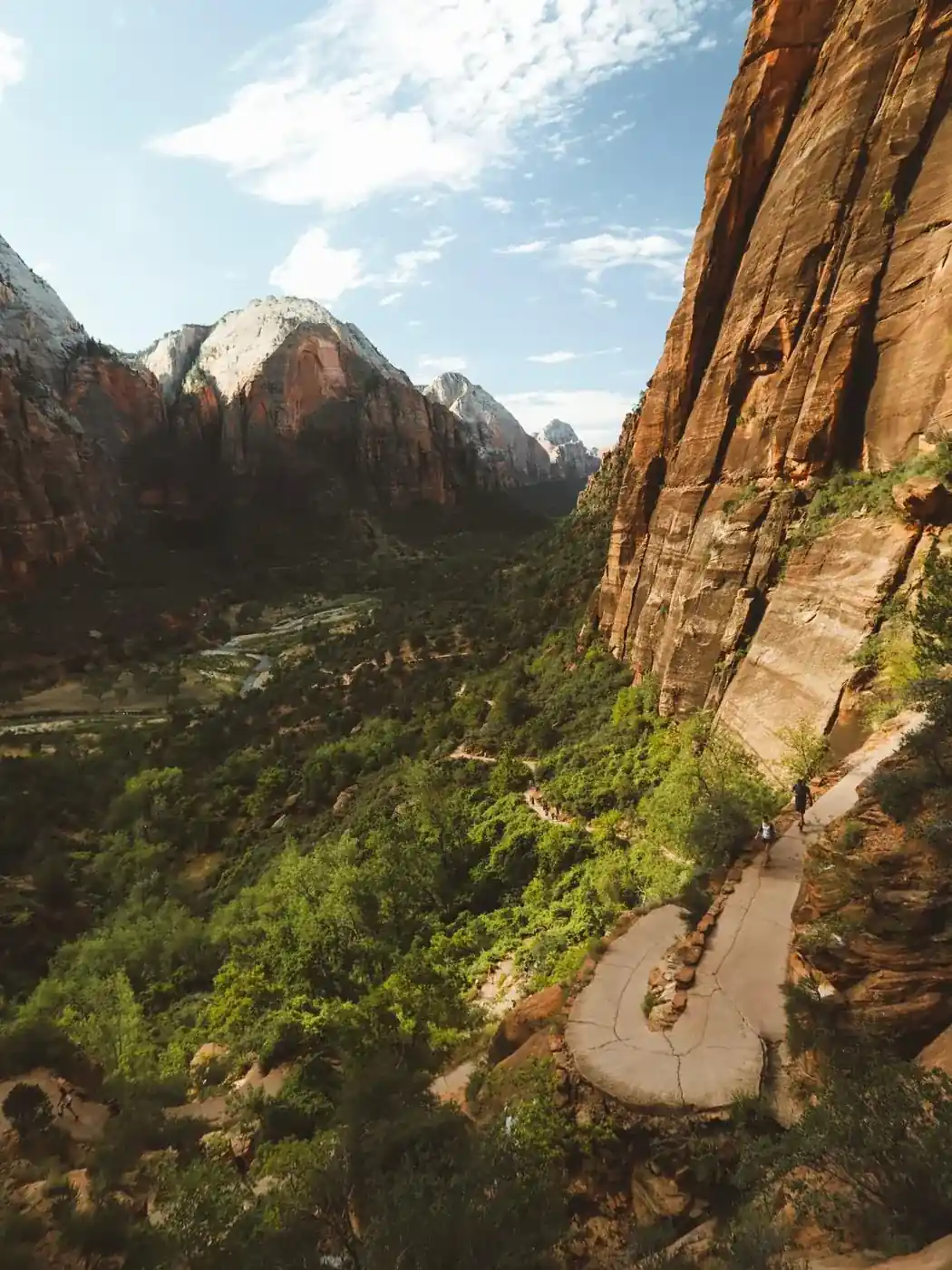
This is the hike people fly in for. From the Grotto shuttle stop (stop 6), it's 5.4 miles round trip with about 1,500 feet of gain. The climb up Walter's Wiggles (21 steep switchbacks) gets you to Scout Lookout, where the famous chained section begins. The final half-mile follows a knife-edge ridge with chains bolted into the rock and drop-offs of roughly 1,000 feet on both sides.
You need a permit for the chained section past Scout Lookout, awarded through a seasonal lottery and a day-before lottery on recreation.gov: a $6 non-refundable application fee plus $3 per person if you're selected (2026 pricing). Scout Lookout itself needs no permit, and the view from there is excellent if heights aren't your thing. Go on the first shuttle (around 6 a.m. in summer) to beat the crowds and heat. Skip it in ice or high wind.
The Narrows: hiking up the Virgin River
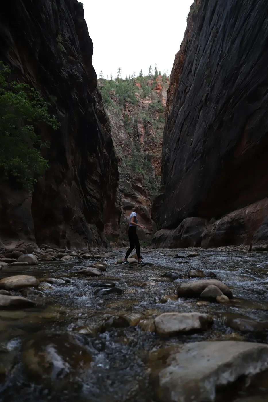
The Narrows is a hike in the river, through a slot canyon where the walls climb close to 1,000 feet. The standard "bottom-up" route starts at the Temple of Sinawava (shuttle stop 9), follows the paved Riverside Walk for one mile, then drops into the water. You can turn around anytime; reaching Wall Street and back is roughly 9.4 miles, but most people do 4–6 miles.
No permit is needed for bottom-up day hiking. You'll want neoprene socks, sturdy footwear and a walking stick, Springdale outfitters rent dry bibs and canyoneering shoes (roughly $25–60/day). The big constraint is water flow: the park closes the bottom-up Narrows when the Virgin River runs above about 150 cfs, and flash-flood risk spikes in the July–September monsoon. Check the forecast and the park's flow gauge that morning.
Observation Point: the view that beats Angels Landing
Observation Point sits a few hundred feet higher than Angels Landing and looks straight down on it. The classic route from Weeping Rock is around 8 miles with about 2,100 feet of gain, but it has been closed for rockfall. The reliable alternative is the East Mesa Trail: about 7 miles round trip with only ~700 feet of gain, far easier, same overlook. East Mesa starts outside the canyon off Zion Ponderosa Ranch Road, so you'll need a high-clearance/4WD vehicle or a private shuttle for the final dirt stretch. No permit required.
Canyon Overlook: the best view for the least effort
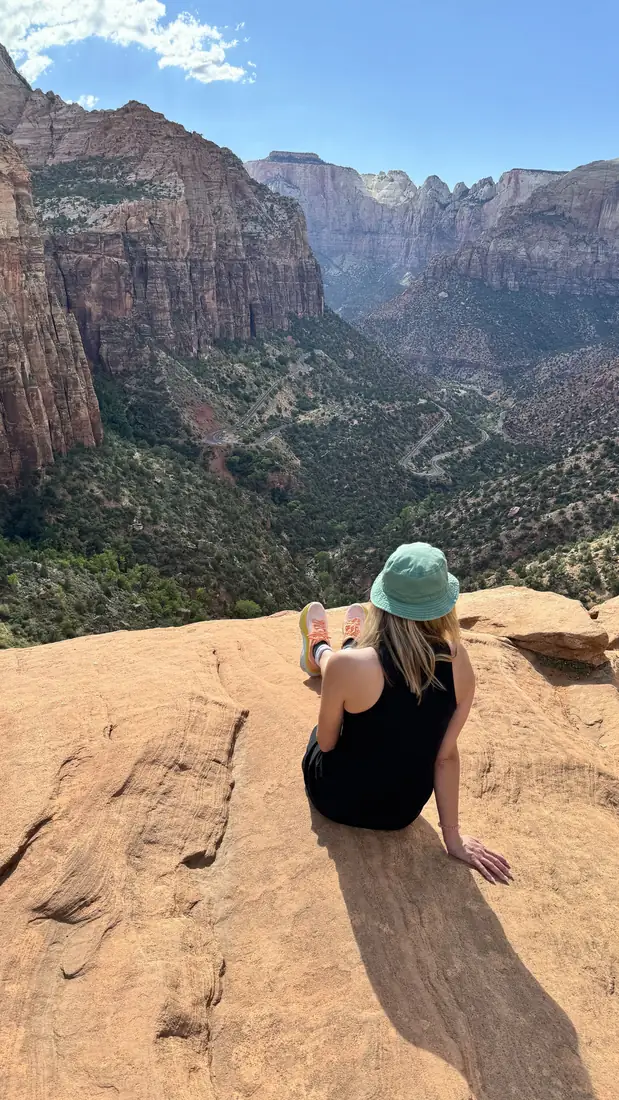
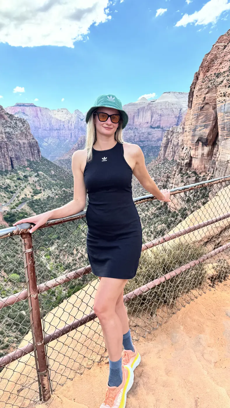
If you only have an hour, do this one. The Canyon Overlook Trail is just 1 mile round trip with about 160 feet of gain, ending at a railed viewpoint over lower Zion Canyon and the switchbacks of the Mt. Carmel Highway. The trailhead is on the east side, just past the long Zion–Mt. Carmel Tunnel, and parking there is tiny (about a dozen spots), so come early or late. It's on the east-side highway, reachable by private car, not the canyon shuttle.
Emerald Pools and the Watchman: the easy wins
The Emerald Pools trails start across from Zion Lodge (shuttle stop 5). The Lower Pool is a paved 1.2-mile round trip past a seeping waterfall; continue to the Middle and Upper Pools for roughly 3 miles total and ~620 feet of gain. The waterfalls run strongest in spring and after rain, by late summer they can be a trickle, so manage expectations.
The Watchman Trail leaves right from the Visitor Center (no shuttle needed), running 3.3 miles round trip with about 370 feet of gain to a bench overlooking Springdale and the Watchman peak. It's my pick for sunset and for the afternoon you arrive, since you can walk to it.
West Rim Trail: the big one nobody puts on these lists
The West Rim runs 14.5 miles from Lava Point down into the canyon, and it is the finest long day in Zion. Most people walk it downhill one way with a shuttle to the top, which turns 3,600 feet of climbing into 3,600 feet of descending. It passes the Angels Landing junction near the end, so you can add the chains if you still have the legs and hold a permit.
You do not need a permit to walk it in a day. You only need one to camp along it.
Riverside Walk and Pa’rus: the two paved ones worth doing
The Riverside Walk is 2.2 flat paved miles from the last shuttle stop to where the canyon narrows and the trail ends. Most people treat it as the approach to the Narrows, which it is, but it is a genuinely good walk on its own and the only truly easy way to see the deep canyon.
Pa’rus is 3.5 paved miles along the Virgin River from the visitor centre. It is the only trail in Zion where dogs are allowed, and the only one you may ride a bike on, which makes it the answer to two questions people ask constantly.
Taylor Creek: the half of Zion nobody visits
Kolob Canyons has its own entrance off I-15, about 40 minutes north of the main canyon, and almost nobody goes. Taylor Creek is 5 miles round trip up a streambed past two homesteader cabins to the Double Arch Alcove, a huge stained overhang at the end.
No shuttle, no permit, no queue. If you have a spare half day and the canyon is heaving, drive north.
The quiet half: hikes at Zion the shuttle never reaches
Everything above starts in Zion Canyon, which is the part of the park with the shuttle, the queue and the parking problem. Three roads reach the rest of it, and on any of them you will see a tenth of the people.
Kolob Terrace Road. It leaves Highway 9 at the town of Virgin and climbs north for about 20 miles, past Wildcat Canyon and up to Lava Point at 7,890 feet. No shuttle, no entrance booth, no crowd, and the highest trailheads in the park. It is also the road that closes first with snow, so check status from November through April.
The Left Fork of North Creek. This is The Subway, the sculpted green tube everybody has seen a photo of. The bottom-up route leaves the Left Fork Trailhead on Kolob Terrace Road and runs about nine miles round trip with heavy boulder-hopping and no maintained trail. It needs a permit from the day-before or advance lottery, and the top-down version needs rope work and a separate skill set.
East Mesa Trailhead. The back door to Observation Point. Instead of climbing 2,100 feet from the canyon floor, you drive up North Fork Road outside Springdale and walk in almost flat, roughly six and a half miles round trip through ponderosa to the same view. The road is dirt and rutted, so a low car in the wet is a bad idea, but this is the easiest big view in Zion by a wide margin.
East Rim Trail. Starts near the East Entrance, on the far side of the Zion-Mount Carmel tunnel, and climbs onto slickrock benches with almost nobody on them. Hike it as an out and back to Jolley Gulch and you get half a day of quiet without arranging a shuttle at either end.
Getting there and the shuttle system
Zion's main entrance is in Springdale, Utah, off State Route 9, about a 2.5-hour drive (roughly 160 miles) from Las Vegas via I-15, and around 4.5 hours from Salt Lake City. The entrance fee is $35 per private vehicle, valid 7 days. (Note: as of 2026 there's an added $100 nonresident fee for international visitors 16+.)
During shuttle season, roughly early March through late November, Zion Canyon Scenic Drive is closed to private cars. You ride the free park shuttle from the Visitor Center to reach the Grotto, Zion Lodge and the Narrows trailheads. The shuttle is free but lines build mid-morning in summer; first buses run around 6–7 a.m. In the off-season (roughly January to early March and late November to late December, aside from a holiday-week shuttle window) you can usually drive the canyon yourself. Canyon Overlook and the eastern trails are always reachable by private car via the Mt. Carmel Highway and tunnel.
When is the best time to hike Zion?
Spring (April–May) and fall (September–October) are ideal: comfortable temps and good water. Summer is hot, canyon-floor highs top 100°F, so start before 7 a.m. and carry 3+ liters. Avoid The Narrows and any slot canyon during monsoon storms. Winter is quiet and beautiful, but Angels Landing and shaded trails ice over and turn genuinely dangerous; bring microspikes.
Practical tips from the trail
- Apply for an Angels Landing permit weeks ahead, and use the day-before lottery as a backup.
- Reserve Narrows gear rentals in Springdale the night before in peak season.
- Cell service in the canyon is unreliable, download maps offline.
- Fill water at the Visitor Center and Zion Lodge; on-trail sources are few.
- Visitor Center and Springdale parking fill by 9 a.m., arrive early or use the free Springdale town shuttle.
Zion Hiking Trails: The 10 Best Hikes in Zion National Park FAQs
Yes. A permit is required for the final chained section past Scout Lookout. Permits come through a seasonal lottery and a day-before lottery on recreation.gov: a $6 non-refundable application fee plus $3 per person if you're selected. Scout Lookout itself needs no permit.
Angels Landing is the most exposed and intimidating because of its narrow chained ridge with roughly 1,000-foot drop-offs. For sheer effort, the full top-down Narrows (about 16 miles, permit required) and the West Rim Trail are the most physically demanding.
Most people spend 4–6 hours covering 4–6 miles up The Narrows and back from the Temple of Sinawava. Reaching Wall Street and returning is about 9.4 miles and can take 7–8 hours. You can turn around at any point.
Some trails, yes. During shuttle season (roughly March through November) the Zion Canyon Scenic Drive is closed to cars, so Angels Landing, The Narrows and Emerald Pools require the free shuttle. The Watchman, Canyon Overlook and eastern trails are reachable by private car year-round.
Canyon Overlook is the best payoff for minimal work: a 1-mile round trip with about 160 feet of gain ending at a sweeping viewpoint over lower Zion Canyon. The trailhead is just east of the Mt. Carmel Tunnel and accessible by car.
Spring (April–May) and fall (September–October) offer the best mix of mild temperatures and water flow. Summer is very hot and brings monsoon flash-flood risk; winter is quiet but icy on exposed trails like Angels Landing.