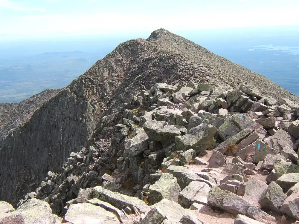
Where the trail actually ends
The Appalachian Trail ends on Baxter Peak, the summit of Katahdin, in Baxter State Park. Not at the park gate, not at Abol Bridge, and not in the town of Millinocket. The sign people photograph is on the summit itself, and getting to it is a full mountain day whichever way you have arrived.
Myron Avery established the northern terminus on Baxter Peak in 1933, two years after Percival Baxter gave more than 6,000 acres, the peak included, to the State of Maine. That order matters: the mountain was a gift with conditions attached before it was a trail terminus, which is why the park still runs the last stretch on its own rules rather than the trail's.
How high it is, and why the number moves
Katahdin is the highest mountain in Maine. The figure you will see most often is 5,269 feet, but the US Geological Survey lists 5,268, and the summit sign itself was updated from 5,267 to 5,268. All three numbers are in circulation and none of them is a misprint. The name comes from Penobscot and means, plainly, the greatest mountain.
Baxter State Park runs the last ten miles
Baxter State Park carries the ten northernmost miles of the Appalachian Trail. Inside the park you are on Baxter's terms, not the trail's. The practical consequences are worth knowing before you get there rather than at the gate:
- Every long-distance AT and IAT hiker needs a permit. It applies in either direction, and it applies whether or not your hike includes Katahdin.
- The Birches is not a general campsite. It is a small long-distance hiker site at Katahdin Stream, about a quarter of a mile from Katahdin Stream Campground.
- The Birches has an entry requirement that is specific. Northbound hikers who have walked 100 continuous miles on the AT from Monson may camp there if there is space. That is the 100-Mile Wilderness, exactly, and it is the reason the section and the summit are usually planned as one trip rather than two.
If you are coming up through the 100-Mile Wilderness
The wilderness ends at Abol Bridge, and Katahdin is still ahead of you. That last stretch is where a plan that worked for a week of shelters stops working, because Baxter takes reservations and the Appalachian Trail lean-tos behind you did not. Our seven-day 100-Mile Wilderness itinerary runs Monson to Abol Bridge and treats the summit as the separate booking it actually is.
The other end, for the record
The southern terminus is Springer Mountain in Georgia. Northbound hikers finish on Katahdin, which is why the summit sign has become the photograph that closes a thru-hike, and why the park sees a concentration of finishing hikers in a narrow late-summer and autumn window.
What to check before you go
Baxter publishes its own rules, its own season, and its own reservation windows, and they move. Fees, parking reservations and the date the road opens are all things to read on the park's site rather than take from a guide written months earlier. What does not move is the shape of it: the trail ends on a summit, inside a park that was a gift, and the park decides how you get there.
Where the Appalachian Trail Ends: Katahdin and the Northern Terminus FAQs
On Baxter Peak, the summit of Katahdin, in Baxter State Park, Maine. Myron Avery established it there in 1933, two years after Percival Baxter donated the land, including the peak, to the state.
About 5,269 feet, and it is the highest mountain in Maine. The US Geological Survey lists 5,268 feet and the summit sign was updated from 5,267 to 5,268, so you will see all three figures quoted. The name is Penobscot for the greatest mountain.
Yes. Baxter State Park requires a long-distance hiker permit for every AT and IAT hiker, in either direction, and it applies whether or not the hike includes Katahdin itself.
Northbound hikers who have walked 100 continuous miles on the Appalachian Trail from Monson, if there is space. It is a long-distance hiker site at Katahdin Stream, about a quarter of a mile from Katahdin Stream Campground, not a general campground.
No. It ends at Abol Bridge, and Katahdin is a separate climb inside Baxter State Park beyond it. The two are usually planned together because The Birches entry rule is written around exactly that 100 continuous miles, but the booking arrangements are completely different: the wilderness shelters are free and first-come, and Baxter takes reservations.
The ten northernmost miles. Inside the park the trail runs under Baxter's rules rather than the trail's, which is why the permit and campsite arrangements change as soon as you cross in.






























