Indian Peaks Wilderness:
Weekend Backpacking Guide
The best intro backpacking trip near Denver: Indian Peaks Wilderness in 2 days, Continental Divide views, alpine lakes, and a beginner-friendly route.
Free interactive planner · drag & reorder your days, add stops, map it in minutes
Build your own Indian Peaks trip, drag, reorder & map it.
Drag stops between days, swap the explore-day objective, and add your own lakes and passes with the place search. The live map and distances recalculate as you go, so you can tune the route to your dates, your pace, and your permit zone.
Opens a side panel · reorder days, add custom stops, see your route live
The best intro backpacking trip near Denver.
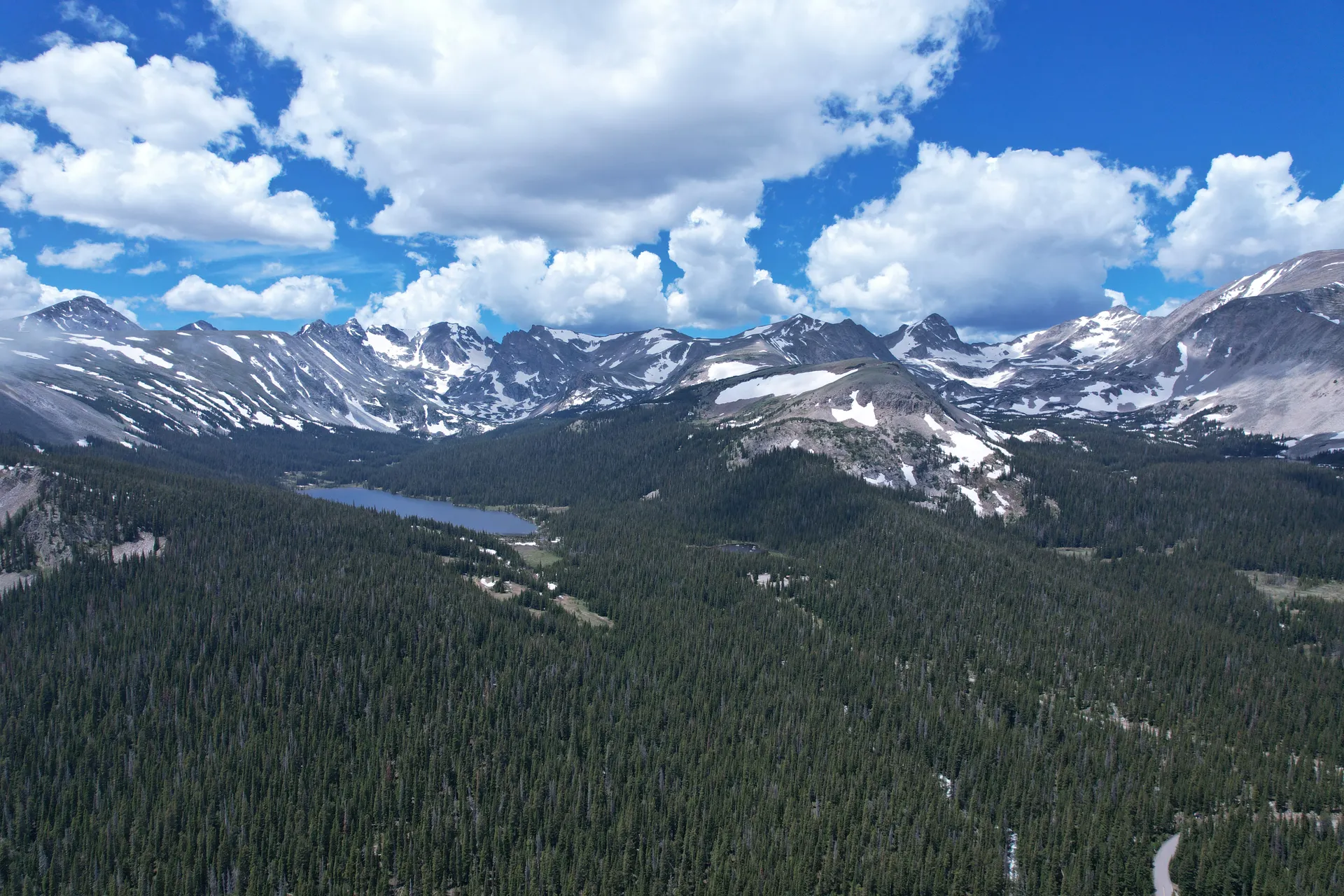
Indian Peaks Wilderness sits on the Continental Divide an hour west of Boulder, 77,000 acres of Front Range alpine country with well-marked trails, genuine wilderness character, and one of the best permit systems in Colorado for planning ahead. It is the closest serious backpacking to Denver and Boulder, and it earns its reputation as the best introduction to Colorado overnight hiking.
Unlike Maroon Bells or the Weminuche, Indian Peaks permits are manageable if you book early. The trails are honest, real elevation, real alpine terrain, but distances are short enough that a first-time backpacker can carry their gear in on Day 1 and still have energy to explore. The Continental Divide views from Arapaho Pass are as good as anything in the state.
Overnight permits are mandatory June 1 through September 15 and open on recreation.gov on a rolling 30-day window. Quotas are strict, 24 overnight visitors per zone per night in the most popular areas, so book the moment the window opens. Day hiking is free and permit-free year-round.


Fourth of July Trailhead to Caribou Lake · 8 mi, 2,200 ft gain
Start at the Fourth of July Trailhead at 10,121 feet, already well above Boulder's elevation. The trail climbs steadily through spruce-fir forest before breaking out above treeline around 11,000 feet. The landscape opens dramatically: tundra, talus, and the long ridge of the Continental Divide ahead.
Push to Arapaho Pass at 11,906 feet, the high point of the main route and one of the great Continental Divide viewpoints in the Front Range. On a clear morning you can see west into the Williams Fork Mountains and east across the plains toward Denver. From the pass, descend the west side into the upper Arapaho Creek drainage.
Camp at Caribou Lake (permit required, designated sites only). The lake sits in a glacial cirque at about 11,500 feet with views back up toward the Divide. Set up early, afternoon thunderstorms are routine in July and August. Water from the lake needs filtering; a Sawyer Squeeze or SteriPen works well at altitude.
- ~8.2 mi · moderate · 2,000 ft · Continental Divide views
- Arapaho Pass (11,906 ft)High point of the main route · one of the great Divide viewpoints
- Permit required · designated sites only · glacial cirque at ~11,500 ft
- Filter water at the lakeSawyer Squeeze or SteriPen works well at altitude
- The trail breaks out above treeline around 11,000 feet, where there is no shelter, so be at or past Arapaho Pass before afternoon storms build.
- Caribou Lake camping requires a permit and is restricted to designated sites only. Reserve your zone on recreation.gov before you go.
- Water from Caribou Lake needs filtering. A Sawyer Squeeze or SteriPen both work well at altitude.
Explore: Lake Dorothy & Arapaho Glacier · 3–5 mi from camp
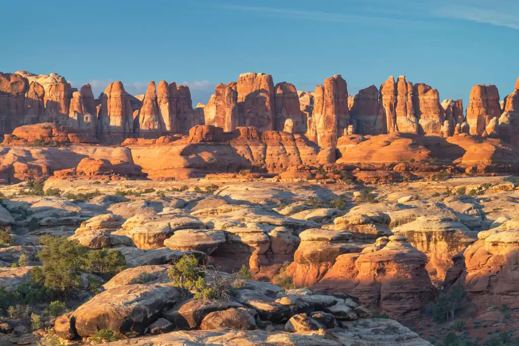
Arapaho PeakLone Eagle altWith your gear at Caribou Lake, Day 2 is exploration. The most rewarding option: hike up to Lake Dorothy (about 1.5 miles each way from Arapaho Pass, passing through tundra and boulder fields). Lake Dorothy sits in a high cirque directly below the Arapaho Glacier, Colorado's southernmost glacier remnant. It is one of the most remote-feeling spots in the Front Range despite being reachable in an afternoon.
For a longer day: from Lake Dorothy, scramble up the talus to Arapaho Peak (13,502 ft) for a full 360-degree view of the Indian Peaks. This is a Class 2 route, no technical gear required, but bring trekking poles and solid footing. The climb from Lake Dorothy adds roughly 700 feet over a mile.
Back at camp by early afternoon, read, filter water, watch for pikas and marmots on the surrounding talus slopes. Lightning is possible every afternoon; stay below the ridgeline if clouds build.
- ~1.5 mi each way from Arapaho Pass · high cirque below the Arapaho Glacier
- Class 2 · ~700 ft over a mile from Lake Dorothy · 360-degree view
- Colorado's southernmost glacier remnant · visible from Lake Dorothy
- Back at camp by early afternoon · watch for pikas and marmots
- Lake Dorothy is about 1.5 miles each way from Arapaho Pass through tundra and boulder fields. It is the most rewarding option for a day with your gear left at camp.
- The scramble to Arapaho Peak (13,502 ft) is Class 2 and needs no technical gear, but bring trekking poles and solid footing for the talus.
- Lightning is possible every afternoon. Be back near camp by early afternoon and stay below the ridgeline if clouds build.
Hike out via North Fork Middle Boulder Creek · 9 mi, mostly downhill
For a true loop, descend from Caribou Lake via the North Fork Middle Boulder Creek trail instead of retracing your steps. This route drops through the upper watershed, passing through willows and wildflower meadows before re-entering spruce-fir forest. The North Fork is less traveled than the Arapaho Pass corridor and often has better wildlife sightings, moose in the willows are common in early morning.
The trail eventually connects back to the Fourth of July Trailhead via the lower trail network, closing the loop at roughly 9 miles. This makes the full trip approximately 17 miles over two nights, manageable for most fit hikers and an ideal introduction to Colorado alpine backpacking.
- Mostly downhill · willows, wildflower meadows, then spruce-fir forest
- Watch for moose in the willowsLess-traveled corridor · common in early morning
- Close the loop at the Fourth of July Trailhead~9 mi out · ~17 mi for the full two-night trip
- Descending via North Fork Middle Boulder Creek instead of retracing your steps turns the route into a true loop closing at the Fourth of July Trailhead.
- The North Fork corridor is less traveled and has better wildlife sightings. Moose in the willows are common in early morning.
- Save your knees and water for the descent. Trekking poles help on the way down to the trailhead.
Loop closeThe DivideNow build your Indian Peaks trip.
You've seen the route. Open the free drag-and-drop planner and tune it for your dates, your pace, and whether you base in Nederland or Boulder before you head up to the Fourth of July Trailhead.
What to plan for at altitude.
Overnight permit required June 1–Sept 15
Overnight permits are mandatory June 1 through September 15, cost $5 per person per night, and are reserved on recreation.gov on a rolling 30-day window. Quotas are strict, 24 overnight visitors per zone per night in the busiest areas, so book the moment the window opens. Day hiking is free and permit-free year-round.
Acclimatize before you start
The trailhead starts at over 10,000 feet and you will sleep near 11,500 feet, so acclimatization matters. Spend at least one night in Boulder (5,400 ft) or Nederland (8,234 ft) before starting.
Bring a real 3-season tent
A 3-season tent is the minimum. Wind at Arapaho Pass can be sustained at 30+ mph, so stakes and a footprint are worth the weight.
Layer for near-freezing camp temps
Pack a base layer, fleece mid, and hardshell. Temperatures at camp can drop to near freezing in July, and you should not skip the rain layer.
Filter all water above treeline
Caribou Lake and the North Fork creek are reliable sources. Carry a Sawyer Squeeze or a chemical backup, and do not drink unfiltered water above treeline.
Bear awareness and trekking poles
Black bears are present in Indian Peaks. A bear canister is not required but is strongly recommended; hang food or use a canister per Leave No Trace. Trekking poles are essential for the talus above Caribou Lake and the knee-saving descent on Day 3.
Everything you'll actually want to know.
Ready to go? Get your
Indian Peaks backpacking route.
Trailheads and mileages, the Arapaho Pass loop, the permit system and quotas, base-town acclimatization, and the gear notes you need to backpack Indian Peaks safely.
Instant book · Free cancellation · Secure payment via Stripe
Know these trails yourself? Become a local guide and host free community hikes.

Planning this trip?
Save it, share it with your crew, or find travelers heading the same way.
What other travelers are saying
Be the first to leave a tip or question for the next traveler.
How was your experience?
Tell us what worked and what did not. It goes straight to Yulia and Margarita.