Two Days in the Guadalupe Mountains:
Texas's Highest Peak
Two days of Guadalupe Mountains hiking: the strenuous Guadalupe Peak hike to the highest point in Texas, McKittrick Canyon's fall color, Devils Hall, and the Smith Spring desert oasis.
Free interactive planner · drag & reorder your days, add stops, map it in minutes
Build your own Guadalupe Mountains trip, drag, reorder & map it.
Drag stops between days, swap hikes, and add your own canyons and overlooks with the place search. The live map and drive times recalculate as you go, and we'll warn you before you stack two strenuous climbs into one windy desert day.
Opens a side panel · reorder days, add custom stops, see your route live
The highest point in Texas, canyons, fall color & desert, all in one quiet park.
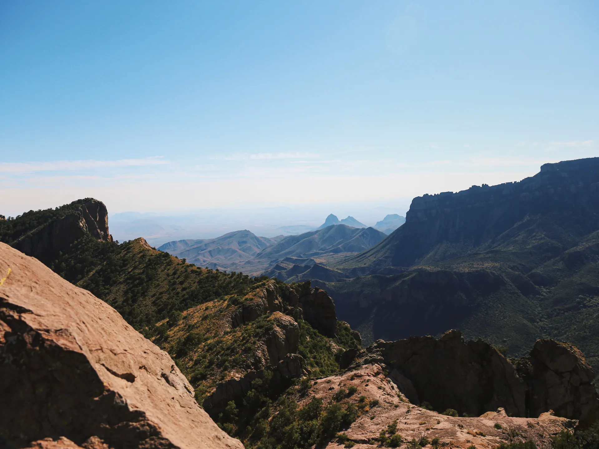
Guadalupe Mountains National Park is one of the least-visited and most remote parks in the lower 48, a wedge of the Chihuahuan Desert where an ancient Permian fossil reef rises into the highest mountains in Texas. El Capitan's sheer prow and 8,751-foot Guadalupe Peak dominate the skyline, and the trails climb from desert floor to forested high country in a single day.
This 2-day route is built around Guadalupe Mountains hiking: the strenuous Guadalupe Peak hike to the highest point in Texas, the fall color of McKittrick Canyon, the rock scramble of Devils Hall, and the Smith Spring desert oasis. It is a park with no food, no gas, and almost no crowds, which is exactly the point.
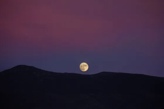
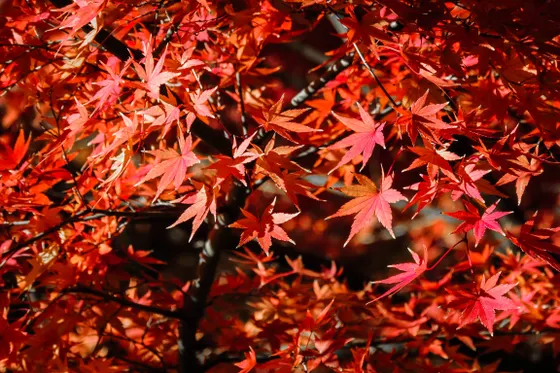
Late October through mid-November is the prime window, when McKittrick Canyon's bigtooth maples turn red and gold. Spring brings notoriously fierce winds that can shut down the summit, and summer is hot and exposed with little shade. Whenever you go, carry far more water than you think you need.

There is no lodging inside the park. Pine Springs Campground is the in-park option and is first-come or reservable through recreation.gov; it fills on fall weekends. Otherwise base in Whites City or Carlsbad, New Mexico (about 35 to 55 minutes, near Carlsbad Caverns) or Van Horn, Texas. There is no food or gas in the park, so arrive fueled and stocked, and bring far more water than you expect to drink.


Guadalupe Peak · the highest point in Texas
Make today the big one. The Guadalupe Peak Trail (about 8.4 miles round trip, roughly 3,000 feet of gain, strenuous) is the marquee hike in the park and climbs to the highest point in Texas at 8,751 feet. It switchbacks up from the Pine Springs trailhead through desert, then forest, to a summit with a metal pyramid marker and a staggering view over El Capitan, the salt flats, and the Chihuahuan Desert far below.
Start at first light. The trail is fully exposed for long stretches with little shade, and the Guadalupe Mountains are famous for fierce wind, especially in spring, which can make the upper ridge genuinely dangerous. Carry at least 3 to 4 liters of water per person, layer up for the wind, and turn around in time to be off the mountain well before dark.
- ~8.4 mi RT · ~3,000 ft gain · strenuous · highest point in Texas, 8,751 ft
- Carry plenty of waterNo water on the trail · little shade · 3 to 4 liters per person
- Watch the wind & exposureFierce spring winds on the ridge · start at first light
- Camp at Pine SpringsThe in-park campground · reservable on recreation.gov · or base in Carlsbad
- The Guadalupe Peak hike is about 8.4 miles round trip with roughly 3,000 feet of gain. Allow 6 to 8 hours and start at dawn to beat the afternoon wind.
- There is no water anywhere on the trail and very little shade. Carry at least 3 to 4 liters per person and pack layers, because the summit ridge is cold and windy even on warm days.
- There is no food or gas in the park. Fuel up and stock food in Carlsbad or Van Horn before you arrive, and fill water bottles at the Pine Springs visitor center.
El Capitan Pine Springs
McKittrick Canyon, Devils Hall & Smith Spring
Devils Hall Smith Spring
Swap the summit for the canyons. Drive to the separate McKittrick Canyon entrance and hike to Pratt Cabin (about 4.8 miles round trip) or push on to the Grotto (about 6.8 miles round trip). In late October through mid-November this canyon erupts with fall foliage, when its bigtooth maples turn red and gold, making it the most famous fall-color hike in West Texas. Note the McKittrick Canyon gate has limited day-use hours, so check the opening and closing times before you drive out.
If you want more, add Devils Hall (about 3.8 miles round trip), a rock scramble up a boulder-strewn wash to a narrow natural corridor, or the easier Smith Spring Loop (about 2.3 miles round trip) to a shaded desert spring oasis. Strong hikers can instead climb into the forested high country of the Bowl and Bear Canyon, while geology buffs eye the Permian Reef Trail and the white gypsum Salt Basin Dunes in a separate unit on the west side. Getting home: Carlsbad is about 35 to 55 minutes northeast, near Carlsbad Caverns, and El Paso (ELP) is about 1.75 hours west, so fuel up before the drive out.
- ~4.8 mi RT to Pratt Cabin · ~6.8 mi to the Grotto · famous fall color
- ~3.8 mi RT · rock scramble up a wash to a stone corridor
- ~2.3 mi RT · easy · a shaded desert spring oasis
- A separate park unit of white gypsum dunes · a long drive around to the west side
- McKittrick Canyon is famous for fall foliage from late October to mid-November. The gate has limited day-use hours, so check the opening and closing times and do not get locked in.
- Devils Hall is a fun rock scramble through a boulder wash, but there is no marked tread for the last stretch. The Smith Spring Loop is an easier alternative to a shaded desert spring.
- Pair the trip with Carlsbad Caverns National Park nearby, about 35 to 55 minutes northeast. El Paso (ELP) is the closest major airport, roughly 1.75 hours west.
Now build your Guadalupe Mountains trip.
You've seen both days. Open the free drag-and-drop planner and tune it for your dates, your pace, and whether you base in Carlsbad, Van Horn, or the Pine Springs Campground.
What we actually learned in the desert.
Pay the entrance fee or bring your pass
Guadalupe Mountains charges about $10 per person for a 7-day pass (kids 15 and under are free). The annual America the Beautiful pass ($80) also covers entry. Pay at the Pine Springs visitor center or online ahead of time.
Bring far more water than you think
The Chihuahuan Desert is brutally dry and the trails are exposed. Carry at least a gallon of water per person per day, and 3 to 4 liters on the Guadalupe Peak hike. There is no water on the trails, so fill up at the Pine Springs visitor center first.
Respect the wind and the sun
The Guadalupe Mountains are notoriously windy, especially in spring, when gusts on the summit ridge can be genuinely dangerous. There is little shade anywhere, so start at first light, pack layers, and wear sun protection regardless of season.
No food or gas in the park
There is no food, fuel, or store inside Guadalupe Mountains National Park. Fill your tank and stock up on food and water in Carlsbad or Whites City to the northeast, or Van Horn to the southwest, before you arrive.
Go in fall for the color
Late October through mid-November is the prime window, when McKittrick Canyon's bigtooth maples turn red and gold. Spring is windy and harsh, summer is hot and exposed, and winter is cold and clear with occasional snow up high.
Lodging is scarce, so plan ahead
There is no lodging in the park. Pine Springs Campground is the in-park option, reservable through recreation.gov and busy on fall weekends. Otherwise base in Carlsbad, New Mexico (near Carlsbad Caverns) or Van Horn, Texas, and drive in.
Do not get locked in at McKittrick Canyon
The McKittrick Canyon entrance road sits behind a gate with strict day-use hours, and rangers lock it at closing. If you linger too long at Pratt Cabin or the Grotto, your vehicle can be shut inside overnight. Note the posted closing time at the gate, and turn back with a comfortable buffer.
Everything you'll actually want to know.
Ready to go? Get your
Guadalupe Mountains hiking route.
Trailheads and mileages, the Guadalupe Peak summit plan, McKittrick Canyon gate hours, the Pine Springs campground, gateway-town lodging, and the water and wind warnings you need to hike here safely.
Instant book · Free cancellation · Secure payment via Stripe
Know these trails yourself? Become a local guide and host free community hikes.


Planning this trip?
Save it, share it with your crew, or find travelers heading the same way.
What other travelers are saying
Be the first to leave a tip or question for the next traveler.
How was your experience?
Tell us what worked and what did not. It goes straight to Yulia and Margarita.