
Two Days in Capitol Reef:
Arches, Orchards & the Fold
Two days through Utah's most underrated national park: the Scenic Drive into Capitol Gorge, Grand Wash and Cassidy Arch, Hickman Bridge, the Fruita orchards, and pie at the Gifford House.
Free interactive planner · drag & reorder your days, add stops, map it in minutes
Build your own Capitol Reef trip, drag, reorder & map it.
Drag stops between days, swap hikes, and add your own canyons, overlooks, and orchard stops with the place search. The live map and drive times recalculate as you go, and we'll flag a day that runs too long for the desert heat.
Opens a side panel · reorder days, add custom stops, see your route live
One park, a 100-mile wrinkle in the earth, and almost no crowds.
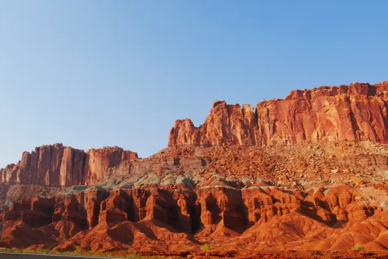
Capitol Reef National Park protects the Waterpocket Fold, a nearly 100-mile wrinkle in the earth where the land buckled and tilted into a long ridge of red cliffs, domes, and slot-like canyons. It is the least-visited of Utah's Mighty Five, which means you can hike the narrows and arches here with a fraction of the crowds you would fight at Zion or Arches.
This 2-day route is built around the heart of the park: the paved Scenic Drive with its spurs into Capitol Gorge and Grand Wash, the steep climb to Cassidy Arch, the big span of Hickman Bridge, and the green oasis of Fruita, a Mormon pioneer settlement where you can pick fruit in season and buy pie and cinnamon rolls at the historic Gifford House.
Spring (April to June) and fall (September to October) are the best seasons, with comfortable days and the orchards in bloom or harvest. Summer days get hot, so hike early. Many of the best routes run through narrow washes, so always check the flash-flood forecast before you enter Grand Wash, Capitol Gorge, or any slot, and never enter a narrows when storms are in the area.
Fruita Campground is the only campground in the developed part of the park, sits right in the historic orchards, and books up fast for spring and fall through recreation.gov. If it is full, base in Torrey just west of the park, which has most of the area's hotels and restaurants. The Gifford House pies and cinnamon rolls sell out by midday, so go early.

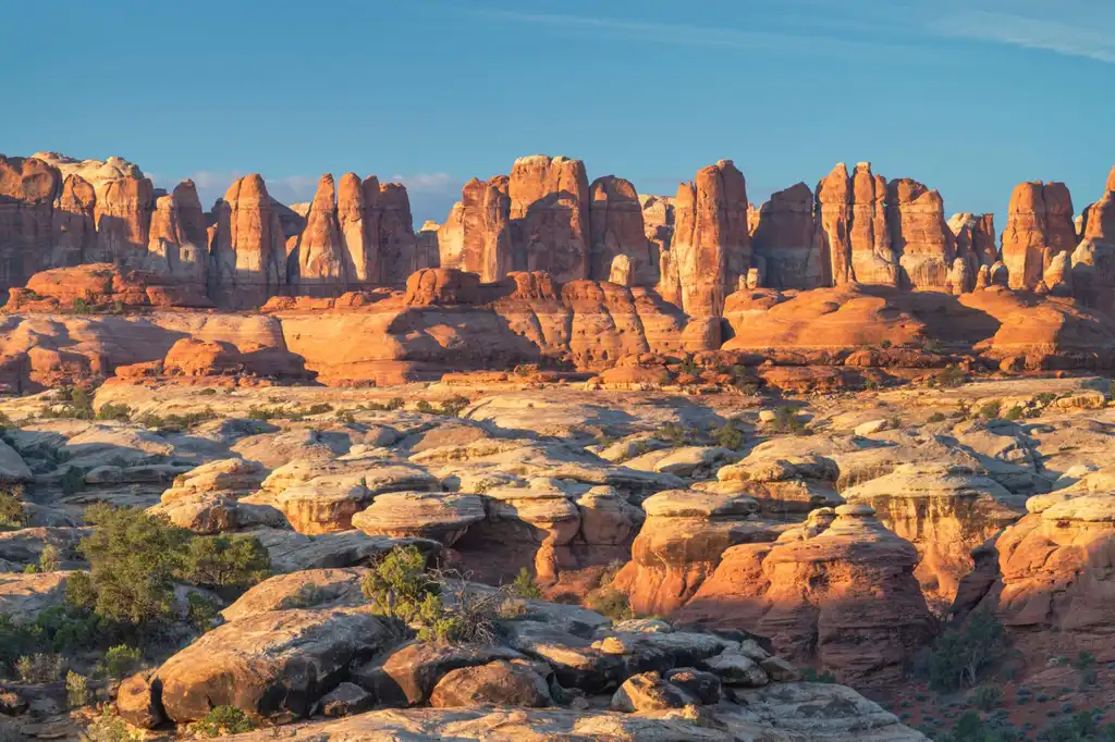
The Scenic Drive · Capitol Gorge, the Tanks & Grand Wash
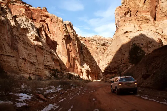
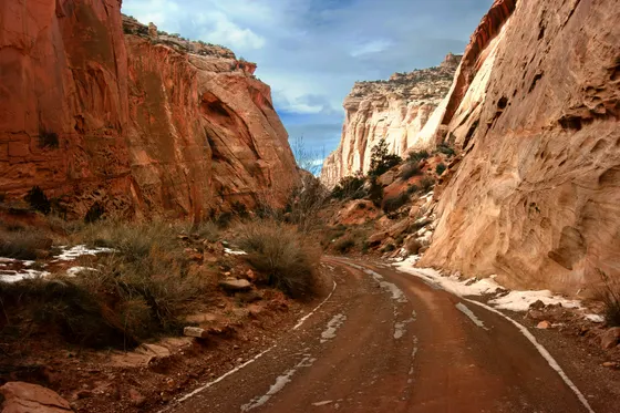
Start at the visitor center on Highway 24, pay the small Scenic Drive fee, and head south on the paved Scenic Drive (about 8 miles one way), which runs along the base of the towering red cliffs of the Waterpocket Fold. Near the end the pavement gives way to a graded dirt spur into Capitol Gorge, a deep, narrow canyon you can walk on a flat trail (about 2 miles round trip) past the Pioneer Register, where 19th-century travelers carved their names, and up a short side scramble to the Tanks, natural waterpockets in the slickrock.
On the way back, turn up the Grand Wash spur and walk the wash itself (about 4.5 miles round trip, flat), where the canyon pinches down to a dramatic narrows between sheer walls. Because both Capitol Gorge and Grand Wash are washes, check the flash-flood forecast at the visitor center first and do not enter if storms are in the area. End the day back in Fruita with a slice of pie from the Gifford House before it closes.
- ~8 mi paved one way · small fee · cliffs of the Waterpocket Fold
- ~2 mi RT · flat · Pioneer Register + waterpocket Tanks
- ~4.5 mi RT · flat · narrow canyon · check flood forecast
- Gifford House for pieHistoric Fruita homestead · pie and cinnamon rolls · go early
- The Scenic Drive charges a small fee (about $20 per vehicle for 7 days, or it is covered by an America the Beautiful pass). The rest of the park on Highway 24 is free.
- Capitol Gorge and Grand Wash are both washes. Check the flash-flood forecast at the visitor center and never enter a narrows when thunderstorms are in the area.
- The Gifford House sells fresh pie and cinnamon rolls but is small and sells out by midday, so grab yours early or first thing the next morning.
 Capitol Gorge
 Scenic Drive
Cassidy Arch, Hickman Bridge & the Fruita district
Hickman BridgeFruita orchardsStart early with the day's big hike. From the Grand Wash trailhead, climb the steep Cassidy Arch trail (about 3.4 miles round trip), which switchbacks up the canyon wall to a viewpoint where you stand level with, and can walk out on top of, a large arch named for the outlaw Butch Cassidy, who is said to have hidden out in these canyons. If you want more, the Cohab Canyon trail (about 3.4 miles) climbs from Fruita to hidden side canyons and overlooks above the campground.
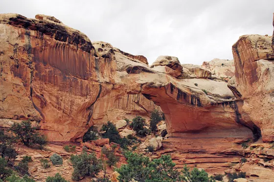
In the afternoon, drive a few minutes east on Highway 24 to Hickman Bridge (about 1.8 miles round trip), an easy climb to a huge 133-foot natural bridge you can walk right under. Wrap up in the Fruita historic district: tour the Mormon pioneer orchards (pick cherries, apricots, peaches, or apples in season), see the petroglyph panels on the Highway 24 boardwalk, and catch the short walks to Sunset Point and the Goosenecks Overlook for the canyon below. Going further? The remote Cathedral Valley loop is a spectacular full-day backcountry drive, but it needs a high-clearance 4x4 and includes a river ford, so it is for confident, well-prepared drivers only.
- ~3.4 mi RT · steep · stand atop an arch named for Butch Cassidy
- ~1.8 mi RT · easy-moderate · big 133-ft natural bridge
- Pick fruit in season · Hwy 24 petroglyph panels · Gifford House
- Sunset Point & Goosenecks OverlookTwo short walks · big views down into the canyon
- Cassidy Arch is short but steep and exposed in places, with a big payoff. Hike it in the cool morning, carry water, and watch your footing on the slickrock near the arch.
- You can pick fruit in the Fruita orchards only when a particular orchard is open for the season. Check the U-pick board or with a ranger for what is ripe and which orchards are open.
- The Cathedral Valley loop is a remote, full-day backcountry drive that requires a high-clearance 4x4 and includes a river ford. Only attempt it if you are an experienced, well-prepared driver and you have checked current road and ford conditions.
Now build your Capitol Reef trip.
You've seen both days. Open the free drag-and-drop planner and tune it for your dates, your pace, and whether you base in Torrey just west of the park or camp at Fruita in the orchards.
What we actually learned in the Fold.
Most of the park is free
Capitol Reef does not charge a standard entrance fee. The one paid section is the Scenic Drive, about $20 per vehicle for 7 days, and that is covered by the annual America the Beautiful pass. Everything along Highway 24, including Hickman Bridge and the Fruita orchards, is free.
Always check the flash-flood forecast
Many of the best hikes here run through washes and narrows: Grand Wash, Capitol Gorge, and the Cathedral Valley drainages. Flash floods can fill a wash with no rain falling where you stand. Check the forecast at the visitor center and never enter a narrows when storms are anywhere in the area.
Hike early in the heat
Summer days get hot in this exposed red-rock country, and there is little shade on Cassidy Arch or the slickrock routes. Start hikes at first light, carry at least a liter of water per person per hour of hiking, and save the afternoon for the orchards and shaded overlooks.
Fruita Campground books up fast
The Fruita Campground sits right in the historic orchards and is the only developed campground in the park. It is reservation-based through recreation.gov for spring and fall and fills quickly. If it is full, base in Torrey just west of the park.
Cathedral Valley is a 4x4-only loop
The remote Cathedral Valley loop is one of the most dramatic drives in Utah, but it is an advanced backcountry route that needs a high-clearance 4x4 and crosses the Fremont River at a ford. Conditions change with weather. Only attempt it well-prepared, and check road status with a ranger first.
Base in Torrey or camp at Fruita
Torrey, just west of the park entrance on Highway 24, has most of the area's hotels, restaurants, and gas. It makes an easy base a few minutes from Fruita. For the full experience, camp at Fruita in the orchards if you can land a site.
Do not overload day one
It runs about 3.5 hours from Salt Lake City to Capitol Reef, and stacking both Capitol Gorge and Grand Wash on top of that drive makes for a very long, tiring first day. If you arrive late, walk one wash that afternoon and save the other for the next morning, or trim Capitol Gorge to the Pioneer Register and skip the scramble up to the Tanks. An early start, or a first night in Torrey on arrival, takes the pressure off.
Time the Gifford House pie
The pies and cinnamon rolls are baked in small batches and often sell out by midday. On your second morning, buy one when the doors open, around 8 AM, and stash it in a cooler in the car. Then enjoy it after Cassidy Arch instead of counting on anything being left in the afternoon.
Everything you'll actually want to know.
Ready to go? Get your
Capitol Reef itinerary.
Trailheads and mileages, the Scenic Drive fee, the Fruita orchards and Gifford House, flash-flood timing, and drive times from Salt Lake City and Las Vegas, all in one route you can build and export.
Instant book · Free cancellation · Secure payment via Stripe
Know these trails yourself? Become a local guide and host free community hikes.


Planning this trip?
Save it, share it with your crew, or find travelers heading the same way.
What other travelers are saying
Be the first to leave a tip or question for the next traveler.
How was your experience?
Tell us what worked and what did not. It goes straight to Yulia and Margarita.