
Blue Ridge Parkway Hikes:
A Scenic Road-Trip Itinerary
Five days of Blue Ridge Parkway hikes and overlooks: the Graveyard Fields Loop, the Price Lake Loop Trail, Linville Falls, Mount Mitchell, Craggy Gardens, plus where to camp along the way.
Free interactive planner · drag & reorder your days, add stops, map it in minutes
Build your own Blue Ridge Parkway trip, drag, reorder & map it.
Drag stops between days, swap hikes, and add your own overlooks and waterfalls with the place search. The live map and drive times recalculate as you go, and we'll flag the long milepost gaps so you know when to stop for gas, food, and the next loop trail.
Opens a side panel · reorder days, add custom stops, see your route live
One road, 469 miles of ridgelines, waterfalls & loop hikes.
The Blue Ridge Parkway runs 469 miles along the crest of the Southern Appalachians, from Shenandoah National Park in Virginia south to the Great Smoky Mountains in North Carolina. There are no tolls, no trucks, and no billboards, just a slow, winding ribbon of pavement marked off by mileposts (MP), with hundreds of overlooks and dozens of short loop trails strung along the way.
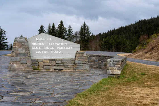
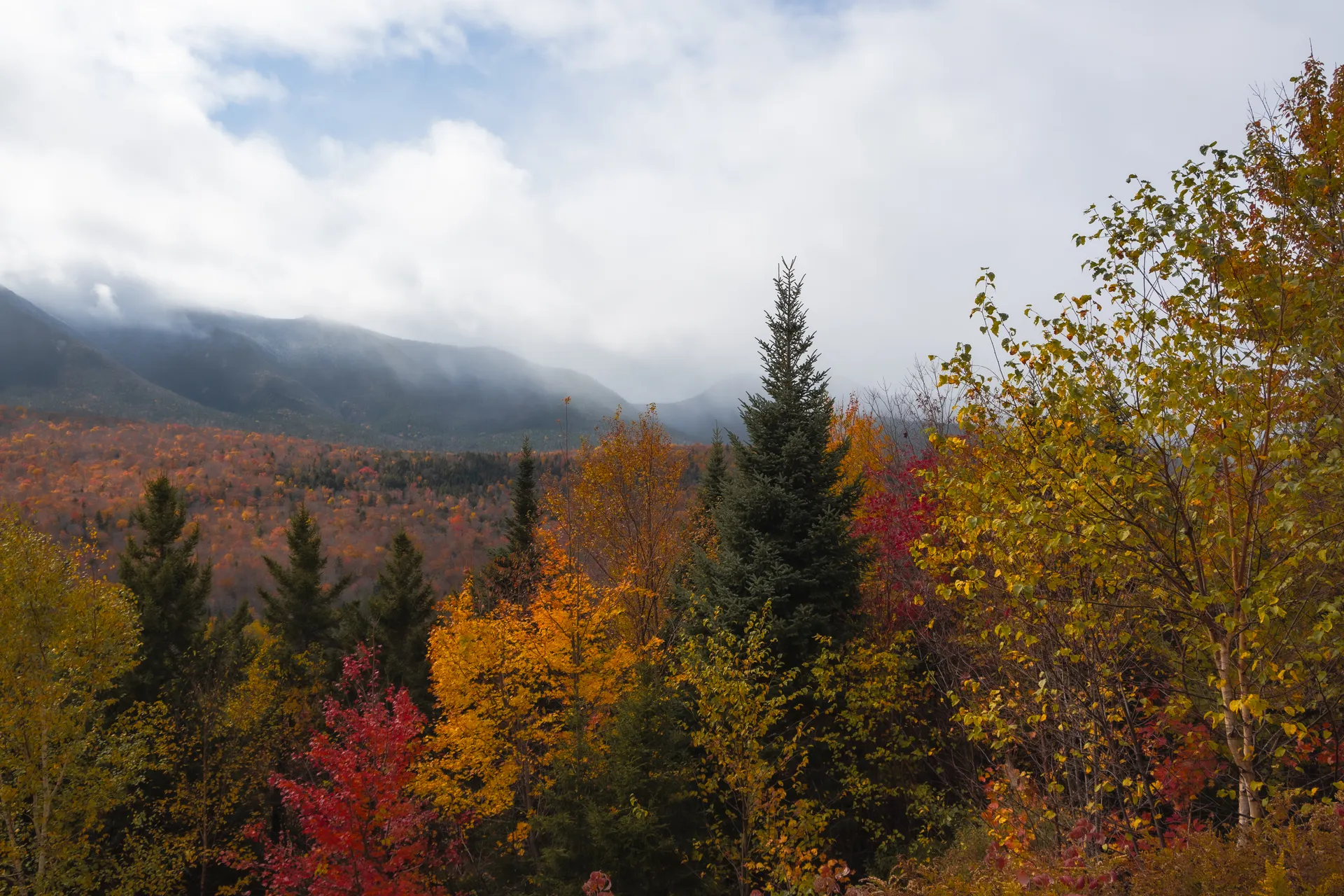
This 5-day route drives south by milepost and builds in the famous Parkway hikes: the Graveyard Fields Loop (MP 418, about 3.2 miles with two waterfalls), the easy Price Lake Loop Trail (MP 297, about 2.7 miles around the lake), the walk to Linville Falls (MP 316), the rhododendron tunnels of Craggy Gardens (MP 364), and the short summit trail on Mount Mitchell (MP 355), the highest peak east of the Mississippi at 6,684 feet.
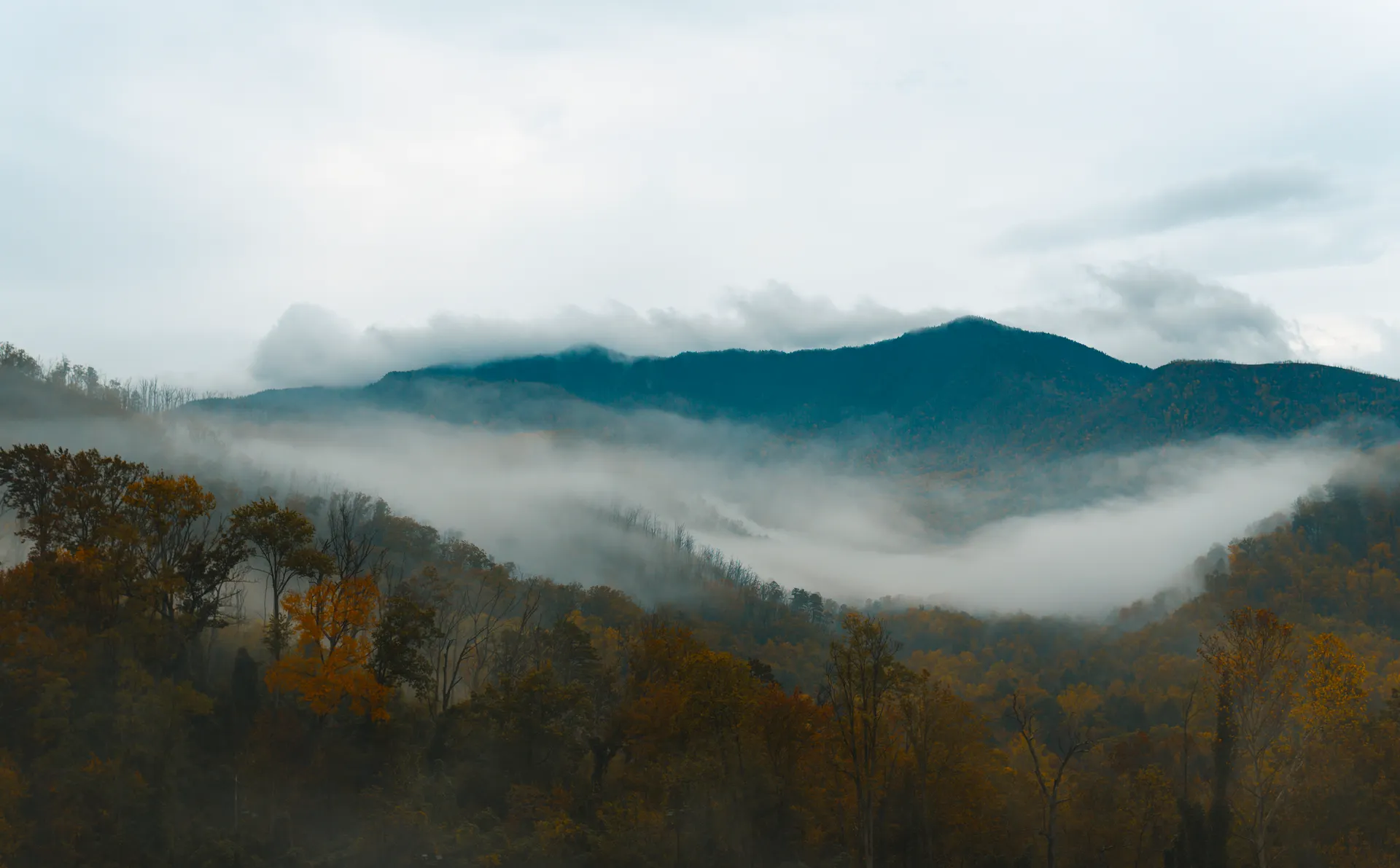
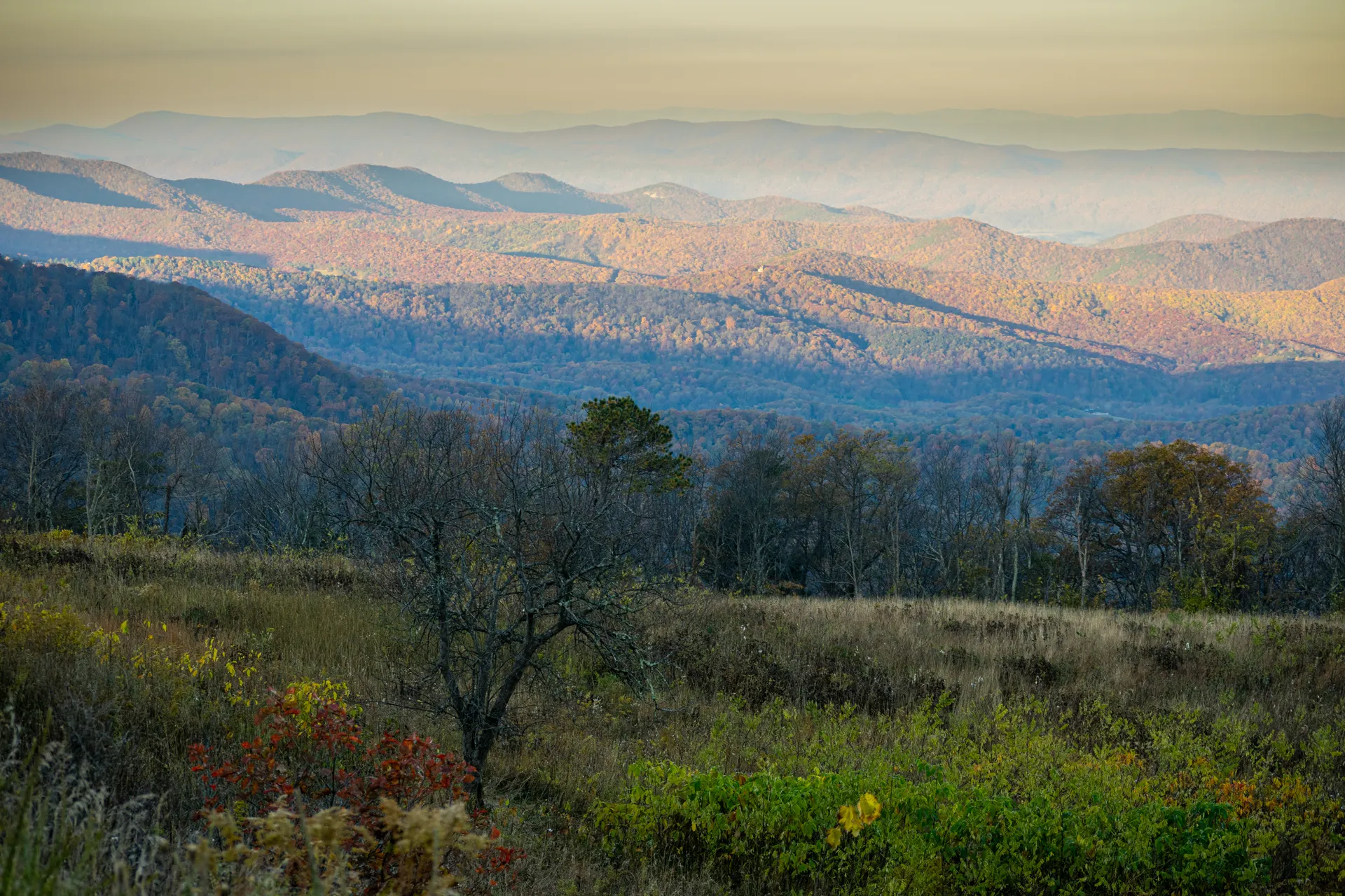
October is the headline season for peak fall foliage, but it also brings peak crowds and slow traffic. Note that winter sections of the Parkway close when ice and snow move in, sometimes for weeks at a time, so always check the road-closure map at nps.gov/blri before you go and have a detour plan onto nearby highways.
The Pisgah Inn (MP 408) is the one lodge right on the Parkway and is seasonal, closed through winter, so book it well ahead for fall. Otherwise base in gateway towns just off the road: Roanoke in Virginia, Boone or Blowing Rock in the High Country, and Asheville near the southern end. For camping along the Blue Ridge Parkway, the NPS campgrounds (Julian Price, Linville Falls, Mount Pisgah and others) book through recreation.gov and fill fast on fall weekends.
Start in Virginia · Humpback Rocks & Mabry Mill
Begin at the northern end near Waynesboro, Virginia, where the Parkway meets Shenandoah at Milepost 0 and rolls south. Stop early at Humpback Rocks (MP 6), where a short but steep climb of roughly 2 miles round trip leads to a rocky outcrop with a wide-open view back over the Shenandoah Valley, a great way to stretch your legs on day one.
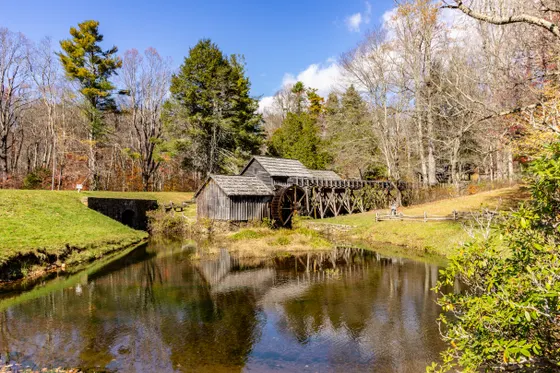
Continue south through rolling Virginia ridgelines to Mabry Mill (MP 176), the most photographed spot on the entire Parkway, an old water-powered gristmill mirrored in its millpond. There is a short, flat interpretive walk and a restaurant known for its buckwheat pancakes. Aim to overnight near Roanoke, the largest city right on the road, or push on toward the Virginia–North Carolina line.
- ~2 mi RT · steep · big Shenandoah Valley view
- Mabry Mill · MP 176The most photographed spot on the Parkway · short flat walk
- Drive south by milepostMP 0 near Waynesboro · watch the mileposts, not the highway signs
- Overnight near Roanoke, VALargest city on the road · or push toward the NC line
- The Parkway has a 45 mph speed limit and is measured in mileposts, not exits. Track the small concrete MP markers so you do not blow past a trailhead.
- Humpback Rocks is short but genuinely steep. Wear real shoes and go early to beat both the heat and the crowd at the overlook.
- Mabry Mill is busiest midday. Stop early or late for photos without a crowd, and the restaurant is known for buckwheat and cornmeal pancakes.
 Virginia overlook
 Rough Ridge
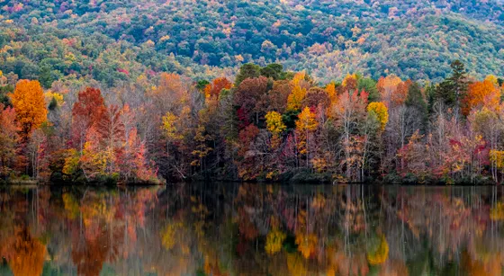
The High Country · Price Lake Loop & Moses Cone
High Country viewLinn Cove aheadCross into North Carolina's High Country around Boone and Blowing Rock and spend the day in the Moses Cone and Julian Price area (around MP 294 to 297). The highlight here is the Price Lake Loop Trail (MP 297), an easy and mostly flat walk of about 2.7 miles all the way around the lake, with the forest and ridgelines mirrored in the water. It is one of the most relaxing hikes on the whole Parkway.
Next door, the Moses Cone Memorial Park has miles of gentle carriage roads radiating from the white Flat Top Manor, perfect for an easy add-on stroll. This is a fine place to camp along the Blue Ridge Parkway: Julian Price Campground sits right on the lake, the largest campground on the road, and books through recreation.gov. Otherwise base in Blowing Rock or Boone for the night.
- ~2.7 mi loop · easy · flat lakeshore walk
- Moses Cone Memorial Park · MP 294Flat Top Manor · gentle carriage-road walks
- Largest Parkway campground · on Price Lake · book ahead
- Base in Blowing Rock or BooneHigh Country gateway towns just off the Parkway
- The Price Lake Loop Trail is about 2.7 miles, easy, and mostly level. It is one of the best family-friendly walks on the Parkway and is gorgeous in fall.
- Julian Price Campground is the largest on the Parkway and sits right on the lake. Reserve through recreation.gov well ahead for any fall weekend.
- Blowing Rock and Boone both have plenty of lodging and food just minutes off the Parkway if the campgrounds are full or the weather turns.
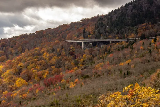
Linn Cove Viaduct, Rough Ridge & Linville Falls
This is one of the most dramatic stretches of the entire road. The Linn Cove Viaduct (MP 304) curls on slender pillars around the rugged shoulder of Grandfather Mountain, the last section of the Parkway to be completed in 1987. Just before it, pull off at Rough Ridge (MP 302) and walk the short trail up to a wooden boardwalk with a knockout view back down onto the viaduct and the ridgelines beyond.
Continue south to Linville Falls (MP 316), where well-built trails of roughly 1.6 miles round trip lead to a string of overlooks above the falls as the Linville River drops into the rugged Linville Gorge. There are upper and lower viewpoints, so pick the overlooks that match your energy. Overnight back in the Blowing Rock or Linville area, or camp at Linville Falls Campground.
- The iconic curve around Grandfather Mountain · pull off below to view it
- Rough Ridge boardwalk · MP 302Short steep trail · boardwalk view over the viaduct
- ~1.6 mi RT · upper & lower overlooks · into Linville Gorge
- Camp or stay near LinvilleLinville Falls Campground, or lodging in Blowing Rock
- You cannot really see the Linn Cove Viaduct from on top of it. Park at the Rough Ridge or viaduct pullouts and walk a little to get the famous curved view.
- Linville Falls has several overlooks at different distances. The upper falls are a shorter walk; the Erwins View and gorge overlooks are a bit farther for the bigger picture.
- These pullouts are small and jam up on October weekends. Arrive early in the morning, and have a backup plan if a lot is already full.
Rough RidgeLinville FallsMount Mitchell, Craggy Gardens & Asheville
 Craggy Gardens
 French Broad River
Climb to the rooftop of the East. A short spur off the Parkway (near MP 355) leads to Mount Mitchell State Park, where a quick paved summit trail reaches 6,684 feet, the highest peak east of the Mississippi River. The air is noticeably cooler and the summit observation deck gives a 360-degree view over a sea of ridges. Just south, Craggy Gardens (MP 364) bursts with wild rhododendron, with a peak bloom usually around mid-June.
Drop down into Asheville (around MP 382), the cultural hub of the southern Parkway. Stop at the Folk Art Center for Appalachian craft, then cool off on the French Broad River with a relaxed tubing float with Asheville Adventure Company. Asheville has the widest choice of lodging, food, and breweries on the whole route, so it makes a great base for the night.
- Short paved trail · 6,684 ft · highest peak east of the Mississippi
- Craggy Gardens · MP 364Wild rhododendron · peak bloom around mid-June
- Relaxed river float near Asheville · book ahead in summer
- Stay in Asheville · MP 382Most lodging, food & breweries on the route
- Mount Mitchell is the highest point east of the Mississippi at 6,684 feet, and the summit is much colder and windier than the valley. Bring a warm layer even in summer.
- Craggy Gardens is at its best when the rhododendron blooms, usually around mid-June. Outside bloom season it is still a worthwhile short walk to the meadow and bald.
- Asheville has by far the most lodging and food on the route. Book ahead on fall weekends, when leaf-peeper demand spikes prices across the whole region.
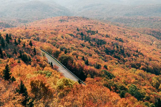
Graveyard Fields Loop, Devil's Courthouse & the Smokies
Save the signature hike for last. The Graveyard Fields Loop (MP 418) is the famous Parkway loop trail, about 3.2 miles through an open high-elevation valley with an Upper and Lower Falls on the Yadkin Fork. It is a moderate loop that is stunning in fall, when the open meadow turns gold and red, so its small parking lot fills very early. Nearby Mount Pisgah (MP 408) and the seasonal Pisgah Inn make a good fuel and view stop.
Finish the high stretch at Devil's Courthouse (MP 422), a short steep climb to a bare rock summit with one of the widest views on the Parkway, then Waterrock Knob (MP 451) near the southern end. Getting there: the Parkway ends at MP 469 near Cherokee, right at the doorstep of Great Smoky Mountains National Park, so you can roll straight from your last overlook into the most-visited national park in the country.
- ~3.2 mi loop · moderate · Upper & Lower Falls · lot fills early
- Seasonal lodge & restaurant right on the Parkway · big views
- Devil's Courthouse · MP 422Short steep climb to a bare-rock summit · huge views
- Finish at the Great Smoky MountainsParkway ends MP 469 near Cherokee · gateway to the Smokies
- The Graveyard Fields Loop is about 3.2 miles with both an Upper and a Lower Falls. The parking lot is small and fills by mid-morning in fall, so start at sunrise.
- The Pisgah Inn (MP 408) is the only lodge right on the Parkway and is seasonal, closed in winter. Book well ahead for fall, or just stop for the view and a meal.
- The Parkway ends at Milepost 469 near Cherokee, at the entrance to Great Smoky Mountains National Park. Plan time to continue into the Smokies if your schedule allows.
Waterrock KnobParkway fallsNow build your Blue Ridge Parkway trip.
You've seen all five days. Open the free drag-and-drop planner and tune it for your dates, your pace, and whether you base in Roanoke, Blowing Rock, or Asheville along the way.
What we actually learned on the Parkway.
Drive by milepost, not by exit
The Blue Ridge Parkway is measured by mileposts (MP) from 0 in the north near Waynesboro, Virginia, to 469 in the south near Cherokee, North Carolina. Trailheads, overlooks, and visitor centers are all signed by milepost, so track the small concrete markers as you go.
Always check road closures first
Sections of the Parkway close every winter for ice and snow, and weather, rockfall, or construction can shut stretches at any time of year. Check the live road-closure map at nps.gov/blri before and during your trip, and keep a detour onto nearby highways in mind.
There is no entrance fee
Unlike most national parks, the Blue Ridge Parkway has no entrance fee and needs no pass. You only pay for things like campgrounds, the Pisgah Inn, or guided activities, which keeps a road trip here refreshingly cheap.
Camping along the Parkway books up
The NPS runs several campgrounds right on the road, including Julian Price, Linville Falls, and Mount Pisgah. They are seasonal and reserve through recreation.gov, and they fill fast on fall weekends, so book camping along the Blue Ridge Parkway well ahead.
Plan gas, food, and slow speeds
There is no commercial development on the Parkway itself, just a handful of seasonal concessions like Mabry Mill and the Pisgah Inn. Fill up and grab food in gateway towns, and budget extra time: the 45 mph limit and curves make 469 miles a multi-day drive.
Go in October, but expect company
October brings the famous fall foliage and the best weather, but also the heaviest crowds, slow traffic, and full parking lots at popular hikes like Graveyard Fields. Start early, and consider a spring or early-fall midweek trip for a quieter road.
Beat the Graveyard Fields lot at first light
The Graveyard Fields lot (MP 418) is tiny, and in peak October foliage it can fill by around 7:30 in the morning, which snarls the two-lane road for hours. Arrive at first light, pack a headlamp for the first half-mile of stairs, and you will have the trail largely to yourself as the light hits the Lower Falls and the fog clears.
Everything you'll actually want to know.
Ready to go? Get your
Blue Ridge Parkway route.
Trailheads and mileposts, the one in-Parkway lodge, campgrounds, gas and food stops, the famous loop hikes, and the road-closure checks you need to drive all 469 miles with confidence.
Instant book · Free cancellation · Secure payment via Stripe
Know these trails yourself? Become a local guide and host free community hikes.
Planning this trip?
Save it, share it with your crew, or find travelers heading the same way.
What other travelers are saying
Be the first to leave a tip or question for the next traveler.
How was your experience?
Tell us what worked and what did not. It goes straight to Yulia and Margarita.