Stevens Arch: The Giant Arch at the Mouth of Coyote Gulch
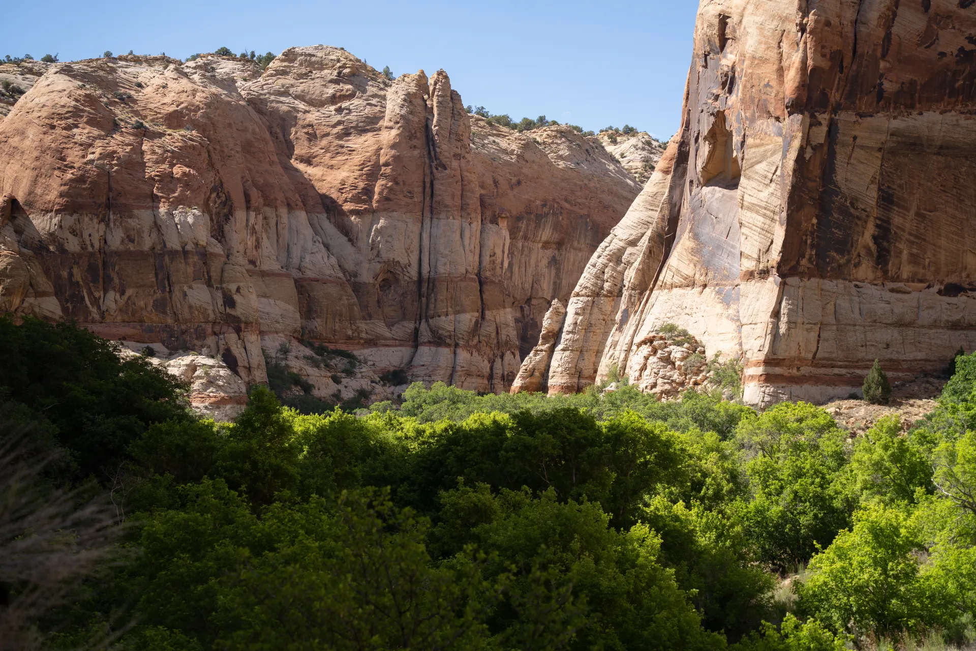
Stevens Arch is not in Arches National Park. It is a 220-foot sandstone span above the Escalante River, in Glen Canyon National Recreation Area, where Escalante Canyon meets Stevens Canyon just upstream from the mouth of Coyote Gulch. There is no road to it and no easy trailhead. People reach it two ways: as part of a multi-day backpacking trip down Coyote Gulch to the Escalante River, or by boat up the Escalante arm of Lake Powell when the reservoir is high enough. Either way, this is a real backcountry destination, not a stop you make on a park loop; our Utah national parks road trip covers the parks you can drive to.
Where Stevens Arch Actually Is
Stevens Arch sits in Kane County, Utah, inside Glen Canyon National Recreation Area, on the wall of Escalante Canyon at its junction with Stevens Canyon. The arch spans about 220 feet and stands about 160 feet tall, carved from Navajo sandstone, and it is one of the longer natural arch spans in the country. It is a common point of confusion that this is somehow part of Arches National Park near Moab; it is a different formation, in a different park, more than 100 miles away by road, in the canyon country around the town of Escalante.
Route One: Backpacking Down Coyote Gulch
Coyote Gulch is the popular multi-day backpacking canyon that drops into the Escalante River just downstream of Stevens Canyon, and it is the overland way in. The National Park Service lists these trailheads off the Hole-in-the-Rock Road: Red Well (13 miles one way to the Escalante River), Hurricane Wash (12.3 miles one way), and the Fortymile Ridge routes, including the Crack-in-the-Wall approach, which drops into the canyon through a narrow gap in the rim and down a steep sand dune. None of these get you to Stevens Arch directly; you still have to hike down-canyon to the Escalante River and then upstream or downstream along the river corridor toward the Stevens Canyon confluence, which means river crossings, no maintained trail, and real route-finding. A backcountry permit is required for any overnight stay in the Escalante District of Glen Canyon NRA, available at the Escalante Interagency Visitor Center in the town of Escalante or at the trailheads; day use only needs a signature in the trail register. Group size is capped at 12, fires are not allowed, and all human waste must be packed out.
Route Two: By Boat on Lake Powell
The other way in is by water. When Lake Powell's level is high enough to back up into the Escalante arm, boaters can motor up near the Stevens Canyon confluence and hike a short distance from the shoreline to the arch, commonly described as around 8 miles round trip with about 1,500 feet of elevation gain depending on exactly where the water line sits that season. Lake Powell's level swings significantly from year to year with drought and snowpack, which changes how far up-canyon a boat can actually get, so this is not a fixed hike. Check current lake levels and access with the Glen Canyon NRA before planning a boat trip around this arch.
Why This Is Not a Casual Stop
There is no parking lot at Stevens Arch, no short interpretive trail, and no cell service in the canyon. Both approaches require either serious backpacking gear and river-crossing experience, or a boat and the knowledge to navigate Lake Powell's arm to the right spot. Flash flooding is a real risk in this canyon country; check the weather for the entire drainage, not just the trailhead, before you go, and do not enter a narrow section if a storm is anywhere in the forecast.
What Else Is Nearby
If a full Coyote Gulch trip is more than you want, the more accessible arches in this same canyon system, including Jacob Hamblin Arch, sit closer to the Hurricane Wash and Red Well trailheads and do not require pushing all the way to the Escalante River confluence. The town of Escalante itself, with the Interagency Visitor Center, is the place to check conditions, get a permit and ask rangers which trailhead fits the water levels and your experience that week.
Have Us Plan Your Escalante or Utah Trip
If you want to build a Coyote Gulch trip or fit Grand Staircase-Escalante into a wider Utah parks loop, tell us your dates and experience level and we will help you plan it. Planning is free.
Keep planning with Best Hikes in Arches National Park Near Moab and Zion to Arches National Park.
Stevens Arch: The Giant Arch at the Mouth of Coyote Gulch FAQs
No. Stevens Arch is in Glen Canyon National Recreation Area, above the Escalante River near the town of Escalante, more than 100 miles from Arches National Park in Moab.
Either by backpacking down Coyote Gulch to the Escalante River and continuing toward the Stevens Canyon confluence, a multi-day trip with river crossings and no maintained trail, or by boat up the Escalante arm of Lake Powell when the water level is high enough, followed by a short hike from the shoreline.
For any overnight stay in the Escalante District of Glen Canyon National Recreation Area, including a Coyote Gulch backpacking trip, yes. Day use does not require a permit, just a signature in the trailhead register.
About 220 feet across and 160 feet tall, cut from Navajo sandstone, which makes it one of the longer natural arch spans in the United States.
No. There is no direct trail to it. The overland approach is a multi-day backcountry trip through Coyote Gulch with river crossings, and the boat approach depends on Lake Powell's water level that season.
Yes. The worked day-by-day plan is Utah Mighty Five: 5-Day National Parks Road Trip (5 Days), with the permits, the stays and the drive times already sorted. Tell us your dates and we will put it together for you and confirm what is genuinely open on those days. Asking is free: no card, no deposit, and nothing is held until you say yes.