Why the South Kaibab Trail Is the Best Day Hike on the South Rim
The South Kaibab Trail is the most scenic corridor trail descending from the South Rim of Grand Canyon National Park. Unlike the Bright Angel Trail, which threads through side canyons, the South Kaibab follows an exposed ridgeline, so you get wide-open views of the inner canyon and the Colorado River almost the entire way down. The trailhead sits near Yaki Point, about a 15 minute shuttle ride east of Grand Canyon Village.
Because it descends a ridge, the South Kaibab is steeper and shorter than Bright Angel, and it has no water and almost no shade. That makes it a phenomenal route down and a punishing route up in the heat. Most experienced hikers go down the South Kaibab and back up Bright Angel, which is exactly how the classic Grand Canyon rim to rim weekend itinerary finishes the canyon crossing.
South Kaibab Trail Distances and Turnaround Points
The trail is marked by a series of natural overlooks that make perfect turnaround spots depending on your fitness and the season. Distances below are one way from the trailhead.
- Ooh Aah Point (0.9 miles, 600 ft down): the classic short hike with a panoramic eastern view, doable in under an hour round trip.
- Cedar Ridge (1.5 miles, 1,140 ft down): a broad saddle with pit toilets, the best turnaround for most day hikers.
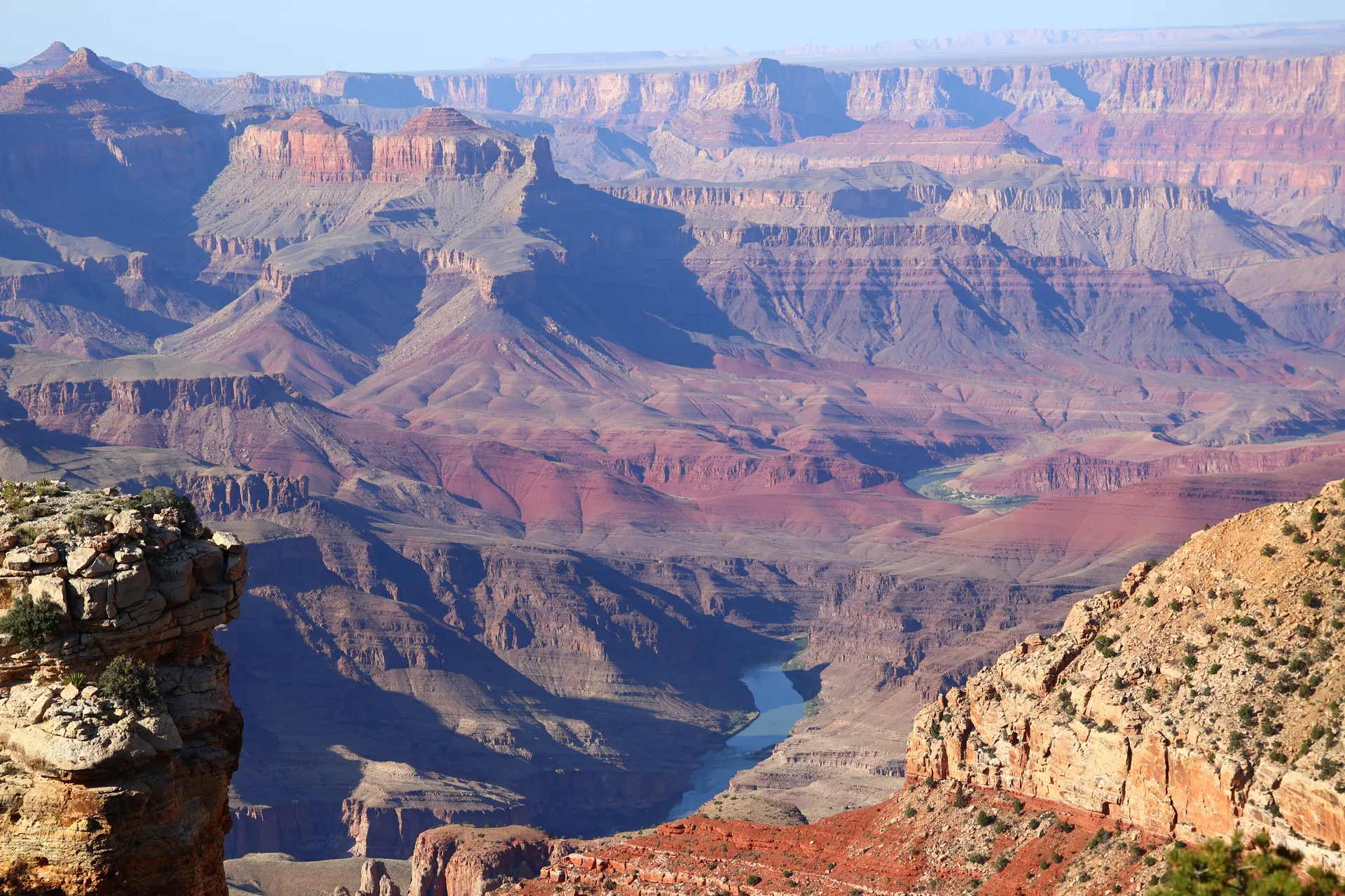
- Skeleton Point (3.0 miles, 2,040 ft down): your first clear look straight down to the Colorado River; a strong half day out and back.
- The Tipoff (4.4 miles, 3,260 ft down): the edge of the Tonto Platform, for fit hikers only.
- Bright Angel Campground and Phantom Ranch (about 7 miles, 4,780 ft down): the river, for backpackers and rim to rim hikers only.
The National Park Service warns against hiking to the river and back in a single day, and that warning is serious. Save the full descent for an overnight at Phantom Ranch or a rim to rim crossing.
Water, Shuttle and Logistics
There is no water anywhere on the South Kaibab Trail, so fill up at the trailhead spigot and carry everything you need. Plan on at least two to three liters per person for a half day. The private car parking near the trailhead is closed, so you must ride the free park shuttle. Take the Orange Route to the South Kaibab Trailhead stop, or in winter the Hikers Express bus that leaves Bright Angel Lodge before dawn.
Trekking poles save your knees on the relentless descent, and microspikes are essential from roughly November through March when the upper switchbacks ice over. The first mile and a half through Chimney and the Cedar Ridge switchbacks holds ice long after the rim looks clear.
Best Seasons to Hike the South Kaibab
Spring (April and May) and fall (late September through October) are the prime windows, with comfortable rim temperatures and manageable inner canyon heat. Summer is dangerous below the rim, where temperatures routinely top 105 F on the exposed ridge and there is zero shade. If you must hike in summer, be back above Cedar Ridge by mid morning.
Winter brings a different beauty, with snow dusting the rim and clear cold air, but you will need traction devices and should start late enough that the upper trail has softened.
Combining the South Kaibab with Bright Angel
The signature South Rim loop is to descend the South Kaibab and climb out on the Bright Angel Trail, which has water stations at Havasupai Gardens (formerly Indian Garden) and the rest houses. This is the same descent strategy used on a full canyon crossing, where you drop in from the North Rim on the North Kaibab Trail and climb out Bright Angel to the South Rim. If a single canyon day inspires you to attempt the whole thing, our rim to rim weekend plan walks through permits, timing and where to sleep at the bottom.
Safety on the South Kaibab Trail
Most rescues here happen to fit people who underestimate the climb out in the heat. Remember that going down is optional and coming up is mandatory, and the return takes roughly twice as long. Eat salty snacks, drink steadily rather than chugging, and rest in any shade you can find on the Tonto Platform. If you feel dizzy, nauseated or stop sweating, stop, cool down and treat it as an emergency.
What to See Along the Way
Beyond the headline overlooks, the South Kaibab rewards attentive hikers with constant geology and wildlife. The descent slices through 1.7 billion years of rock layers, starting in the cream colored Kaibab Limestone at the rim, dropping past the red Hermit Shale and Supai Group, and eventually reaching the dark Vishnu Schist near the river. Watch for California condors riding the thermals above O'Neill Butte, the prominent red tower you pass between Cedar Ridge and Skeleton Point, and listen for canyon wrens whose descending song echoes off the cliffs. At the Tipoff you cross onto the green Tonto Platform, where the trail flattens briefly before the final plunge to the Black Bridge and the Colorado River.
Sunrise and sunset turn the whole ridge molten, and because the trail faces east and west across an open spine, the South Kaibab is widely considered the best place on the South Rim to watch first light flood the inner canyon. If you only have time for one short hike, time it for the first hour after sunrise from the trailhead down to Ooh Aah Point and Cedar Ridge.


