At 13,065 feet, Wheeler Peak is the crown of Great Basin National Park and the second-highest summit in Nevada. The cluster of trails that climb its flanks deliver some of the most rewarding alpine hiking in the Great Basin, from a quad-burning summit push to gentle loops through the oldest living trees on Earth. Here is how to choose the right hike for your day.
Getting Oriented Before You Go
Wheeler Peak rises in the Snake Range of eastern Nevada, and almost everything for hikers funnels off one paved artery, the Wheeler Peak Scenic Drive. The nearest services are in tiny Baker, just outside the park entrance, with fuller resupply in Ely about 70 miles to the west. Because the park is so isolated, the trails here stay refreshingly uncrowded even in peak season, but that remoteness cuts both ways: there is no cell service on the mountain and the nearest hospital is in Ely, so self-sufficiency matters. Tell someone your plan, carry a paper map, and start with a clear sense of how much vertical you want to take on. The good news is that the trailhead network lets you scale your day from a flat lakeside stroll to a 13,000-foot summit without ever changing parking lots.
Wheeler Peak Summit Trail
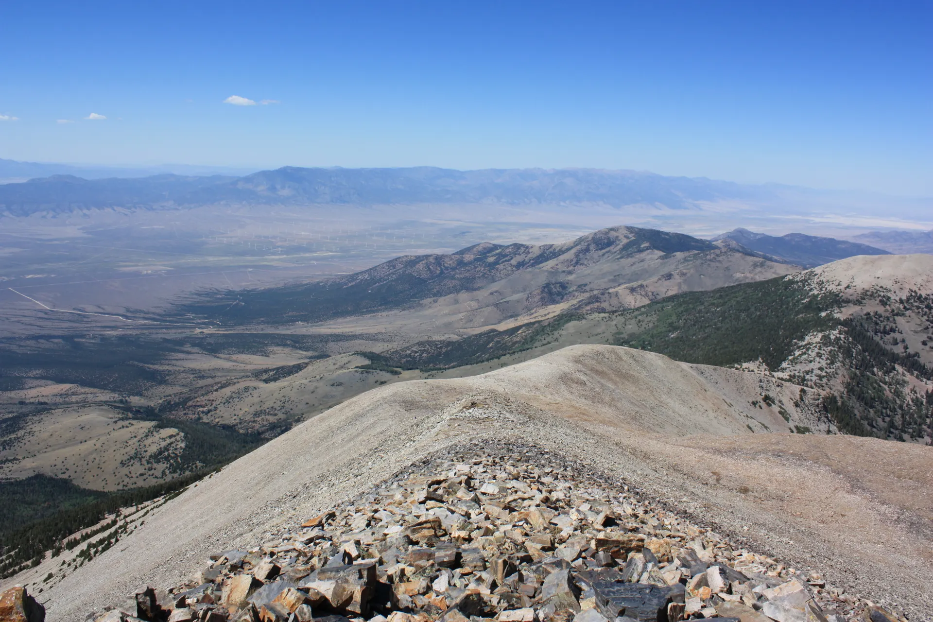
The Wheeler Peak Summit Trail is the big one: roughly 8.6 miles round trip with about 2,900 feet of elevation gain, topping out above 13,000 feet. It begins at the Summit Trailhead near the Wheeler Peak Campground and climbs through forest before breaking out onto a long, exposed ridge. The final stretch is a relentless rocky slog with no shade. Plan for 6 to 9 hours and start at sunrise to beat the afternoon thunderstorms that build over the high country in summer.
Bristlecone Pine Trail
If a full summit is not in the cards, the Bristlecone Pine Trail is the most beloved hike in the park. This roughly 2.8-mile round trip climbs gently from the Bristlecone parking area to a grove of Great Basin bristlecone pines, some of which are nearly 5,000 years old. These gnarled, weather-sculpted trees are among the oldest living organisms on the planet, and interpretive signs explain how they survive at the timberline. It is a must-do even for casual walkers.
Glacier Trail to Nevada's Only Glacier
Extend the Bristlecone hike onto the Glacier Trail for a roughly 4.6-mile round trip that ends at the base of the rock glacier tucked beneath Wheeler Peak's dramatic north face. This is the only glacier in Nevada. The final section crosses rocky moraine and can hold snow into summer, so trekking poles help.
Altitude and Safety Tips
Every trail here starts high, with the upper trailheads near 10,000 feet, so altitude affects almost everyone.
- Acclimatize first. Spend a night at the Wheeler Peak Campground (9,886 feet) before attempting the summit if you can.
- Carry more water than you think. The dry, high-elevation air dehydrates you fast and there is no reliable water on the summit route.
- Watch the weather. Lightning is the biggest danger above treeline; turn around by early afternoon.
- Layer up. Summit temperatures can be 30 degrees colder than the valley, with fierce wind.
How to Reach the Trailheads
All of these hikes start off the Wheeler Peak Scenic Drive, a paved 12-mile road that climbs from the Lehman Caves Visitor Center to nearly 10,000 feet. The drive itself is spectacular and usually opens in late spring once the snow clears, closing again with the first heavy storms in fall. RVs and trailers over 24 feet are not advised on the upper switchbacks.
Other Trails Worth Adding
The Wheeler Peak area packs several more rewarding hikes within a short drive of the same trailheads. Stack a couple together for a full day in the high country.
- Alpine Lakes Loop (about 2.7 miles): A gentle forested loop past Stella Lake and Teresa Lake, two glassy alpine tarns that mirror Wheeler Peak. It is the best easy hike for big mountain scenery.
- Lexington Arch: A six-story limestone arch reached by a steeper trail in the park's remote southern end, accessed by a rough dirt road. Worth it for solitude seekers.
- Baker and Johnson Lakes: A long, strenuous backcountry route for strong hikers who want to escape the day crowds entirely.
Camping and Where to Stay
To get an early start on the summit, base yourself in the park. The Wheeler Peak Campground at 9,886 feet puts you right at the trailheads and is the highest of the park's developed campgrounds, though it is first-come or limited reservation and closes in winter. Lower options like Upper and Lower Lehman Creek campgrounds stay open longer and sit closer to the visitor center. For a roof and a shower, the small towns of Baker (just outside the entrance) and Ely (about 70 miles west) have basic motels. Fill your gas tank and stock up on food in Ely, because Baker is tiny.
Best Time to Hike
The prime window is July through September, when the scenic drive is fully open and the upper trails are snow-free. Wildflowers peak in July, and golden aspens light up the lower slopes in late September. Outside that window, snow can linger on the high routes well into early summer. To fit Wheeler Peak into a smart loop with Lehman Caves and the rest of the park, follow the Great Basin National Park itinerary and let the road conditions guide your timing.


