Why Alice Lake Is the Sawtooths' Postcard Hike
Alice Lake sits in a high glacial basin in Idaho's Sawtooth Mountains, ringed by granite spires and reflecting the unmistakable fin of El Capitan. It is widely considered the single most beautiful day-hike and overnight destination in the entire range, and for good reason: the water glows an improbable teal, talus slopes plunge straight into the shallows, and the peaks stack up behind it like a movie set. If you only have time for one classic Sawtooth lake basin, this is the one most locals send you to.
Reaching it is a real effort, though. From the trailhead it is roughly 12 miles round trip with around 1,600 feet of elevation gain, almost all of it concentrated in the last few miles. Plan on a long day, or far better, an overnight.
The Trailhead: Tin Cup at Pettit Lake
The hike starts at the Tin Cup Trailhead on the north shore of Pettit Lake, reached by a gravel spur off Idaho Highway 75 between Stanley and Ketchum. The lot is small and fills early on summer weekends, so arrive before 8 a.m. or expect to park along the road. There is a vault toilet but no water, so fill up in Stanley or Ketchum first.
From the trailhead, follow the Tin Cup Trail west along the shoreline of Pettit Lake. The first couple of miles are gentle and forested, paralleling the lake and then Pettit Lake Creek, which makes for a deceptively easy warm-up.
The Climb Into the Basin
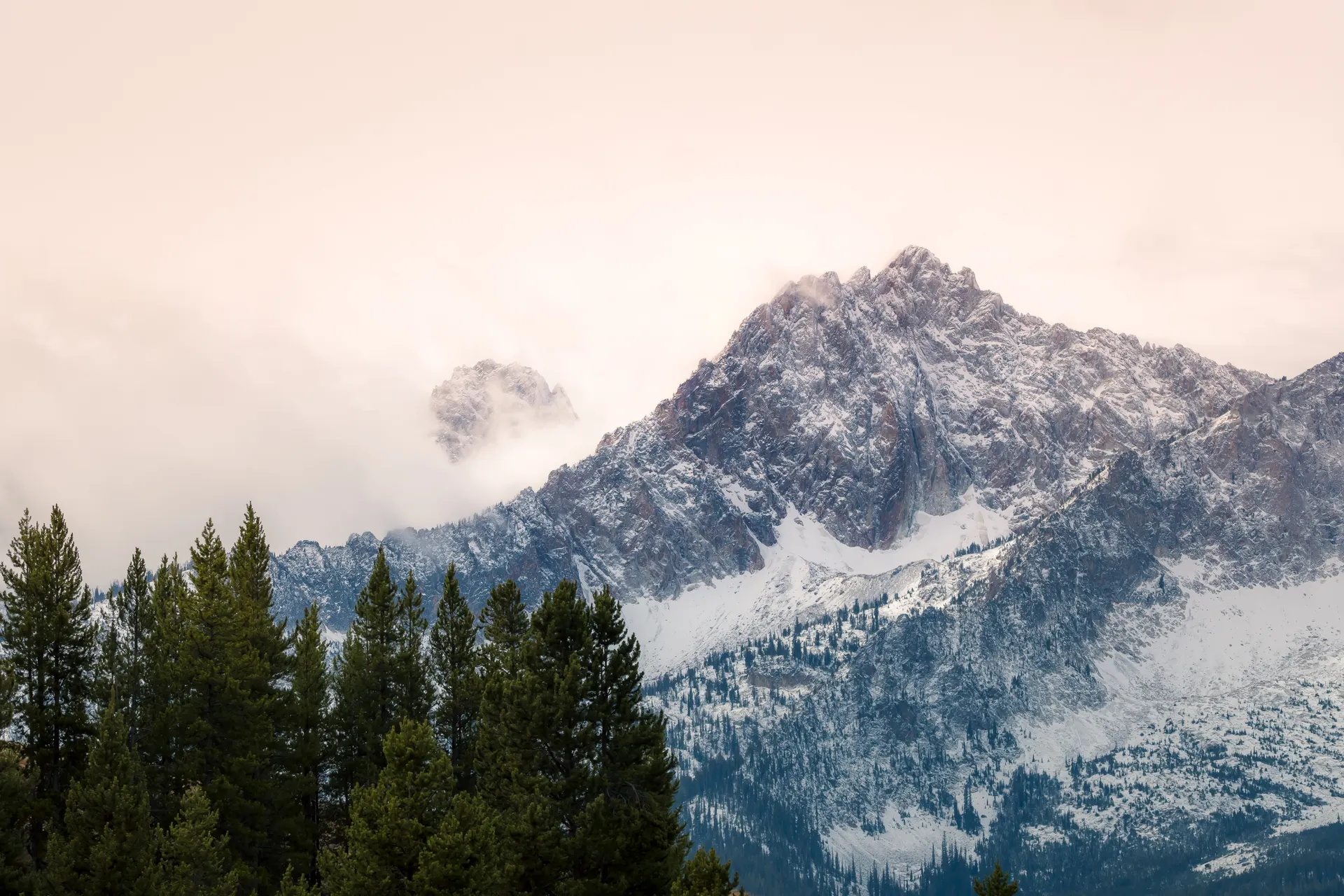
After the junction with the trail to Toxaway Lake, the route steepens noticeably. You climb through lodgepole and Douglas fir, cross talus fields, and pass a string of small ponds and meadows that hint at what is coming. The grade is steady rather than brutal, but at elevation it will get your attention. Keep an eye out for marmots on the rocks and the first dramatic views of the granite walls ahead.
When you finally crest into the Alice Lake basin, the payoff is immediate: the lake spread out beneath El Capitan, with the Sawtooth crest curving around the far shore. Stick to established trails and existing campsites here, because this fragile high basin sees heavy use and the soils recover slowly.
Extend to Twin Lakes and the Toxaway Loop
Alice Lake is the turnaround for most day hikers, but it is also the gateway to one of Idaho's best backpacking loops. Strong hikers continue past Alice to:
- Twin Lakes, a short, mostly level mile beyond Alice, with equally stunning views and often quieter campsites.
- Toxaway Lake, reached by climbing over Snowyside Pass, the high point of the loop at around 9,400 feet.
- The full Alice-Toxaway Loop, roughly 18 to 19 miles, which drops back down to Pettit Lake and is one of the signature multi-day trips in the Sawtooth Wilderness.
If you would rather sample Alice Lake as part of a packed weekend that also hits Sawtooth Lake and the Redfish-area trails, our Sawtooth Mountains Idaho weekend hiking itinerary lays out a three-day plan with timing and logistics.
Best Time to Hike Alice Lake
The reliable window is mid-July through late September. Snow lingers on the higher approach and at Snowyside Pass well into July in big winters, and afternoon thunderstorms are common in midsummer, so start early and watch the sky. September is a local favorite: bug pressure drops sharply, the air is crisp, and the larches and groundcover begin to turn gold. By October nights are freezing and the first storms can close the high passes.
Permits, Camping, and Leave No Trace
Day hiking the Tin Cup Trail does not require a permit, but you must fill out a free self-issued wilderness permit at the trailhead kiosk for any trip into the Sawtooth Wilderness. Campfires are restricted or banned at many alpine lakes including Alice, so plan to cook on a stove. Camp at least 100 feet from the water on durable surfaces, pack out everything, and store food properly; black bears do roam the basin. Because Alice Lake is so popular, the single most important thing you can do is camp only in existing sites rather than creating new ones.
What to Pack and Know Before You Go
This is a high-elevation hike in a remote corner of central Idaho, so come prepared even for a day trip:
- Plenty of water and a filter, since you will be crossing and refilling from Pettit Lake Creek and basin streams.
- Layers and a rain shell, because mountain weather flips fast and the basin is exposed.
- Sturdy boots for the talus and rooty climb into the basin.
- Sun protection and bug spray, essential in July and early August.
Cell service disappears once you leave Highway 75, so download offline maps and leave your plan with someone. The nearest gas, food, and lodging are in Stanley to the north and Ketchum to the south, both worth a stop before or after the hike.


