Highway 1 Road Trip Itinerary: The California Pacific Coast Highway
The classic California Highway 1 road trip itinerary runs 3 to 5 days along the Pacific Coast Highway from San Francisco to Los Angeles, stopping at Santa Cruz, Monterey, Big Sur, Hearst Castle at San Simeon, Morro Bay, and Santa Barbara. Drive southbound so you ride the ocean-side lane. The Big Sur stretch is the highlight but it is prone to landslides, so check Caltrans for closures before you go. Want more coast? Extend north from San Francisco up the wild California and Oregon shoreline.
The California Highway 1 road trip itinerary is the most famous drive in the American West, a ribbon of Pacific Coast Highway that threads cliffs, redwoods, and surf towns between San Francisco and Los Angeles. This hub guide lays out the classic route, tells you which direction to drive, how many days to give it, and how to handle the Big Sur closures that trip up first-timers, then points you to the hikes and itineraries worth building in. When you are ready to slow down and walk the coast, our day by day Big Sur hiking itinerary is the perfect anchor for the middle of this trip.
The classic San Francisco to Los Angeles route
Most people drive the California Highway 1 road trip itinerary from north to south, San Francisco to Los Angeles, and for good reason: heading southbound keeps you in the ocean-side lane, right against the cliff edge, so every overlook and pullout is on your side of the road. Here is the classic run of stops, north to south.
1. Santa Cruz
An hour and a half south of San Francisco, Santa Cruz is the first proper beach town on the route, with its historic boardwalk, a working wharf, and some of the best surf breaks in California at Steamer Lane. It is an easy first stop or lunch break before the coast turns wild. Natural Bridges State Beach and the tide pools nearby are worth a quick walk.
2. Monterey and the 17 Mile Drive
Monterey is the gateway to the peninsula, home to Cannery Row, the world-class Monterey Bay Aquarium, and the launch point for whale watching trips. Just south, the private 17 Mile Drive loops past Pebble Beach and the famous Lone Cypress, and the storybook village of Carmel by the Sea sits right at its edge. Point Lobos State Natural Reserve, just below Carmel, is one of the most beautiful short walks on the entire coast.
3. Big Sur
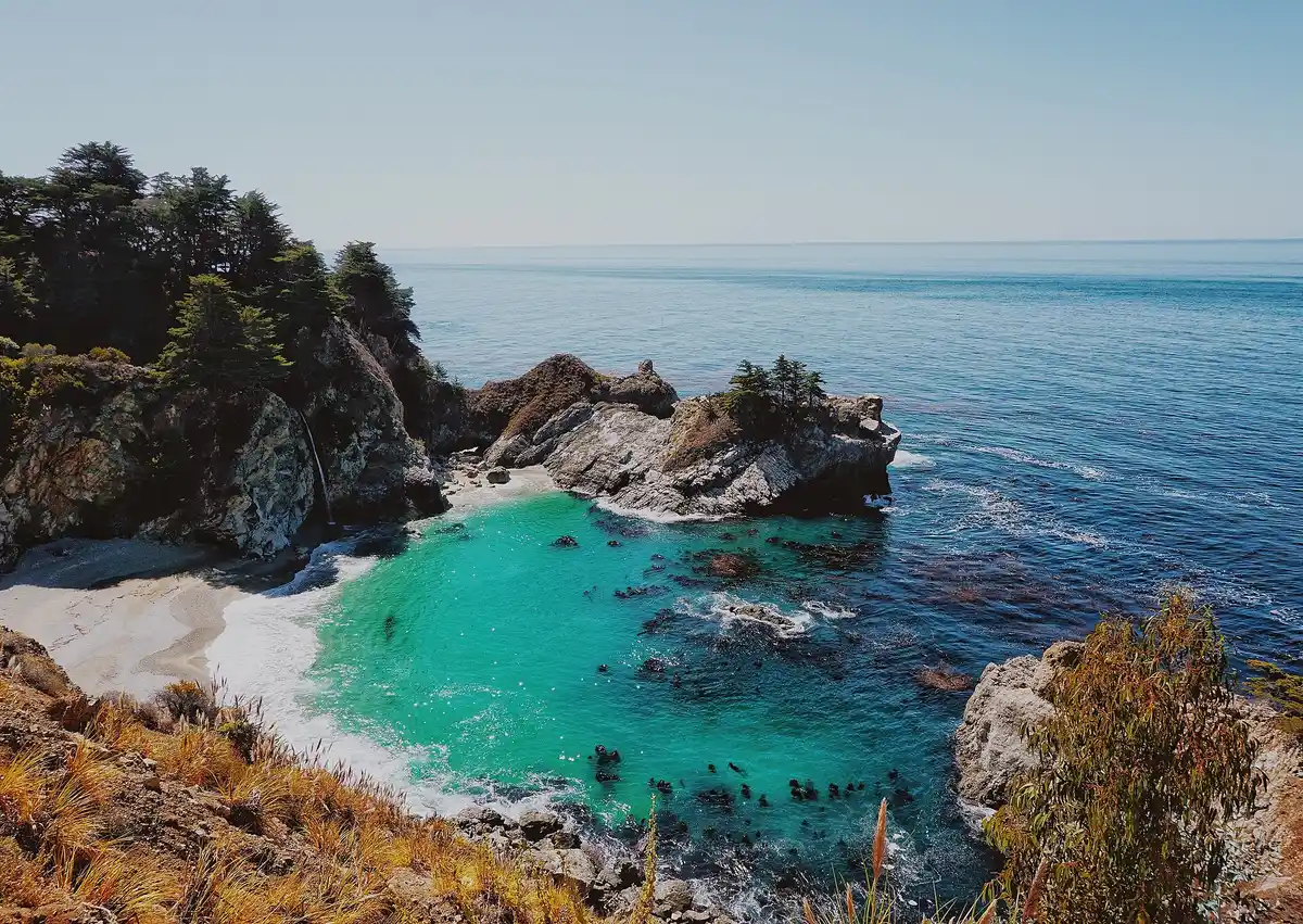
Big Sur is the heart of the drive and the reason most people come. For roughly 90 miles the mountains fall straight into the sea, and the highlights come fast: Bixby Creek Bridge, the arch and blufftop trail at Garrapata, the redwood loops of Pfeiffer Big Sur State Park, and McWay Falls, which drops onto a cove beach in Julia Pfeiffer Burns State Park. This is where you want to spend the most time and, ideally, the night. Our Big Sur hiking itinerary breaks the best trails into a day by day plan.
4. Hearst Castle and San Simeon
As Big Sur eases into rolling ranch country, Hearst Castle rises on a hilltop above San Simeon. The over-the-top Gilded Age estate is a ticketed tour and worth booking ahead. A few minutes north, the Piedras Blancas elephant seal rookery lets you watch hundreds of seals hauled out on the beach year round, one of the best free wildlife stops on the whole route.
5. Morro Bay and San Luis Obispo
Morro Bay is defined by Morro Rock, a 576 foot volcanic plug guarding the harbor, with an easy waterfront, kayaking, and sea otters in the estuary. Nearby San Luis Obispo makes a friendly overnight base with a walkable downtown and good food. This stretch is a natural midpoint if you split the drive over more days.
6. Santa Barbara
Santa Barbara is the polished finale before the road bends toward Los Angeles, a red-tiled, mission-era town with broad beaches, the Old Mission, and wine country in the hills behind it. From here the Channel Islands sit just offshore. If you want to trade the car for a paddle, our Channel Islands kayaking weekend reaches the sea caves and wildlife of the national park. From Santa Barbara it is about a two hour drive down to Los Angeles.
Which direction to drive, and the reverse LA to SF route
If you can choose, drive the Highway 1 road trip itinerary southbound. On the Pacific Coast Highway the southbound lane hugs the cliff edge while the northbound lane rides against the hillside, so heading San Francisco to Los Angeles puts you closest to the water and makes the vista pullouts a simple right turn. That said, plenty of travelers fly into Los Angeles and drive the reverse LA to SF direction. It works fine: the views are the same, you just cross the road to reach the ocean-side turnouts, so use the marked vista points and take your time. The tidiest option of all is to fly into one city and out of the other so you never have to backtrack the route.
How many days for the Highway 1 road trip itinerary
Give the San Francisco to Los Angeles drive 3 to 5 days.
- 3 days: the efficient version. Night one near Monterey, night two in or near Big Sur, night three around San Luis Obispo or Santa Barbara. You will see the greatest hits without lingering.
- 4 days: add a slower morning in Big Sur for a real hike, plus a Hearst Castle tour at San Simeon.
- 5 days: the relaxed version. Fold in Santa Cruz, the 17 Mile Drive, Point Lobos, Morro Bay, and a full afternoon in Santa Barbara.
Only have a weekend? Focus on Monterey to Big Sur, which packs the most dramatic coast into the shortest distance.
Big Sur landslides and closures: check before you go
The Big Sur section of Highway 1 is carved into steep, unstable coastal mountains, and it is genuinely prone to landslides and storm damage. Sections have closed for months at a time in recent years, and a single slide can sever the route and force a long detour inland on Highway 101. None of this should scare you off, but it does mean one rule: check the current road status with Caltrans (the California Department of Transportation) before you drive, ideally the morning you set out. Caltrans posts closures and detours, and conditions change, so trust the live status over any older map or blog. Build a little buffer into your schedule in case you have to reroute.
Optional extension: north up the wild California and Oregon coast
Highway 1 does not end at San Francisco. It runs north past Point Reyes, the Sonoma and Mendocino coast, and into the redwoods, and the coastline only gets wilder and quieter from there. If you have extra days and want to trade crowds for solitude, keep going. The remote Lost Coast backpacking route in Humboldt County is the most rugged stretch of shoreline in the state, so wild that the highway builders gave up and routed around it. Cross into Oregon and the Oregon Coast Trail strings together five days of beaches, headlands, and sea stacks. It is the natural next chapter for anyone who finishes the California drive wanting more coast.
Plan your Highway 1 road trip
The Pacific Coast Highway rewards the travelers who get out of the car. The best way to do that is to anchor your trip around the hikes: our Big Sur hiking itinerary maps the redwood and blufftop trails at the center of the drive, the Channel Islands kayaking weekend adds an offshore adventure from Santa Barbara, and if you push north the Lost Coast and Oregon Coast Trail carry the coast even farther. Pick your days, check Caltrans for Big Sur, and drive southbound for the best seat in the house.
Highway 1 Road Trip Itinerary: The California Pacific Coast Highway FAQs
Plan 3 to 5 days for the classic California Highway 1 road trip itinerary from San Francisco to Los Angeles. Three days is the fast version: one night near Monterey, one in or near Big Sur, and one around San Luis Obispo or Santa Barbara. Five days lets you slow down for Santa Cruz, the 17 Mile Drive, longer Big Sur hikes, a Hearst Castle tour at San Simeon, and a full stop in Santa Barbara. If you only have a weekend, focus on the Monterey to Big Sur stretch, which holds the most dramatic coast.
Drive Highway 1 southbound, from San Francisco to Los Angeles, so you are in the ocean-side lane the whole way. On the Pacific Coast Highway the northbound lane sits against the hillside, while the southbound lane hugs the cliff edge, which means the best pullouts and overlooks are on your side and easy to reach without crossing traffic. If your flights force you to start in Los Angeles, you can still drive the reverse LA to SF direction and simply pull off at the marked vista points, or fly into one city and out of the other to avoid backtracking.
The signature stops on a California Highway 1 road trip itinerary, north to south, are Santa Cruz and its boardwalk, the Monterey Peninsula with Cannery Row and the 17 Mile Drive, Big Sur with Bixby Bridge and McWay Falls, Hearst Castle at San Simeon and the nearby elephant seal rookery, Morro Bay and its harbor rock, and Santa Barbara with its Spanish mission and beaches. Between them, dozens of state beaches and turnouts invite you to stop for whale watching, tide pools, and photos.
The Big Sur stretch of Highway 1 is prone to landslides and storm damage, and sections have closed for months at a time in recent years. Always check the current road status with Caltrans (the California Department of Transportation) before you drive, since a single slide can force a long detour inland on Highway 101. Closures are usually well signed and Caltrans posts detours, but they can add hours, so build in a buffer and confirm the route the morning you set out rather than trusting an older map.
The best hiking on the route is in Big Sur, where Julia Pfeiffer Burns State Park frames McWay Falls, Pfeiffer Big Sur State Park has redwood loops, and Andrew Molera and Garrapata State Parks open onto bluff and beach trails. Point Lobos near Carmel is a short, spectacular walk on the north end. If you extend the trip up the coast, the Lost Coast in Humboldt County is California hiking at its wildest. Our Big Sur hiking itinerary maps the best trails into a day by day plan you can drop into the middle of the drive.
Yes. Highway 1 keeps going north from San Francisco past Point Reyes, the Sonoma and Mendocino coast, and the redwoods, and you can continue all the way up the wild California and Oregon coast. It is slower, foggier, and far less crowded than the Big Sur stretch. Good add-ons are the remote Lost Coast in Humboldt County and, across the state line, the Oregon Coast Trail for five days of beach and headland walking.
Yes. The worked day-by-day plan is Hiking Trails in Big Sur California: A 3-Day Coast Itinerary (3 Days), with the permits, the stays and the drive times already sorted. Tell us your dates and we will put it together for you and confirm what is genuinely open on those days. Asking is free: no card, no deposit, and nothing is held until you say yes.







