Tour du Mont Blanc Eight Days, Three Countries
The walk that circles a mountain
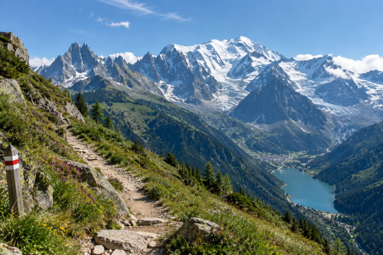
A hundred and five miles around the roof of Western Europe, sleeping in mountain huts, crossing a border on foot twice, and never once carrying a tent. Counter-clockwise from Les Houches, mapped col by col.
Guided from $6,120 per person. Free to ask, pay after the guide confirms.
“I’ve requested to book a Chain Lakes Loop guide on ExplorOFF, and it was the best idea ever! I highly recommend going with their guided option since you get a real human connection on the trail and don’t have to worry about a thing. Yulia was great to talk to!”




 23 stops on a real mapEvery stop pinned in order→
Tour du Mont Blanc: every stop pinned in order.
The counter-clockwise circuit, Les Houches to Chamonix
Every stop on this trip, in order, opens as one driving route in the Google Maps app. No copying addresses across one at a time.
Plan and book your 8 days in the TMB, one step at a time
- The refuge season on the TMB runs mid-June to mid-September. Rifugio Bonatti takes its last guests on September 30, 2026, so a walk starting now finds most refuges shut and has to plan around village hotels. Source
- Refuge and guesthouse beds for the whole circuit book through the official Tour du Mont-Blanc portal; the 2027 season is not open for booking yet. Source
How 8 days in the TMB split up
Plan 8 days for the TMB. Distance: 105 mi. Ascent: 32,800 ft. Walking days: 8. The Tour du Mont Blanc is a loop of roughly 170 km around the Mont Blanc massif, crossing from France into Italy over the Col de la Seigne and out of Italy into Switzerland over the Grand Col Ferret, before coming back into France at the Col de Balme. You end up almost exactly where you started, having walked around a mountain rather than up it.
Day 1: Les Houches to Les Contamines-Montjoie
4 stops · Day one
Day 2: Over the Col du Bonhomme to Les Chapieux
4 stops · Day two
Day 3: Into Italy over the Col de la Seigne
3 stops · Day three
Day 4: The Mont de la Saxe balcony to Rifugio Bonatti
2 stops · Day four
Day 5: Into Switzerland over the Grand Col Ferret
2 stops · Day five
Day 6: La Fouly to Champex-Lac
2 stops · Day six
Day 7: Champex to Trient, by Bovine or the Fenêtre d’Arpette
2 stops · Day seven
Day 8: Back into France over the Col de Balme
4 stops · Day eight
Les Houches to Les Contamines-Montjoie
A gentle opening by TMB standards. Take the Bellevue cable car out of Les Houches if you want to save 800 m of climbing on day one, which almost everyone does, then traverse under the Bionnassay glacier and drop through the Chalets de Miage to Les Contamines.
Not the order you want? Drag a stop, or use the arrows beside it. Stops move between days too.
- Travel from
Shuttle to Chamonix, about 1h15 · Drive - Les Houches
The start of the loop · ViewpointThe traditional start and finish, a few minutes down the valley from Chamonix.
- Col de Voza
1,653 m · Hike - Les Contamines-Montjoie
Night 1 · lodge
Over the Col du Bonhomme to Les Chapieux
The first big day, and the one that tells you what the next week will be like. A long steady climb up the Montjoie valley past the Notre-Dame de la Gorge chapel, then up to the Col du Bonhomme at 2,329 m and on to the Col de la Croix du Bonhomme at 2,479 m.
Not the order you want? Drag a stop, or use the arrows beside it. Stops move between days too.
- Notre-Dame de la Gorge
Roman road and chapel · Viewpoint - Col du Bonhomme
2,329 m · Hike - Col de la Croix du Bonhomme
2,479 m · Hike - Les Chapieux
Night 2 · lodgeA hamlet with a refuge and a dairy. That is the whole place.
Into Italy over the Col de la Seigne
The best day of the first half. Up the Vallée des Glaciers to the Col de la Seigne at 2,516 m, where you step across the French Italian border and the whole south side of Mont Blanc opens in front of you in one go. People stop dead at this col. It is worth the stop.
Not the order you want? Drag a stop, or use the arrows beside it. Stops move between days too.
- Col de la Seigne
2,516 m · France to Italy · HikeThe border col, and the first full sight of the Italian side of Mont Blanc.
- Rifugio Elisabetta
Lunch below the Col de la Seigne · Viewpoint - Courmayeur
Night 3 · halfway resupply · lodge
The Mont de la Saxe balcony to Rifugio Bonatti
Short on distance, enormous on view. Climb out of Courmayeur onto the Mont de la Saxe and walk the Grand Balcon: a high traverse with the Grandes Jorasses, the Dent du Géant and the whole Italian face of Mont Blanc across the valley the entire way.
Not the order you want? Drag a stop, or use the arrows beside it. Stops move between days too.
- Mont de la Saxe balcony
The best sustained view on the TMB · Hike - Rifugio Bonatti
Night 4 · lodgeThe most sought-after bed on the circuit, facing the Grandes Jorasses.
Into Switzerland over the Grand Col Ferret
The second border crossing, and the highest col of the route so far. A steady pull up the head of the Italian Val Ferret to the Grand Col Ferret at 2,537 m, then a long descent into the Swiss Val Ferret and the village of La Fouly.
Not the order you want? Drag a stop, or use the arrows beside it. Stops move between days too.
- Grand Col Ferret
2,537 m · Italy to Switzerland · Hike - La Fouly
Night 5 · lodge
La Fouly to Champex-Lac
The easiest walking day on the circuit and a welcome one after two big cols. A gentle descent along the Dranse de Ferret through Praz de Fort and Issert, then a modest climb through forest to Champex-Lac, a small resort set around a lake.
Not the order you want? Drag a stop, or use the arrows beside it. Stops move between days too.
- Praz de Fort
Swiss valley hamlet · Viewpoint - Champex-Lac
Night 6 · lodgeA small lake resort and the best place on the route to take a rest day.
Champex to Trient, by Bovine or the Fenêtre d’Arpette
The one real decision on the TMB. The Fenêtre d’Arpette at 2,665 m is the highest point of the whole circuit, a steep rocky scramble beside the Trient glacier, and the finest single stage on the route if the weather holds. It is also long, and unpleasant in rain or lingering snow.
Not the order you want? Drag a stop, or use the arrows beside it. Stops move between days too.
- Fenêtre d’Arpette
2,665 m · the high point · HikeThe highest point of the circuit and the finest stage, in good weather only.
- Trient
Night 7 · lodge
Back into France over the Col de Balme
The closing day. Climb from Trient to the Col de Balme at 2,191 m, where you cross back into France and the entire Chamonix valley opens below you with Mont Blanc at its head. It is the view the whole loop has been building towards, because this time you have walked all the way around the thing you are looking at.
Not the order you want? Drag a stop, or use the arrows beside it. Stops move between days too.
- Col de Balme
2,191 m · Switzerland to France · HikeThe whole Chamonix valley opens below, with Mont Blanc at its head and the entire loop behind you.
- Argentière
Valley train into Chamonix · Viewpoint  Tandem paragliding flight over Chamonix
Optional · 15 to 30 min in the air · 4.95 from 465 reviews · activityYou have walked all the way around Mont Blanc; this is the way to see the whole massif at once. Meet your pilot at the Planpraz lift in Chamonix, ride up, and fly 15 to 30 minutes facing Mont Blanc before landing in the valley. Book it for the afternoon you arrive, or the next morning if the legs need a rest; flights are weather dependent.
Book this →- Chamonix
Night 8 · the loop closes · lodge
Book the 7 nights
Beds near the trailheads are the one thing on this trip that genuinely runs out. Everything else can be decided later.
Tell us your dates and we will do the checking. We find what is still open near each trailhead and email you this plan back with a booking link for each night. Nothing is charged and you decide at the end.
Request to bookWhat to pack for the TMB
Built from this route, not a generic list. Every line says why it is here.
On every day of this trip
On your feet
Because you are sleeping indoors
For the driving days
What actually decides your trip
Book the huts in January
Summer beds open in January and Bonatti and Elisabetta are gone within weeks. Book huts first, flights second. It is the only part of this trip that genuinely sells out.
Go counter-clockwise
The huts, the signs and the bus timetables all assume it, and you meet fewer people head-on. Clockwise works but you will be swimming against the current all week.
Ten thousand metres of up
The distance is manageable. The ascent is what breaks people. Train on hills with a loaded pack, and use poles on the descents from day one, not from day four when your knees complain.
You can bail almost anywhere
Valley buses run from Les Contamines, Courmayeur, La Fouly, Champex and Trient. A bad forecast or a bad knee costs you a stage, not the trip.
Take the half board
Dinner and breakfast at the refuge is usually the only food available and it is good. Carry lunch, snacks and cash. Some huts still do not take cards.
Three countries, two currencies
France and Italy are euros, Switzerland is francs. Swiss huts take euros at a rate that will annoy you. Draw francs in Courmayeur before you cross.
Tour du Mont Blanc questions
Tmb hike: the questions people ask most.
It is a serious walk but not a technical one. No scrambling is required on the main route, the paths are well made and signed, and there is a bed and a hot dinner at the end of every day. The difficulty is cumulative ascent: around 10,000 m over eight days, which is roughly 4,000 ft of climbing per day. If you can walk uphill for six hours with a light pack and do it again the next morning, you can walk the TMB.
Eight walking days is the standard fit schedule and the one on this page. Ten or eleven days is the relaxed version with shorter stages and a rest day, and it is the better choice for a first long-distance walk. Seven days is possible using the Courmayeur and Champex bus links. Add a travel day at each end whatever you choose.
Late June to mid September, which is when the refuges are open. July and August are the most reliable weather and the most crowded. Early to mid September is the sweet spot: quieter trails, stable weather, autumn colour, but huts start closing from around the middle of the month so check dates before you commit.
Yes, and earlier than you think. Bookings for the summer open in January and the best-placed huts, Rifugio Bonatti and Rifugio Elisabetta especially, fill within weeks. Turning up without a reservation in July or August means sleeping in a valley hotel and taking buses. Book the huts before you book the flights.
No. The TMB is a hut to hut route and you can walk the whole circuit sleeping in refuges, gites and hotels. Wild camping is restricted across much of the route and banned in parts of the Italian and Swiss sections. Carrying a tent means carrying weight you do not need up 10,000 m of ascent.
Counter-clockwise from Les Houches, which is what almost everyone does. The hut booking patterns, the signage and the valley bus timetables are all built around it, and you will pass fewer people coming the other way. Clockwise is perfectly walkable, just consistently against the flow.
Yes. It is waymarked throughout, busy in season, and the navigation is straightforward in good visibility. A map, a GPS track and the ability to read a mountain forecast are enough. A guide is worth it if you want the harder variants in mixed weather, or you would rather not deal with the hut booking at all.
The traditional start and finish is Les Houches, a few minutes down the valley from Chamonix. Most people fly into Geneva, take the shuttle to Chamonix, and start and end there. You can join the loop anywhere: Courmayeur and Champex are both easy places to begin if your travel suits them better.
Yes. Tell us your dates and we check what is still open for the plan on this page, then send it back with a booking link for each night and the total. Nothing is charged and nothing is held, and you pay the normal rate.
Pick how you want to go.
Same 8-day route. Same 14 stops.
- 7 nights, refuges and gites, dinner and breakfast included
- $1,218
- Tandem paragliding flight
- $358
- Shared shuttle, Geneva Airport to Chamonix and back
- $202
- A private local guide, rooms and campsites booked
- Included
- Airport pickup and every drive
- Included
- Park, permit and campsite fees paid
- Included
- All the gear and the trail meals
- Included
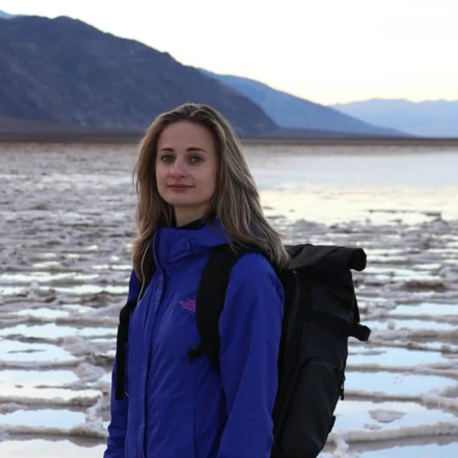
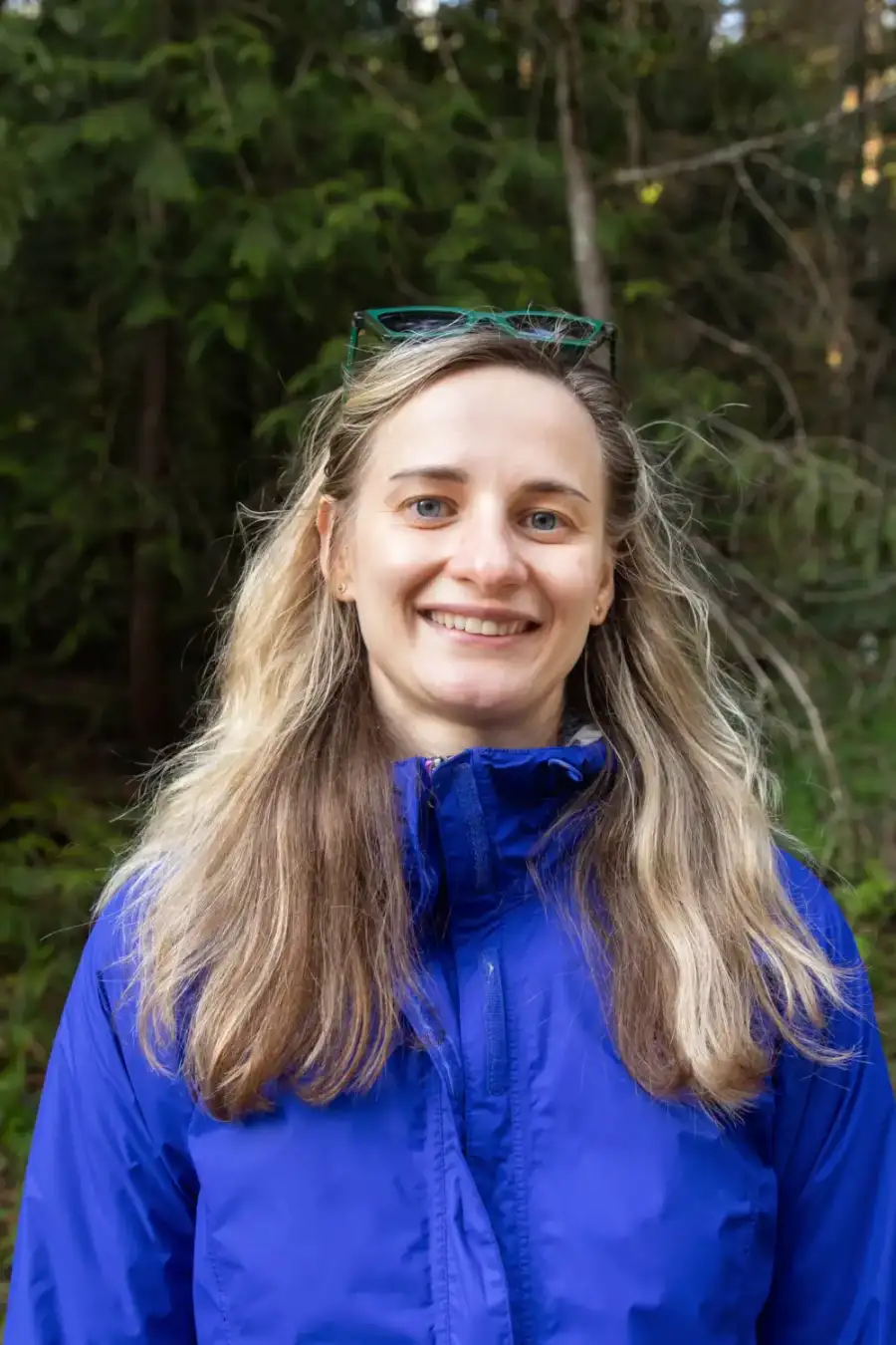
Written and walked by Yulia Vasilyeva · Co-founder · Lead planner and guide
Three years leading guided hikes in the Pacific Northwest, rated 5.0 by 20+ verified guests, and she builds every custom itinerary herself. Based in Seattle.
Last checked October 2026
You might also love these
Other itineraries near this one.

Best Things to Do in Bergen, Norway: 3-Day Fjord Itinerary
The best things to do in Bergen, Bryggen, Mount Fløyen, and the Fish Market, plus the Flåm Railway and a Nærøyfjord cruise on the…

Iceland Itinerary: The Perfect 6-Day Highlights Loop
A 6-day Iceland self-drive: the Golden Circle, the south-coast waterfalls, the Jökulsárlón glacier lagoon, Diamond Beach, and the…
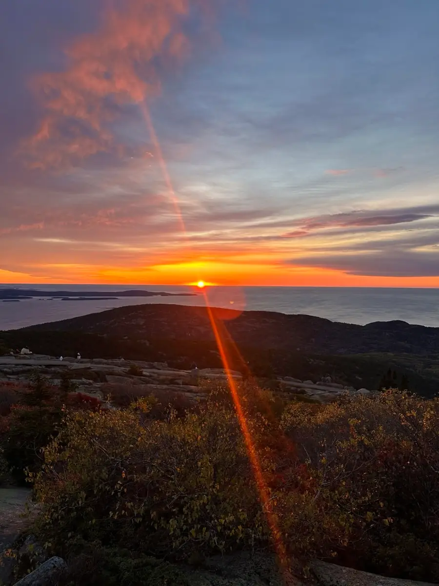
Acadia National Park 3-Day Itinerary: Best Hikes + Where to Stay
Three days in Acadia: Cadillac Mountain sunrise, the iron-rung Precipice Trail, Jordan Pond popovers, the car-free carriage roads, and…
Guides for this tripDolomites ItineraryTour du Mont Blanc CostTour du Mont Blanc Hut to HutTour du Mont Blanc Packing List
What adventurers say about us.
All reviews are from verified guests. ★★★★★ 5.0 average from 20+ bookings.
"Felt like going out with a really knowledgeable friend who just happens to know everything about the area. No awkward tour-guide energy, just a magnificent day."
"Yulia is an incredible guide. She knew every trail, every viewpoint, and exactly how to pace the day for our group. The photos she took of us were stunning. 100% booking again."
"I was visiting Seattle solo and this was the best decision I made on the trip. Yulia picked me up, had snacks, and took us to a trail I never would have found on my own. Absolute must-do."
"We did this as a couple's trip and it was perfect. Yulia adapted everything to us, our pace, our interests, our photo obsession. The mountain views were unreal."
"Phenomenal experience. Yulia has deep local knowledge and a real passion for the outdoors. She went out of her way to show us the hidden gems tourists never see. Will remember this forever."
"I've done a few guided hikes and this was by far the best. Yulia is warm, funny, and genuinely expert. The trail she chose had the most insane wildflower bloom, we got so lucky."
Fees, reservation windows, shuttle dates and trail closures are planning estimates. Confirm hours, road status and any reservations with the land manager before you go.
What other travelers are saying
Be the first to leave a tip or question for the next traveler.
Was this helpful?
One tap. It goes straight to Yulia and Margarita.
You can't hike it if you can't get the permit.
The best hikes in America run on lotteries that open once a year and sell out in minutes. Every trail runs on its own calendar. Pick the ones you want and we do the watching.
 The WaveCoyote Buttes North · Arizona / UtahPermitLotterybrutal odds
 Half Dome CablesYosemite NP · CaliforniaPermitOpens Mar 1fair odds
 Mt. WhitneyInyo NF · CaliforniaPermitOpens Feb 1tough odds
 Angels LandingZion NP · UtahPermitLotterytough odds
 The SubwayZion NP · UtahPermitLotterytough odds
 Mount St. Helens Summit ClimbGifford Pinchot NF · WashingtonPermitReservationtough odds
How it works
- An email the morning each window opens, never the day after.
- A 14-day heads-up so you can line up your group and dates.
- Win odds and a ranked backup plan for every trail you pick.
Didn't win? We keep watching. We check recreation.gov every day for The Enchantments, Half Dome and Angels Landing, and email you the moment a sold-out date frees up. Cancellations are the second chance most people never hear about.