Arches, Antelope Canyon & the Grand Canyon, One Seven-Day Loop from Las Vegas
Three icons, one loop, and less driving than you fear.
Three of the most photographed places in the Southwest are farther apart than they look on a map. This loop joins them with the least driving: Moab for Arches and Canyonlands, a night in Monument Valley, Page for Antelope Canyon and Horseshoe Bend, two nights on the South Rim.
“I’ve requested to book a Chain Lakes Loop guide on ExplorOFF, and it was the best idea ever! I highly recommend going with their guided option since you get a real human connection on the trail and don’t have to worry about a thing. Yulia was great to talk to!”




 28 stops on a real mapEvery stop pinned in order→
Arches to the Grand Canyon: every stop pinned in order.
Las Vegas → Moab → Monument Valley → Page → Grand Canyon
Every stop on this trip, in order, opens as one driving route in the Google Maps app. No copying addresses across one at a time.
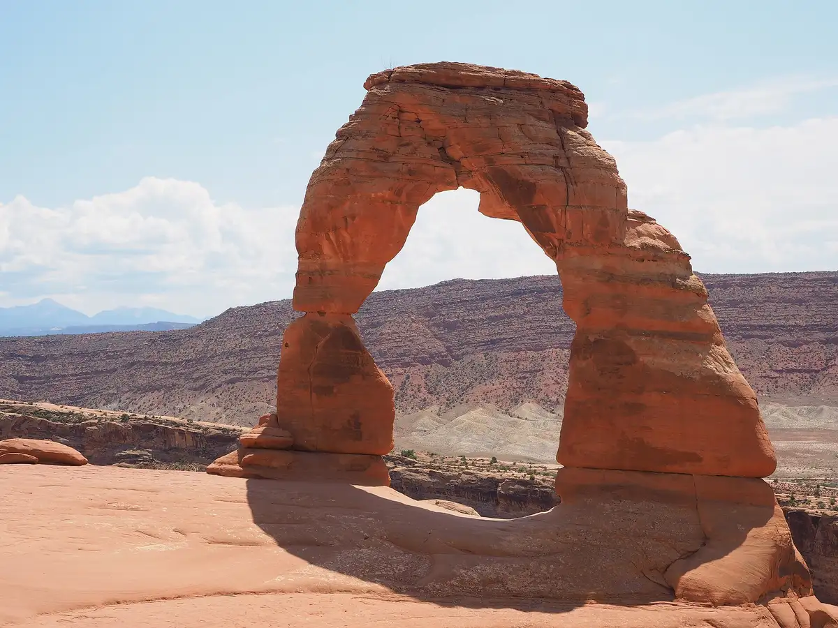
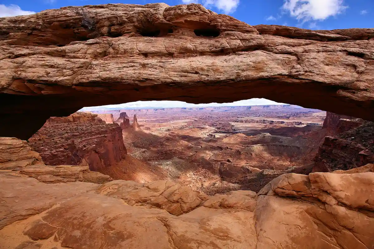
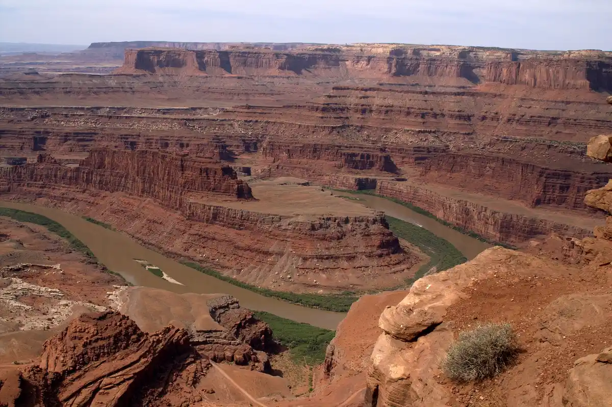
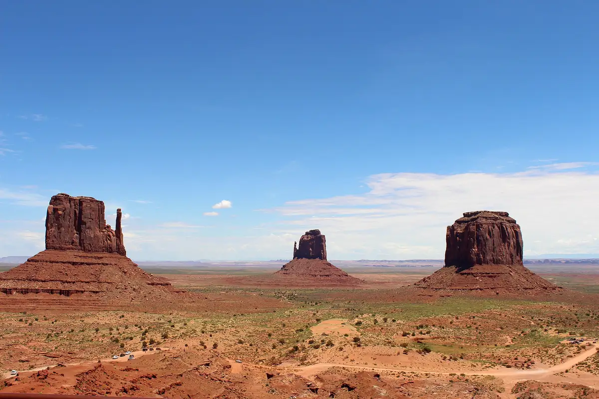
Arches to the Grand Canyon in photos: 6 of the stops.
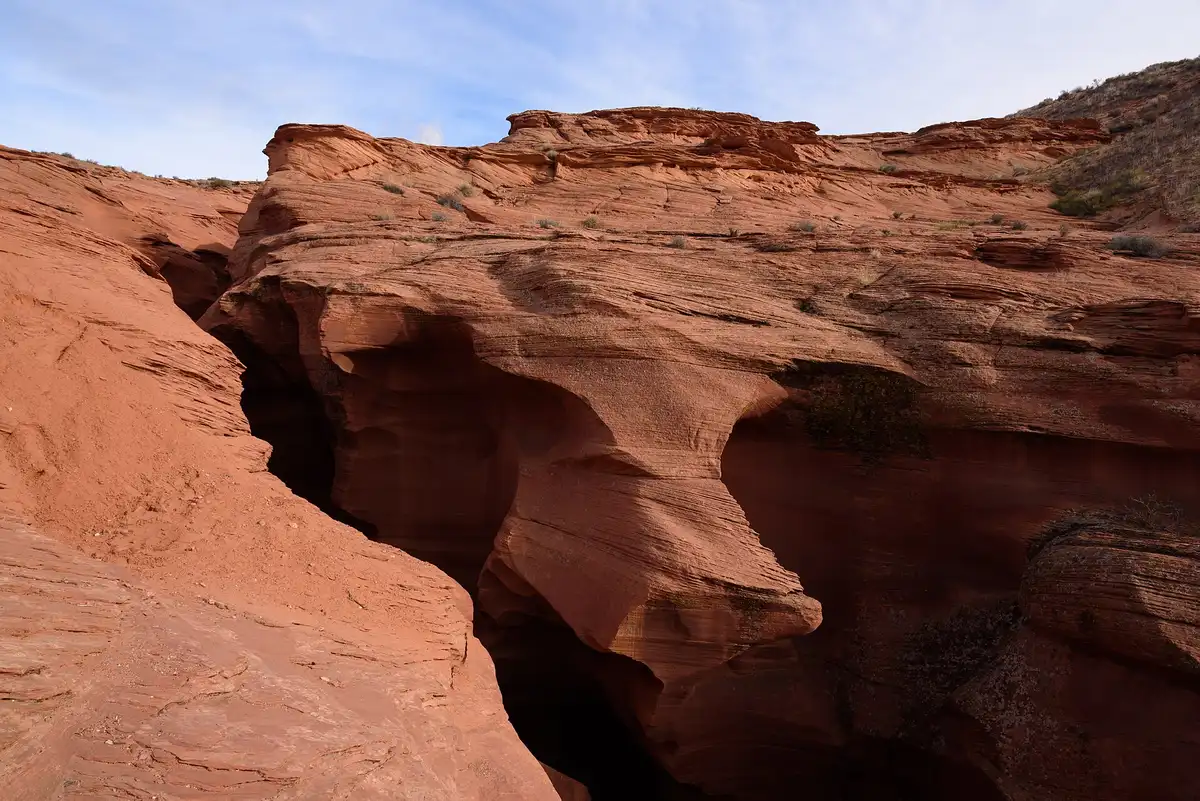
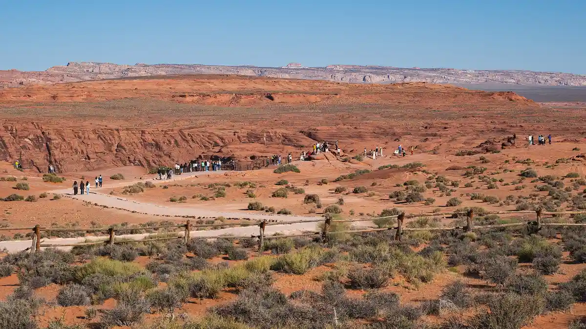
Plan and book your 7 days in Arches to the Grand Canyon, one step at a time
- Lipan Point and its road on Desert View Drive are closed for rebuilding from June 22 to December 23, 2026. Stop at Navajo Point and Grandview Point instead. Source
- After the August 29 flash flood, the South Kaibab Trail is closed below the Tip-Off, with no reopening date. Ooh Aah Point and Cedar Ridge are above the closure. Water is off below the rim, so carry all you need. Source
- Monument Valley switches to winter hours on October 17. The Valley Drive then runs 8 AM to 5 PM, with the last car in at 2:30 PM. Source
- Canyonlands lists a Grand View Point remodel for late summer to early fall 2026, so expect construction at the end of the Island in the Sky road. Source
- Desert View Campground closes for the season on October 18, 2026. The free South Rim shuttles run through November 30. Source
How 7 days in Arches to the Grand Canyon split up
Plan 7 days for Arches to the Grand Canyon. Distance: ~1,400 mi. Arches to Grand Canyon: ~334 mi. Best season: Apr-May, Sep-Oct. People ask how far Arches is from the Grand Canyon because the two look close on a map. They aren't. Arches to the South Rim is about 334 miles and six hours of driving, the South Rim to Antelope Canyon is 143 miles, about 2 hours 45 minutes, and Antelope Canyon back to Arches is 275 miles, about 4 hours 45 minutes. Trying to see all three from one base doesn't work. A loop does.
Day 1: Las Vegas to Moab, and the Windows at Sunset
4 stops · Day one
Day 2: Delicate Arch at Sunrise, Canyonlands by Afternoon
6 stops · Day two
Day 3: Moab to Monument Valley
4 stops · Day three
Day 4: Antelope Canyon and Horseshoe Bend
4 stops · Day four
Day 5: Page to the Grand Canyon by the East Entrance
4 stops · Day five
Day 6: A Full Day on the South Rim
4 stops · Day six
Day 7: Grand Canyon to Las Vegas over the Hoover Dam Bridge
2 stops · Day seven
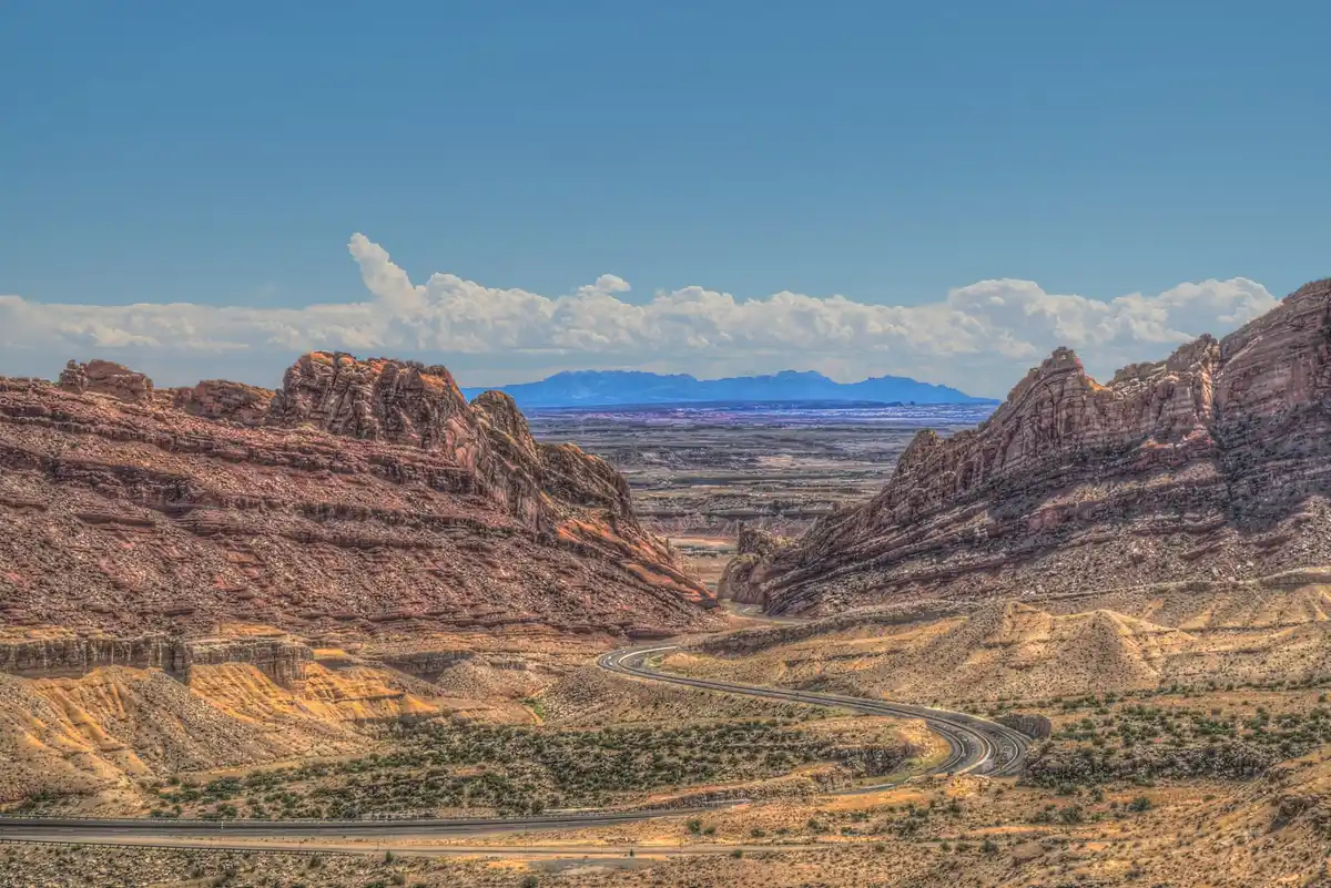
Las Vegas to Moab, and the Windows at Sunset
This is the long one, so leave Las Vegas early. North on I-15 through the Virgin River Gorge, then east on I-70 across the middle of Utah. The best of it comes near the end, where the interstate cuts through the San Rafael Swell in Spotted Wolf Canyon. Turn south at Crescent Junction on US-191 for the last half hour into Moab.
Not the order you want? Drag a stop, or use the arrows beside it. Stops move between days too.
- Drive from
~457 mi to Moab via I-15 and I-70 · DriveNorth on I-15, east on I-70 across Utah, south on US-191 at Crescent Junction. About six and a half hours of driving, and Utah is an hour ahead of Nevada.
- Spotted Wolf Canyon, I-70
San Rafael Swell · viewpoint pullouts · DriveWhere I-70 cuts through the San Rafael Reef. Use the signed view areas, never the shoulder.
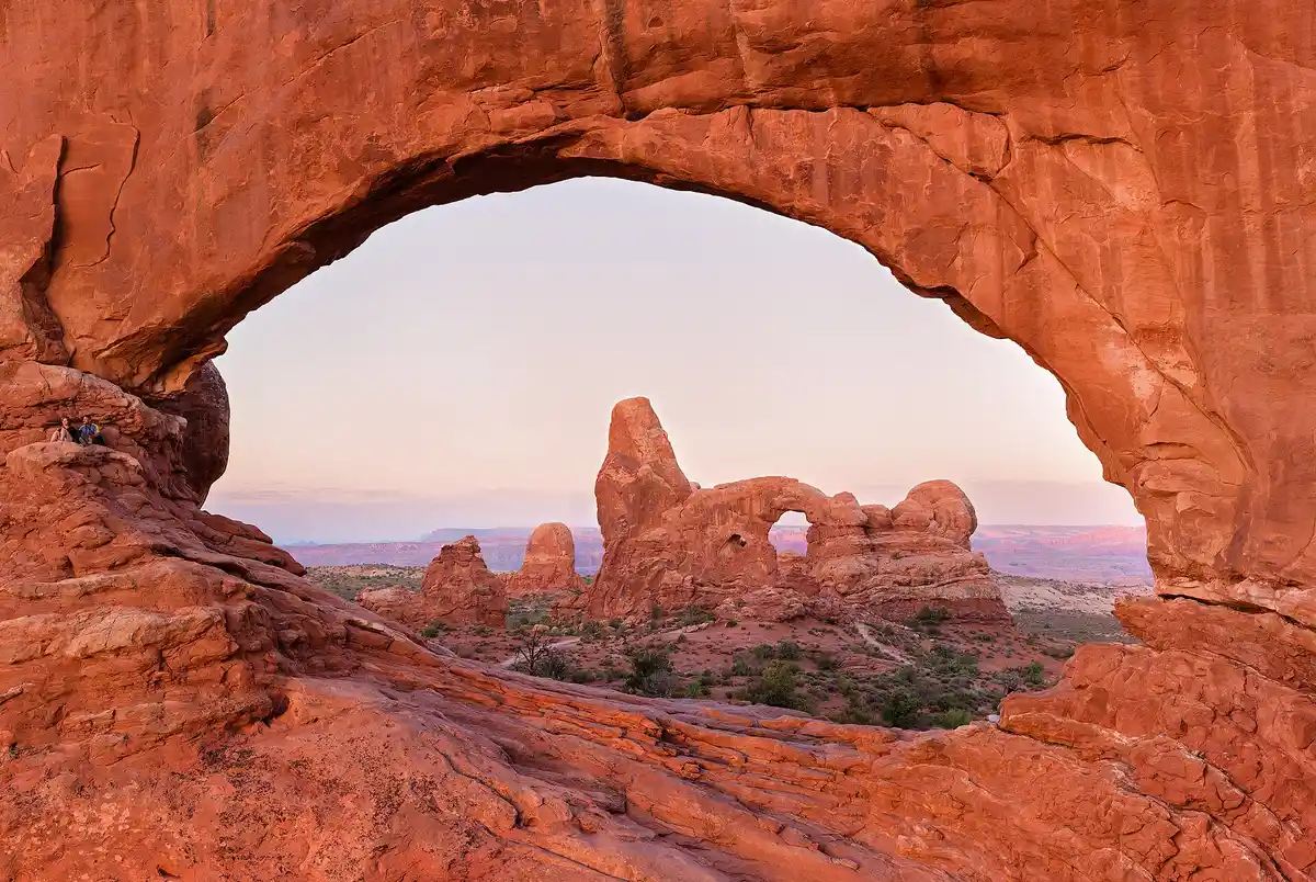 The Windows and Balanced Rock, Arches
Short walks · sunset · ViewpointEasy first-evening walks to the North and South Windows and Turret Arch, with Balanced Rock on the way in. No timed entry in 2026.
Park conditions →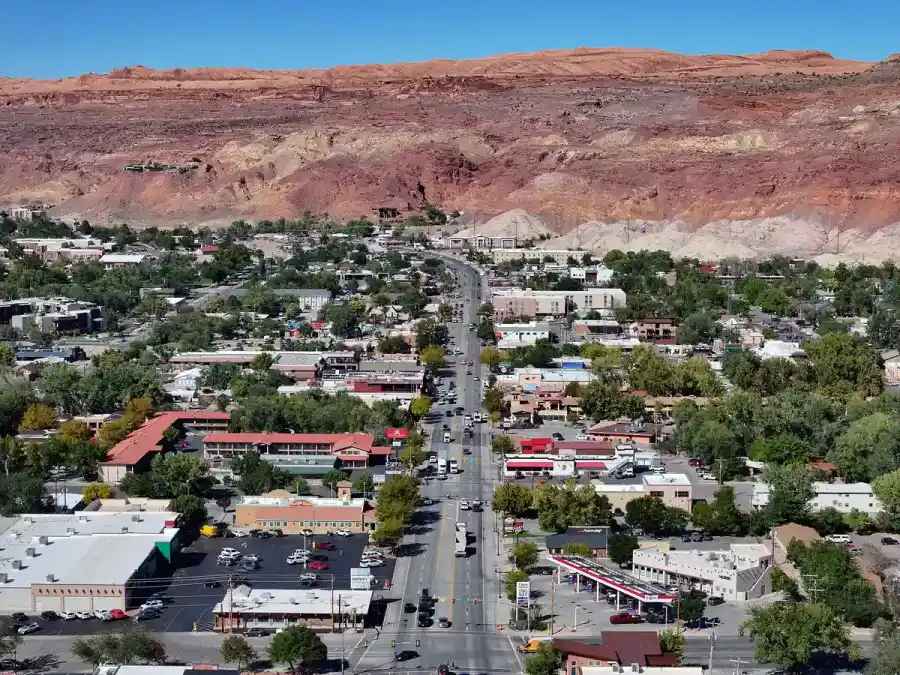 Stay in Moab
Two nights · 10 min from Arches · lodgeThe base for Arches, Canyonlands and Dead Horse Point. Devils Garden Campground inside Arches takes reservations for March 1 to October 31 and is usually full.
Delicate Arch at Sunrise, Canyonlands by Afternoon
Be at the Delicate Arch trailhead at Wolfe Ranch before sunrise. The trail is 3 miles round trip and climbs 480 feet over open slickrock with no shade, which is why it's best done in the cool of the morning. You'll share the arch with far fewer people than at sunset.
Not the order you want? Drag a stop, or use the arrows beside it. Stops move between days too.
- Delicate Arch from Wolfe Ranch
3 mi RT · 480 ft · sunrise · HikeOpen slickrock with no shade to the most famous arch in Utah. Start in the dark with a headlamp and plenty of water.
NPS trail page → 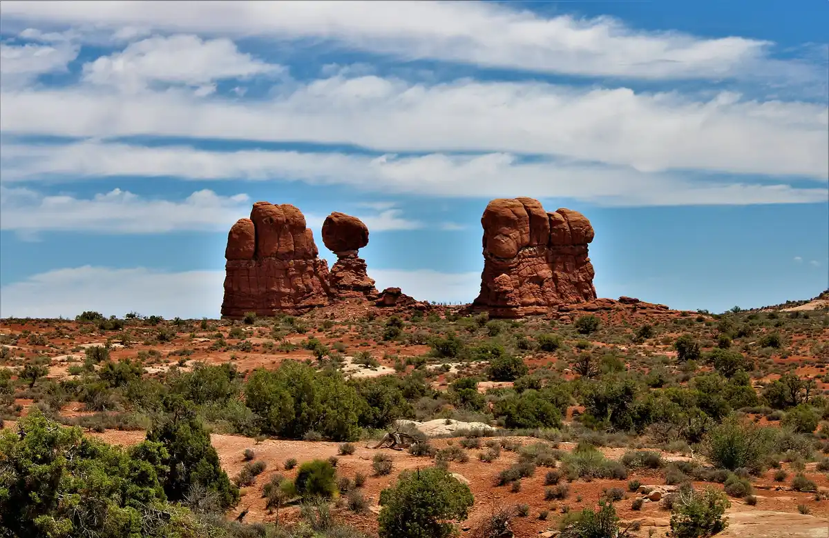 Landscape Arch, Devils Garden
1.9 mi RT · flat · HikeThe longest arch in the park, at the end of the scenic drive, on a flat hard-packed trail.
NPS trail page →- Mesa Arch, Island in the Sky
0.6 mi RT · Canyonlands · ViewpointA short loop to an arch on the rim of the mesa, about 40 minutes from Moab. Canyonlands charges its own $30 fee unless you hold a pass.
NPS info → 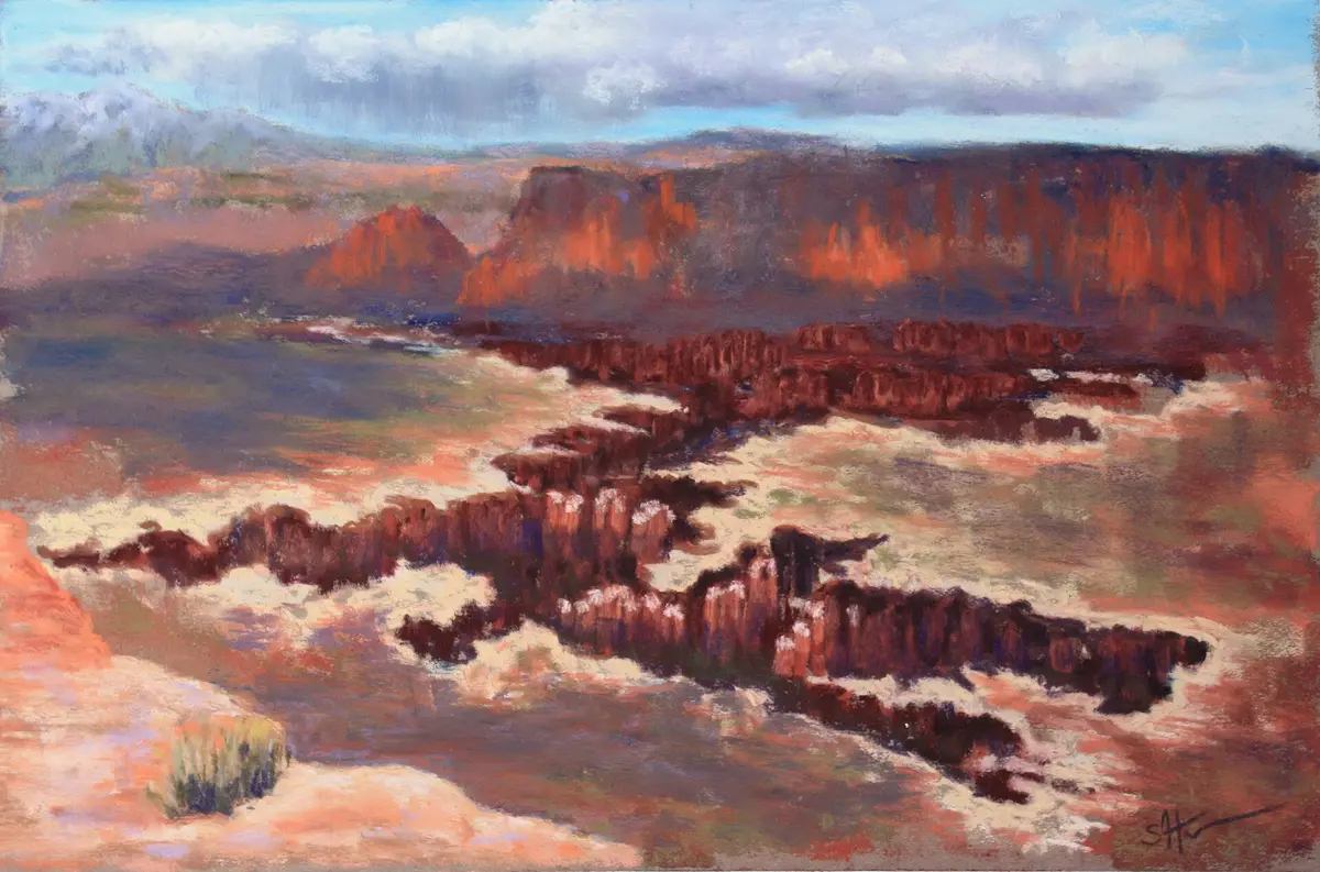 Grand View Point
1.8 mi RT · end of the road · ViewpointA flat rim walk at the south tip of Island in the Sky, over the White Rim and the canyons of the Green and Colorado. The overlook is being remodeled in fall 2026.
NPS info →- Dead Horse Point State Park
Sunset · $20 a car · ViewpointThe gooseneck of the Colorado River far below, on the road back from Canyonlands. A Utah state park, so NPS passes don't count.
State park fees → - Second night in Moab
Back in town · lodgeBack to Moab for the night. Tomorrow is a short drive, so no need for an early start.
Moab to Monument Valley
Head south on US-191 through Monticello and Bluff, then west on US-163 past Mexican Hat, the balanced rock the town is named for. North of the park the road runs dead straight at the buttes. That's Forrest Gump Point, and you'll want to pull over even if you've never seen the film.
Not the order you want? Drag a stop, or use the arrows beside it. Stops move between days too.
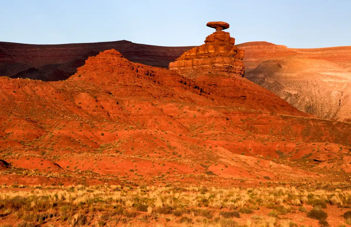 Mexican Hat
US-163 · the balanced rock · DriveSouth through Monticello and Bluff, then west on US-163 past the sombrero-shaped rock the town is named for.
- Forrest Gump Point
US-163 · the straight road · ViewpointThe long straight run of US-163 aimed at the buttes. Pull fully off the road and watch for traffic, because people stand in the lane for photos.
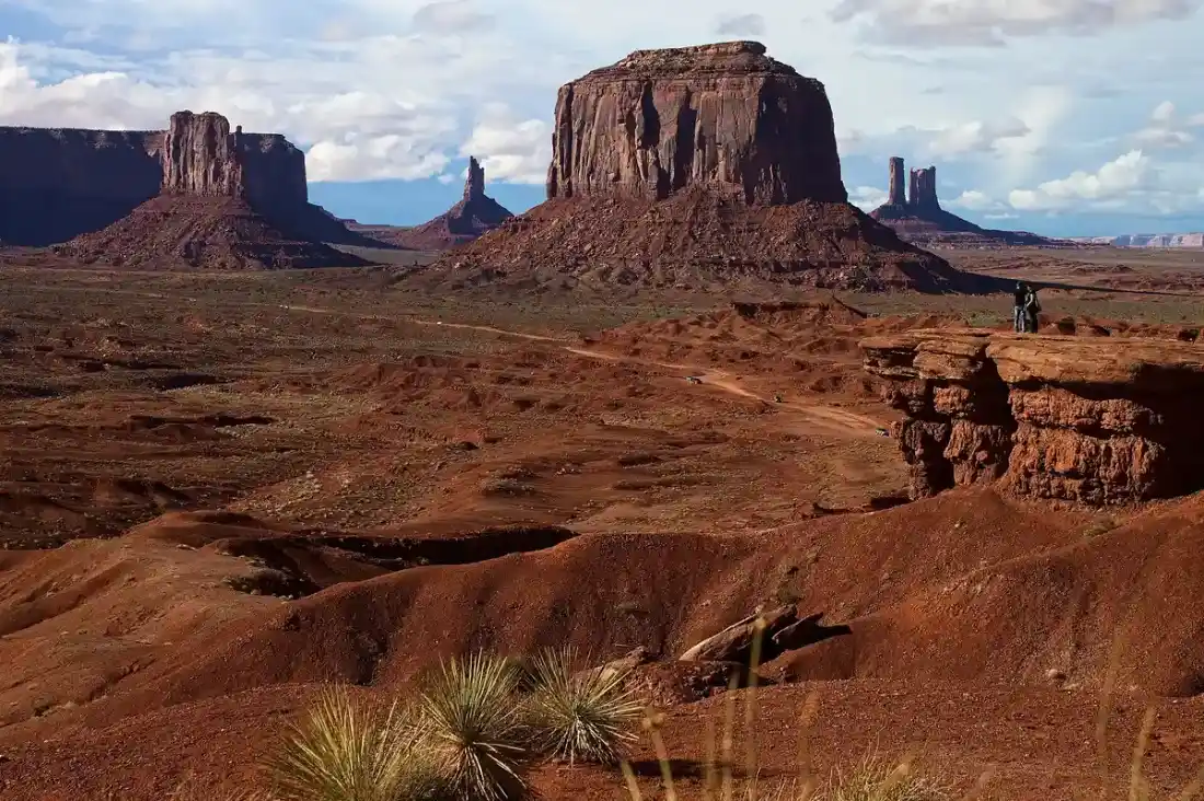 Monument Valley, Navajo-guided valley tour
2.5 hr · or drive the Valley Drive yourself · activityNavajo guides take you past the end of the public Valley Drive into areas closed to private cars. Park entry is $10 a person and $15 a car, and NPS passes don't count.
Book this →- Stay in Monument Valley
One night · few rooms · lodgeRooms inside the tribal park or around Oljato on the Utah side. There are only a handful of places to stay, so book this night early.
Antelope Canyon and Horseshoe Bend
Watch the sun come up over the Mittens, then drive to Page through Kayenta, about 125 miles and two and a quarter hours. Between March and early November your clock goes back an hour as you leave the Navajo Nation for Page, so leaving at 10 AM gets you to Page around 11:15 AM Page time.
Not the order you want? Drag a stop, or use the arrows beside it. Stops move between days too.
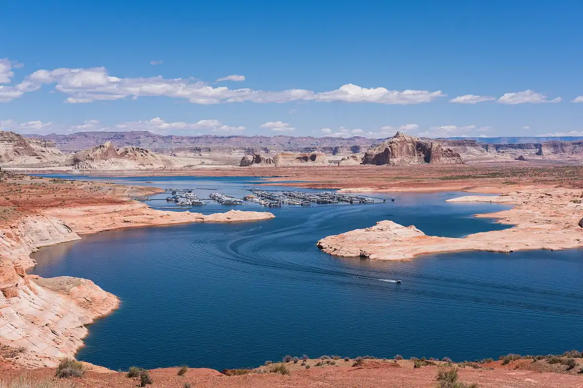 Monument Valley to Page
~125 mi via Kayenta · clocks go back in summer · DriveSouth to Kayenta, west on US-160 and AZ-98 to Page. About two and a quarter hours. From March to early November, Page is an hour behind the Navajo Nation.
- Lower Antelope Canyon tour
~1 hr · Navajo guide · permit included · activityA narrow slot you walk through on steel stairs, with a Navajo guide, which the Navajo Nation requires. The $15 permit is in the price. No bags allowed.
Book this → - Horseshoe Bend
1.5 mi RT · $10 a car · ViewpointA hardened path to the rim above the Colorado River's famous loop. The City of Page runs the lot, $10 a car, sunrise to sunset, and NPS passes don't count.
NPS info → - Stay in Page
One night · Lake Powell · lodgeThe town above Lake Powell and Glen Canyon Dam, minutes from both Antelope canyons and Horseshoe Bend.
Page to the Grand Canyon by the East Entrance
South on US-89 past the Echo Cliffs, then west at Cameron on AZ-64 into the park by the East Entrance at Desert View. Page to Desert View is about 115 miles, two hours, and Arizona keeps one clock all the way, so no change today.
Not the order you want? Drag a stop, or use the arrows beside it. Stops move between days too.
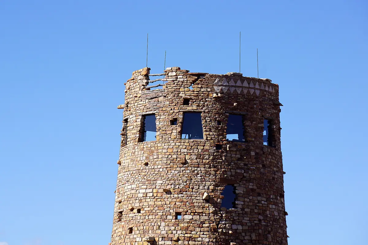
- Desert View Watchtower, East Entrance
~115 mi from Page · ~2 hr · DriveUS-89 south, AZ-64 west at Cameron, into the park by the East Entrance. The stone watchtower is free, upper floors 8 AM to 6 PM.
NPS info → 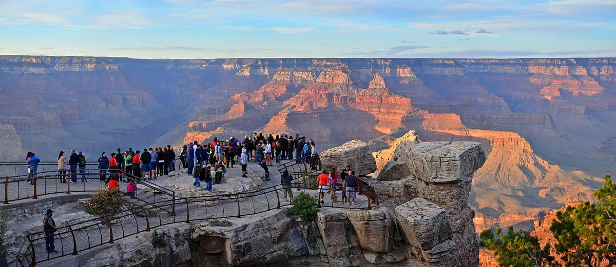 Grandview Point
Desert View Drive · Lipan Point closed · ViewpointOne of the widest views on Desert View Drive. Lipan Point, a few miles east, is closed for rebuilding until December 23, 2026.
- Mather Point
Sunset · by the visitor center · ViewpointThe classic first view of the South Rim, a short walk from the main visitor center and its parking.
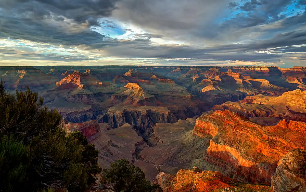 Stay at Grand Canyon Village
Two nights · or Tusayan · lodgeIn-park lodges and Mather Campground ($30) book months ahead. Tusayan, outside the South Entrance, is the fallback.
A Full Day on the South Rim
Take the first Kaibab Rim shuttle to the South Kaibab trailhead, which private cars can't reach, and walk down to Ooh Aah Point, about 1.8 miles round trip and 600 feet down and back up. Go further to Cedar Ridge if you're strong. The trail is closed below the Tip-Off after the August 2026 flood, and there's no water below the rim, so carry your own.
Not the order you want? Drag a stop, or use the arrows beside it. Stops move between days too.
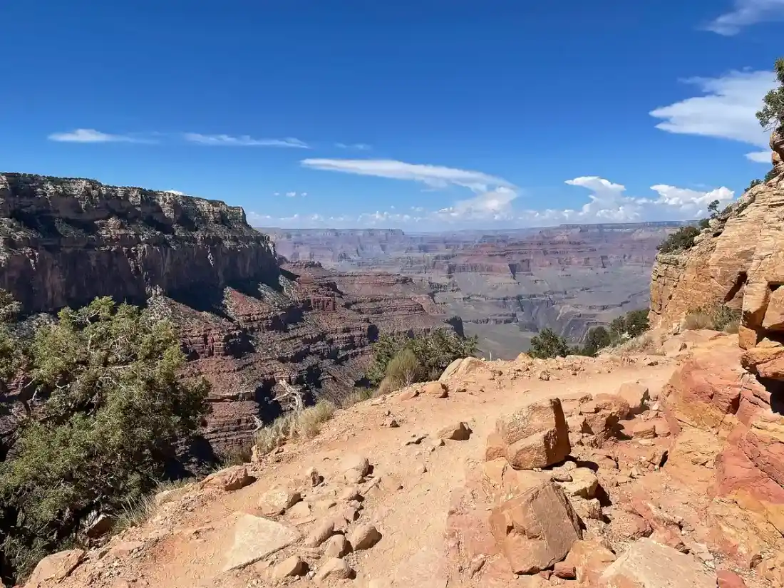 South Kaibab to Ooh Aah Point
~1.8 mi RT · ~600 ft · shuttle only · HikeTake the Kaibab Rim shuttle to the trailhead. The trail is open to the Tip-Off and closed below it after the August 2026 flood. No water below the rim.
Trail closures →- Rim Trail through the Village
Paved · flat · HikeThe paved path along the rim past the historic lodges. The midday walk, while the inner canyon bakes.
- Hopi Point
Hermit Road shuttle · sunset · ViewpointHermit Road is shuttle-only from March 1 to November 30. The free Red route runs until an hour after sunset.
NPS info → - Second night at Grand Canyon Village
Sunrise tomorrow · lodgeLast night on the rim. Yavapai Point is a short walk for sunrise before the drive.
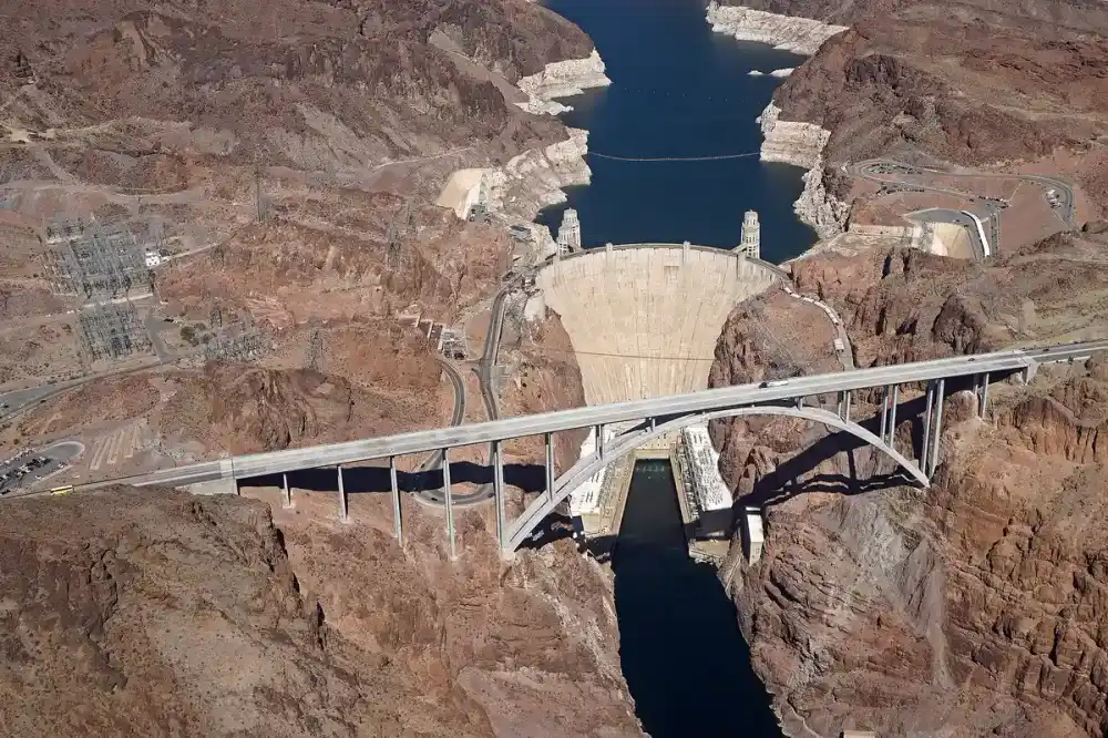
Grand Canyon to Las Vegas over the Hoover Dam Bridge
One last sunrise on the rim, then south to Williams and west on I-40 to Kingman. From there US-93 runs north to Nevada and crosses the Colorado on the Hoover Dam bypass bridge, which has a walkway with a view straight down onto the dam.
Not the order you want? Drag a stop, or use the arrows beside it. Stops move between days too.
- Hoover Dam bypass bridge
US-93 · walkway over Black Canyon · ViewpointThe arch bridge that carries US-93 over the Colorado. Park on the Nevada side and walk out over the dam.
- Fly home from Las Vegas
~281 mi from the Village · ~4.75 hr · DriveHarry Reid International Airport. Las Vegas shows the same time as Arizona from March to early November, and an hour less in winter.
Book the 6 nights
Beds near the trailheads are the one thing on this trip that genuinely runs out. Everything else can be decided later.
Tell us your dates and we will do the checking. We find what is still open near each trailhead and email you this plan back with a booking link for each night. Nothing is charged and you decide at the end.
Request to bookWhat to pack for Arches to the Grand Canyon
Built from this route, not a generic list. Every line says why it is here.
On every day of this trip
On your feet
Because you are sleeping indoors
For the driving days
Specific to Arches to the Grand Canyon
What actually decides this trip.
How far apart they really are
Arches to the Grand Canyon South Rim is about 334 miles and six hours. The South Rim to Antelope Canyon is 143 miles and about 2 hours 45 minutes. Antelope Canyon to Arches is 275 miles and about 4 hours 45 minutes. Las Vegas to Moab is 457 miles. No single base works for all three, which is why this is a loop.
Two clocks, and when they disagree
Nevada runs on Pacific time. Utah and the Navajo Nation, which covers Monument Valley and the land around Antelope Canyon, use Mountain time with daylight saving. The rest of Arizona, including Page and the Grand Canyon, stays on Mountain Standard Time all year. From March to early November that puts Page an hour behind Monument Valley, so read your Antelope tour ticket carefully.
Antelope Canyon needs a Navajo guide
There's no self-guided way into Upper or Lower Antelope. The Navajo Nation requires a guide at every Antelope Canyon location, and the $15 permit is part of the tour price. Book weeks or months ahead for spring and fall, and expect cancellations when storms threaten.
Heat and flash floods
Arches often passes 100F in summer, and the Southwest monsoon, June 15 to September 30, brings sudden storms that flood slot canyons and dirt roads. Hike early, carry more water than you think, and treat a cancelled Antelope tour as good news.
What the passes cover
An $80 America the Beautiful pass covers Arches, Canyonlands and the Grand Canyon. It doesn't cover Dead Horse Point ($20 a car), Monument Valley ($10 a person and $15 a car) or Horseshoe Bend parking ($10). Non-US residents pay $100 each at the Grand Canyon unless they hold the $250 non-resident pass.
Reservations in 2026
Arches dropped timed entry for 2026, so you can drive in any time. Fiery Furnace and Devils Garden Campground still need reservations. The Grand Canyon has no entry reservation, but its lodges and Mather Campground fill months ahead.
Arches to the Grand Canyon: questions before you go
Antelope canyon to arches: the questions people ask most.
About 334 miles and six hours of driving from the Arches visitor center to Grand Canyon Village on the South Rim, without stops. The fastest road runs south on US-191 to Mexican Water, west on US-160 past Kayenta, and in by the East Entrance at Desert View. Going through Monument Valley on US-163 instead adds only a few miles and about 15 minutes, which is why this loop sleeps there on the way.
About 143 miles and 2 hours 45 minutes from Grand Canyon Village to Antelope Canyon outside Page. Entering or leaving the park by the East Entrance at Desert View, as this loop does, makes it about two hours from Page to the rim.
About 275 miles and 4 hours 45 minutes. This loop splits that drive with a night in Monument Valley, which sits almost exactly halfway.
Yes, as a loop from Las Vegas. Two nights in Moab for Arches and Canyonlands, one in Monument Valley, one in Page for Antelope Canyon and Horseshoe Bend, and two on the Grand Canyon South Rim. Day one, Las Vegas to Moab, is the only long drive at about six and a half hours.
No. Arches announced in February 2026 that it would not use timed-entry reservations this year. You still need reservations for Devils Garden Campground and for Fiery Furnace hikes, and the entrance line can top an hour from March to October.
No. Antelope Canyon is on Navajo Nation land and a Navajo guide is mandatory at every Antelope Canyon location. The $15 Navajo permit is included in the tour price. Lower Antelope tours don't allow bags.
Most Antelope Canyon tours run on Arizona time, the same as Page, which doesn't use daylight saving. The surrounding Navajo Nation does, so from March to early November phones near the canyon can jump an hour ahead. Check the time zone on your ticket and set your phone to Phoenix time.
Las Vegas, for this loop. Moab is about six and a half hours from Las Vegas and closer to seven and three quarter hours from Phoenix. Phoenix works better for a trip that only covers the Grand Canyon and Page.
Yes. Tell us your dates and we check what is still open for the plan on this page, then send it back with a booking link for each night and the total. Nothing is charged and nothing is held, and you pay the normal rate.
Pick how you want to go.
Same 7-day loop. Same 16 stops.
- 2 nights, a campsite near Moab
- $50
- 1 night, a campsite near Monument Valley
- $40
- 1 night, a campsite near Page
- $40
- 2 nights, a campsite near Grand Canyon Village
- $60
- Monument Valley guided tour
- $140
- Lower Antelope Canyon tour
- $150
- Rental car from Las Vegas, 7 days
- $420
- Gas, about 1,400 miles
- $255
- America the Beautiful pass, one car (Arches, Canyonlands, Grand Canyon)
- $80
- Dead Horse Point State Park, one car
- $20
- Monument Valley vehicle fee
- $15
- Monument Valley entry, per person
- $20
- Horseshoe Bend parking, one car
- $10
- 2 nights, a room in Moab
- from $470
- 1 night, a room in Monument Valley
- from $350
- 1 night, a room in Page
- from $130
- 2 nights, a room in Grand Canyon Village
- from $500
- Monument Valley guided tour
- $140
- Lower Antelope Canyon tour
- $150
- Rental car from Las Vegas, 7 days
- $420
- Gas, about 1,400 miles
- $255
- America the Beautiful pass, one car (Arches, Canyonlands, Grand Canyon)
- $80
- Dead Horse Point State Park, one car
- $20
- Monument Valley vehicle fee
- $15
- Monument Valley entry, per person
- $20
- Horseshoe Bend parking, one car
- $10
- A private local guide, rooms and campsites booked
- Included
- Airport pickup and every drive
- Included
- Park, permit and campsite fees paid
- Included
- All the gear and the trail meals
- Included
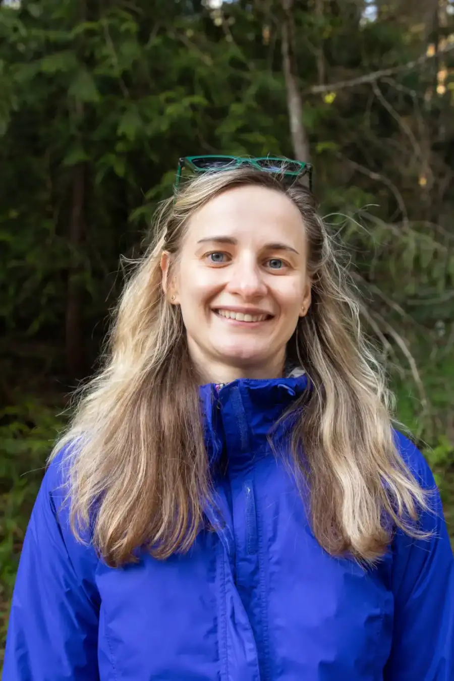
Written and walked by Yulia Vasilyeva · Co-founder · Lead planner and guide
Three years leading guided hikes in the Pacific Northwest, rated 5.0 by 20+ verified guests, and she builds every custom itinerary herself. Based in Seattle.
Last checked October 2026
You might also love these
Other itineraries near this one.
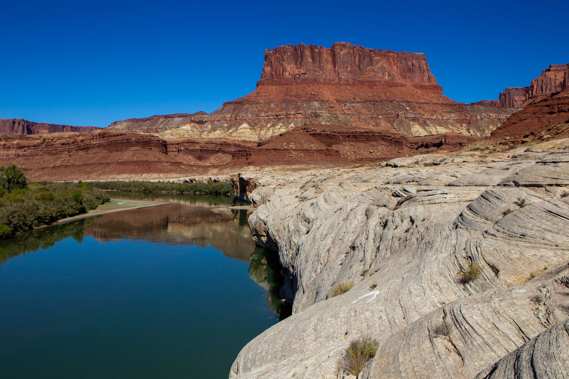
Colorado River Kayaking Trips: A 3-Day Moab and Lake Powell Itinerary
Three days of flatwater paddling, from kayaking the Moab Colorado River under red cliffs to an Antelope Canyon kayak on Lake Powell and…
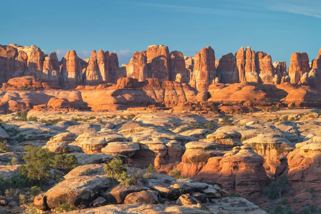
Canyonlands Needles District: A 3-Day Backpacking Itinerary
Three days of Needles District hiking in the remote southwest corner of Canyonlands: the Chesler Park Loop and Joint Trail, Druid Arch,…

Utah's Mighty Five: Family Road Trip (7–10 Days)
All five Utah national parks designed for families, easy canyon hikes, dramatic views, and short drives between parks.
Guides for this tripArches National Park to the Grand CanyonGrand Canyon to Antelope CanyonLas Vegas to Arches National ParkZion National Park to Antelope Canyon
What adventurers say about us.
All reviews are from verified guests. ★★★★★ 5.0 average from 20+ bookings.
"Felt like going out with a really knowledgeable friend who just happens to know everything about the area. No awkward tour-guide energy, just a magnificent day."
"Yulia is an incredible guide. She knew every trail, every viewpoint, and exactly how to pace the day for our group. The photos she took of us were stunning. 100% booking again."
"I was visiting Seattle solo and this was the best decision I made on the trip. Yulia picked me up, had snacks, and took us to a trail I never would have found on my own. Absolute must-do."
"We did this as a couple's trip and it was perfect. Yulia adapted everything to us, our pace, our interests, our photo obsession. The mountain views were unreal."
"Phenomenal experience. Yulia has deep local knowledge and a real passion for the outdoors. She went out of her way to show us the hidden gems tourists never see. Will remember this forever."
"I've done a few guided hikes and this was by far the best. Yulia is warm, funny, and genuinely expert. The trail she chose had the most insane wildflower bloom, we got so lucky."
Fees, reservation windows, shuttle dates and trail closures are planning estimates. Confirm hours, road status and any reservations with the land manager before you go.
What other travelers are saying
Be the first to leave a tip or question for the next traveler.
Was this helpful?
One tap. It goes straight to Yulia and Margarita.
You can't hike it if you can't get the permit.
The best hikes in America run on lotteries that open once a year and sell out in minutes. Every trail runs on its own calendar. Pick the ones you want and we do the watching.
 The WaveCoyote Buttes North · Arizona / UtahPermitLotterybrutal odds
 Half Dome CablesYosemite NP · CaliforniaPermitOpens Mar 1fair odds
 Mt. WhitneyInyo NF · CaliforniaPermitOpens Feb 1tough odds
 Angels LandingZion NP · UtahPermitLotterytough odds
 The SubwayZion NP · UtahPermitLotterytough odds
 Mount St. Helens Summit ClimbGifford Pinchot NF · WashingtonPermitReservationtough odds
How it works
- An email the morning each window opens, never the day after.
- A 14-day heads-up so you can line up your group and dates.
- Win odds and a ranked backup plan for every trail you pick.
Didn't win? We keep watching. We check recreation.gov every day for The Enchantments, Half Dome and Angels Landing, and email you the moment a sold-out date frees up. Cancellations are the second chance most people never hear about.