
Selway-Bitterroot Wilderness:
A Backpacking Itinerary
Five days of Selway-Bitterroot Wilderness backpacking: the granite walls of Blodgett Canyon, the high Bitterroot crest, alpine lakes off Canyon Creek, and the wild and scenic Selway River on the Idaho side.
Free interactive planner · drag & reorder your days, add stops, map it in minutes
Build your own Selway-Bitterroot trip, drag, reorder & map it.
Drag stops between days, swap canyons and lakes, and add your own trailheads with the place search. The live map and drive times recalculate as you go, and we'll warn you before you build a day that does not fit in this much remote, vertical country.
Opens a side panel · reorder days, add custom stops, see your route live
Granite canyons, a high crest & a wild and scenic river, on the Idaho–Montana line.
The Selway-Bitterroot Wilderness straddles the Idaho–Montana border across more than 1.3 million acres of remote, rugged country. Together with the neighboring Frank Church–River of No Return Wilderness it forms one of the largest roadless areas in the lower 48, some of the wildest land left in the country. This is not a place of crowded trailheads and shuttle buses. It is steep canyons, a high granite crest, and a river that runs untouched for miles.
This 5-day route is built around Selway-Bitterroot Wilderness backpacking from both sides of the divide: the dramatic granite walls of Blodgett Canyon and the steep Bitterroot canyons rising out of the Montana valley, alpine lakes tucked off Canyon Creek, the high Bitterroot crest, and on the Idaho side the famous Selway River Trail, a classic riverside backpack along a Wild and Scenic river. The Selway itself is a premier permit-only whitewater run.
July through September is the window. Snow lingers on the high passes well into July, creeks run high with snowmelt, and trails can be brushy or burned in stretches. This is grizzly country, so you must hang or canister your food and travel bear-aware. There are no facilities, no reliable water treatment but the creeks, and very little cell service once you leave the highway.
Hiking the Selway-Bitterroot is permit-light: most trailheads use a free, self-issued wilderness permit you fill out on the spot, with no fee for hiking. What is competitive is the river. A permit to raft the Wild and Scenic Selway is awarded through a very hard-to-win recreation.gov lottery each spring, so do not count on floating it without planning a year out. For lodging, book your nights in Hamilton or Darby in the Bitterroot Valley, or in the Lowell / US-12 corridor in Idaho, early for summer weekends.


Drive in & Blodgett Canyon · into the granite
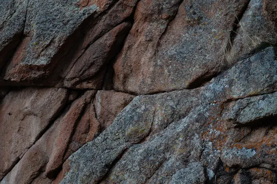
Fly into Missoula (MSO) and drive about an hour south down the Bitterroot Valley to Hamilton, the main gateway town on the Montana side. Pick up fuel, last groceries, and bear spray, then head out to the Blodgett Canyon trailhead just west of town. Fill out the free, self-issued wilderness permit at the trailhead box before you start.
Hike up the Blodgett Canyon Trail, one of the signature canyons of the Bitterroots, where sheer granite walls hundreds of feet tall close in on a clear creek. The grade is gentle for the first several miles, following the water past wildflower meadows and old burn, so it is a forgiving first day with a heavy pack. Find a creekside camp, hang or canister your food well away from the tent, and settle in under the big walls.
- Blodgett Canyon TrailGranite walls hundreds of feet tall · gentle creekside grade for the first miles
- Free · fill out at the trailhead box · no hiking fee
- Filter from Blodgett CreekClear water along the trail · always treat or filter
- Camp under the canyon wallsCreekside site · hang or canister all food · bear country
- Hamilton and Darby in the Bitterroot Valley are your last reliable stops for fuel, groceries, and bear spray. There is nothing once you start up the canyon.
- The wilderness permit is free and self-issued at the trailhead. Fill it out before you walk in, and note this carries no fee for hiking.
- This is grizzly country. Hang your food or use a bear canister every night, cook away from your tent, and carry bear spray where you can reach it.
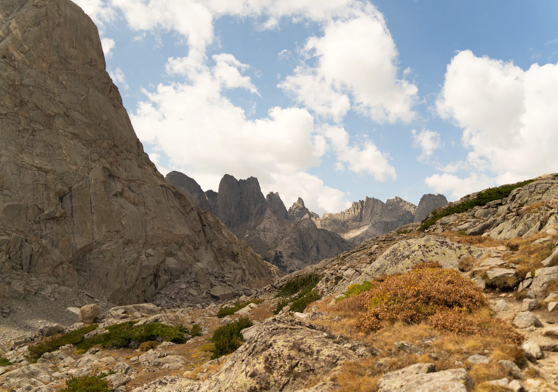
Up Canyon Creek to the alpine lakes
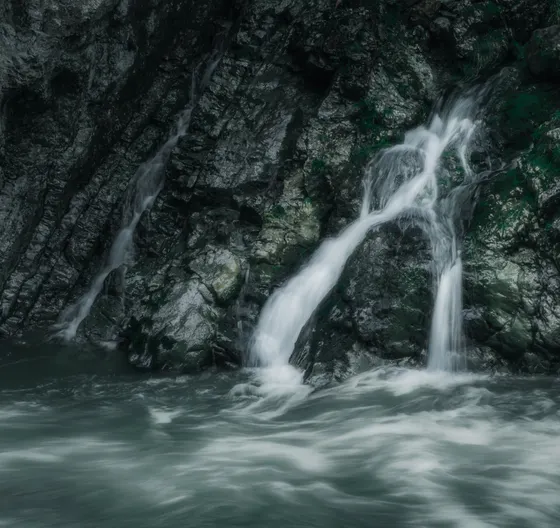
Today you climb out of the canyon bottoms toward the high country. The Canyon Creek drainage, one canyon south, is the classic Bitterroot route to a string of alpine lakes set in granite basins below the crest. Expect a steep, sustained grind: the Bitterroot canyons gain elevation fast, with switchbacks, brushy stretches, and a few creek fords that run cold and pushy in early summer from snowmelt.
The reward is a basin of clear lakes ringed by granite slabs and stunted whitebark pine, with the high Bitterroot crest rising above. Pick a durable, established site back from the water, filter from the inlet, and watch the evening light catch the peaks. Nights up here are cold even in midsummer, and afternoon thunderstorms build fast over the divide, so plan to be off the highest ground by early afternoon.
- Canyon Creek to the lakesSteep, sustained climb · the classic Bitterroot route to alpine lakes
- Cold creek fordsSnowmelt runs high into July · unbuckle your hip belt to cross
- Alpine lake basinGranite slabs, whitebark pine, the Bitterroot crest above
- Camp in the lake basinDurable site back from the water · cold nights even in summer
- The Bitterroot canyons climb hard. Pace yourself, carry plenty of water on the dry switchbacks, and expect brushy or burned stretches where trail crews have not been through.
- Creek fords run cold and strong with snowmelt into July. Unbuckle your pack hip belt before crossing, face upstream, and use trekking poles for balance.
- Snow can linger on the high passes and in shaded basins well into July. Check current conditions with the Bitterroot National Forest before you commit to a high route.
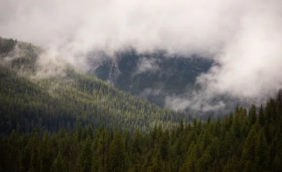
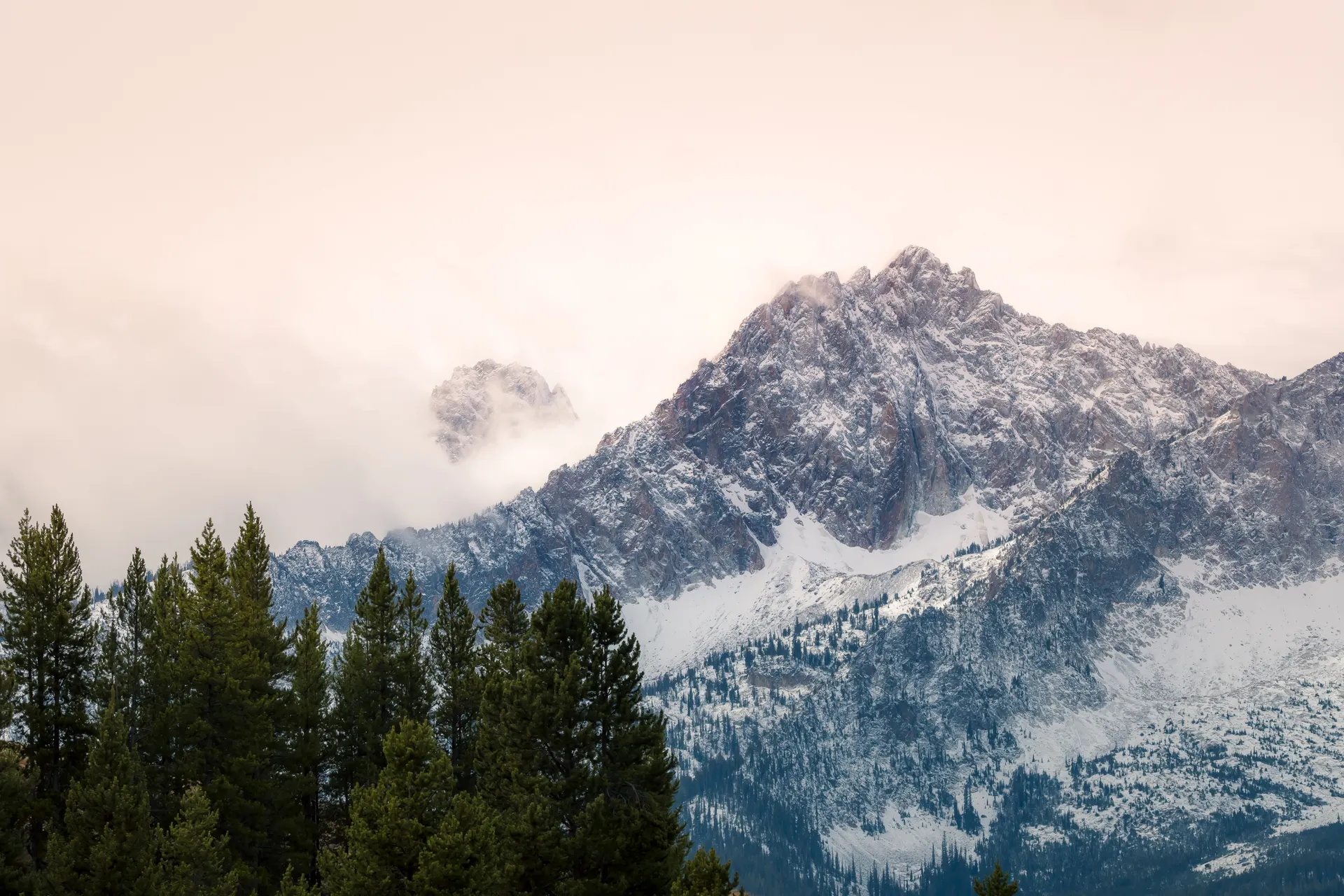
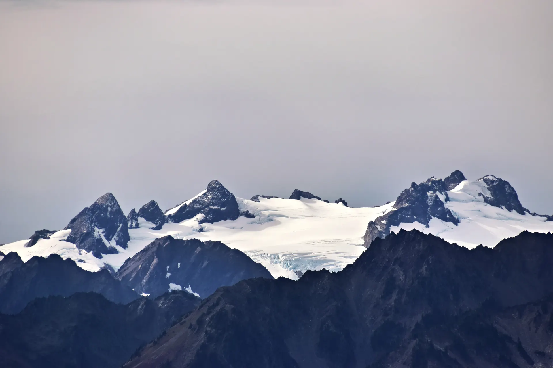
The Bitterroot crest & over the divide
A high day along the spine of the range. Climb from the lakes to the Bitterroot crest, the granite divide that carries the Idaho–Montana state line and separates the steep Montana canyons from the vast Idaho backcountry rolling away to the west. From up here the scale of the wilderness finally registers: ridge after forested ridge with no road, no town, and no sign of anyone, all the way to the horizon.
Watch for lingering snow on north-facing passes and loose talus near the top. This is a committing stretch with long water carries, so top off at the last reliable creek and keep an eye on the weather, because there is nowhere to hide from lightning on the crest. As the divide drops toward Idaho, the country opens into the deep Selway drainages, the gateway to the river days ahead.
- Climb to the Bitterroot crestThe granite divide on the Idaho–Montana state line
- Views into the Idaho backcountryRidge after roadless ridge toward the Selway country
- Top off at the last creekLong water carries on the crest · plan your fills
- Camp on the Idaho sideDrop off the divide toward the Selway drainages
- The crest is exposed. Get over the high passes in the morning and be heading down before afternoon thunderstorms build over the divide.
- Water is scarce on the ridgetops. Fill up at the last reliable creek before you climb and ration what you carry across the divide.
- North-facing passes and shaded basins hold snow into July. A lightweight ice axe and the know-how to use it are worth carrying early in the season.


Down to the Selway River Trail
Descend the long way down to the Selway River, the wild heart of the Idaho side. The Selway River Trail is one of the great riverside backpacks in the Northern Rockies, following a federally designated Wild and Scenic river for miles through deep forest, past clear pools, rapids, and old pack-trail history. The river itself is a premier whitewater run, floated only by the lucky few who draw the permit, so most days you will have long stretches of it entirely to yourself.
The walking here is gentler than the canyons and the crest, rolling along above the water with frequent access down to gravel bars and swimming holes. It is still genuine backcountry: brushy in places, with side-creek fords and the same bear precautions. Camp on a bench above the river, hang your food, and fall asleep to the sound of the Selway moving through one of the wildest valleys in the country.
- A classic Wild and Scenic riverside backpack · pools, rapids, gravel bars
- Premier whitewater runThe Selway is a permit-only float via a competitive recreation.gov lottery
- Gentler river milesRolling trail above the water · swimming holes and side creeks
- Camp on a river benchAbove the water · hang food · same bear-aware routine
- The Selway River Trail is the gentlest walking of the trip, but it is still remote backcountry with brushy sections and side-creek fords. Do not let your guard down.
- The river is one of the most coveted whitewater permits in the country, drawn through a competitive recreation.gov lottery each spring. If floating it is a goal, plan a year ahead.
- River benches make great camps, but stay well back from the water on durable ground and keep a clean, bear-aware camp every night.
River miles out & the US-12 corridor
Finish with easy river miles out to the trailhead, soaking up the last of the Selway forest, the clear water, and the quiet of a valley most people never reach. Take your time, swim a pool or two, and look back at five days of country that runs from Montana granite to an Idaho river without crossing a single road.
Getting home: the Idaho-side trailheads sit near Lowell and the US-12 / Lochsa River corridor, the scenic highway that follows the Lochsa River over Lolo Pass back to Montana. From there it is a long, beautiful drive back to Missoula (MSO), roughly a few hours over the pass. Top off your fuel in the small US-12 towns where you can, because services are sparse, and start the drive with daylight to spare.
- Easy river miles outFinal Selway forest, pools, and quiet to the trailhead
- Lowell & the US-12 corridorIdaho-side trailheads near the Lochsa River and US-12
- Drive back over Lolo PassUS-12 along the Lochsa to Missoula (MSO) · a few hours
- The Idaho-side trailheads are reached via Lowell and the US-12 / Lochsa River corridor. Services are sparse, so fuel up whenever you get the chance.
- US-12 over Lolo Pass back to Missoula is a slow, winding, scenic drive along the Lochsa. Allow more time than the mileage suggests and start with daylight.
- If you staged a car on the Montana side instead, plan the long shuttle around the range in advance. The drive between the two sides is several hours.
Now build your Selway-Bitterroot trip.
You've seen all five days. Open the free drag-and-drop planner and tune it for your dates, your pace, and whether you start from the Bitterroot Valley side in Montana or the Selway River corridor in Idaho.
What we actually learned in the wilderness.
Get the free self-issued permit
Most Selway-Bitterroot trailheads use a free, self-issued wilderness permit you fill out at the trailhead box. There is no fee for hiking. The big exception is the Selway River whitewater permit, which is awarded by a competitive recreation.gov lottery and is hard to win.
Travel bear-aware in grizzly country
Grizzlies are possible across the Selway-Bitterroot. Hang your food or use a bear canister every night, cook and store food well away from your tent, carry bear spray where you can reach it, and make noise on brushy trails so you never surprise a bear.
Plan for cold, pushy creek fords
Snowmelt keeps the creeks running high and cold well into July. Unbuckle your pack hip belt before fording, face upstream, use trekking poles, and pick wide, shallow crossings. Always filter or treat your water, even from clear mountain creeks.
Go July through September
July through September is the window. Snow lingers on the high passes and shaded basins into July, and the first storms can return in September. Expect cold nights even in midsummer and fast-building afternoon thunderstorms over the crest, so get over high ground early.
Expect rough, remote trails
This is some of the wildest country in the lower 48. Trails can be brushy, faint, or running through old burns where crews have not cleared deadfall. Carry a map, compass, and GPS, know how to navigate, and build in extra time for slow, rugged miles.
Base in the valley towns
There are no facilities in the wilderness. Stock up and stay in Hamilton or Darby in the Bitterroot Valley on the Montana side, or in the Lowell / US-12 corridor on the Idaho side. Book summer weekends early, and fuel up before you leave the highway.
Everything you'll actually want to know.
Ready to go? Get your
Selway-Bitterroot route.
Trailheads and canyon routes, the free self-issued permit, creek-ford and grizzly safety, the two valley gateways, and the drive logistics you need to backpack the Selway-Bitterroot Wilderness.
Instant book · Free cancellation · Secure payment via Stripe
Planning this trip?
Save it, share it with your crew, or find travelers heading the same way.

Liked this itinerary?
What other travelers are saying
Be the first to leave a tip or question for the next traveler.