Nebraska Sandhills:
A 10-Day Road Trip Itinerary
Ten days across the largest sand-dune sea in the Western Hemisphere: float the Niobrara, chase waterfalls and wildlife around Valentine, ride the Cowboy Trail, and roam badlands and pine ridges in the far northwest.
Free interactive planner · drag & reorder your days, add stops, map it in minutes
Build your own Sandhills road trip, drag, reorder & map it.
Drag stops between days, swap a float for a wildlife refuge, and add your own lakes, byways, and overlooks with the place search. The live map and drive times recalculate as you go, and we'll flag the long, empty legs before you run low on fuel out here.
Opens a side panel · reorder days, add custom stops, see your route live
One sand sea, rivers, refuges & badlands, all across Nebraska.
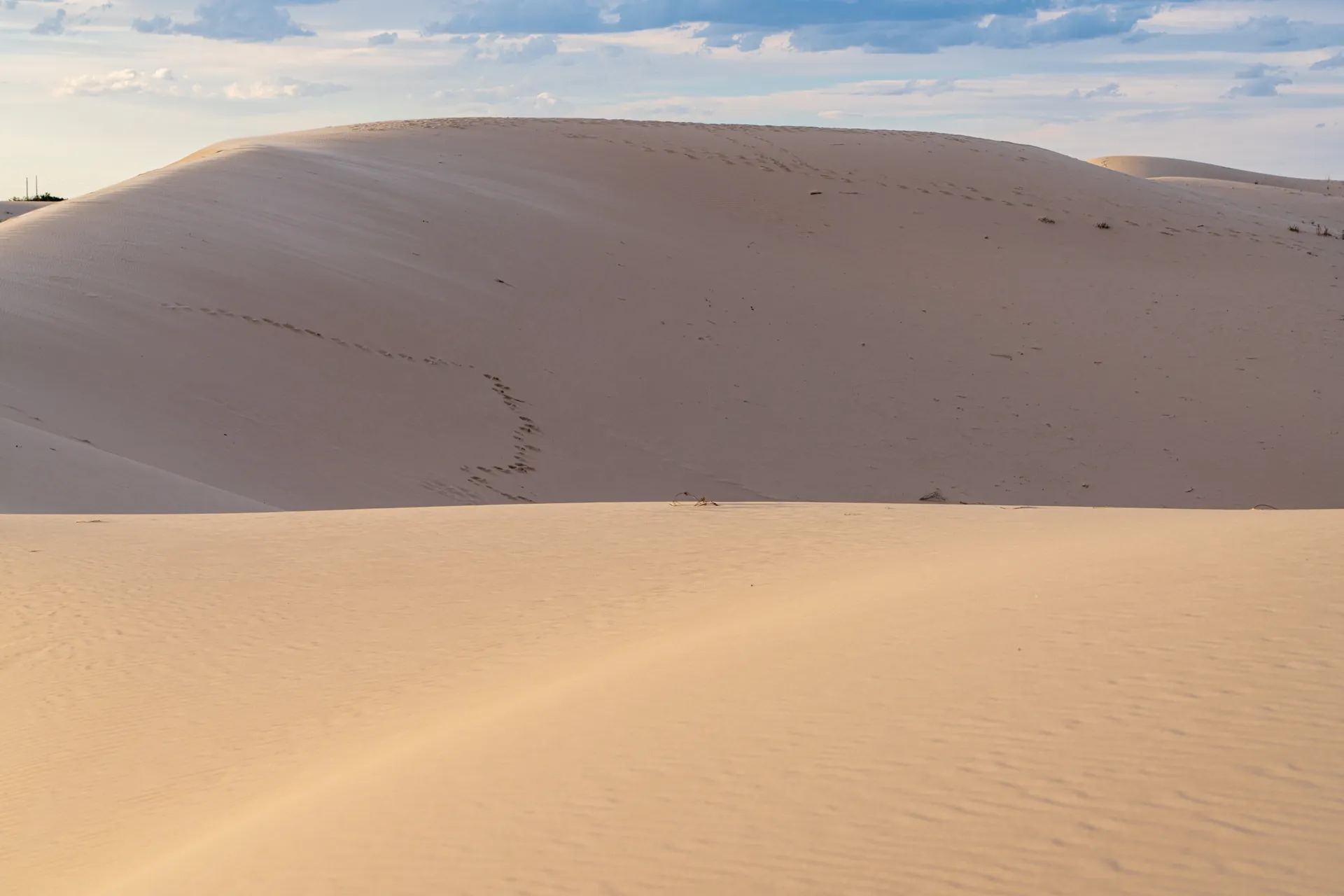
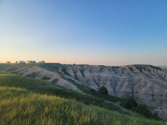
The Nebraska Sandhills are the largest sand-dune formation in the Western Hemisphere, roughly 20,000 square miles of grass-stabilized dunes spread across north-central Nebraska. Beneath the grass and cattle ranches sits the Ogallala Aquifer, which feeds thousands of shallow lakes, spring-fed creeks, and the cold, clear rivers that make this one of the most surprising landscapes on the Great Plains.
This 10-day loop is built around the best of it: tubing and canoeing the Niobrara National Scenic River past waterfalls, the 63-foot Smith Falls (Nebraska's tallest), the Sandhills lakes and birding around Valentine, the bison and elk of Fort Niobrara, the 200-plus-mile Cowboy Trail rail-trail, and the badlands and fossils of Toadstool Geologic Park and the Pine Ridge out west. In spring, the nearby Platte River hosts the sandhill crane migration, one of the great wildlife spectacles on the continent.
This is big-sky, remote country with very dark night skies and few services, so fuel up whenever you can and carry water. Late spring through fall is the sweet spot: the crane migration runs February into April on the Platte, summer is float season, and fall brings color along the river and across the grasslands.
Valentine fills up fast on summer weekends when float season peaks, so book lodging and your outfitter ahead. Out west, Chadron is the main base for the Pine Ridge and Toadstool, with limited rooms. Services are sparse between towns, so fuel up at every chance, carry water, and download offline maps before you head into the dunes.


Arrive in Valentine · the heart of the Sandhills
Valentine is the natural base for the eastern half of this trip and the gateway to the Niobrara. You can fly into the small Valentine airport (VTN), but most people drive in: roughly 5 hours from Omaha or about 6 hours from Denver, with long, empty, beautiful stretches of dune country along the way. Stop for gas whenever you see a station, because the next one can be a long way off.
Spend the afternoon getting your bearings in town, lining up your Niobrara float with a local outfitter, and stocking up on water and supplies. Valentine sits high on the edge of the Sandhills with cottonwood-lined creeks below, and the surrounding refuges put thousands of lakes and grasslands within easy reach for the days ahead.
- Drive in to Valentine~5 hr from Omaha · ~6 hr from Denver · or fly into VTN
- Reserve tubes, kayaks, or a canoe with a local outfitter
- Fuel up & stock waterServices are sparse between towns · top off and carry water
- Stay in ValentineYour base for the Niobrara, Smith Falls, and the refuges
- Valentine is the main base for the eastern half of the loop. Book lodging early for summer weekends, when float season is at its peak.
- Reserve your Niobrara outfitter ahead of time. They handle tube, kayak, and canoe rentals plus the shuttle back to your car.
- Stock up on water, snacks, and fuel in Valentine. Services thin out quickly once you leave town for the refuges and back roads.
Float the Niobrara National Scenic River

Today is the centerpiece. The Niobrara National Scenic River is a cold, clear, spring-fed river that runs east from Valentine through a lush canyon where the Great Plains, eastern woodlands, and Rocky Mountain ecosystems all overlap. Floating it by tube, kayak, or canoe is the most popular paddle trip in Nebraska, drifting past more than 200 waterfalls that spill out of the canyon walls.
Pick a float length that suits your group, from a relaxed few-hour tube run to a full-day paddle, and let the current do the work. Your outfitter shuttles you to the put-in and back. Bring water, sun protection, and dry bags, and keep an eye out for the side-canyon waterfalls that make this stretch of river famous.
- Tube, kayak, or canoe · the most popular float in Nebraska
- Spot the canyon waterfallsMore than 200 falls spill from the canyon walls along the river
- Pack water & dry bagsSun protection, water, and a dry bag for the float
- Second night in ValentineStay put so the river and falls are an easy day trip
- The Niobrara is spring-fed and cold even in summer. Wear sun protection and bring layers and water for a long day on the river.
- Choose your float length to match your group: a short tube run is family-friendly, while a full-day paddle reaches more of the waterfalls.
- Let the outfitter handle the shuttle. They drop you at the put-in and pick you up downstream, so you only float one direction.
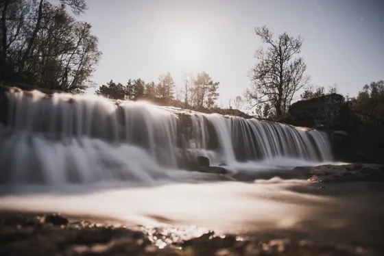
Smith Falls State Park · Nebraska's tallest waterfall
Head back to the Niobrara valley for Smith Falls State Park, home to Smith Falls, the tallest waterfall in Nebraska at 63 feet. A short, easy walk crosses the river on a footbridge and leads to the falls, where spring water pours over a mossy fern-draped cliff in a cool, green pocket of canyon. It is one of the prettiest spots in the state and an easy half-day from Valentine.
Smith Falls is also a popular put-in and take-out for Niobrara floats, so if you want a second, shorter river day, this is a great place to do it. Otherwise wander the river trails, picnic in the canyon, and soak up the unexpected lushness before driving back toward town.
- Nebraska's tallest waterfall · 63 ft · short, easy walk
- Smith Falls is a popular put-in and take-out on the river
- River canyon trails & picnicEasy footbridge walk · cool, green, fern-draped canyon
- Third night in ValentineKeep the same base for the refuges tomorrow
- Smith Falls State Park requires a Nebraska state park entry sticker, about $8 per day or available as an annual pass.
- The walk to the falls is short and easy and crosses the river on a footbridge, so it works well for families and mixed-ability groups.
- Combine the falls with a short float that takes out here, or just picnic in the canyon. It pairs nicely with a relaxed afternoon.

Fort Niobrara & Valentine wildlife refuges
Spend a day on the wildlife refuges that ring Valentine. Fort Niobrara National Wildlife Refuge, just east of town, protects herds of bison and elk along the river, with a wildlife drive and short trails where you can watch the prairie come alive at dawn and dusk. It is one of the most reliable places in the state to see big plains animals up close.
South of town, the Valentine National Wildlife Refuge spreads across the Sandhills proper, a maze of shallow lakes, marshes, and grass-covered dunes that draws huge numbers of waterfowl and other birds. Drive the refuge roads, walk to a lakeshore, and bring binoculars. This is some of the best Sandhills birding anywhere, and the big-sky emptiness is the whole point.
- Bison and elk · wildlife drive and short trails east of town
- Sandhills lakes, marshes, and grasslands · superb birding
- Bring binoculars & waterBest wildlife viewing at dawn and dusk · carry water
- Fourth night in ValentineLast night here before heading west and along the river
- Dawn and dusk are the best times for wildlife at both refuges. Keep a safe distance from bison and elk, which are large and unpredictable.
- Valentine National Wildlife Refuge has gravel roads and shallow lakes. A regular car is fine in dry weather, but the roads turn greasy after rain.
- Bring binoculars, water, and bug protection. The Sandhills refuges are open, exposed, and have little shade.
The Cowboy Trail & the Niobrara trestle
Trade the car for the trail. The Cowboy Trail is a rail-trail built on a former rail line that runs more than 200 miles across northern Nebraska, making it one of the longest rail-trails in the country. Near Valentine it crosses the Niobrara River on a long, high former railroad trestle, a quarter-mile bridge nearly 150 feet above the water with sweeping views up and down the river valley.
Walk or bike out to the Niobrara trestle for the marquee view, then pick a stretch of the crushed-limestone trail to explore at your own pace through grassland and ranch country. It is flat, scenic, and a completely different way to feel the scale of the Sandhills. Stock up on water in town before you set out.
- 200-plus-mile rail-trail · flat crushed-limestone surface
- Niobrara River trestleQuarter-mile bridge ~150 ft above the river · sweeping views
- Bike or walk a trail sectionPick a stretch from Valentine through grassland and ranch country
- Last night in ValentinePack up and prep for the long drive west tomorrow
- The Niobrara trestle is the highlight of this section of the Cowboy Trail. You can reach it on foot or by bike from the Valentine trailhead.
- The trail surface is flat crushed limestone, friendly for hybrid bikes and walking. There is little shade, so carry water and sun protection.
- Bikes can be rented in Valentine if you did not bring your own. Confirm availability ahead, especially in peak summer.


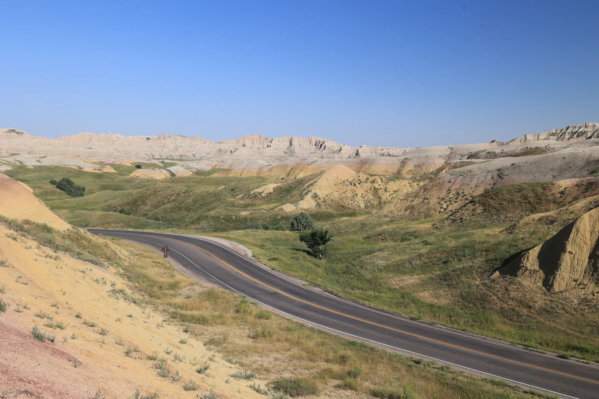
Sandhills scenic byways · drive west

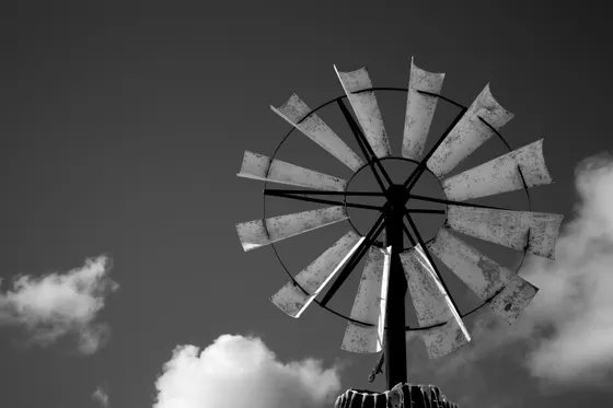
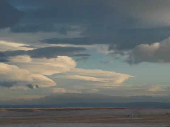
Today is a big driving day across the heart of the dune sea toward the far northwest. Take your time on the Sandhills scenic byways, the lonely state highways that roll over endless grass-covered dunes, past windmills, cattle, and shallow blue lakes with rarely another car in sight. This is the classic Nebraska Sandhills road trip drive, and the emptiness is the attraction.
Break up the miles with stops at small ranch towns, a roadside lake, or whatever overlook catches your eye. Fuel up at every opportunity, because stations are far apart out here. Aim to reach the Chadron area by evening, where the dunes give way to the wooded buttes of the Pine Ridge.
- Lonely highways over grass-covered dunes, windmills, and lakes
- Roadside lakes & ranch townsStop at shallow blue lakes and small towns along the way
- Fuel up at every chanceStations are far apart · top off and carry water
- Stay in ChadronYour base for the Pine Ridge and the badlands out west
- This is the longest driving day of the loop. Start early, fuel up before you go, and carry water and snacks for the empty stretches.
- The Sandhills byways have almost no services. Treat every town with a gas station as a chance to top off the tank.
- Cell service is patchy across the dunes. Download offline maps and let someone know your route before you set out.
Chadron State Park & the Pine Ridge
The far northwest corner of Nebraska is a different world. Chadron State Park, the oldest state park in Nebraska, sits in the Pine Ridge, a band of pine-covered buttes and canyons that rises out of the plains. Hike the park trails, drive the ridge roads, and take in views that feel more Black Hills than Great Plains, with ponderosa pine, rock outcrops, and deep green canyons.
Spend the day exploring the Pine Ridge country around Chadron, from park trails to the scenic byway that climbs the escarpment. It is a cool, shaded contrast to the open dunes and a great place to stretch your legs after the long drive west.
- Nebraska's oldest state park · Pine Ridge trails and ridge roads
- Pine Ridge scenic bywayPonderosa pine, buttes, and canyons rising from the plains
- Hike the park trailsShaded canyon and ridge hikes · a contrast to the dunes
- Second night in ChadronStay put for the badlands day trip tomorrow
- Chadron State Park needs a Nebraska state park entry sticker, the same one that covers Smith Falls. An annual pass pays off across this trip.
- The Pine Ridge feels like a slice of the Black Hills. Bring layers, as it sits higher and cooler than the dune country to the east.
- Chadron is the main town for services out here, with a handful of motels. Book ahead, because rooms are limited.


Toadstool Geologic Park & Oglala National Grassland

Drive northwest into the Oglala National Grassland for Toadstool Geologic Park, a pocket of stark badlands where wind and water have carved the clay and sandstone into mushroom-shaped rock formations, hoodoos, and barren gullies. A short interpretive loop trail winds through the formations, and the area is rich in fossils from an ancient floodplain, including tracks preserved in the rock.
The grassland around it is wide, empty, and beautiful in a harsh way, a complete contrast to the green Pine Ridge. Bring plenty of water and sun protection, because there is no shade and no services out here. It is a half-day to a full-day trip, then it is back to Chadron for the night.
- Badlands hoodoos and fossils · short interpretive loop trail
- Oglala National GrasslandWide, empty grassland and badlands in far northwest Nebraska
- Carry water · no servicesNo shade and no facilities · bring everything you need
- Third night in ChadronLast night out west before the drive back east
- Toadstool is reached by gravel roads that turn slick and impassable when wet. Check the forecast and avoid it right after rain.
- There is no water, shade, or cell service at Toadstool. Carry plenty of water, sun protection, and a full tank of gas.
- Leave fossils and rock formations where you find them. The badlands are fragile and the fossils are protected.
Drive back east · dark skies over the dunes
Begin the loop back east across the Sandhills, retracing or varying your route through the dune country toward Valentine or your exit point. With more time today, you can stop at the lakes, byways, and small towns you blew past on the way west, or simply enjoy the hypnotic roll of grass-covered dunes one more time.
Wherever you stop for the night, look up. The Sandhills have some of the darkest night skies in the country, with almost no light pollution for a hundred miles. On a clear, moonless night the Milky Way arches edge to edge over the dunes. Find a pullout away from town, let your eyes adjust, and take it in before the trip ends.
- Drive back eastRetrace or vary the Sandhills byways toward Valentine or your exit
- Dark-sky stargazingAlmost no light pollution · the Milky Way over the dunes
- Fuel up & carry waterLong empty legs again · top off whenever you can
- Last night in the SandhillsStay in Valentine or a town along your route out
- For the best stargazing, get well away from any town lights and let your eyes adjust for 20 minutes. A red flashlight preserves night vision.
- Plan your fuel stops the same way as the drive out. The byways are just as empty heading east.
- If spring cranes are on your wish list, this is the day to angle south toward the Platte for the migration (see the season note below).


Head home · optional Platte River cranes


On your last day, make the drive out to your airport or onward destination, with Omaha (about 5 hours from Valentine) and Denver (about 6 hours) the usual gateways, or a short hop from Valentine's own airport (VTN). Fuel up before you leave town and give yourself plenty of daylight for the long, remote miles.
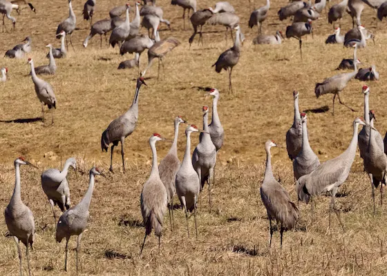
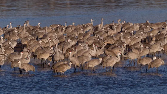
If you are traveling between late February and early April, point yourself toward the Platte River around Kearney and Grand Island on the way out. Each spring, hundreds of thousands of sandhill cranes stage on the Platte, roosting on the river at night and feeding in the fields by day. It is one of the great wildlife spectacles on the continent and a fitting finale to a Sandhills road trip.
- Drive to your gatewayOmaha ~5 hr · Denver ~6 hr · or fly out of Valentine (VTN)
- Optional: Platte River cranesLate Feb to early April · the great sandhill crane migration
- Fuel up & leave with daylightLong remote drive out · top off before you go
- The sandhill crane migration peaks in March along the Platte near Kearney and Grand Island. Book a blind or viewing spot well ahead if you go.
- Cranes roost on the river at dawn and dusk. Those golden hours are the best and most dramatic times to watch them.
- It is a long, remote drive to either Omaha or Denver. Fuel up, carry water, and start early so you reach your gateway with daylight to spare.
Now build your Sandhills trip.
You've seen all ten days. Open the free drag-and-drop planner and tune it for your dates, your pace, and whether you base in Valentine, Chadron, or split the loop between both.
What we actually learned in the Sandhills.
Fuel up at every chance
The Sandhills are vast and empty, and gas stations can be 50 or more miles apart. Treat every town with a pump as an opportunity to top off the tank. Running low out here is a real risk, so never pass a station below half a tank.
Carry water and sun protection
Services are sparse and shade is rare across the dunes, refuges, and badlands. Carry more water than you think you need, plus sunscreen and a hat. Places like Toadstool have no facilities at all, so bring everything in with you.
Expect patchy cell service
Coverage is spotty to nonexistent across much of the Sandhills and the far northwest. Download offline maps, screenshot your stops, and tell someone your route before you set out on the back roads and gravel byways.
Get the state park sticker
Smith Falls, Chadron State Park, and other Nebraska state parks require an entry sticker, about $8 per vehicle per day. If you are visiting several, the annual park permit pays for itself quickly over a ten-day trip.
Go late spring through fall
Summer is float season on the Niobrara, fall brings color along the river and grasslands, and the sandhill crane migration runs late February into April on the Platte. Winter is cold, windy, and quiet, with most outfitters closed.
Base in Valentine and Chadron
Valentine anchors the eastern half (river, falls, refuges, Cowboy Trail) and Chadron anchors the west (Pine Ridge, Toadstool). Both have limited rooms that fill on summer weekends, so book lodging ahead, especially around float season.
Everything you'll actually want to know.
Ready to go? Get your
Nebraska Sandhills road trip.
River floats and outfitters, the tallest falls in the state, the Valentine refuges, the Cowboy Trail trestle, the Toadstool badlands, drive times from Omaha and Denver, and the fuel-and-water logistics you need out in the dunes.
Instant book · Free cancellation · Secure payment via Stripe


Planning this trip?
Save it, share it with your crew, or find travelers heading the same way.

Liked this itinerary?
What other travelers are saying
Be the first to leave a tip or question for the next traveler.