Pine Ridge Nebraska Map +
3-Day Soldier Creek Wilderness Loop
3-day Pine Ridge backpacking itinerary in northwestern Nebraska. An ~11-mile figure-eight of the Boots & Saddle and Trooper trails through the 7,794-acre Soldier Creek Wilderness, based out of Fort Robinson, with Toadstool Geologic Park on the drive out.
Free interactive planner · drag & reorder your days, add stops, map it in minutes
Build your own Pine Ridge trip, drag, reorder & map it.
Drag stops between days, add Toadstool Geologic Park or a Fort Robinson layover with the place search, and the live map and trail legs recalculate as you go. Tune the Soldier Creek figure-eight to your pace and your dry-camp water plan before you head into the wilderness.
Opens a side panel · reorder days, add custom stops, see your route live
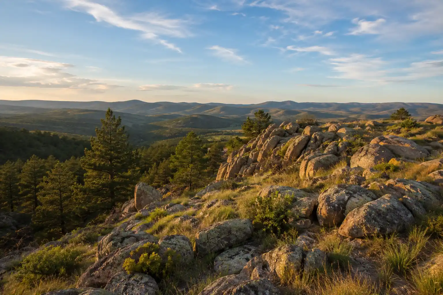
A hidden wilderness loop in the Nebraska Pine Ridge.
For a 3-day backpacking trip in northwestern Nebraska's Pine Ridge, base your logistics out of Fort Robinson State Park near Crawford and hike the Soldier Creek Wilderness. This 7,794-acre wilderness, designated in 1986 and managed by the Nebraska National Forests and Grasslands, is laced with an ~11-mile figure-eight of the Boots & Saddle and Trooper trails through ponderosa pine ridges and clay buttes.
The route climbs from the North Fork Trailhead at Soldier Creek Campground onto open ridges with panoramic Pine Ridge views, then loops back on the Trooper Trail. Two nights of dispersed backcountry camping give you real solitude in one of the least-visited wilderness areas in the Great Plains.
No backcountry permit is required and dispersed camping is allowed, but a Nebraska state park entry permit is needed to park at Fort Robinson. The single biggest planning factor is water: sources are limited and unreliable, so carry 4–6 liters of capacity or cache water in advance. May–June and September–October are the best months, avoiding summer heat, thunderstorms, and ticks.
No backcountry permit or reservation is required for the Soldier Creek Wilderness, and dispersed camping is allowed. You do need a Nebraska state park entry permit to park at Fort Robinson ($8/day or $45 annual for non-residents, from outdoornebraska.gov). If you want a bed before or after the loop, the Fort Robinson lodge and cabins and lodging in Crawford fill up in summer, so reserve early.
Fort Robinson to the Ridge · ~5 miles
Drive to Fort Robinson State Park near Crawford, top off every water bottle and bladder at the trailhead, and check in for current fire and trail conditions. From there it is 6 miles north on Soldier Creek Road to Soldier Creek Campground and the North Fork Trailhead, the gateway into the wilderness.
Hike up the Boots & Saddle Trail into the ponderosa pines, gaining the first open ridge with wide Pine Ridge views. Set a dispersed camp on durable ground well back from the trail, store your food away from wildlife, and settle into the solitude. Carry all the water you need for the night and morning, sources up here are scarce and unreliable.
- 6 mi north on Soldier Creek Road to the North Fork Trailhead
- ~5 mi in · ponderosa pines to the first open ridge
- Dispersed camp on the ridgeDurable ground · Leave No Trace · store food from wildlife
- Fill every bottle and bladder at the Soldier Creek Campground hand-pump well before you start, water in the wilderness is limited and unreliable.
- You do not need a backcountry permit, but you do need a Nebraska state park entry permit to park at Fort Robinson.
- Camp on durable surfaces well away from water and the trail, and store food properly; rattlesnakes, ticks, and the occasional mountain lion live here.
Fort RobinsonFirst ridgeRidge Traverse & Butte Views · ~7 miles
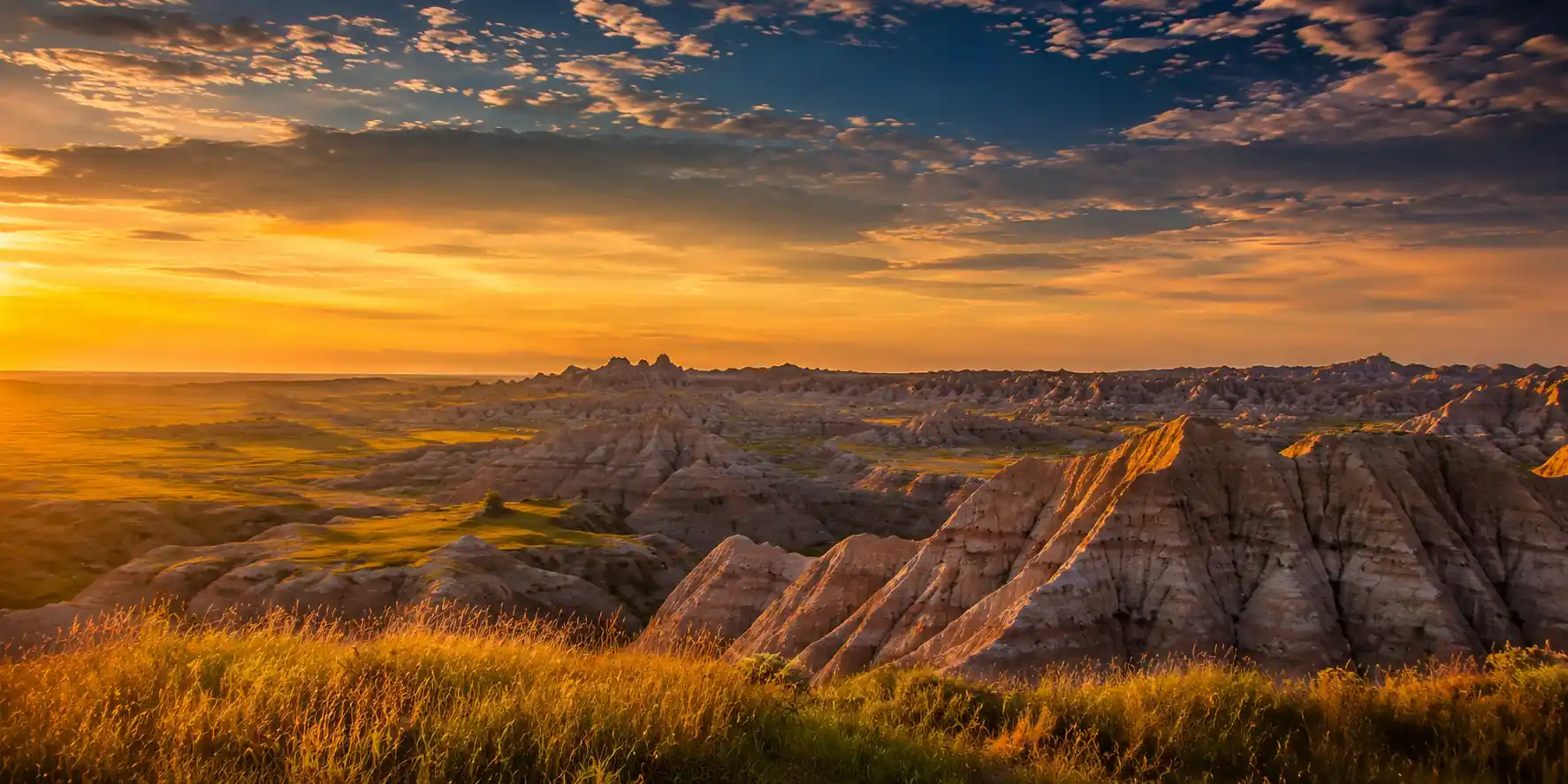
Ridge traverseSheltered drawThis is the big day: connect onto the Trooper Trail and traverse the high ridges for panoramic views across the Pine Ridge. Faint stretches and game trails mean map, compass, and a downloaded GPS track earn their keep. The reward is dramatic clay buttes and eroded formations, remnants of ancient seabeds, standing above the pines.
Watch for deer, wild turkeys, and soaring raptors as you complete the figure-eight of the Boots & Saddle and Trooper loops. Drop into a sheltered draw for your second night, prioritizing a spot with a windbreak and good drainage. Ration your water carefully, you are carrying most of what you will drink.
- ~9.7 mi loop · high ridges & panoramic Pine Ridge views
- Clay butte & badlands formationsEroded ancient seabeds above the ponderosa pines
- Dispersed camp in a sheltered drawWindbreak & good drainage · store food from wildlife
- Trails fade in and out on the ridges, so carry a paper map and compass plus a downloaded GPS track, and do not rely on cell service.
- The ridges are exposed to sun and wind; start early, and turn back if afternoon thunderstorms build.
- Ration water deliberately today, there are no reliable sources on the high ground, so drink to your plan, not just your thirst.
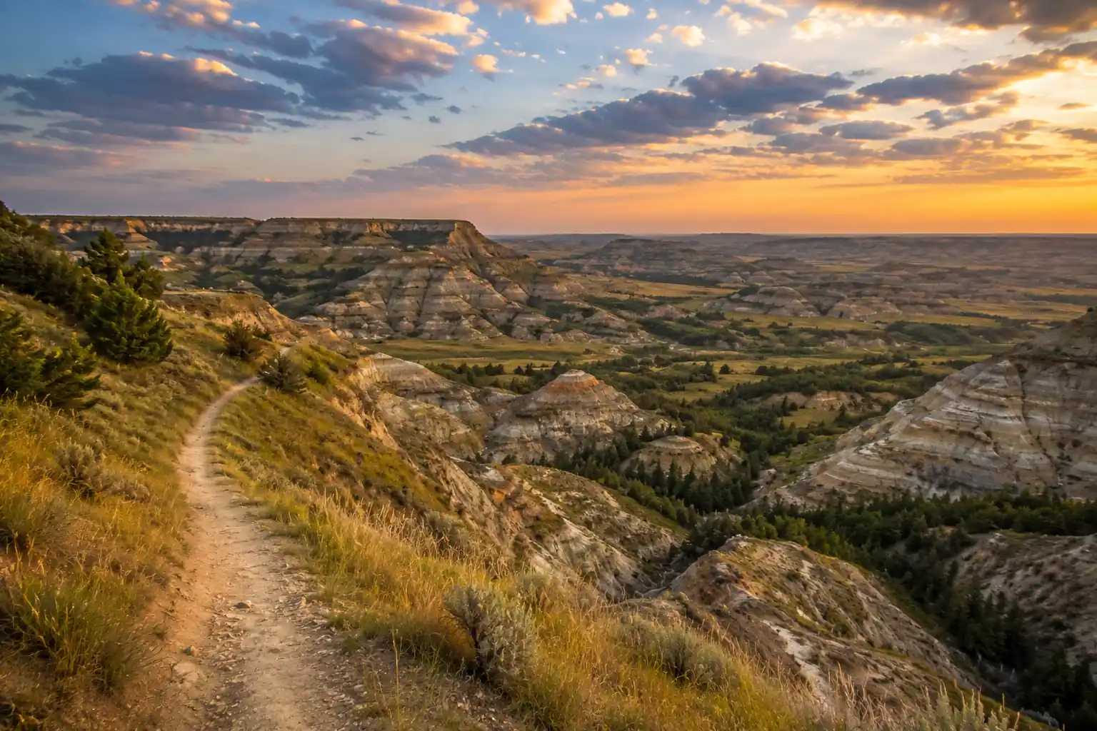
Hike Out & Toadstool Geologic Park · ~5 miles
Finish the figure-eight back to the North Fork Trailhead on more defined tread, taking in the last views of the Pine Ridge before you reach the car at Soldier Creek Campground. Clean up at Fort Robinson and grab a celebratory meal in Crawford.
On the way out, drive about an hour north to Toadstool Geologic Park in the Oglala National Grassland. The one-mile interpretive loop winds through mushroom-shaped rock formations, ancient mammal trackways, and eroded badlands, a fitting geological finale to a Pine Ridge weekend.
- Hike out to the North Fork Trailhead~5 mi · more defined trail · last Pine Ridge views
- ~1-mi loop · toadstool rock formations & badlands
- The hike out is the easiest leg; aim to reach the trailhead by midday so you have time for Toadstool on the drive out.
- Toadstool is a day-use area with no potable water, so bring your own and wear sun protection; the badlands are shadeless.
- Toadstool's formations and fossils are fragile and protected, so look but do not climb on or remove anything.
Hiking outBack at Fort RobinsonNow build your Pine Ridge trip.
You've seen all three days. Open the free drag-and-drop planner and tune it for your dates, your pace, and how much water you can carry or cache in this dry wilderness.
Essential wilderness planning for the Pine Ridge.
Water is the crux
Sources in the Soldier Creek Wilderness are limited and unreliable, and creek beds are often dry. Carry 4–6 liters of capacity per person, treat everything you do find, and consider caching water at a road access point in advance. Do not plan on finding water on the ridges.
No permit, but bring navigation
No backcountry permit is required and dispersed camping is allowed, but trails fade into game paths. Carry a paper map, compass, and a downloaded GPS track. Cell service is spotty to non-existent across the wilderness.
Leave No Trace camping
Camp on durable surfaces at least a quarter mile from roads and developed areas, pack out all trash, and store food away from wildlife. A bear canister is not required, but an Ursack or a proper hang keeps rodents and other critters out.
Go in spring or fall
May–June and September–October have the most pleasant temperatures. Summer brings heat, humidity, frequent thunderstorms, ticks, and mosquitoes; winter is harsh with snow and extreme cold. Spring adds wildflowers but more ticks and mud.
Wildlife & tick awareness
Expect deer, wild turkeys, and coyotes, with rattlesnakes in rocky areas and the occasional mountain lion. Do thorough tick checks in spring and summer, and watch where you place hands and feet on the buttes.
Getting there needs a car
Crawford is about 5–6 hours from Denver International Airport and 2.5–3 hours from Rapid City Regional Airport. Fort Robinson is 2.5 miles southwest of Crawford on US-20, and the Soldier Creek trailhead is 6 miles north on Soldier Creek Road. No transit reaches the trailhead, so a car is required.
Everything you'll actually want to know.
Ready to go? Get your
Pine Ridge Nebraska route.
Trailheads and mileages for the Soldier Creek figure-eight, the water-carry and dispersed-camping rules, the Nebraska park permit, drive times from Rapid City and Denver, and the Toadstool Geologic Park detour, all in one place.
Instant book · Free cancellation · Secure payment via Stripe

Planning this trip?
Save it, share it with your crew, or find travelers heading the same way.

Liked this itinerary?
What other travelers are saying
Be the first to leave a tip or question for the next traveler.