Pennsylvania Outdoor Adventure:
A 10-Day Itinerary
A 10-day Pennsylvania outdoor road trip looping the best state parks and forests: the Pine Creek Gorge, Ricketts Glen's 21 waterfalls, Worlds End and the Loyalsock, the Allegheny National Forest, Ohiopyle whitewater, and the Lehigh Gorge.
Free interactive planner · drag & reorder your days, add stops, map it in minutes
Build your own Pennsylvania trip, drag, reorder & map it.
Drag stops between days, swap a waterfall hike for a rail-trail ride, and add your own overlooks and trailheads with the place search. The live map and drive times recalculate as you go, so you can shape the whole 10-day loop around your dates and pace.
Opens a side panel · reorder days, add custom stops, see your route live
One state, gorges, waterfalls & whitewater, end to end.
Pennsylvania hides some of the best outdoor country in the Northeast inside its enormous network of state parks and forests, and almost none of it charges a dime to enter. This 10-day loop strings together the headline sights: the Pine Creek Gorge (the Grand Canyon of Pennsylvania), the 21 waterfalls of Ricketts Glen, the wild Loyalsock country around Worlds End, the Allegheny National Forest with the Kinzua Bridge skywalk, the whitewater of Ohiopyle, and the Lehigh Gorge rail trail and river.
It is a Pennsylvania outdoor road trip built for variety: one day you are hiking past a dozen waterfalls, the next you are biking a rail trail along a creek, then rafting whitewater, then walking out over a gorge on a glass-floored skywalk. The driving is easy and scenic, the parks are free, and you can base in a handful of friendly small towns rather than chasing a single park.
Spring and fall are the prime seasons. Spring brings the highest water, so the waterfalls thunder and the rivers run big for whitewater. Fall paints the gorges and forests in color and is the single most beautiful time to be out here. Summers are warm and humid and still good for the rivers and rail trails; winters are cold and quiet, with icy falls and limited services.
Small-town lodging in Wellsboro, Benton, Ohiopyle, and Jim Thorpe is limited and books up fast for peak fall-foliage weekends, so reserve early. Guided whitewater on the Lehigh and the Youghiogheny, plus the Pine Creek raft and bike outfitters, run on a reservation system and sell out on summer and high-water weekends, so book those ahead too. Pennsylvania state parks are free to enter, so no entrance pass is needed.


Wellsboro & the Pine Creek Gorge · the Grand Canyon of Pennsylvania
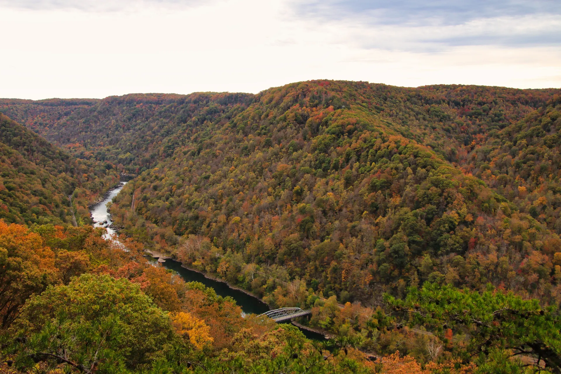
Start in Wellsboro, the charming, gas-lit county seat that serves as the gateway to the Pine Creek Gorge, the thousand-foot-deep canyon better known as the Grand Canyon of Pennsylvania. Drive out to Leonard Harrison State Park on the east rim for the classic overlook, where the gorge drops away below you and Pine Creek winds along the bottom far below.
Cross to the quieter west rim at Colton Point State Park for a different, wilder angle on the same canyon, then walk a stretch of rim trail for views you cannot get from the parking lots. Both parks are free to enter, like every state park on this trip, so settle into Wellsboro for the night and save the canyon-floor adventures for tomorrow.
- East-rim overlook of the Pine Creek Gorge · free to enter
- Quieter west-rim views of the Grand Canyon of Pennsylvania
- Short rim hikes for views beyond the overlooks
- Stay in WellsboroGas-lit gateway town · inns, diners, and outfitters
- Leonard Harrison State Park on the east rim has the most accessible overlook and a visitor center; Colton Point on the west rim is quieter and wilder.
- Wellsboro is the hub for the whole northern leg, with the best lodging, food, and gear shops in the Pine Creek area, so use it as your base.
- Pennsylvania state parks charge no entrance fee, so you can hop between Leonard Harrison and Colton Point freely all day.

The Pine Creek Rail Trail · biking & kayaking the gorge


Get down into the canyon today. The Pine Creek Rail Trail runs flat and car-free for more than 60 miles along the old railroad grade through the bottom of the gorge, and it is consistently rated one of the best rail-trail rides in the country. Rent bikes and pedal a scenic stretch through the canyon, watching for bald eagles, deer, and the occasional river otter along the creek.
When the water is up, Pine Creek itself is the play: spring high water turns the gorge into a kayaking and rafting run, while summer flows are gentler for floats. Book a guided raft, a kayak, or a bike with Pine Creek Outfitters, the long-running gorge outfitter, and let them shuttle you so you can ride or paddle one-way through the canyon instead of doubling back.
- Guided raft, kayak rental & bike rental with shuttle · book ahead
- 60+ mi flat car-free rail trail through the gorge bottom
- Best in spring high water · gentler summer floats
- Second night in WellsboroStay put for an easy gorge-day base
- Pine Creek Outfitters runs guided rafting, kayak rentals, and bike rentals with shuttles, so you can do the gorge one-way instead of an out-and-back. Reserve ahead on summer and high-water weekends.
- Pine Creek runs highest in spring snowmelt, the prime window for whitewater and rafting; by midsummer it usually mellows into easy floats.
- The Pine Creek Rail Trail is flat and shaded along the creek, ideal for all abilities and a great option on a hot day.
Worlds End State Park & the Loyalsock Trail
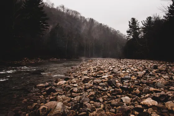
Head southeast into the rugged Loyalsock country and Worlds End State Park, a small but spectacular park tucked into a tight S-bend of Loyalsock Creek deep in the forest. The drama here is the steep, rocky terrain: the High Rock Vista looks straight down the gorge, and the creek itself forms natural water slides and swimming holes when the flow is right.
For the headline hike, pick up a stretch of the Loyalsock Trail, the classic long-distance footpath that runs nearly 60 miles across this corner of the state, threading vistas, hemlock ravines, and creek crossings. You do not have to do the whole thing: a day-hike segment out of Worlds End delivers big views and quiet forest before you settle in for the night.
- Vistas, hemlock ravines & creek crossings · pick a day stretch
- Steep gorge of Loyalsock Creek · overlook & swimming holes
- Natural slides & pools when the flow is right · free park
- Stay near Worlds End or BentonPark campground, or push toward Benton for tomorrow
- The Loyalsock Trail runs about 60 miles end to end, but day-hike segments out of Worlds End give you the best vistas without committing to a backpack.
- Worlds End sits in a tight bend of Loyalsock Creek, so the terrain is steep and rocky; wear real hiking shoes and watch footing on wet rock.
- The creek swimming holes are wonderful in warm weather but dangerous in high water, so only swim when the flow is low and calm.
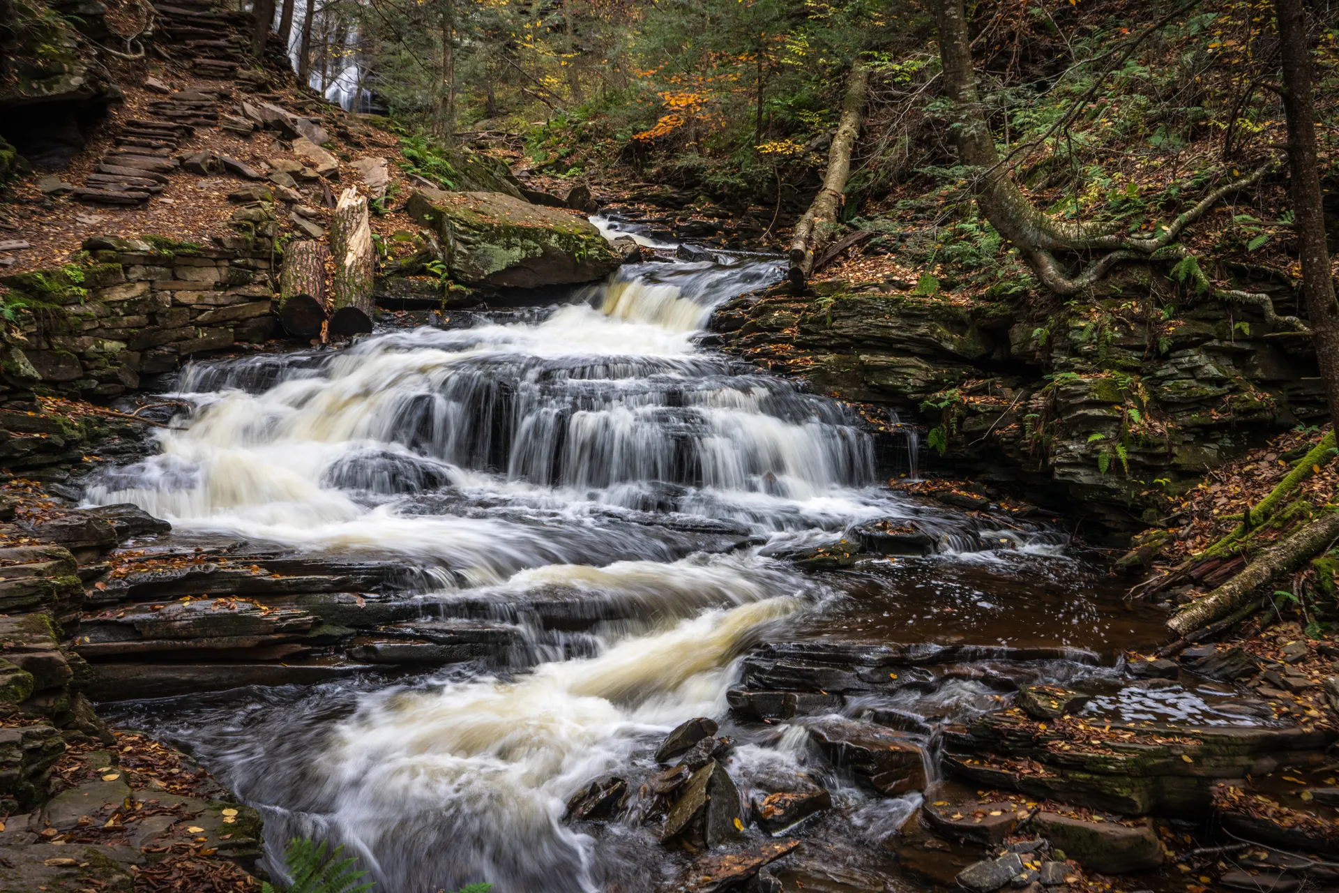
Ricketts Glen State Park · 21 waterfalls on the Falls Trail
Today is the waterfall masterpiece. Ricketts Glen State Park, near Benton, holds the Falls Trail, a roughly 7-mile loop that passes 21 named waterfalls, several of them dropping more than 30 feet, as two glens converge in a deep hemlock gorge. It is widely considered the finest waterfall hike in the eastern United States, and there is simply nothing else like it in Pennsylvania.
The full Falls Trail loop is strenuous, with steep, often wet stone steps and railings beside the cascades, so take your time and wear grippy footwear. If you want a shorter day, you can do just the upper Glen Leigh or Ganoga Glen branch and still see a dozen falls. Either way, plan a full half-day for this hike and base nearby in Benton.
- ~7 mi loop · 21 named falls · steep wet steps · half-day
- Two glens of cascades meeting in a hemlock gorge
- The tallest fall on the loop · the trail's showpiece
- Stay in BentonClosest base to Ricketts Glen · small-town lodging
- The full Falls Trail loop is about 7 miles and strenuous, with steep, slick stone staircases beside the falls. Grippy shoes and trekking poles help a lot.
- If you want a shorter visit, hike just one branch (Ganoga Glen or Glen Leigh) and you will still pass a dozen waterfalls.
- The falls run hardest in spring snowmelt and after rain; in winter they freeze into ice and the trail is often closed or treacherous.
West to the Allegheny National Forest · Kinzua Bridge skywalk
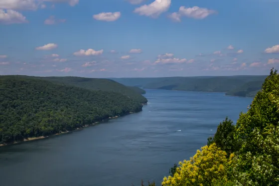
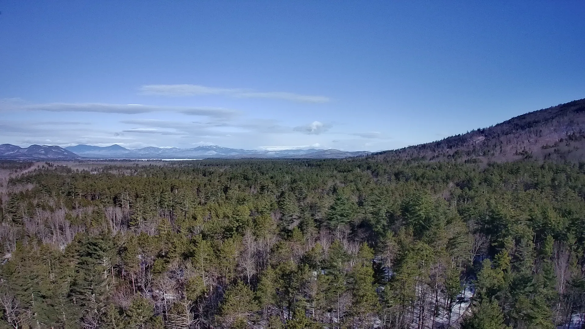
Make the scenic drive west across the northern tier to the Allegheny National Forest, Pennsylvania's only national forest, a half-million acres of hardwoods, hemlock, and the Allegheny Reservoir. The set-piece is Kinzua Bridge State Park, where a former railroad viaduct partly toppled by a tornado has been turned into the Kinzua Sky Walk, a 600-foot pedestrian walkway out over the valley with a glass-floored overlook at the end.
Walk out to the end of the skywalk for the view straight down through the glass to the wrecked towers and the forest below, then explore the forest's scenic drives and overlooks. The Allegheny is managed by the U.S. Forest Service rather than the state, so it adds a different flavor of big, wild public land to the trip.
- 600-ft pedestrian walkway · glass-floored overlook · free
- A half-million acres of forest, reservoir & overlooks
- Allegheny Reservoir views and easy forest walks
- Stay near the Allegheny forestKane, Bradford, or a forest campground for two nights
- The Kinzua Sky Walk is free and partly accessible, with a glass-floored overlook at the end looking down on the railroad towers a tornado knocked over in 2003.
- The Allegheny National Forest is U.S. Forest Service land, not a state park, so check the Forest Service site for current trail, road, and campground conditions.
- The drive west across the northern tier is long but scenic; fuel up and plan to arrive with daylight for the skywalk.
Hickory Creek Wilderness & the Allegheny
Spend a full day in the heart of the Allegheny National Forest. For a real wilderness hike, take on the Hickory Creek Wilderness, the largest of Pennsylvania's federally designated wilderness areas, where a roughly 11-mile loop wanders through deep second-growth forest with creek crossings and no facilities, signage, or shortcuts. It is a quiet, immersive walk in the woods, the antidote to the busier waterfall trails.
If you want a lighter day, swap the wilderness loop for shorter forest trails, an overlook drive along the Allegheny Reservoir, or a paddle on the water. However you spend it, this is the wild, forested middle of the trip before you turn south toward the whitewater country, so soak in the quiet.
- ~11 mi loop · PA's largest wilderness · no facilities
- Flatwater kayak or canoe on the reservoir
- Shorter walks if you want a lighter day
- Second night near the AlleghenyStay put before the long drive south tomorrow
- The Hickory Creek Wilderness loop is about 11 miles, unmarked by design, and has no facilities, so carry a map, water, and the skills to navigate before you start.
- As wilderness, Hickory Creek bans bikes and motorized use; it is foot travel only, which keeps it wonderfully quiet.
- If 11 miles is too much, the Allegheny Reservoir and the forest's shorter trails make an easier full day in the same area.
South to Ohiopyle · Cucumber Falls & Fallingwater
Drive south through the Laurel Highlands to Ohiopyle State Park, the whitewater and waterfall hub of southwestern Pennsylvania, set on a horseshoe bend of the Youghiogheny River. Walk down to the powerful Ohiopyle Falls in the center of town, then follow the short trail to Cucumber Falls, a graceful bridal-veil cascade tucked into a side glen, an easy stop you can reach almost from the parking lot.
Just up the road sits Fallingwater, Frank Lloyd Wright's masterpiece cantilevered directly over a waterfall, one of the most famous houses in the world and a must even on an outdoor trip. Reserve a house tour in advance, then settle into Ohiopyle for the night, with the river roaring in the background and tomorrow's rafting on your mind.
- Short trail to a bridal-veil cascade · free park
- Powerful falls in the heart of Ohiopyle on the Yough
- Frank Lloyd Wright's house over a waterfall · reserve a tour
- Stay in OhiopyleRiver town base for tomorrow's whitewater
- Fallingwater requires a timed, reserved tour and sells out far ahead in peak season, so book your house tour well before you arrive.
- Cucumber Falls is one of the easiest waterfall stops on the whole trip, just a short walk from a small parking area near the river.
- Ohiopyle is tiny and books up on summer and fall weekends, so reserve lodging early or look at nearby Laurel Highlands towns.
Youghiogheny whitewater & the Great Allegheny Passage
This is the southwestern whitewater day. The Youghiogheny River through Ohiopyle is one of the most popular whitewater runs in the eastern United States, with the Middle Yough offering family-friendly water and the famous Lower Yough delivering nonstop Class III to IV rapids through the gorge. Book a guided raft trip with one of Ohiopyle's long-running outfitters and let them handle the shuttle and the safety.
If you would rather stay dry, the Great Allegheny Passage rail trail runs right through Ohiopyle, so you can rent a bike and pedal a flat, scenic stretch along the river instead. Either way you are on the Yough all day, mixing whitewater and rail trail in the same horseshoe bend before you start the long drive east.
- Class III-IV rapids through the gorge · guided · book ahead
- Gentler family-friendly water above the falls
- Flat rail trail along the Yough · bike rentals in town
- Second night in OhiopyleStay put for a full river day
- The Lower Yough is continuous Class III to IV and runs on a guided, reserved basis through Ohiopyle's outfitters; book ahead, especially on summer weekends.
- The Middle Yough above the falls is gentle enough for families and first-timers, a good choice if the Lower Yough sounds intimidating.
- Prefer to stay dry? The Great Allegheny Passage rail trail runs straight through Ohiopyle, so you can swap the raft for a flat riverside bike ride.
East to the Lehigh Gorge & Jim Thorpe
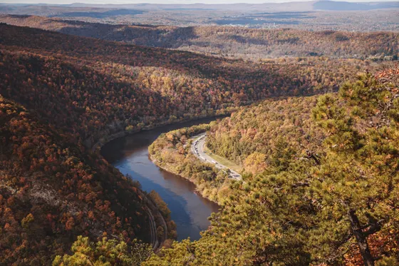
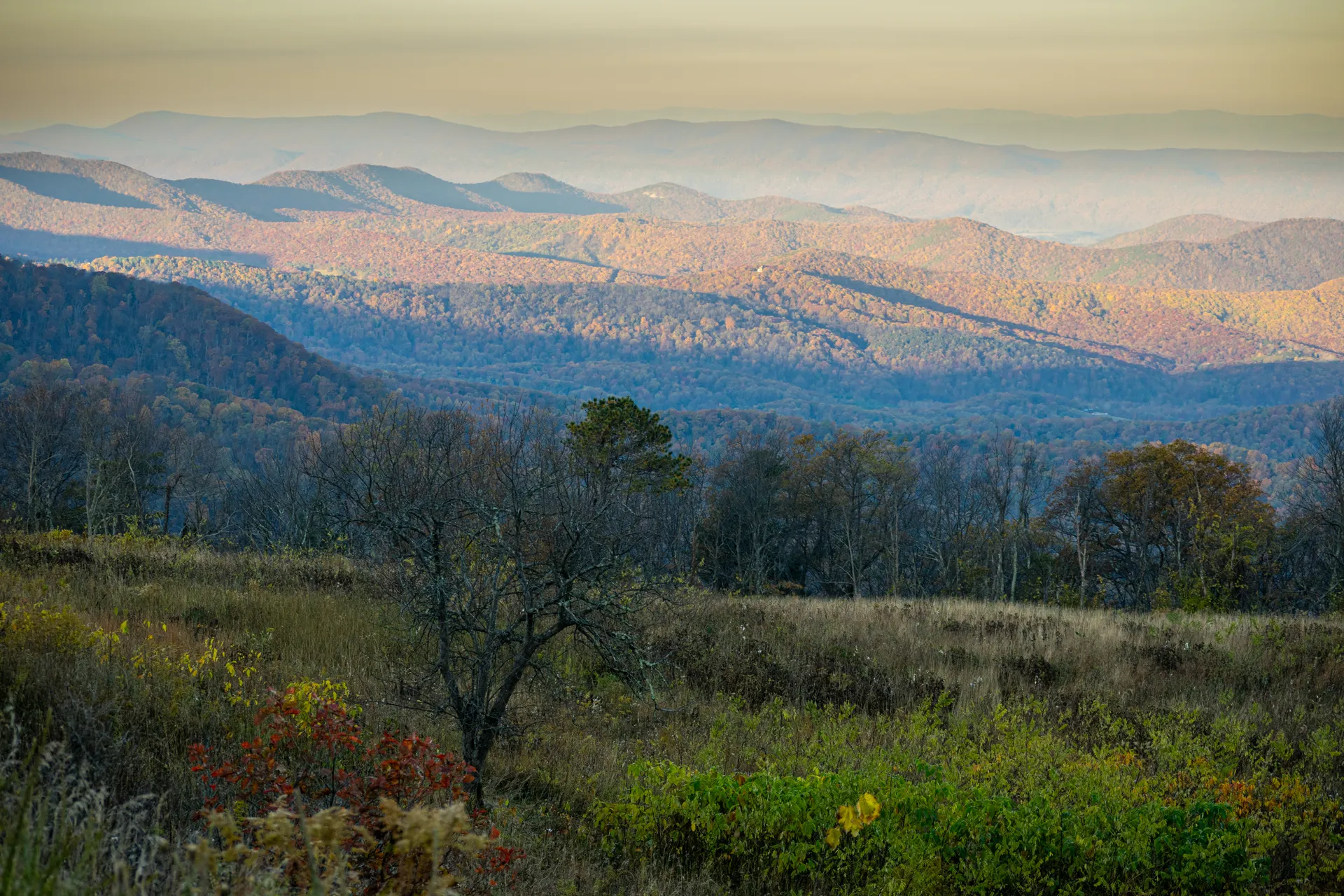
Cross the state east to Lehigh Gorge State Park and the storybook river town of Jim Thorpe, often called the Switzerland of America for its steep streets, Victorian architecture, and mountain setting. Lehigh Gorge protects a deep, dramatic canyon along the Lehigh River, with a long rail trail running its length and frequent waterfalls spilling down the walls after rain.
Rent a bike and ride the flat, car-free Lehigh Gorge Trail through the canyon, one of the most popular rail-trail rides in the Poconos region, with the river beside you and rock walls towering above. Spend the rest of the day wandering Jim Thorpe's shops and overlooks, and book tomorrow's whitewater before you turn in.
- Flat car-free rail trail through the river canyon
- Victorian river town · the Switzerland of America
- Deep gorge, waterfalls after rain · free state park
- Stay in Jim ThorpeInns and B&Bs in the heart of the river town
- The Lehigh Gorge Trail is flat and car-free along the old railroad grade, so it suits all abilities; outfitters in Jim Thorpe rent bikes and run shuttles for one-way rides.
- Jim Thorpe is compact and very popular for fall foliage, so reserve lodging early and expect busy weekends in October.
- Waterfalls spill down the gorge walls best after rain and during spring runoff, so time a rainy-week visit if you want the canyon at its fullest.
Lehigh River whitewater & the Pocono Mountains
Finish the trip with whitewater. The Lehigh River through the gorge is the Poconos' premier rafting run, with dam-release weekends pumping up the flow for lively Class II to III rapids that suit families and first-timers as well as seasoned paddlers. Book a guided trip with Jim Thorpe River Adventures, the town's established outfitter, and raft the same canyon you biked yesterday from water level.
With the rafting done, spend your last hours in the wider Pocono Mountains, a lake-and-forest region full of waterfalls, overlooks, and easy trails to wander before you head home. Getting home: from Jim Thorpe it is about an hour to Wilkes-Barre/Scranton (AVP), under two hours to Harrisburg (MDT), or you can close the loop back toward Pittsburgh (PIT) on the western end, so plan your departure airport before you set the route.
- Lakes, falls & easy forest walks for your last hours
- Getting home: AVP, MDT or PITWilkes-Barre ~1 hr · Harrisburg ~2 hr · or loop to Pittsburgh
- Jim Thorpe River Adventures runs guided Lehigh River raft trips with shuttles. The biggest water comes on scheduled dam-release weekends, so check the release calendar and book ahead.
- The Lehigh is Class II to III and beginner- and family-friendly, a gentler finale than the Lower Yough out west.
- Pick your departure airport in advance: Wilkes-Barre/Scranton (AVP) is closest to Jim Thorpe, Harrisburg (MDT) is central, and Pittsburgh (PIT) makes sense if you reverse the loop and end out west.
Now build your Pennsylvania trip.
You've seen all ten days. Open the free drag-and-drop planner and tune it for your dates, your pace, and whether you base in Wellsboro, Benton, Ohiopyle, or Jim Thorpe.
What we actually learned across Pennsylvania.
State parks are free to enter
Every Pennsylvania state park on this route, Pine Creek's rim parks, Worlds End, Ricketts Glen, Ohiopyle, Lehigh Gorge, charges no entrance fee. The Allegheny National Forest is also free for day use, though some developed campgrounds and boat launches charge. That makes this one of the most affordable outdoor road trips in the country.
Go in spring or fall
Spring brings snowmelt and high water, so the waterfalls thunder and the rivers run big for whitewater. Fall paints the gorges and forests in color and is the single most beautiful time to be out here. Summers are warm and humid but still fine for rivers and rail trails, and winters are cold, icy, and quiet.
Book whitewater & rentals ahead
Guided rafting on the Lehigh and the Youghiogheny, plus the Pine Creek raft, kayak, and bike rentals, run on reservations and sell out on summer and high-water weekends. The Lehigh's biggest flows come on scheduled dam-release weekends, so check the calendar and reserve early.
Use the rail trails
Pennsylvania has some of the best rail trails in the country: the Pine Creek Rail Trail, the Great Allegheny Passage, and the Lehigh Gorge Trail all run flat and car-free through dramatic scenery. They are perfect for mixed-ability groups and a great low-impact alternative to a big hike.
Base in the small towns
Rather than chasing one park, base in Wellsboro for Pine Creek, Benton for Ricketts Glen and Worlds End, Ohiopyle for the Yough, and Jim Thorpe for the Lehigh. Lodging in these towns is limited and fills fast for peak fall weekends, so reserve early.
Plan the loop and your airports
This is a big statewide loop of roughly 750 miles, so plan your driving in advance. Pittsburgh (PIT) is closest to Ohiopyle in the west, Harrisburg (MDT) is central, and Wilkes-Barre/Scranton (AVP) is closest to the Pine Creek, Ricketts Glen, and Lehigh corners in the east and north.
Everything you'll actually want to know.
Ready to go? Get your
Pennsylvania outdoor route.
State parks and trailheads, the rail-trail and whitewater outfitters, free park entry, small-town lodging in Wellsboro, Benton, Ohiopyle, and Jim Thorpe, and the loop driving and airport options you need to road-trip Pennsylvania.
Instant book · Free cancellation · Secure payment via Stripe
Planning this trip?
Save it, share it with your crew, or find travelers heading the same way.

Liked this itinerary?
What other travelers are saying
Be the first to leave a tip or question for the next traveler.