Ouachita Trail Backpacking:
A 7-Day Arkansas Itinerary
Seven days backpacking the Arkansas Ouachita Trail: long east-west ridge walks, Rich Mountain, the Flatside Wilderness and Forked Mountain, free first-come shelters, and the logistics to thru hike it safely.
Free interactive planner · drag & reorder your days, add stops, map it in minutes
Build your own Ouachita Trail trek, drag, reorder & map it.
Drag segments between days, adjust your daily mileage, and drop in your own shelters, water sources, and trailheads with the place search. The live map and distances recalculate as you go, so you can plan realistic days and water carries before you ever shoulder the pack.
Opens a side panel · reorder days, add custom stops, see your route live
One long ridge walk, shelters, springs & fall color, across Arkansas.
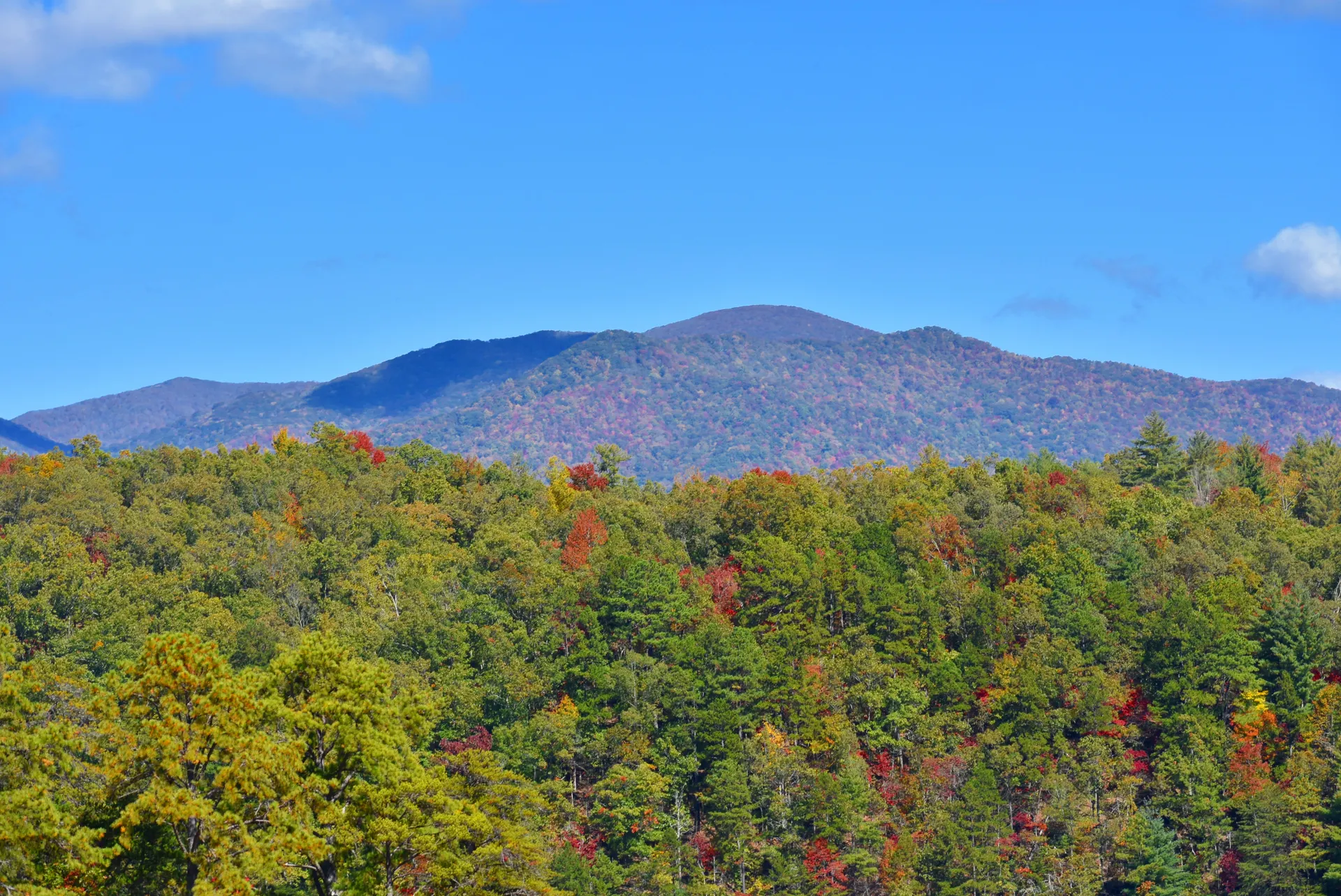
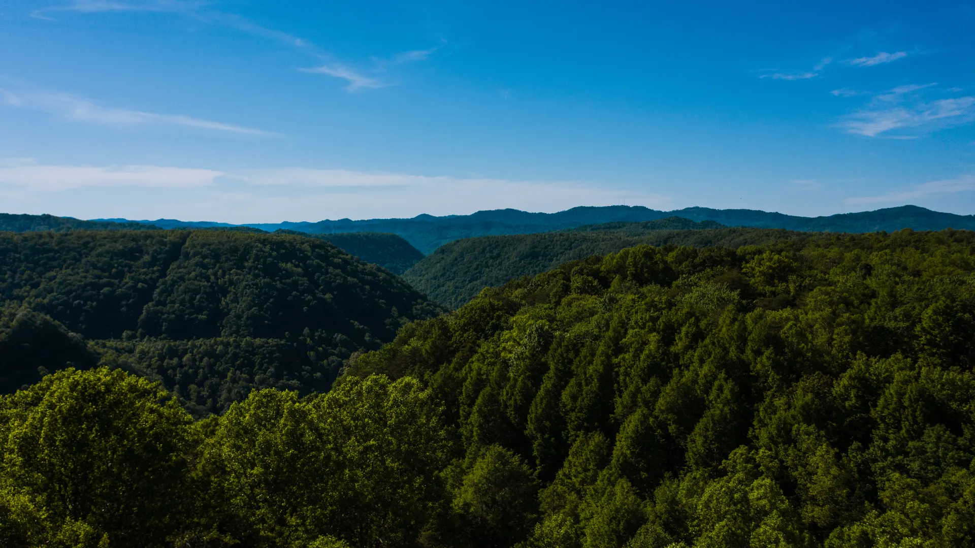
The Ouachita Trail runs about 223 miles from Talimena State Park near the Oklahoma line east to Pinnacle Mountain State Park just outside Little Rock. Most of it, roughly 180 miles, lies in Arkansas, threading the Ouachita National Forest along ridges that, unusually for North America, run east to west. It is a quiet, primitive long trail: free to camp, lightly traveled, and a true week-plus backpack rather than a stroll.
This 7-day route covers the heart of the Arkansas section, built around Ouachita Trail backpacking: long forested ridge walks, the climb over Rich Mountain (the high point near Queen Wilhelmina State Park), the rugged Flatside Wilderness and Forked Mountain, and the Crystal and Fourche Mountain country. You'll sleep in free first-come trail shelters and primitive campsites and cross creeks that ring with frogs at dusk.
Late October through April is the window. Late October into early November brings the best fall color and crisp ridge walking; winter is cold but clear and bug-free; spring greens up fast. Summer is hot, humid, and brutal with ticks, chiggers, and mosquitoes, and springs and creeks can run dry, so most thru hikers avoid June through September entirely.
The Ouachita Trail is point-to-point, so the single biggest logistic is arranging a shuttle or a car at each end before you start. The second is water: springs and small creeks can run dry in late summer and fall, so study the water sources, carry and treat plenty, and never count on a single unverified spring. There is no permit for most of the route and camping is free, but plan your resupply, because towns are far off-trail.


Talimena start & the climb over Rich Mountain
Stage your shuttle, then start at the western Arkansas trailhead near Talimena State Park and the Oklahoma line. The Ouachita Trail throws you straight into the high country, climbing toward Rich Mountain, the high point of the trail near Queen Wilhelmina State Park, where a lodge and tower crown a long forested crest with views across ridge after ridge.
These first miles are classic Ouachita: a long east-west ridge walk through oak and pine, rocky underfoot in places, with the wind moving through the trees. Top off and treat water wherever you find a reliable source, because the high ridge can be dry, and settle into the first trail shelter or primitive campsite as the light fades. Camping is free and needs no permit on the national forest.
- Rich Mountain & Queen WilhelminaTrail high point · lodge & tower · long ridge views
- Arrange your shuttle firstPoint-to-point · stage a car or shuttle at each end before you start
- Treat all waterSprings can be dry on the ridge · carry & filter / treat plenty
- Camp at a shelter or primitive siteFree, first-come trail shelters · no permit on the forest
- The trail is strictly point-to-point. Arrange a shuttle or leave a car at the far end before you set off, because the two trailheads are hours apart by road.
- Rich Mountain is the high point of the trail. Queen Wilhelmina State Park has a lodge if you want a real bed and a hot meal the night before you start.
- Camping is free and needs no permit on most of the Ouachita National Forest, so plan to sleep at the first-come shelters and primitive sites along the way.
Long ridge walks east through the Ouachita National Forest


Today is the rhythm that defines the trail: long, rolling ridge walks east through the Ouachita National Forest, dropping into hollows to cross small creeks and climbing back onto the spine. The Ouachitas' east-west grain means you trade short, steep climbs for mile after mile of forested crest, with the occasional rocky outcrop opening a view.
This is big-mileage country if you want it, but plan your day around water: note which creeks and springs are running, fill up when you can, and treat everything. Aim your camp for a known trail shelter or a flat spot near a reliable creek so you are not searching for water at dusk. Watch for ticks and chiggers in the brush and copperheads on warm rocks.
- Long east-west ridge walkingRolling forested crest · short steep climbs between hollows
- Plan camp around waterFill & treat at reliable creeks · don't leave a source low on water
- Ticks, chiggers & copperheadsCheck for ticks daily · watch warm rocks for snakes
- Camp at a shelter or by a creekFirst-come shelters · or a flat primitive site near running water
- Treat or filter all water on the Ouachita Trail. Springs and small creeks can run low, so fill up whenever you pass a reliable source rather than gambling on the next one.
- Ticks and chiggers are the real nuisance in the brush. Wear permethrin-treated clothing, do a tick check every evening, and watch warm rocks for copperheads.
- The ridge is mostly green-tunnel forest, so it is about the walking, not constant views. Aim each day at a known shelter or creek so you set camp with water in hand.
Shelters, creek crossings & quiet forest miles
A full day in the heart of the Ouachita National Forest: quiet, lightly traveled miles where you may not see another hiker for hours. The trail rolls along the ridges and dives to creek crossings in shaded hollows, the kind of spots where the temperature drops, the frogs start up, and a cold filtered drink feels earned.
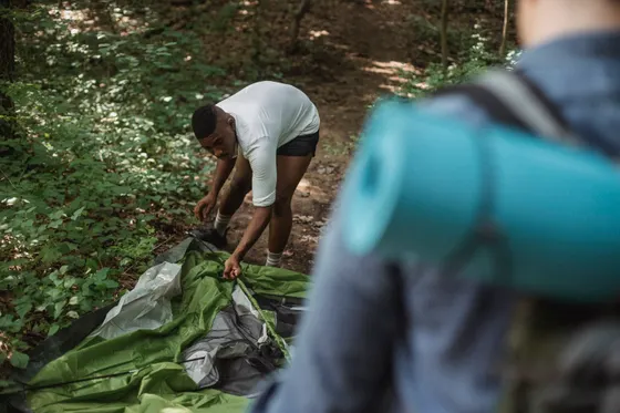
The Ouachita Trail's string of free trail shelters is one of its quiet joys: simple three-sided structures, first-come and no permit, spaced along the route. They are a dry roof in a region that can deliver sudden rain, and a social hub if you do meet other thru hikers. If shelters are full or off your mileage, primitive camping anywhere on the forest is allowed and free.
- Free first-come trail sheltersSimple three-sided shelters · no permit · a dry roof in the rain
- Shaded creek crossingsCool hollows · good water and lunch spots · treat before drinking
- Quiet, lightly traveled milesYou may go hours without seeing anyone · solitude is the draw
- Watch for sudden rainStorms build fast · the shelters earn their keep
- The trail shelters are first-come and free, so carry a tent or tarp as a backup. If one is full or it does not line up with your mileage, you can camp anywhere on the forest.
- Creek crossings in the hollows are your best water and lunch stops. Treat everything, and note on your map which ones are reliable in the season you are hiking.
- This stretch is genuinely remote and lightly used. Carry a paper map and a charged GPS or phone with the route downloaded, because there is little to no cell service.

Crystal & Fourche Mountain country
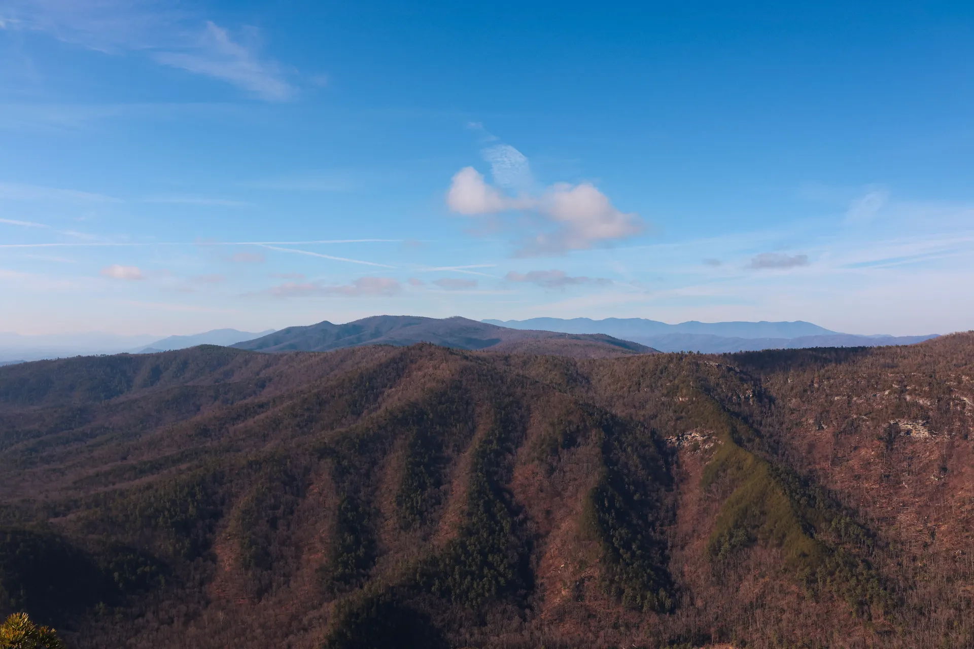
The middle of the trek runs through the Crystal and Fourche Mountain country, more long ridge walking with rocky stretches and a string of climbs and descents that earn their reward in evening light. This is the kind of remote, restful midpoint where the trail and your pace finally sync up.
Keep managing water and resupply: by now you are deep in the forest and far from any town, so know where your next reliable source is and whether you have enough food to reach the far end. If you arranged a midpoint food cache or a town resupply via a road crossing, this is the region where it tends to fall. Stay on top of ticks and keep an eye on the weather.
- Crystal & Fourche MountainRocky ridge walking · climbs and descents · remote midpoint
- Track your next water sourceDeep in the forest · don't pass a reliable source low on water
- Resupply at a road crossingTowns are far off-trail · cache food or resupply where roads cross
- Camp at a shelter or primitive siteFree camping · pick a spot near water before dark
- Towns sit well off the trail, so plan resupply around the road crossings or cache food ahead of time. Carry enough to reach your next certain food point with a margin.
- The Crystal and Fourche Mountain stretch is rocky and rolling. Lighter feet and trekking poles help, and good footwear matters more here than almost anywhere on the trail.
- Keep doing daily tick checks and watch the forecast. Ouachita storms can build quickly, and being on an exposed rocky knob in lightning is the one thing to avoid.
Into the Flatside Wilderness & Forked Mountain
A highlight of the Arkansas section: the trail enters the Flatside Wilderness, a roadless, federally protected pocket of the Ouachitas with some of the trek's most rugged and rewarding miles. Nearby rises the distinctive cone of Forked Mountain, a landmark that punctuates the forested sea of ridges.
Wilderness rules mean no motors and a stronger leave-no-trace ethic, so camp on durable ground, keep groups small, and pack out everything. The walking is wilder and rockier here, the forest feels older, and a side scramble or an overlook can open a long view across the Ouachitas. Take the time to enjoy it; this is the stretch most thru hikers remember.
- Flatside WildernessRoadless, protected · the most rugged, rewarding miles of the trek
- Forked Mountain landmarkDistinctive cone above the ridges · a classic Ouachita view
- Leave no trace in wildernessNo motors · camp on durable ground · pack everything out
- Camp in or near the wildernessPrimitive sites · choose durable, established spots
- The Flatside Wilderness is the scenic high point of the Arkansas section. Slow down and enjoy it, and follow strict leave-no-trace since it is federally protected wilderness.
- Forked Mountain is the iconic cone you will see from the ridges. It makes the best photo of the trek, especially in late-afternoon light or with fall color.
- Wilderness miles are rockier and slower than the open ridge. Build a little extra time into this day rather than trying to push your biggest mileage through it.
Fall-color ridges toward the eastern forest
East of the wilderness the trail rolls on through prime fall-color country. In late October and early November the oak and hickory ridges blaze gold and red, and a cool, clear day of ridge walking here is the reason to time your trek for autumn. The miles tick by under a changing canopy with occasional rocky overlooks.
You are nearing the eastern end now, so dial in the logistics: confirm your pickup or car at Pinnacle Mountain for tomorrow, account for your remaining water, and enjoy a last full night under the trees at a shelter or primitive site. If you based out of Hot Springs for the start or finish, this is the side of the trek closer to town comforts and a hot meal.
- Peak fall colorLate Oct to early Nov · gold and red oak-hickory ridges
- Confirm your pickup for tomorrowNearing Pinnacle Mountain · re-check your shuttle or car at the end
- Account for remaining waterPlan the last carries · fill at the last reliable source
- Last full night on trailShelter or primitive site · enjoy a final forest camp
- Time the trek for late October if you want fall color. The eastern ridges of oak and hickory turn gold and red, and the cooler air makes the long days far more pleasant.
- Re-confirm your shuttle or end-of-trail car the day before you finish if you have any signal. Nothing is worse than walking out at Pinnacle Mountain with no ride.
- Hot Springs is the nearest real town to the eastern end, with lodging and restaurants. It makes a comfortable base for the night before or after your finish.
Final miles to Pinnacle Mountain & the finish
The last day brings you out of the forest toward the eastern terminus near Pinnacle Mountain State Park, just outside Little Rock, where the wild ridge country gives way to the edge of the city. The distinctive peak of Pinnacle Mountain marks the end of the Ouachita Trail and the close of your week-plus across Arkansas.
Getting home: from the eastern terminus, Little Rock (LIT) is the nearest airport, about 30 to 40 minutes away; Fort Smith (FSM) is the closer option to the western end. Collect your shuttle or car, and if you can, treat yourself to a real meal and a night in Hot Springs or Little Rock before the journey home. You have earned it.
- Pinnacle Mountain finishEastern terminus near Little Rock · the end of the Ouachita Trail
- Getting home: Little Rock or Fort SmithLIT ~30-40 min from the east end · FSM closer to the west end
- Recover in Hot Springs or Little RockReal meal & a bed · celebrate a week-plus of ridge walking
- Collect your shuttle or carPoint-to-point · your pre-arranged ride waits at the terminus
- The eastern terminus is near Pinnacle Mountain State Park just outside Little Rock, so Little Rock (LIT) is the most convenient airport for flying home.
- If you flew into Fort Smith (FSM) for the western start, factor the long road transfer between the two ends into your shuttle plan and your flight timing.
- Hot Springs and Little Rock both have lodging and restaurants for a celebratory night after the trek. A hot soak in Hot Springs is a fitting way to end a long backpack.

Now build your Ouachita Trail trek.
You've seen all seven days. Open the free drag-and-drop planner and tune it for your dates, your pace, your shuttle, and how far you want to walk each day across the Arkansas ridges.
What we actually learned on the trail.
Arrange a shuttle, it is point-to-point
The Ouachita Trail runs one way from Talimena State Park to Pinnacle Mountain, and the two ends are hours apart by road. Stage a car at each end, arrange a hiker shuttle, or split the drive with a partner. Sort this out before anything else, because the whole trek depends on it.
Plan your water carefully
Springs and small creeks along the trail can run low or dry, especially in late summer and fall. Study the water sources for your section, treat or filter everything, and never leave a reliable source low on water. Carry extra across the dry ridge stretches.
Ticks, chiggers & copperheads
The Ouachitas are tick and chigger country, and copperheads sun on warm rocks. Wear permethrin-treated clothing, do a tick check every evening, watch where you put your hands and feet, and carry a basic first-aid kit. They are manageable, but you need to respect them.
Free shelters & dispersed camping
A string of simple three-sided trail shelters runs the route, all free and first-come with no permit. They are not guaranteed, so carry a tent or tarp. On most of the Ouachita National Forest you may also camp dispersed, free, almost anywhere off the trail.
Hike late October through April
Late October into early November brings the best fall color and crisp ridge walking. Winter is cold but clear and bug-free; spring greens up fast. Summer is hot, humid, and thick with ticks and chiggers, with unreliable water, so most thru hikers avoid June through September.
Fly into Little Rock or Fort Smith
Little Rock (LIT) is the closest airport to the eastern terminus near Pinnacle Mountain, about 30 to 40 minutes away. Fort Smith (FSM) is closer to the western end near Talimena. Base in Mena to the west or Hot Springs to the east for lodging at either end.
Everything you'll actually want to know.
Ready to go? Get your
Ouachita Trail trek plan.
Shelters and water sources, daily mileage, the shuttle logistics, the Flatside Wilderness and Forked Mountain highlights, airport options at Little Rock and Fort Smith, and the seasonal timing you need to backpack the Ouachita Trail safely.
Instant book · Free cancellation · Secure payment via Stripe
Planning this trip?
Save it, share it with your crew, or find travelers heading the same way.

Liked this itinerary?
What other travelers are saying
Be the first to leave a tip or question for the next traveler.