Mississippi Outdoor Adventure Map +
10-Day Road Trip Itinerary
10-day Mississippi outdoor road trip. Paddle the Black Creek Wild & Scenic River, camp on a Gulf Islands barrier island, backpack a section of the Natchez Trace, and climb Mississippi's only via ferrata at Tishomingo State Park, from Hattiesburg to the Appalachian foothills.
Free interactive planner · drag & reorder your days, add stops, map it in minutes
Build your own Mississippi road trip, drag, reorder & map it.
Drag stops between days, swap activities, and add your own trailheads, landings, and towns with the place search. The live map and drive legs recalculate as you go, so you can tune the 10-day loop from the Gulf Coast to the Appalachian foothills around your own pace and flights.
Opens a side panel · reorder days, add custom stops, see your route live
River, barrier island, trace & via ferrata, end to end.
This 10-day Mississippi outdoor road trip is built for active travelers who want variety: wilderness river paddling, barrier-island camping, historic-trail backpacking, and climbing, all in one state. You base out of four towns, Hattiesburg, Gulfport, Natchez, and Tishomingo, and cover roughly 700 miles from the Gulf Coast up to the Appalachian foothills.
The signature legs are a two-day paddle on the Black Creek Wild & Scenic River (Mississippi's only National Wild & Scenic River), an overnight on West Ship Island in the Gulf Islands National Seashore, an overnight backpack on the Natchez Trace National Scenic Trail, and Mississippi's only via ferrata at Tishomingo State Park.
Most permits are free but need planning: a self-issue permit for Black Creek Wilderness camping, a free reservation for primitive camping on Ship Island, and state-park reservations at Tishomingo. Go in spring (March–May) or fall (September–November) to dodge summer heat, humidity, and hurricane season.
Reserve primitive camping on West Ship Island through Gulf Islands National Seashore (free, but competitive) and book the Ship Island Excursions ferry ahead in peak season. Reserve Tishomingo State Park cabins/campsites and the via ferrata 3–6 months out for spring and fall weekends. Black Creek Wilderness camping is free and self-issued at the landing kiosks.
Arrive in Hattiesburg & prep for Black Creek
Fly into Jackson-Medgar Wiley Evers International Airport (JAN), pick up your rental car, and drive about 90 minutes south to Hattiesburg, your base for the Black Creek Wilderness. Use the afternoon to grab last-minute supplies and confirm your canoe or kayak rental for tomorrow.
Hattiesburg has full services, the last easy resupply before you head into the wilderness. Sort your dry bags, water, and food for a two-day self-supported paddle tonight, because there are no facilities once you're on the river.
- Drive JAN → Hattiesburg~90 mi · 1.5 hr · major airport to base town
- Confirm canoe/kayak rentalOutfitters near Hattiesburg / Brooklyn deliver to the landing
- Resupply & dinner in HattiesburgLast full services before the wilderness
- JAN is the most central airport for this trip; New Orleans (MSY) works for the southern legs and Memphis (MEM) for the northern end.
- Arrange a shuttle or self-shuttle so a vehicle is waiting at the Fairley Bridge take-out before you launch.
- Buy and pack all your drinking water tonight; Black Creek water requires filtering or purifying.
Black Creek aheadGear checkBlack Creek paddle & sandbar camping
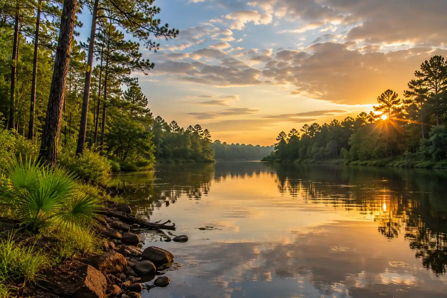
Cypress banksSandbar campDrive to Janice Landing off Highway 29 and self-issue your free wilderness permit at the kiosk. Launch onto the Black Creek, Mississippi's only National Wild & Scenic River, and paddle downstream through the Black Creek Wilderness past cypress, vertical bluffs, and white sand bars.
The full Janice-to-Fairley-Bridge run is about 12 miles; today, paddle roughly half and pick a white sandbar above the waterline for a primitive camp. Practice strict Leave No Trace: pack out all trash, bury waste well away from the water, and keep fires small in a pan.
- ~12 mi total · calm, scenic water · beginner-friendly with experience
- Free · at the landing kiosk · Black Creek National Wild & Scenic River
- Primitive camp on a river sandbarAbove the waterline · Leave No Trace · no facilities
- Camp on sandbars above the waterline and set up well back from the channel in case levels rise overnight.
- Mosquitoes and gnats are worst at dusk; bring strong repellent and a head net for spring and fall evenings.
- Check water levels before you go, low water exposes more snags and slows the paddle.
Paddle out & drive to the Gulf Coast
Enjoy the morning quiet and finish the paddle to Fairley Bridge Landing, the designated take-out with a concrete ramp and parking. De-rig your boats and hand off to your outfitter or shuttle.
Drive south about 90 minutes to Gulfport on the Mississippi Gulf Coast, trading wilderness river for the coast. Check in, then stock up on all your water, food, and sun protection for tomorrow's overnight on Ship Island, where nothing is for sale.
- Paddle to Fairley Bridge LandingRemaining miles · concrete ramp, gravel road, parking
- Drive Fairley Bridge → Gulfport~60 mi · 1.5 hr · wilderness to coast
- Resupply for Ship IslandWater, food, sunblock, shade, no services on the island
- Confirm your shuttle pickup time at Fairley Bridge before you launch on Day 2, cell service is spotty on the river.
- Gulfport has beachfront and budget hotels; book near the small-craft harbor where the Ship Island ferry departs.
- There is no drinking water or store on Ship Island, so pack every drop you'll need for the overnight.
Take-outFerry harborFerry to West Ship Island & camp
Fort MassachusettsSound crossingTake the morning Ship Island Excursions ferry from Gulfport out to West Ship Island, part of the Gulf Islands National Seashore, watching for dolphins across the Mississippi Sound on the roughly hour-long crossing.
On arrival, tour Fort Massachusetts, a Civil War-era brick fort, then hike to your designated primitive campsite. Sites are remote with no facilities, so you carry in all water and supplies and pack everything out. Expect full sun, wind, sand, and insects.
- ~1 hr each way · book ahead in peak season
- Tour Fort MassachusettsFree · Civil War brick fort · rare island shade
- Free permit + reservation via Gulf Islands National Seashore
- Reserve the free primitive-camping permit through Gulf Islands National Seashore well ahead, spring and fall spots fill months out.
- Book the ferry in advance and confirm the last return sailing, schedules shift with weather.
- There is almost no natural shade outside the fort, so bring a sun shelter, extra water, and strong sunscreen.
Ship Island morning & return to Gulfport
Spend the morning walking the pristine beaches and dunes of West Ship Island, a fantastic spot for birdwatching, shelling, and swimming in the Gulf. The island is critical migratory-bird habitat, so keep your distance from nesting areas.
Catch the afternoon ferry back to Gulfport, then reward the barrier-island effort with a fresh Gulf Coast seafood dinner, shrimp, oysters, and fresh fish, and resupply groceries for the drive inland tomorrow.
- Morning beach walk & birdingShelling, swimming, migratory birds along the shore
- ~1 hr · afternoon departure · confirm the time
- Seafood dinner in GulfportFresh Gulf shrimp, oysters & fish · resupply for the drive
- Confirm the return ferry time when you land on the island; the last sailing can be earlier than you expect.
- Give roped-off dune and nesting areas a wide berth, they protect shorebirds and stabilize the island.
- Rinse salt and sand off your gear back in Gulfport before you pack for the inland legs.
Migratory birdsSeafood dinnerDrive to Natchez & the Natchez Trace
Emerald MoundNatchez bluffDrive about 3.5 hours west to Natchez, one of the oldest European settlements on the Mississippi River and the southern terminus of the Natchez Trace Parkway. Spend the afternoon on the Trace, an ancient travel corridor turned scenic byway managed by the National Park Service.
Visit Emerald Mound, one of the largest Native American ceremonial mounds in the country, and walk a stretch of the atmospheric Sunken Trace, where centuries of foot and hoof traffic wore the path deep into the earth. Then check into a historic Natchez B&B and prep your backpack for tomorrow.
- Drive Gulfport → Natchez~180 mi · 3.5 hr · inland through rural Mississippi
- Second-largest ceremonial mound in the US · free
- Short, flat, atmospheric · the historic Old Trace
- The Natchez Trace Parkway has a 50 mph limit, no commercial trucks, and frequent pull-offs, allow extra time to stop.
- Natchez has historic-mansion B&Bs as well as standard hotels; book a river-bluff room for the views.
- Organize your food and water tonight, Trace campgrounds are primitive with limited or no potable water.
Backpack the Natchez Trace Trail
Drive north to Rocky Springs (Parkway milepost 54.8) and start an overnight backpack on the Natchez Trace National Scenic Trail. The Rocky Springs section winds through hardwood forest, over rolling hills, and past a ghost-town site and historic markers.
Water sources are limited, so carry enough or a reliable filter, and self-register where posted. Camp back at the free, first-come Rocky Springs Campground, a primitive site with a pit toilet but no potable water. Watch for deer, turkey, and ticks in the woods.
- Drive to Rocky Springs trailhead~60 mi · 1.5 hr · Parkway milepost 54.8
- ~10–12 mi · 6–8 hr · moderate · forest & historic markers
- Free · first-come · pit toilet, no potable water
- Water is scarce on the Trace trail, carry plenty and treat anything you collect.
- Trace campgrounds are free and first-come, first-served, so have a backup plan on busy weekends.
- Do a thorough tick check after hiking, and treat clothing with permethrin before the trip.
Rocky SpringsTrace forestHike out & drive to Tishomingo
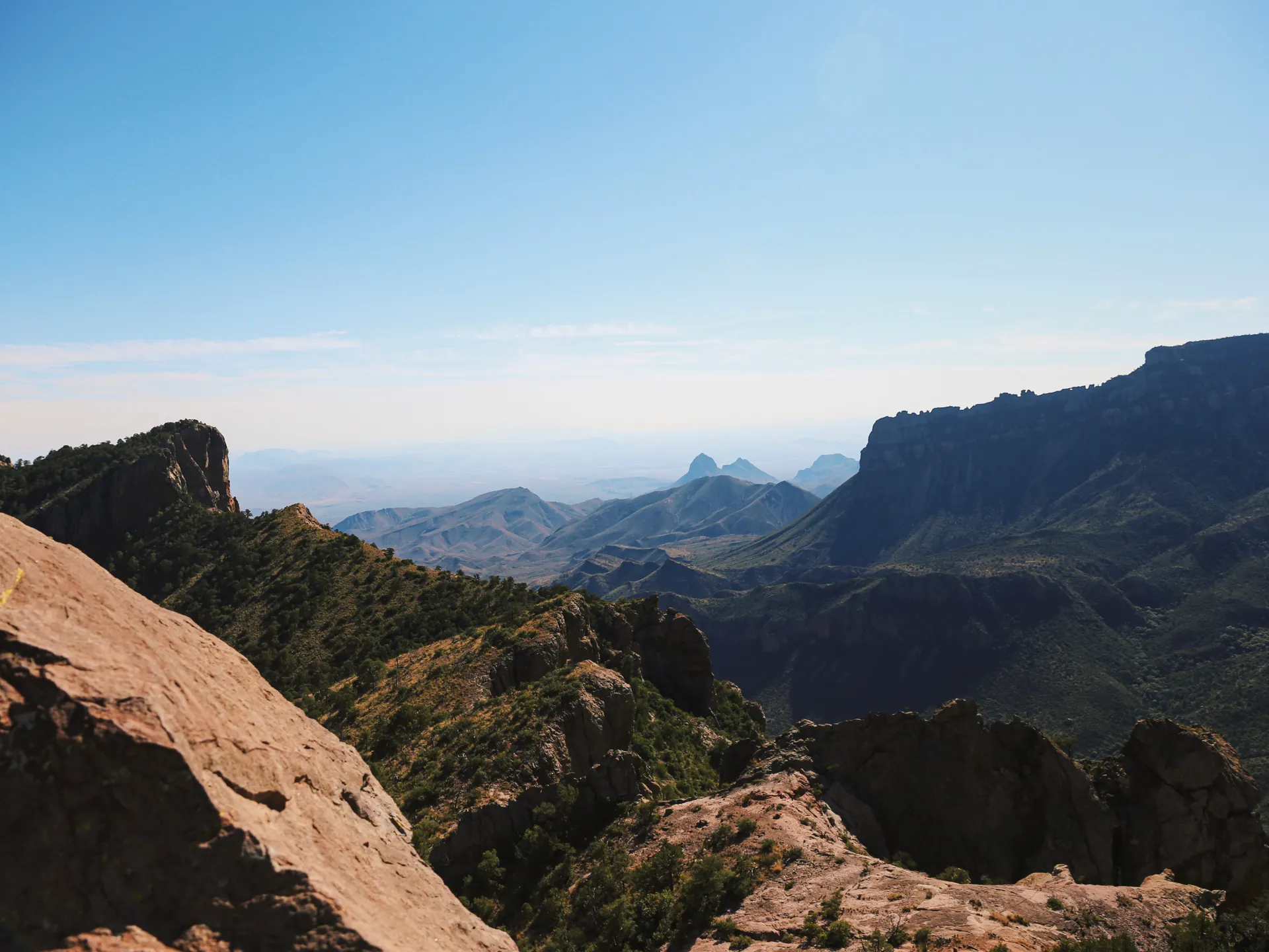
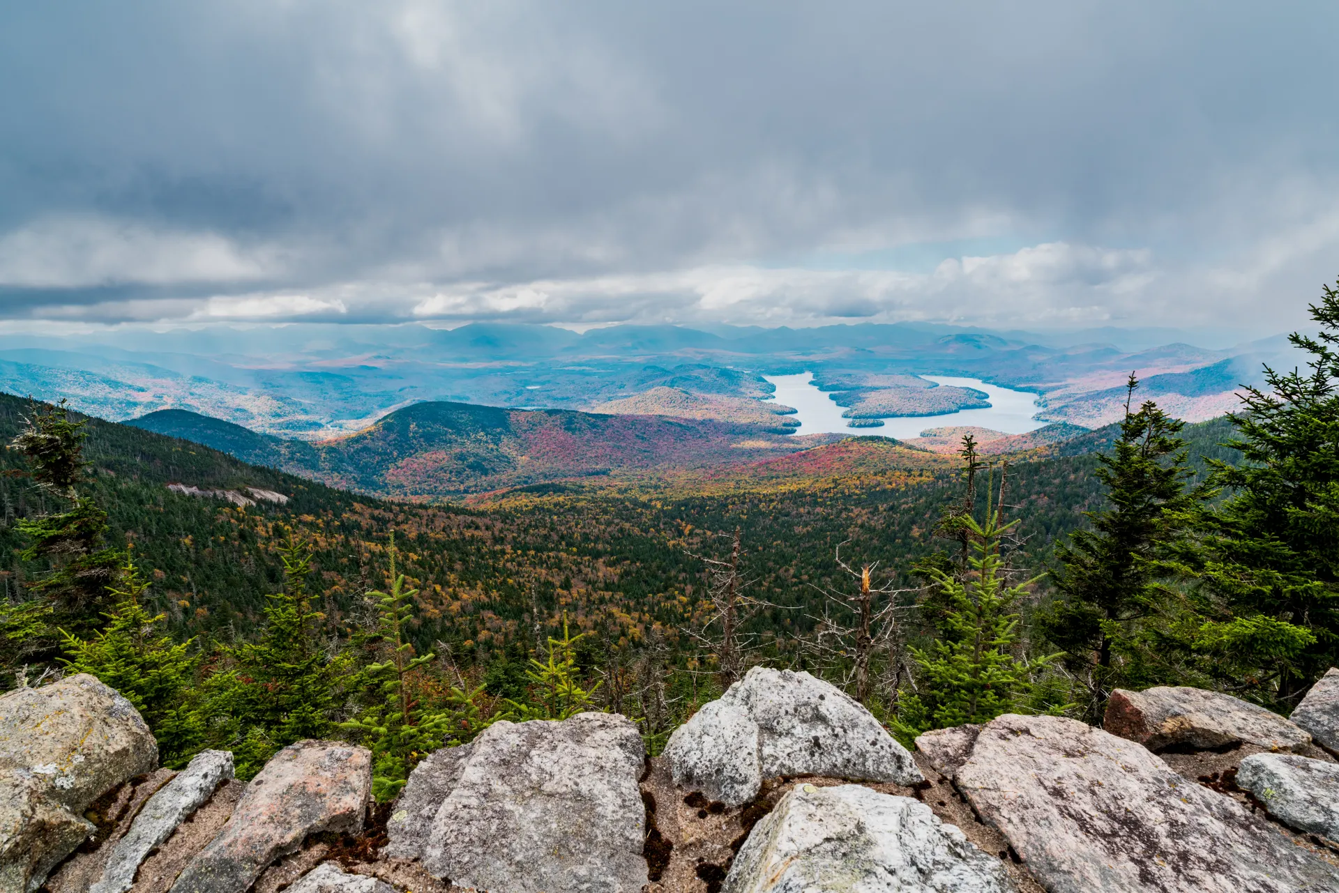
Park cabinClear streamsFinish the backpack with an easy morning walk back to your vehicle at Rocky Springs, then start the trip's longest driving leg, roughly 5 hours northeast to Tishomingo State Park in the Appalachian foothills of the state's far corner.
This is the geographic surprise of Mississippi: rocky sandstone bluffs, clear streams, and a canyon landscape that looks nothing like the coastal plain. Check into a cabin or campsite at Tishomingo and rest up for the via ferrata.
- Hike out to Rocky Springs~4–6 mi · 2–3 hr · flat to gently rolling
- Drive Rocky Springs → Tishomingo~270 mi · ~5 hr · longest driving day
- Cabins & campsites · book ahead for weekends
- Fuel up and pack road food, it's a long, mostly rural drive across the width of the state.
- Tishomingo cabins and campsites book out on spring and fall weekends, reserve 3–6 months ahead.
- Arrive with daylight to spare so you can scope the park and confirm your via ferrata time for tomorrow.
Tishomingo via ferrata & Bear Creek trails
Climb Mississippi's only via ferrata at Tishomingo State Park, a guided fixed-cable route along the rock faces above Bear Creek Canyon. Reservations are mandatory and all climbing gear (harness, helmet, lanyard) is provided; check the park's minimum age and weight requirements.
In the afternoon, explore the park's sandstone outcroppings on the Outcroppings / Bear Creek Trail and cross the historic swinging bridge. Spend a second night at Tishomingo, the dark skies here are great for stargazing.
- 2–3 hr · reservations required · gear provided
- Moderate · sandstone bluffs & rock formations
- Dark skies · park store for basics
- Book the via ferrata as soon as your dates are set, spots are limited and fill fast in spring and fall.
- Check the posted minimum age and weight limits before you count on the whole group climbing.
- The swinging bridge and Outcroppings Trail are the classic short hikes, easy to pair with the climb.
Swinging bridgeOutcroppingsFinal hike & drive to your airport
Final hikeFly from MemphisTake a short final hike, the Swinging Bridge Trail or the in-park section of the Natchez Trace Trail, then break camp. Depending on your flight, drive to the airport that fits best.
Memphis International (MEM) is the closest major hub (~1.5 hr) with the most direct flights, while Jackson (JAN) (~3 hr) keeps you in Mississippi if that matches your return. Allow time for rental-car return and check-in.
- Morning Swinging Bridge Trail1–2 hr · easy · optional last hike
- Drive to MEM or JANMemphis ~90 mi / 1.5 hr · Jackson ~180 mi / 3 hr
- Return rental & fly homeAllow time for car return and check-in
- Memphis (MEM) is the easiest fly-out from Tishomingo, book flights out of MEM to save driving.
- If you fly home from Jackson (JAN), you can add a stop on the drive south for a rounder loop.
- Top off fuel near Tupelo before the airport run, options thin out in the far northeast corner.
Now build your Mississippi trip.
You've seen all ten days. Open the free drag-and-drop planner and tune it for your dates, your pace, and which airports you fly in and out of.
Essential permits, seasons & planning.
Free but planned permits
Black Creek Wilderness camping is free and self-issued at the landing kiosks. Primitive camping on West Ship Island needs a free reservation through Gulf Islands National Seashore and fills months ahead. Tishomingo State Park camping and the via ferrata both require reservations.
Go spring or fall
March–May and September–November bring moderate temperatures, lower humidity, and fewer bugs. Summer (June–August) means intense heat, humidity, thunderstorms, and hurricane risk that make multi-day trips brutal. Winters are mild but can bring cold snaps and occasional ice.
Leave No Trace everywhere
On Black Creek and Ship Island especially, pack out all trash, bury human waste away from water, minimize fire impact, and respect wildlife. Camp on Black Creek sandbars above the waterline and use only designated primitive sites on Ship Island and the Trace.
Water is the constant
Black Creek water needs filtering, Ship Island has none for sale, and Natchez Trace campgrounds have limited or no potable water. Carry or treat your own on every backcountry leg, and top off in town before each one.
This is a driving trip
Plan on roughly 700 miles: JAN → Hattiesburg (1.5 hr), Hattiesburg → Gulfport (1.5 hr), Gulfport → Natchez (3.5 hr), Natchez area → Tishomingo (~5 hr), then out via Memphis (1.5 hr) or Jackson (3 hr). A reliable car with decent clearance helps on access roads.
Book the standout activities
The Ship Island ferry, Tishomingo cabins, and the via ferrata all sell out on peak-season weekends. Reserve accommodations and the via ferrata 3–6 months out, and buy ferry tickets a few weeks ahead.
Everything you'll actually want to know.
Ready to go? Get your
Mississippi 10-day route.
Landings and take-outs, the free Black Creek and Ship Island permits, ferry timing, the Natchez Trace campgrounds, the Tishomingo via ferrata booking, and the drive times between all four base towns.
Instant book · Free cancellation · Secure payment via Stripe

Planning this trip?
Save it, share it with your crew, or find travelers heading the same way.

Liked this itinerary?
What other travelers are saying
Be the first to leave a tip or question for the next traveler.