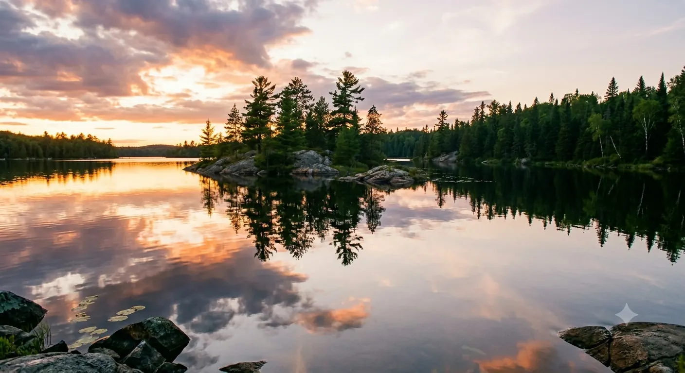
Minnesota Boundary Waters Map +
10-Day Canoe & Superior Hiking Trail Itinerary
10-day Minnesota wilderness itinerary. Two warm-up days on the Superior Hiking Trail, then an 8-day, 75+ mile canoe route from Sawbill Lake to Polly Lake across 18 portages, exiting at Kawishiwi Lake, all based out of Grand Marais.
Free interactive planner · drag & reorder your days, add stops, map it in minutes
Build your own Boundary Waters trip, drag, reorder & map it.
Drag stops between days, swap lakes and portages, and add your own campsites and Superior Hiking Trail sections with the place search. The live map and route legs recalculate as you go, so you can tune the Sawbill-to-Polly canoe route to your pace before you lose cell service at the trailhead.
Opens a side panel · reorder days, add custom stops, see your route live
An 8-day canoe route & the Superior Hiking Trail, from Grand Marais.
This 10-day Minnesota itinerary pairs the Boundary Waters Canoe Area Wilderness (BWCAW) with the Superior Hiking Trail. Base your logistics out of Grand Marais on Lake Superior, warm up with two days on the trail, then paddle an 8-day, 75+ mile canoe route from Sawbill Lake to Polly Lake across 18 portages.
The canoe route enters at the Sawbill Lake entry point (#38) and threads Alton, Beth, Grace, Frost, Long Island, Gordon, and Polly Lakes before exiting at the Kawishiwi Lake entry point (#37). It is a strenuous multi-sport trip: multi-day paddling with portages and two days of Superior Hiking Trail with real elevation change.
A BWCAW entry permit is required and issued through a quota system on Recreation.gov; reservations for the season typically open in late January of the prior year, so book popular entry points as soon as the window opens. The Superior Hiking Trail itself needs no permit, but a Minnesota State Park pass is required to park at state-park trailheads.
BWCAW entry permits are issued through a daily quota per entry point on Recreation.gov and typically open for reservation in late January for the following season. Reserve the Sawbill Lake entry point (#38) and your date as soon as the window opens, especially for June through August. Outfitting and permit pickup are handled through Sawbill Canoe Outfitters at the Sawbill Lake landing; group size is capped at 9 people and 4 watercraft per permit.
Arrive in Grand Marais & the Superior Hiking Trail · 5 miles
Drive the scenic North Shore of Lake Superior on Highway 61 to Grand Marais, an artsy harbor town about two hours from Duluth International Airport (DLH). Check into your lodging, then stretch your legs on your first section of the Superior Hiking Trail along the Kadunce River gorge toward Judge C.R. Magney State Park.
This 5-mile warm-up eases you into the trip with river views and Lake Superior overlooks. Grand Marais is your last real base for amenities, groceries, and cell service, so top up on anything you need before the wilderness stretch.
- Drive to Grand Marais~2 hr · 110 mi from Duluth Airport (DLH) on Hwy 61
- ~5 mi · ~300 ft gain · river gorge and Lake Superior views
- Overnight in Grand MaraisMotels, cabins & inns · restaurants and groceries in town
- Arrive in Grand Marais with time to resupply. It is the last place with reliable groceries, fuel, and cell service before you head inland to Sawbill.
- A Minnesota State Park pass ($7/day or $35 annual) is required if you park at state-park trailheads such as Judge C.R. Magney.
- Filter, purify, or boil all water from lakes and streams on both the trail and the canoe route. Giardia is present throughout the region.
Highway 61 North ShoreKadunce River gorgeSuperior Hiking Trail: Oberg & Leveaux Mountains · 6 miles
Leveaux MountainLutsen shorelineDrive about 25 minutes south to the shared trailhead on the Onion River Road (Forest Road 336) for two of the most loved loops on the Superior Hiking Trail. Hike the Oberg Mountain Loop first, a series of overlooks with the best fall-color and Lake Superior views on the trail, then connect to the more rugged Leveaux Mountain Loop above the Temperance River valley.
Together the two loops make a roughly 6-mile day with real elevation change, the final tune-up before the Boundary Waters. Arrive early, as the Oberg lot fills fast in autumn. Overnight in Lutsen or back in Grand Marais.
- ~2.5 mi · ~400 ft gain · panoramic Lake Superior overlooks
- ~3.5 mi · ~500 ft gain · Temperance River valley views
- FR 336 (Onion River Road) · ~18 mi from Grand Marais
- Do Oberg first for the classic overlooks, then add Leveaux, which is rockier, more rugged, and usually far less crowded.
- The Oberg trailhead is a Superior National Forest lot, not a state park, so no state-park pass is needed there. Overnight parking is allowed.
- This is your last big pre-trip day. Rest well and repack, because tomorrow you drive to Sawbill and enter the BWCAW.
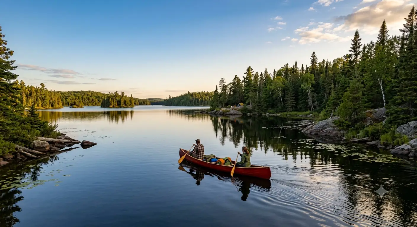
Drive to Sawbill & BWCAW Entry · 7 miles paddle, 1 portage
Head inland on the Sawbill Trail (Cook County Road 2) to Sawbill Canoe Outfitters at the Sawbill Lake landing, part of it unpaved. This is your last stop for gear, a final briefing, and pickup of your reserved BWCAW entry permit (Sawbill Lake, entry point #38). Attend the mandatory wilderness orientation covering Leave No Trace and current fire conditions.
Launch onto Sawbill Lake, a large open lake where wind and waves matter, and cross to your first short portage into Alton Lake, where you'll make your first wilderness camp. Focus the first day on efficient packing, paddling, and portage technique.
- ~1 hr · ~55 mi from Grand Marais · partly unpaved
- Sawbill Lake EP #38 · reservation required · Recreation.gov
- ~5 mi paddle · 1 short portage (~10 rods)
- Camp on Alton LakeFirst night in BWCAW · designated campsite, first-come
- You must enter on your reserved date and through your reserved entry point. All group members should be present or listed on the permit at pickup.
- Cans and bottles are prohibited in the BWCAW. Repackage food into reusable containers before you launch.
- Sawbill is a large, open lake. Start early and hug a shoreline if the wind picks up on the crossing.
First portageAlton Lake campAlton to Beth Lake · 8 miles paddle, 3 portages
Kelso portageNarrow channelsBreak camp and paddle across Alton Lake, then string together three portages through Kelso and Lujenida Lakes to reach Beth Lake. The carries are moderate, some rocky, and reward you with a clear, narrow lake and secluded campsites that feel noticeably deeper in the wilderness.
Kelso is known for its beauty and good fishing, and the day mixes open water with narrower channels where you may spot beaver activity. Make camp on Beth Lake and settle into the rhythm of the route.
- Paddle Alton Lake to Kelso Lake~2 mi · 1 portage (~40 rods) · rocky carry
- Paddle Kelso Lake to Lujenida Lake~3 mi · 1 short portage (~20 rods)
- Paddle Lujenida Lake to Beth Lake~3 mi · 1 portage (~30 rods)
- Camp on Beth LakeClear water · good swimming · secluded campsites
- Expect to double-portage heavier carries: one trip with packs, one with the canoe. It is slower but safer on rocky, uneven ground.
- Store all food in a bear-resistant container or a well-hung bear bag every night. Never keep food in the tent.
- Camp only at designated sites with fire grates. Sites are first-come, first-served, so stop paddling with daylight to spare.
Beth to Grace Lake · 9 miles paddle, 4 portages
Today is the biggest portage day: four carries, including a longer one into Grace Lake that may involve some elevation. Detour to quiet, less-traveled Phoebe Lake for a serene paddle and wildlife viewing, then return to camp on large, scenic Grace Lake.
Grace has many campsites and sits at a hub of interior routes, making it a natural spot for a layover day if you want one. Good walleye and northern pike fishing rewards anyone who brought a rod, and on clear nights the interior offers a chance at the northern lights.
- Paddle Beth Lake to Grace Lake~2 mi · 1 longer portage (~50 rods) · plan to double-carry
- Side trip to Phoebe Lake~4 mi · 2 portages (~30 & ~10 rods) · quiet, scenic
- Return to Grace Lake~3 mi · 1 short portage (~10 rods)
- Camp on Grace LakeLarge lake · many sites · good fishing · layover option
- The Grace Lake portage is the longest of the day. Pace yourself, hydrate, and split loads so no single carry is punishing.
- Grace Lake is central and well-served with campsites, so it is the best spot on the route to build in a rest or fishing layover day.
- On a clear, dark night far from any town lights, watch north after midnight. The interior lakes are excellent for aurora when it is active.
Grace portagePhoebe side tripGrace to Frost Lake · 10 miles paddle, 3 portages
Frost Lake campDeep clear waterThe longest paddling day of the trip. Leave Grace Lake for quiet Carl Lake, then push through a longer carry into Frost Lake, renowned for its clear, deep water and excellent campsites. The effort is rewarded with a genuinely remote, scenic lake.
Frost is a highlight: swim on a warm afternoon, then settle in for some of the best stargazing on the route. This is deep-wilderness country, so pace yourselves across the 10 miles and stop early enough to claim a good site.
- Paddle Grace Lake to Carl Lake~3 mi · 1 portage (~40 rods) · quiet, well-maintained
- Paddle Carl Lake to Frost Lake~7 mi · 2 portages (~60 & ~20 rods)
- Camp on Frost LakeClear deep water · swimming · excellent stargazing
- Start early. Ten miles with three portages is a long day, and afternoon thunderstorms are common in summer.
- Frost Lake's campsites are popular, so aim to arrive by mid-afternoon to secure one before other parties come through.
- Fires are allowed only in the provided fire grates using dead-and-down wood. Check for a fire ban before lighting anything in dry spells.
Frost to Gordon Lake · 9 miles paddle, 2 portages
Paddle from Frost across expansive, island-dotted Long Island Lake, where open sections can get windy, then take a final portage into smaller, sheltered Gordon Lake. The lighter portage load makes this a good day to slow down and watch for wildlife, including moose and a range of birds.
Gordon is quieter and more intimate, with sheltered campsites and good bird watching. Set up early, listen for loons at dusk, and enjoy one of the most peaceful evenings of the route.
- Paddle Frost Lake to Long Island Lake~5 mi · 1 portage (~40 rods) · large, island-filled lake
- Paddle Long Island Lake to Gordon Lake~4 mi · 1 portage (~30 rods)
- Camp on Gordon LakeSheltered sites · quiet water · loons at dusk
- Long Island Lake is big and exposed. If wind kicks up, break the crossing into island-to-island legs and stay off the open middle.
- Gordon is smaller and sheltered, so it usually offers calmer water and a quieter night than the big lakes.
- Dawn and dusk are the best times for moose and loons. Keep a respectful distance and never approach or feed wildlife.
Long Island LakeGordon Lake campGordon to Polly Lake · 9 miles paddle, 3 portages
Hazel portagePolly Lake campPaddle across Gordon and take a short portage into secluded, often-overlooked Hazel Lake, then make the day's main push through two moderate portages to large, scenic Polly Lake. Polly is a hub with many campsites and marks the end of your deep-wilderness canoe route.
This is your last night in the Boundary Waters. Claim a good site, enjoy a final campfire if conditions allow, take time to reflect on the journey, and pre-pack what you can for an efficient exit in the morning.
- Paddle Gordon Lake to Hazel Lake~2 mi · 1 short portage (~20 rods) · secluded, calm
- Paddle Hazel Lake to Polly Lake~7 mi · 2 portages (~50 & ~30 rods)
- Camp on Polly LakeLast night in BWCAW · large scenic lake · many sites
- Polly is a popular lake near the Kawishiwi exit, so it can be busier. Arrive early to secure a good campsite.
- Pack down everything you won't need overnight so tomorrow's exit and drive go quickly.
- Before you leave any site, make sure the fire is dead out and pack out every scrap, including food waste. Leave the site cleaner than you found it.
Polly Exit & Drive to Grand Marais · 5 miles paddle, 2 portages
Complete the final paddle across Polly and two short portages out to the Kawishiwi Lake exit (entry point #37). After officially leaving the BWCAW and returning any rented gear, drive back toward Grand Marais on partly unpaved forest roads as cell service returns.
Check into a comfortable lodge, take a well-earned hot shower, and celebrate with dinner in town. After nine days out, a real bed and a restaurant meal feel like genuine luxuries.
- ~5 mi · 2 short portages (~20 & ~10 rods) · EP #37
- Drive Kawishiwi Lake to Grand Marais~1.5 hr · ~70 mi · partly unpaved forest roads
- Overnight in Grand MaraisHot shower · celebratory dinner · resupply personal items
- Kawishiwi Lake is a straightforward exit with short final portages. Leave enough of the morning to drive out on the unpaved roads unhurried.
- If you rented from an outfitter, confirm gear-return details and timing before you leave for the canoe route.
- Book Grand Marais lodging in advance for this night. North Shore rooms fill fast in summer and fall foliage season.
Final portagesBack in Grand MaraisDepart from Grand Marais
Highway 61 southNorth Shore viewsEnjoy a final North Shore breakfast at one of Grand Marais's cafes and, if time allows, stroll the harbor, visit the lighthouse, and browse the art galleries and outfitters in town. Grab a coffee and a local pastry before you point the car south.
Drive Highway 61 back along Lake Superior toward Duluth International Airport (DLH), roughly two hours away, with a possible stop at Split Rock Lighthouse. Allow ample time for the drive and any traffic near Duluth before your flight.
- Breakfast & harbor stroll in Grand MaraisNorth Shore cafes · lighthouse · art galleries
- Drive to Duluth International Airport (DLH)~2 hr · ~110 mi south on scenic Highway 61
- Give yourself a buffer for the two-hour Highway 61 drive to Duluth, plus traffic near the city, so you are not rushed for a flight.
- Split Rock Lighthouse State Park is a worthwhile stop on the way south if you have an hour to spare.
- Grand Marais galleries and Stone Harbor Wilderness Supply are good spots for a last souvenir or any gear you meant to buy.
Now build your Boundary Waters trip.
You've seen all ten days. Open the free drag-and-drop planner and tune it for your dates, your paddling pace, and whether you add layover days or more Superior Hiking Trail around your Grand Marais base.
Essential wilderness rules & planning.
BWCAW permits & quotas
A BWCAW entry permit is required for overnight trips and is issued through a daily quota per entry point on Recreation.gov. Reservations typically open in late January for the following season, so book the Sawbill Lake entry point (#38) as soon as the window opens for June through August. You must enter on your reserved date and through your reserved entry point.
Group size & watercraft
Group size is capped at 9 people and 4 watercraft per permit in the BWCAW. Plan your party within that limit. All members should be present or listed on the permit at pickup, handled through Sawbill Canoe Outfitters or the ranger station.
Camping, fires & no cans
Camp only at designated sites with the provided fire grates, which are first-come, first-served. Fires are allowed only in the grates using dead-and-down wood. Cans and bottles are prohibited in the BWCAW, so repackage food before you launch, and pack out all trash and food waste.
Water, waste & Leave No Trace
Filter, purify, or boil all water from lakes and streams; giardia is present. Bury human waste 6 to 8 inches deep at least 200 feet from water, trails, and camp, and wash at least 200 feet from any water source with biodegradable soap. Leave No Trace is mandatory in both the BWCAW and on the Superior Hiking Trail.
When to go
The season runs late May to early October. Late May and June bring higher water and easier portages but heavy bugs; July and August are warmest and busiest, with common thunderstorms; September into early October offers fewer insects, cool weather, and fall color, though lower water can make some portages harder.
Getting there needs a car
Grand Marais is about two hours (110 miles) from Duluth International Airport (DLH) on Highway 61. Sawbill is roughly an hour inland on the Sawbill Trail, part of it unpaved, and Kawishiwi Lake is reached on forest roads. No public transportation serves the trailheads, so a car is required.
Everything you'll actually want to know.
Ready to go? Get your
Minnesota Boundary Waters route.
Entry points and portage counts, the Recreation.gov permit timing, outfitter and shuttle logistics from Grand Marais, the Superior Hiking Trail warm-up hikes, and the Leave No Trace rules you need to run Sawbill to Polly over 10 days.
Instant book · Free cancellation · Secure payment via Stripe

Planning this trip?
Save it, share it with your crew, or find travelers heading the same way.

Liked this itinerary?
What other travelers are saying
Be the first to leave a tip or question for the next traveler.