Maah Daah Hey Trail Map +
6-Day Badlands Backpacking Itinerary
6-day Maah Daah Hey Trail backpacking itinerary covering a 60-mile central section of the North Dakota Badlands. From the Sully Creek trailhead near Medora north through the Little Missouri National Grassland and past Theodore Roosevelt's Elkhorn Ranch to the Peaceful Valley trailhead.
Free interactive planner · drag & reorder your days, add stops, map it in minutes
Build your own Maah Daah Hey trek, drag, reorder & map it.
Drag stops between days, add camps or water caches, and drop in your own trailheads with the place search. The live map and trail legs recalculate as you go, so you can tune the 60-mile Badlands route to your pace and your shuttle windows before you head into the Little Missouri National Grassland.
Opens a side panel · reorder days, add custom stops, see your route live
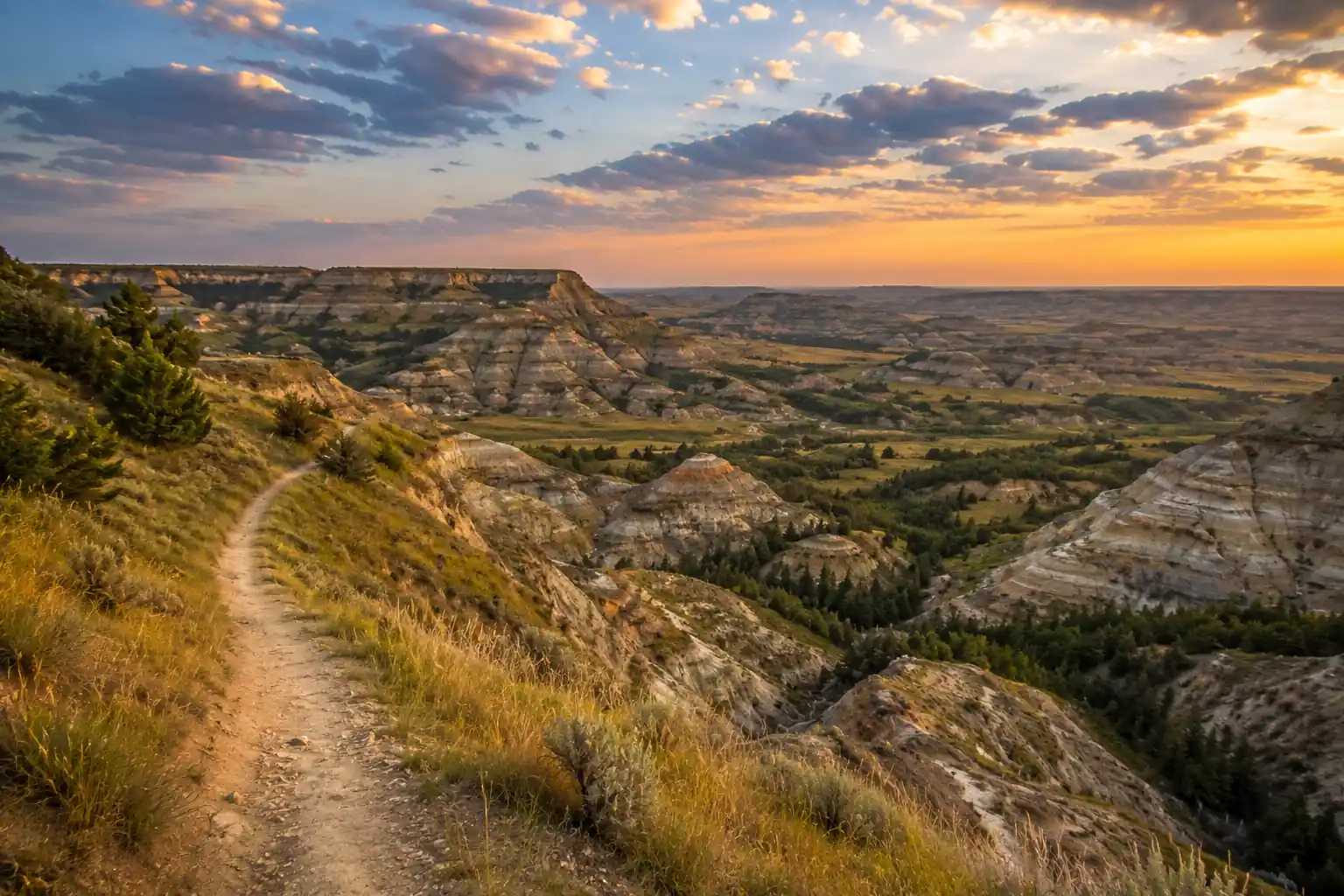
Sixty miles of remote Badlands, Sully Creek to Peaceful Valley.
The Maah Daah Hey Trail runs 144 miles of non-motorized singletrack through the North Dakota Badlands. This 6-day itinerary covers a prime 60-mile central section, using Medora, ND as your base town and a pre-booked shuttle to run the point-to-point route from the Sully Creek trailhead north to Peaceful Valley.
Expect open grasslands, dramatic Badlands formations, and views over the Little Missouri River valley, with bison and wild horses along the way. The trail passes near Theodore Roosevelt's historic Elkhorn Ranch Site, the "cradle of conservation," roughly halfway through the section.
This is a strenuous, self-sufficient trek. Water is the biggest challenge: reliable sources are scarce and seasonal, so plan on 3–4+ liters per person per day, always filter or purify, and use the Maah Daah Hey Trail Association water caches. A free backcountry permit is required for camping inside Theodore Roosevelt National Park.
Reserve your trailhead shuttle weeks in advance (Dakota Cyclery in Medora runs one-way shuttles for hikers). Secure a free Theodore Roosevelt National Park backcountry permit 3–6 months ahead for peak-season dates, and confirm current water-cache and creek status with the Medora Ranger District before you set out.
Arrival in Medora & Shuttle Setup · 0 miles
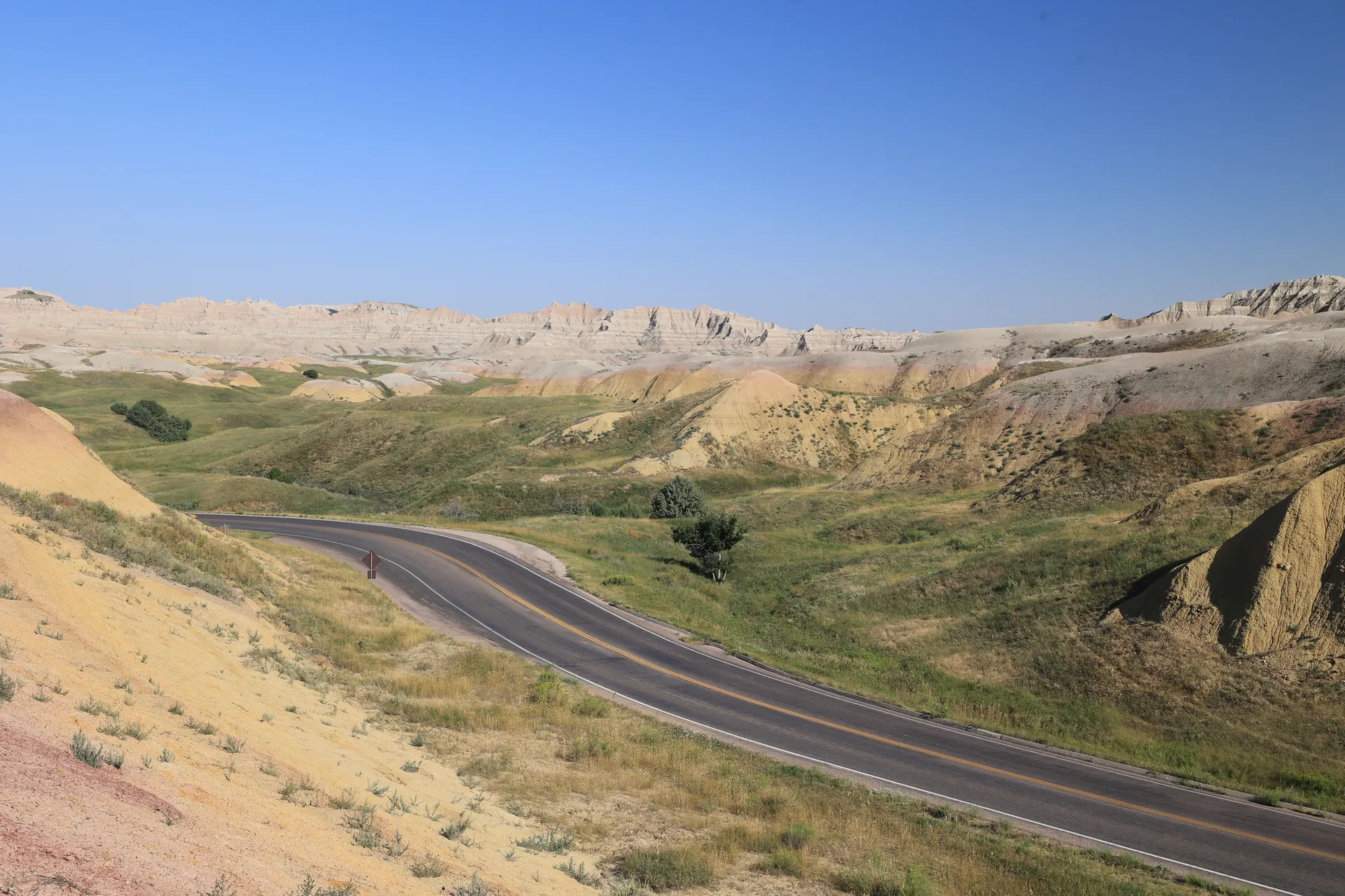
Your trek begins in Medora, North Dakota, the small historic town that is the gateway to the South Unit of Theodore Roosevelt National Park and the surrounding Badlands. Settle into your lodging, top off water, and confirm tomorrow's shuttle drop-off at the Sully Creek trailhead and your Day 6 pick-up at Peaceful Valley.
Spend the afternoon gathering last-minute supplies, reviewing your route and water plan, and picking up a free backcountry permit at the South Unit Visitor Center if you'll camp inside park boundaries. Medora has a small grocery store and several restaurants, so enjoy a last cooked meal before the wilderness.
- Arrive in Medora, ND~130 mi / 2 hr from Bismarck (BIS) airport · last full resupply
- Free · required for camping inside the park · South Unit Visitor Center
- Confirm trailhead shuttlePre-booked · Sully Creek drop-off + Peaceful Valley pick-up
- Book your one-way shuttle weeks ahead. Dakota Cyclery in Medora runs shuttles for hikers as well as mountain bikers.
- A backcountry permit for Theodore Roosevelt National Park is free but must be arranged in advance for peak season; pick it up or confirm at the South Unit Visitor Center.
- Top off every water container in Medora and confirm current water-cache and creek reliability with the Medora Ranger District before you leave town.
Badlands aheadLittle Missouri RiverSully Creek Trailhead to CCC Campground · 11.5 miles
Badlands climbsCCC campYour shuttle drops you at the Sully Creek trailhead (GPS 46.88974, -103.5378), about 1.5 miles south of Medora in Rough Rider State Park. The first miles ease you into the Badlands, following Sully Creek before a ford of the Little Missouri River, which can be knee-deep after rain.
From the river, the trail climbs and drops through classic Badlands formations with widening views, ending at the designated CCC Campground. This is your first full night in the wilderness, so set up camp, filter water at the hand pump if it's running, and settle in under the vast North Dakota sky.
- Shuttle to Sully Creek trailhead~1.5 mi south of Medora · official start of the section
- Ford the Little Missouri River~3.5 mi in · knee-deep after rain · can be muddy
- Camp at CCC Campground~11.5 mi day · vault toilet · hand-pump water (confirm status)
- The Little Missouri ford can run knee-deep after rain and the approach gets muddy; trekking poles help with stability.
- Sections are fully exposed with little shade, so start early, carry ample water, and cover up against the sun.
- Forest Service campgrounds have hand-pump potable water in season, but always confirm the pump is working before relying on it.
CCC Campground to Wannagan Campground · 12 miles
Leaving CCC, the trail crosses open grasslands broken by Badlands features, a mix of easy walking and moderate climbs. Watch for wild horses and bison grazing the Little Missouri National Grassland, a highlight of this stretch.
The route steepens toward the end of the day, rewarding the effort with panoramic views before dropping into Wannagan Campground (GPS 47.05568, -103.587). Wannagan is a well-situated backcountry site known for its Badlands sunsets, with a vault toilet and a hand pump.
- Grassland & Badlands traverse~12 mi · open grasslands, moderate then steeper climbs
- Watch for wild horses & bisonCommon in the Little Missouri National Grassland
- Camp at Wannagan CampgroundGPS 47.05568, -103.587 · vault toilet · hand-pump water
- Give bison and wild horses a wide berth; never approach or get between animals, especially bison.
- Some sections can be overgrown or faint, so keep a GPS track and map handy to stay on the singletrack.
- Wannagan is exposed and can be windy; stake your tent well and use it for its excellent sunset views.
PanoramasWannagan campWannagan to Elkhorn Ranch Site · 10.5 miles
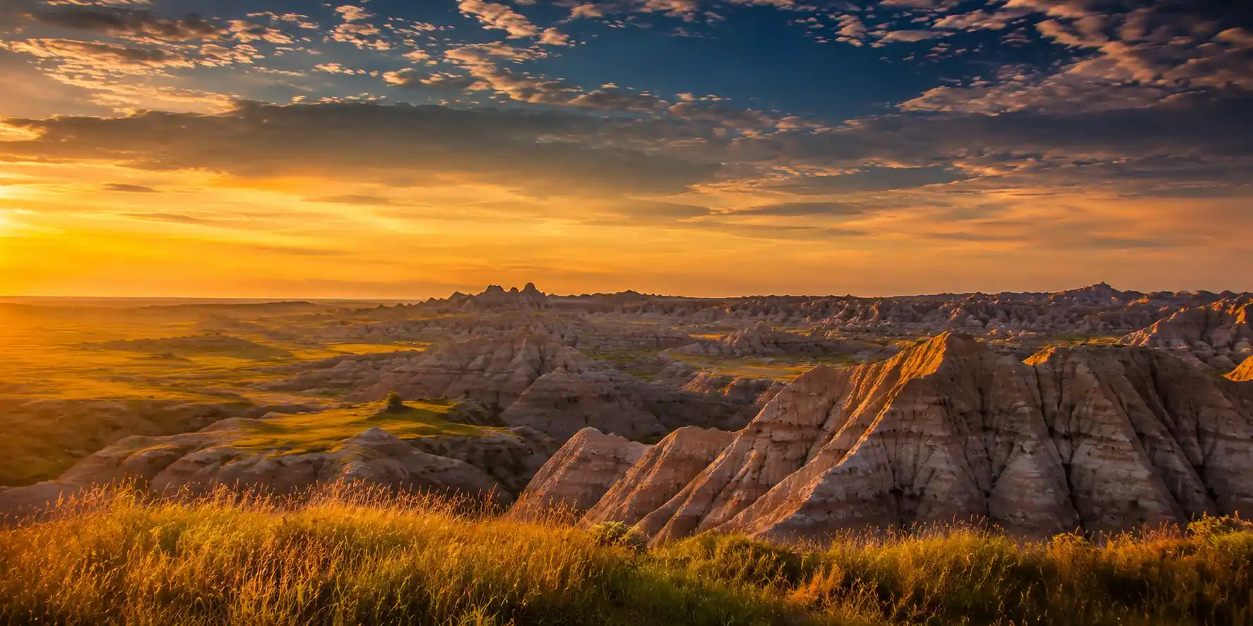
Badlands geologyRemote campToday crosses some of the most remote and wild country on the section. The trail winds through intricate Badlands formations that can be faint and require careful navigation, so carry extra water and stay on your track.
Near the midpoint you pass the historic Elkhorn Ranch Site (GPS 47.1778, -103.4300), where Theodore Roosevelt ranched in the 1880s, the experience that shaped his conservation legacy. Interpretive signs mark the spot; there are no facilities. Camp primitively nearby, practicing strict Leave No Trace, with all your water carried in.
- Remote Badlands navigation~8 mi · faint trail, careful route-finding · carry extra water
- Theodore Roosevelt's historic ranch · interpretive signs · no facilities
- Primitive camp near ElkhornDispersed site · no water source · strict Leave No Trace
- This is the most remote day; there is no reliable water near the Elkhorn camp, so carry everything you need for the afternoon and overnight.
- Camp on durable surfaces at least 200 ft from water, trails, and the historic site, and bury human waste 6–8 inches deep.
- The trail can be less defined here; download offline maps and keep a compass as backup for route-finding.
Elkhorn Ranch to Icebox Canyon · 13 miles
A longer, more challenging push: the trail traverses ridges and coulees with significant elevation change and grand vistas over the Little Missouri River and the surrounding Badlands. Watch for loose rock on the steep ascents and descents.
The scenery grows more dramatic as you approach Icebox Canyon, a scenic primitive camp that offers some shelter from wind and sun. A seasonal creek sometimes provides water here, but it can be dry by late summer, so confirm status and purify everything.
- Ridge & coulee traverse~13 mi · steep ascents and descents · grand river vistas
- Approach Icebox CanyonDramatic Badlands formations · unique rock
- Camp at Icebox CanyonPrimitive site · seasonal creek (purify, confirm) · wind shelter
- This is a big-mileage day with real elevation change; start early and pace your water.
- The Icebox Canyon creek is seasonal and can be dry in late summer, so treat it as unreliable and confirm before you count on it.
- The canyon offers good wind protection; check current fire restrictions before using any existing fire ring.
River vistasCanyon rockIcebox Canyon to Peaceful Valley & Departure · 13 miles
Last viewsBack in MedoraThe final day pushes out of Icebox Canyon over the last challenging climbs, then descends gradually toward the Peaceful Valley trailhead, completing your 60-mile Maah Daah Hey journey. Soak in the last Badlands views on the way down.
Your pre-arranged shuttle meets you at Peaceful Valley to run you back to Medora. Allow plenty of buffer for the hike and pick-up, then celebrate with a well-earned meal in town before heading home or on to your next destination.
- Final climbs out of Icebox~6 mi · last significant elevation · monitor water
- Descend to Peaceful Valley trailhead~7 mi · gradual descent · trail's end
- Shuttle back to MedoraPre-arranged pick-up · celebratory meal in town
- Build in buffer time so a slow final morning doesn't make you miss the shuttle at Peaceful Valley.
- Confirm your pick-up time and exact trailhead with the shuttle service the day before if you have signal.
- Medora's restaurants and services make it the natural place to clean up and refuel before the drive out.
Now build your Maah Daah Hey trek.
You've seen all six days. Open the free drag-and-drop planner and tune it for your dates, your pace, your water plan, and your shuttle drop-off and pick-up times.
Essential wilderness logistics & planning.
Permits & registration
A free backcountry permit is required to camp inside Theodore Roosevelt National Park; arrange it in advance and reserve early for peak season (May–June, Sept–Oct). No permit is needed on the Little Missouri National Grassland, but registering your itinerary with the Medora Ranger District is recommended for safety.
Water is the crux
Reliable water is scarce and seasonal. Carry a minimum of 3–4 liters per person per day, always filter or purify, and use the eight Maah Daah Hey Trail Association water caches plus the hand pumps at Forest Service campgrounds. Confirm current conditions with the ranger district before you go.
Shuttle logistics
This is a point-to-point route, so you need a shuttle. Dakota Cyclery in Medora runs one-way shuttles (roughly $250 one-way for up to four). Book weeks ahead and confirm your Sully Creek drop-off and Peaceful Valley pick-up times and locations.
Leave No Trace
Pack out everything you pack in, including food scraps. Bury human waste 6–8 inches deep and at least 200 ft from water, trails, and camps, or use wag bags in sensitive areas. Camp on durable surfaces and expect fires to be restricted or prohibited.
Wildlife awareness
Expect bison, wild horses, rattlesnakes, and scorpions. Keep a safe distance from all animals, especially bison and horses. Grizzlies are not present, but store food securely against rodents and other critters, and watch your step for snakes on warm days.
Go in the shoulder seasons
May–June and September–October bring milder temperatures, fewer bugs, and better water, with wildflowers in spring and cooler foliage in fall. Summer often tops 90°F with dry sources and thunderstorms; winter brings snow and extreme cold suited only to experienced winter backpackers.
Everything you'll actually want to know.
Ready to go? Get your
Maah Daah Hey Trail route.
Trailheads and mileages, the backcountry permit and shuttle logistics, the water-cache and Leave No Trace rules, drive time from Bismarck, and the day-by-day timing you need to hike the 60-mile Badlands section point-to-point.
Instant book · Free cancellation · Secure payment via Stripe

Planning this trip?
Save it, share it with your crew, or find travelers heading the same way.

Liked this itinerary?
What other travelers are saying
Be the first to leave a tip or question for the next traveler.